Sheerwater
Videos
Sheerwater is a residential neighbourhood or small suburb of Woking, in the Woking district in Surrey, England, occasionally described as a village, between West Byfleet and Horsell. Its border is defined to the north by a gently winding part of the Basingstoke Canal and to the south by the South West Main Line which passes from cutting level to that of an embankment. The neighbourhood has a business park and light industry at its south-western end. The whole area is linear, includes diverse green spaces to north and south, and covers 92 hectares.

Boats on the Basingstoke Canal

A small part of Albert Drive with high pines, long-established in the soil type, see Bagshot Formation.

A natural habitat part of the cleared towpath beside the Basingstoke Canal, Sheerwater,which is particularly home to swans here.

Scotwood Park is one of the more industrial business parks, suitable for storage and manufacturing
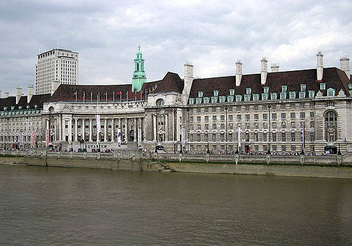
London County Council
Videos
The London County Council (LCC) was the principal local government body for the County of London throughout its existence from 1889 to 1965, and the first London-wide general municipal authority to be directly elected. It covered the area today known as Inner London and was replaced by the Greater London Council. The LCC was the largest, most significant and most ambitious English municipal authority of its day.

The First Meeting of the London County Council in the County Hall Spring Gardens, 1889 by Henry Jamyn Brooks

Aldwych, a broad, porticoed street with underpass to Waterloo Bridge, from a slum clearance project in 1905

Lambeth Bridge, built by the LCC in 1932, its red colour being that of the nearby House of Lords