The Shire of Cardwell was a local government area of Queensland. It was located on the Coral Sea coast about halfway between the cities of Cairns and Townsville. The shire, administered from the town of Tully, covered an area of 3,062.2 square kilometres (1,182.3 sq mi), and existed as a local government entity from 1884 until 2008, when it amalgamated with the Shire of Johnstone to form the Cassowary Coast Region.
Cardwell Divisional Board Hall (later Cardwell Shire Council Chambers), Cardwell, 1911
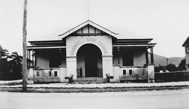
Cardwell Shire Council Chambers, Tully, circa 1930
Tully is a town and locality in the Cassowary Coast Region, Queensland, Australia. It is adjacent to the Bruce Highway, approximately 140 kilometres (87 mi) south of Cairns by road and 210 kilometres (130 mi) north of Townsville. At the 2016 census, the population was 2,390. Tully is perhaps best known for being one of the wettest towns in Australia, and home to the 7.9 m tall Golden Gumboot.
Tully's main street, Butler Street, 2006
The township of Tully in 1927
Cardwell Shire Council Chambers in Tully, 1930
Butler Street, looking west, 1935