Shotley Peninsula
Videos
Page
The Shotley Peninsula is a rural area east of the A137 Ipswich-Colchester road located between the rivers Stour and Orwell in Suffolk, England. The peninsula is named after the settlements of Shotley and Shotley Gate which are situated near its south-eastern tip. Other villages on the peninsula include Chelmondiston, Erwarton (Arwarton), Freston, Harkstead, Holbrook, Stutton, Tattingstone, Wherstead and Woolverstone.

Main entrance to H.M.S. Ganges – geograph.org.uk – 1247889

Shotley – rolling fields – geograph.org.uk – 1120722

Erwarton Hall Gatehouse – geograph.org.uk – 283393

Royal Hospital School, Holbrook
River Stour, Suffolk
Videos
Page
The River Stour is a major river in East Anglia, England. It is 47 miles (76 km) long and forms most of the county boundary between Suffolk to the north, and Essex to the south. It rises in eastern Cambridgeshire, passes to the east of Haverhill, through Cavendish, Sudbury, Bures, Nayland, Stratford St Mary and Dedham. It becomes tidal just before Manningtree in Essex and joins the North Sea at Harwich.

The Stour at Manningtree, Essex

Constable's Dedham Vale was painted in 1802.

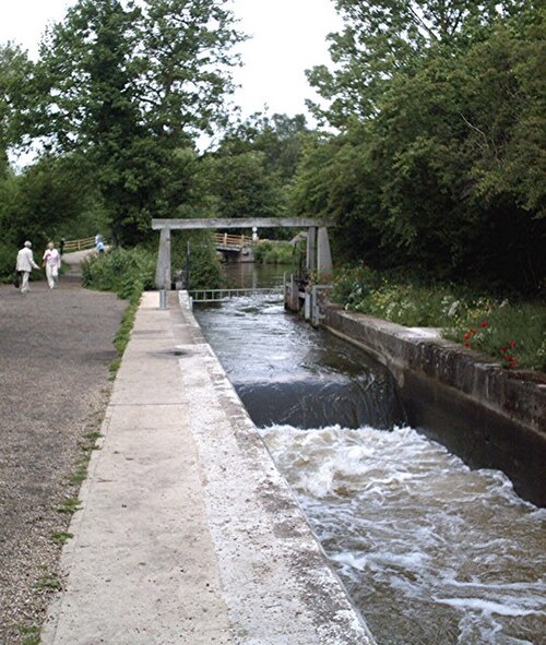
Stratford St Mary's lock was restored in 2017
Flatford Lock, with the tilting weir being used to manage flood levels in the river