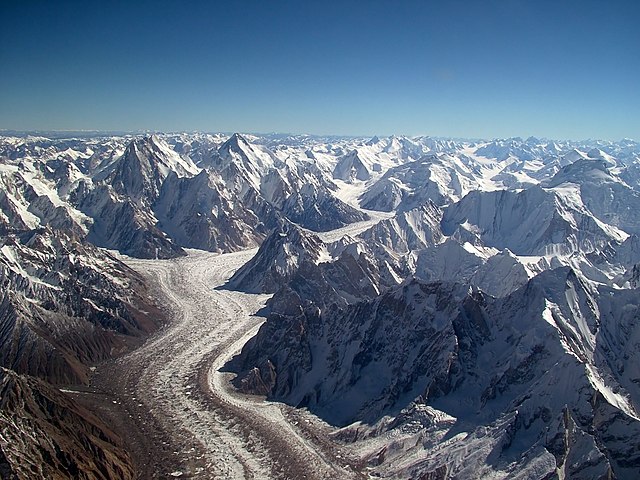
The Siachen Glacier is a glacier located in the eastern Karakoram range in the Himalayas at about 35.421226°N 77.109540°E, just northeast of the point NJ9842 where the Line of Control between India and Pakistan ends. At 76 km (47 mi) long, it is the longest glacier in the Karakoram and second-longest in the world's non-polar areas. It falls from an altitude of 5,753 m (18,875 ft) above sea level at its head at Indira Col on the India–China border down to 3,620 m (11,875 ft) at its terminus. The entire Siachen Glacier, with all major passes, has been under the administration of India as part of the union territory of Ladakh, located in the Kashmir region since 1984. Pakistan maintains a territorial claim over the Siachen Glacier and controls the region west of Saltoro Ridge, lying west of the glacier, with Pakistani posts located 1 km below more than 100 Indian posts on the ridge.
Satellite imagery of the Siachen Glacier
Sia plant in Khaplu. Balti people grow this rose family in their houses as decoration, and its bark is used in payo cha (butter tea) instead of green tea leaves in some areas
Indian Army Jawans performing yoga, on the occasion of the 3rd International Day of Yoga – 2017, at Siachen on June 21, 2017
The Karakoram is a mountain range in the Kashmir region spanning the border of Pakistan, China, and India, with the northwestern extremity of the range extending to Afghanistan and Tajikistan. Most of the Karakoram mountain range falls under the jurisdiction of Gilgit-Baltistan, which is controlled by Pakistan. Its highest peak, K2, is located in Gilgit-Baltistan, Pakistan. It begins in the Wakhan Corridor (Afghanistan) in the west, encompasses the majority of Gilgit-Baltistan, Pakistan and extends into Ladakh and Aksai Chin.
Baltoro Glacier in the Central Karakoram Gilgit−Baltistan, Pakistan
The black gravel of Karakoram mountains, as seen near Pakistan's Biafo Glacier
Hunza Valley in the Gilgit-Baltistan region administered by Pakistan
K2


