Sierra Highway or El Camino Sierra is a road in Southern California, United States. El Camino Sierra refers to the full length of a trail formed in the 19th century, rebuilt as highways in the early 20th century, that ran from Los Angeles to Lake Tahoe following parts of modern State Route 14, U.S. Route 395 and State Route 89. Two portions of this road are currently signed as Sierra Highway. The first is an old alignment of SR 14/U.S. Route 6 from Los Angeles to Mojave. This road is also signed with the unusual designation of State Route 14U through the city of Santa Clarita. The second part signed as Sierra Highway is a portion of US 395 in Bishop.
Sierra Highway in Santa Clarita. Although Route 14 was moved to a freeway bypass years ago, this portion remains under state control in a state of bureaucratic limbo, signed as Route 14 "Un-relinquished"
Sierra Highway in Santa Clarita, about a mile north of Soledad Canyon Road.
Southbound US 395 cresting Deadman Summit with Mount Morrison in the distance
1918, Lancaster, California. Looking south on Sierra Highway, at the intersection with Lancaster Boulevard.
California State Route 14
State Route 14 (SR 14) is a north–south state highway in the U.S. state of California that connects Los Angeles to the northern Mojave Desert. The southern portion of the highway is signed as the Antelope Valley Freeway. Its southern terminus is at Interstate 5 in the Los Angeles neighborhoods of Granada Hills and Sylmar just immediately to the south of the border of the city of Santa Clarita. SR 14's northern terminus is at U.S. Route 395 (US 395) near Inyokern. Legislatively, the route extends south of I-5 to SR 1 in the Pacific Palisades area of Los Angeles; however, the portion south of the junction with I-5 has not been constructed. The southern part of the constructed route is a busy commuter freeway serving and connecting the cities of Santa Clarita, Palmdale, and Lancaster to the rest of the Greater Los Angeles area. The northern portion, from Vincent to US 395, is legislatively named the Aerospace Highway, as the highway serves Edwards Air Force Base, once one of the primary landing strips for NASA's Space Shuttle, as well as the Naval Air Weapons Station China Lake that supports military aerospace research, development and testing. This section is rural, following the line between the hot Mojave desert and the forming Sierra Nevada mountain range. Most of SR 14 is loosely paralleled by a rail line originally built by the Southern Pacific Railroad, and was once the primary rail link between Los Angeles and Northern California. While no longer a primary rail line, the southern half of this line is now used for the Antelope Valley Line of the Metrolink commuter rail system.
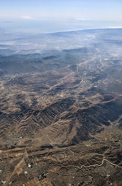
Antelope Valley Freeway through the San Gabriel Mountains, with California Aqueduct at Palmdale in the foreground
The northern terminus of SR 14 near Inyokern
Looking south at the corner of Sierra Highway and Lancaster Boulevard in Lancaster c. 1918
Route 14 inside Red Rock Canyon


