Sierra Madre (Philippines)
The Sierra Madre is the longest mountain range in the Philippines. Spanning over 540 kilometers (340 mi), it runs from the province of Cagayan down to the province of Quezon, forming a north–south direction on the eastern portion of Luzon, the largest island of the archipelago. It is bordered by the Pacific Ocean to the east, Cagayan Valley to the northwest, Central Luzon to the midwest, and Calabarzon to the southwest. Some communities east of the mountain range, along the coast, are less developed and so remote that they could only be accessed by taking a plane or a boat.
View south of the northern Sierra Madre from the peak of Mount Cagua in Cagayan
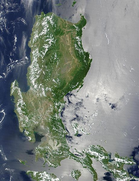
Luzon island satellite image showing the range in dark green
The mountains as viewed near summit of the Mount Oriod in Bulacan
Tinipak or Agos River in Tanay, Rizal
Cagayan, officially the Province of Cagayan, is a province in the Philippines located in the Cagayan Valley region, covering the northeastern tip of Luzon. Its capital is the city of Tuguegarao. It is about 431 kilometres (268 mi) northwest of Manila, and includes the Babuyan Islands to the north. The province borders Ilocos Norte and Apayao to the west, and Kalinga and Isabela to the south.
Image: View of the northeast coast of Luzon from the foothills of Mt. Cagua Zoo Keys 266 001 g 005
Image: Smith Volcano 1
Image: Buguey resort Cagayan
Image: Buntun Bridge


