Sierra Pelona Ridge
Videos
The Sierra Pelona, also known as the Sierra Pelona Ridge or the Sierra Pelona Mountains and originally known as the Liebre Mountains, is a mountain ridge in the Transverse Ranges in Southern Californi
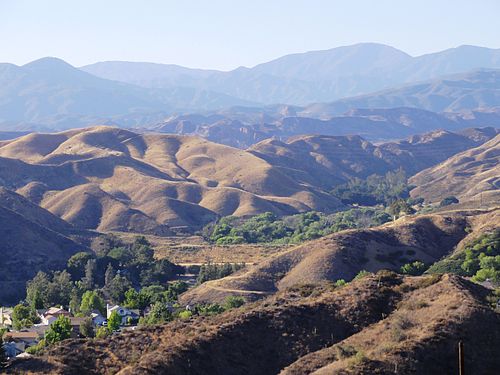
View from Santa Clarita

Aerial view of the Sierra Pelona Mountains and San Andreas Fault

Burnt Peak is the tallest mountain in the Sierra Pelona Mountains.
St. Francis Dam
Videos
The St. Francis Dam, or the San Francisquito Dam, was a concrete gravity-arch dam located in San Francisquito Canyon in northern Los Angeles County, California, United States, that was built between 1
Sierra Pelona Ridge
…separate reservoirs to supply water to the region: Castaic Lake, Bouquet Reservoir, Drinkwater Reservoir, Pyramid Lake and Dry Canyon Reservoir and the St. Francis Reservoir, both now drained and destroyed. Burnt Peak: 5,788 ft (1,764 m…

View of the dam looking north, with water in its reservoir, in February 1927

St. Francis Dam in early 1928

The approximate extent of the reservoir created by the dam

The same view of the "Tombstone" post-collapse. The west (left) abutment was entirely swept away. The inactive San Francisquito Fault is clearly visible, being located along the contact zone of schist and conglomerate.