South Bruny National Park
The South Bruny National Park is a national park located on Bruny Island, Tasmania, Australia, about 50 kilometres (31 mi) south of Hobart. The park contains the Cape Bruny Lighthouse. The highest point of the park is Mount Bruny at 504 metres (1,654 ft).
The Friars
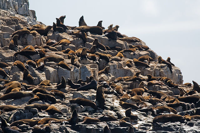
Australian fur seals in the park
A trail in South Bruny National Park
Bruny Island is a 362-square-kilometre (140 sq mi) island located off the southeastern coast of Tasmania, Australia. The island is separated from the Tasmanian mainland by the D'Entrecasteaux Channel, and its east coast lies within the Tasman Sea. Located to the island's northeast Storm Bay, is the river mouth to the Derwent River estuary, and serves as the main port of Hobart, Tasmania's capital city. Both the island and the channel are named after French explorer, Antoine Bruni d'Entrecasteaux. Its traditional Aboriginal name is lunawanna-allonah, which survives as the name of two island settlements, Alonnah and Lunawanna.
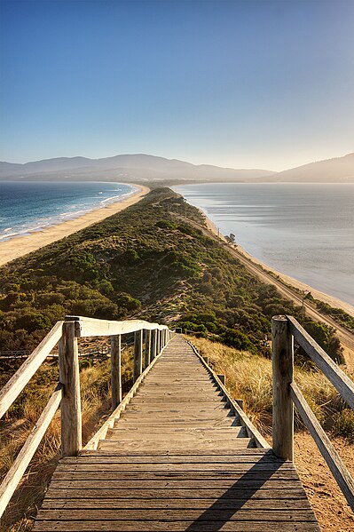
Aerial perspective of the isthmus of Bruny Island, looking north
"The Neck" connects the two halves of Bruny Island and is an important breeding site for short-tailed shearwater and fairy penguins
Black-faced cormorants (Phalacrocorax fuscescens), Bruny Island, Tasmania
Rock formation off the coast of Bruny Island