South Holland
Videos
South Holland is a province of the Netherlands with a population of over 3.8 million as of January 2023 and a population density of about 1,410/km2 (3,700/sq mi), making it the country's most populous province and one of the world's most densely populated areas. Situated on the North Sea in the west of the Netherlands, South Holland covers an area of 3,308 km2 (1,277 sq mi), of which 609 km2 (235 sq mi) is water. It borders North Holland to the north, Utrecht and Gelderland to the east, and North Brabant and Zeeland to the south. The provincial capital is the Dutch seat of government The Hague, while its largest city is Rotterdam. The Rhine-Meuse-Scheldt delta drains through South Holland into the North Sea. Europe's busiest seaport, the Port of Rotterdam, is located in South Holland.

The liberation of Leiden in 1574

The Binnenhof by the Hofvijver, 1625

The centre of Rotterdam in ruins after the Rotterdam Blitz in 1940
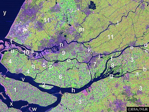
A satellite image of the Rhine–Meuse–Scheldt delta, showing the islands of South Holland
Rotterdam
Videos
Rotterdam is the second-largest city in the Netherlands after the national capital of Amsterdam. It is in the province of South Holland, part of the North Sea mouth of the Rhine–Meuse–Scheldt delta, via the "New Meuse" inland shipping channel, dug to connect to the Meuse at first and now to the Rhine.

Image: Erasmusbrug seen from Euromast

Image: Laurenskerk, Rotterdam

Image: Rotterdam zadkine monument
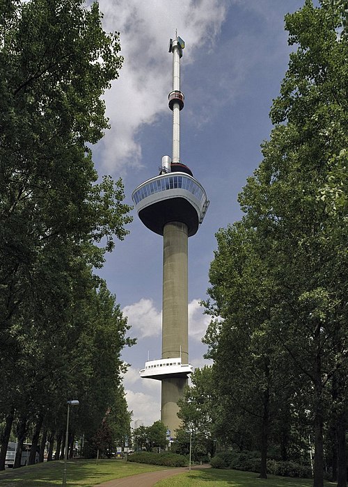
Image: Overzicht Rotterdam 20358120 RCE