Southeast Alaska
Videos
Photos
Southeast Alaska, often abbreviated to southeast or southeastern, and sometimes called the Alaska(n) panhandle, is the southeastern portion of the U.S. state of Alaska, bordered to the east and north by the northern half of the Canadian province of British Columbia. The majority of southeast Alaska is situated in Tlingit Aaní, much of which is part of the Tongass National Forest, the United States' largest national forest. In many places, the international border runs along the crest of the Boundary Ranges of the Coast Mountains. The region is noted for its scenery and mild, rainy climate.

A MODIS photograph of Southeast Alaska, February 2002. Border lines with Yukon and British Columbia have been artificially added.

The City and Borough of Juneau, the most populous borough in southeast Alaska.

Ketchikan Gateway Borough, the second most populous borough in southeast Alaska.

The Tongass National Forest, near Ketchikan
Alaska
Videos
Photos
Alaska is a non-contiguous U.S. state on the northwest extremity of North America. It borders the Canadian province of British Columbia and the Yukon territory to the east; it shares a western maritime border in the Bering Strait with Russia's Chukotka Autonomous Okrug. The Chukchi and Beaufort Seas of the Arctic Ocean lie to the north and the Pacific Ocean lies to the south. Technically a semi-exclave of the U.S., it is the largest exclave in the world.

The Russian settlement of St. Paul's Harbor (present-day Kodiak town), Kodiak Island, 1814

Miners and prospectors climb the Chilkoot Trail during the 1898 Klondike Gold Rush.

U.S. troops navigate snow and ice during the Battle of Attu in May 1943.
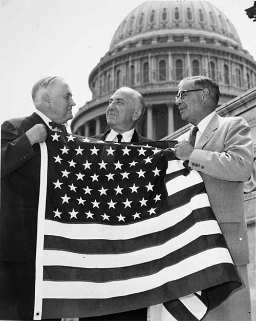
Bob Bartlett and Ernest Gruening, Alaska's inaugural U.S. Senators, hold the 49 star U.S. Flag after the admission of Alaska as the 49th state.