Streets and highways of Washington, D.C.
The streets and highways of Washington, D.C., form the core of the surface transportation infrastructure in Washington, D.C., the federal capital of the United States. Given that it is a planned city, the city's streets follow a distinctive layout and addressing scheme. There are 1,500 miles (2,400 km) of public roads in the city, of which 1,392 miles (2,240 km) are owned and maintained by city government.
Facsimile of manuscript of Peter Charles L'Enfant's 1791 plan for the federal capital city (United States Coast and Geodetic Survey, 1887).
Thackara & Vallance's 1792 print of Ellicott's "Plan of the City of Washington in the Territory of Columbia", showing street names, lot numbers, depths of the Potoma River and legends
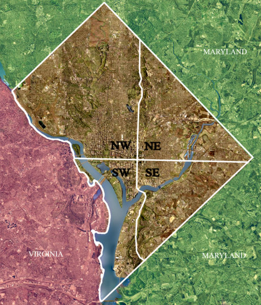
Washington, D.C., is divided into four quadrants: Northwest, Northeast, Southeast, and Southwest. The axes bounding the quadrants radiate from the United States Capitol building.
A street sign for the unit block of G Street Northeast, next to Union Station. Tourists sometimes see this sign as a reference to G-Unit.
Rock Creek (Potomac River tributary)
Rock Creek is a tributary of the Potomac River, in the United States, that empties into the Atlantic Ocean via the Chesapeake Bay. The 32.6-mile (52.5 km) creek drains about 76.5 square miles (198 km2). Its final quarter-mile is affected by tides.
Rock Creek in Washington, D.C., in 2015
The culvert at the source of Rock Creek
Lake Needwood
The Boundary Footbridge crosses Rock Creek at the Maryland–D.C. border


