Synoptic scale meteorology
In meteorology, the synoptic scale is a horizontal length scale of the order of 1,000 km (620 mi) or more. This corresponds to a horizontal scale typical of mid-latitude depressions. Most high- and low-pressure areas seen on weather maps are synoptic-scale systems, driven by the location of Rossby waves in their respective hemisphere. Low-pressure areas and their related frontal zones occur on the leading edge of a trough within the Rossby wave pattern, while high-pressure areas form on the back edge of the trough. Most precipitation areas occur near frontal zones. The word synoptic is derived from the Ancient Greek word συνοπτικός (sunoptikós), meaning "seen together".
Golden Gate Bridge in fog
In meteorology, a low-pressure area, low area or low is a region where the atmospheric pressure is lower than that of surrounding locations. Low-pressure areas are commonly associated with inclement weather, while high-pressure areas are associated with lighter winds and clear skies. Winds circle anti-clockwise around lows in the northern hemisphere, and clockwise in the southern hemisphere, due to opposing Coriolis forces. Low-pressure systems form under areas of wind divergence that occur in the upper levels of the atmosphere (aloft). The formation process of a low-pressure area is known as cyclogenesis. In meteorology, atmospheric divergence aloft occurs in two kinds of places:The first is in the area on the east side of upper troughs, which form half of a Rossby wave within the Westerlies.
A second is an area where wind divergence aloft occurs ahead of embedded shortwave troughs, which are of smaller wavelength.

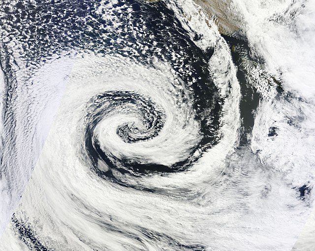
A clockwise spinning low-pressure area or cyclone of southern Australia. The center of the spiral-shaped cloud system is also center of the low.
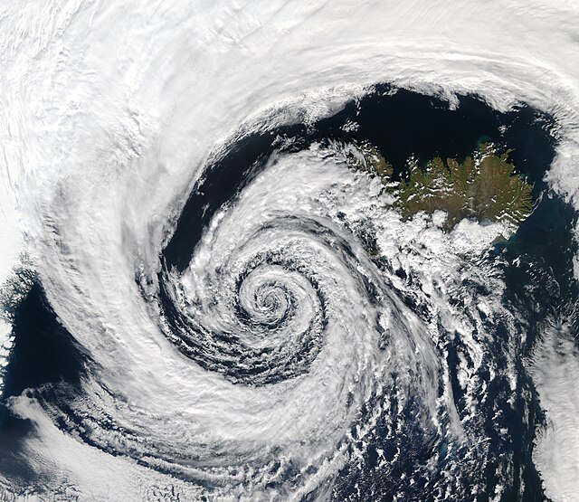
A low-pressure system over Iceland.
This depiction of the Hadley cell shows the process which sustains low-pressure areas. Diverging winds aloft allow for lower pressure and convergence at the Earth's surface, which leads to upward motion.
QuikSCAT image of typical extratropical cyclones over the ocean. Note the maximum winds on the poleward side of the occluded front.


