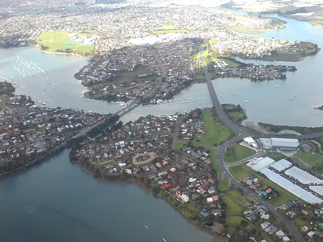
The Tāmaki River or Tāmaki Estuary is mostly an estuarial arm and harbour of the Hauraki Gulf, within the city of Auckland in New Zealand. It extends south for 15 kilometres (9 mi) from its mouth between the suburb of Saint Heliers and the long thin peninsula of Bucklands Beach, which reaches its end at Musick Point. The inlet extends past the suburbs of Glendowie, Wai o Taiki Bay, Point England, Glen Innes, Tāmaki, Panmure, and Ōtāhuhu to the west, and Bucklands Beach, Half Moon Bay, Farm Cove, Sunnyhills and Pakuranga to the east.
The middle of the estuary looking east
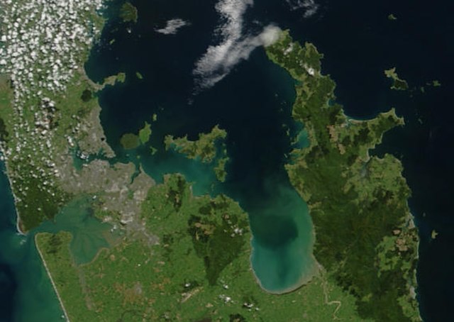
The Hauraki Gulf / Tīkapa Moana is a coastal feature of the North Island of New Zealand. It has an area of 4000 km2, and lies between, in anticlockwise order, the Auckland Region, the Hauraki Plains, the Coromandel Peninsula, and Great Barrier Island. Most of the gulf is part of the Hauraki Gulf Marine Park.
True-colour image showing the Hauraki Gulf / Tīkapa Moana, with Auckland (left) and the Coromandel Peninsula (right), by NASA's Terra satellite, 2002.
Sunset view of The Noises viewed from Waiheke Island
Farmland and native bush on Ponui Island
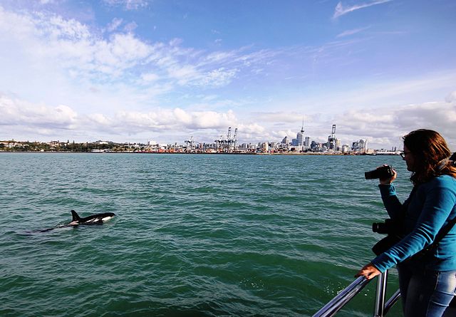
An orca swims in Waitematā Harbour, with Auckland CBD in the background.