Tabula Peutingeriana, also referred to as Peutinger's Tabula or Peutinger Table, is an illustrated itinerarium showing the layout of the cursus publicus, the road network of the Roman Empire.
Tabula Peutingeriana (section of a modern facsimile), top to bottom: Dalmatian coast, Adriatic Sea, southern Italy, Sicily, African Mediterranean coast
Rome (from a facsimile)
A modern version of the Roman Tabula Peutingeriana, without the reconstructed British and Iberian panel in the west to India in the east. (Konrad Miller, 1887)
The cursus publicus was the state mandated and supervised courier and transportation service of the Roman Empire, whose use continued into the Eastern Roman Empire. It was a system based on obligations placed on private persons by the Roman State. As contractors, called mancipes, they provided the equipment, animals, and wagons. In the Early Empire compensation had to be paid but this had fallen into abeyance in Late Antiquity when maintenance was charged to the inhabitants along the routes. The service contained only those personnel necessary for administration and operation. These included veterinarians, wagon-wrights, and grooms. The couriers and wagon drivers did not belong to the service: whether public servants or private individuals, they used facilities requisitioned from local individuals and communities. The costs in Late Antiquity were charged to the provincials as part of the provincial tax obligations in the form of a liturgy/munus on private individual taxpayers.
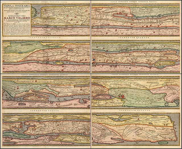
Cursus publicus shown in the Tabula Peutingeriana


