1.
Development regions of Nepal
–
As of 20 September 2015 Nepal is divided into 7 provinces. They are defined by schedule 4 of the new constitution, by grouping together the existing districts, two districts however are split in two parts ending up in two different provinces. Before the new constitution, Nepal was divided into five development regions,14 administrative zones and 75 districts, the 14 administrative zones were grouped into five development regions. Each district is headed by a Chief District Officer responsible for maintaining law and order, the five development regions of Nepal were, King Birendra divided the entire Kingdom in 4 different regions in 2029 BS. These regions were as below, Eastern Development Region, Central Development Region, Western Development Region, to fill the gap between different parts of the nation by balanced or proportionate development. List of provinces of Nepal List of zones of Nepal List of districts of Nepal List of village development committees of Nepal ISO 3166-2, NP
2.
Eastern Development Region, Nepal
–
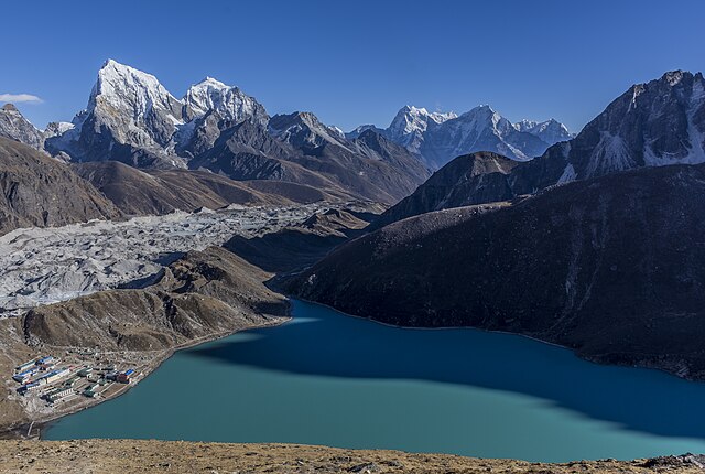
The Eastern Development Region was one of Nepals five development regions. It was located at the end of the country with its headquarters at Dhankuta. The fourteen administrative zones of Nepal were split between five development regions, one of which was the Eastern Region, the town of Dhankuta was the capital of the Eastern Region, as well as the capital of the Dhankuta District. The Eastern Sector embraced the snow-capped peaks including Mt. Everest, Mt. Kangchenjunga, the profusion of natural resources connected with the amiable and warm nature of the inhabitants makes the region uniquely different. It comprised three zones, Sagarmatha Koshi Mechi Mt. Everest, Kanchanjunga, Makalu, Lhotse, Pumori are the mountains of Eastern Development Region. Sagarmatha National Park, Makalu Barun National Park, Kanchanjunga Conservation Area, the Eastern Development Region consists of about 28,456 square kilometers of area. Terai, extended from east to west, is made up of alluvial soil, to the west of Koshi River, in between Mahabharat and Churia, there elongates a valley called Inner Terai. Churai ranges, Mahabharat, hills of various height, basins, tars, some parts of this region are favourable for agriculture but some other parts are not. Himalayan region, in the north, consists of many mountains ranges, mahalangur, Kumbhakarna, Umvek, Lumba Sumba and Janak are some of them. The highest mountain in the world, Mount Everest, and the third highest mountain, nepal’s lowest point, Kechana Kalan at 60 m, is located in the Jhapa district of this development region. There are many river basins and gentle slopes as well, churai, Mahabharat, many basins, tars and valleys form the Terai region. Between the Churia and Mahabharat a low land of inner Terai exists, the Koshi river flows through the region with its seven tributaries like Indrawati, Likhu, Tamur, Dudh Kosi, Arun, Tamakoshi and Bhote Koshi. There are other rivers as well, tundra vegetables, coniferous forest, deciduous monsoon forests and sub-tropical evergreen woods are vegetations found here. Sub-tropical, temperate, sub-temperate, and alpine and tundra types of climates are found here, the major cities of this region are Biratnagar, Dharan, Dhankuta, Itahari, Rajbiraj, Birtamod and Damak, Gaighat, Lahan, Ilam and Bhadrapur. Other notable places are Namche Bazaar, the town near the camp of Mt. Everest
3.
Limbuwan
–
Limbuwan is an area of the Himalaya historically made up of 10 Limbu kingdoms, all now part of Nepal. Limbuwan means abode of the Limbus or Land of the Limbus, Limbus themselves call Limbuwan Yakthung Laaje or the country of the Yakthungs. Today, Limbuwan comprises the districts of Taplejung, Panchthar, Ilam, Jhapa, Terhathum, Sankhuwasabha, Dhankuta, Sunsari, Limbuwan is the land east of the Arun and Koshi Rivers and west of Kanchenjunga Mountain and the Mechi River. The seat of power in Kathmandu and western Nepalese refer to Limbuwan as the Pallo Kirant region or far Kirant, the Ten Kings of Limbus came together to formally declare all the ten kingdoms between the Arun River and Teesta River to be called Yakthung Laaje. The ten rulers, their kingdoms and their forts, Samlupi Samba Hang, King of Tambar, sisiyen Shering Hang, King of Mewa and Maiwa kingdoms and his capital Meringden Yiok. Thoktokso Angbo Hang, King of Athraya and his capital Pomajong, thindolung Khokya Hang, King of Yangwarok and his capital Hastapojong Yiok Yengaso Papo Hang, King of Panthar and his capital at Yashok and Pheden. Shengsengum Phedap Hang, King of Phedap and his capital at Poklabung, mung Tai Chi Emay Hang, King of Ilam and his capital at Phakphok. Soiyak Lado Hang, King of Bodhey and his capital at Shanguri Yiok, tappeso Perung Hang, King of Thala and his capital at Thala Yiok. Taklung Khewa Hang, King of Chethar and his capital at Chamling Chimling Yiok, after a brief period, King Mawrong Hang came to prominence and took over Terai lands of Chethar, Bodhey, Panthar and Ilam. He named his Kingdom Morang after his name and rose to power and he subdued all the Ten Limbu Kings of Limbuwan and became their overlord. He died without any heir and King Uba Hang took over as supreme ruler of Limbuwan in 849 AD-865 AD. He made many religious and social reforms in Limbuwan, Uba Hangs worthy son Mabo Hang succeeded him in 865 AD and ruled till 880 AD. Uba hang kept on with the reforms his father had started, Uba Hang was succeeded by his son Muda Hang. Muda Hang was a weak ruler so the local chiefs started ruling their areas independently, Muda Hang was succeeded by his son Wedo Hang, by this time Limbuwan was in chaos and every principality was ruling independently and fighting with each other. Wedo hang was murdered and his son Chemjonghang succeeded, during this chaos and the waning phase of King Chemjong hang, King Sirijonga of Yangwarok kingdom rose to power. He subdued all the independent rulers and took over as the new ruler of Limbuwan. He built two big forts in Phedap and Chainpur, the remains of the structure still stand today. One of legacy was that he brought all the Limbus under the writing system in Limbu script
4.
Zones of Nepal
–
As of 20 September 2015 Nepal is divided into 7 provinces. They are defined by schedule 4 of the new constitution, by grouping together the existing districts, two districts however are split in two parts ending up in two different provinces. As of earlier model, Nepal was divided into 14 administrative zones and 75 districts, the 14 administrative zones were grouped into five development regions. Each district is headed by a Chief District Officer and is responsible for maintaining law and order and coordinating the work of field agencies of the various government ministries
5.
Mechi Zone
–
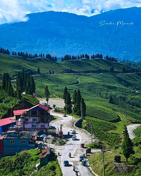
Mechi (Nepali, मेची अञ्चल Listen is one of the fourteen zones of Nepal, comprising four districts, namely Ilam, Jhapa, Panchthar and Taplejung. It comes under the Eastern Development Region of Nepal, the Indian state of Bihar is to the south and Tibet to the north. The largest town is Damak in the Terai, the majority of the population in Mechi are Kirantis and other ethnic groups like Koche and Meche, and hill castes like Bahun and Chhetris. Mechi is divided into four districts, Among the four districts, Jhapa is in the Terai, Ilam and Panchthar are in the hilly region. Ilam is also in a developing stage, Ilam is naturally very beautiful, with many tourists visiting Ilam annually. Kanyam is popular for its tea garden, at Antu the rising sun can be viewed. Panchthar is the least developed of the four districts, Taplejung is in the mountainous zone. There are two airports within Mechi, one in Bhadrapur and one in Taplejung, Mechi is famous for microcredit development. The Small Farmer Development Programme was the first rural and micro-financing program in Mechi, the Agricultural Development Bank started this SFDP in 1988. It started in a few VDCs and spread, after lifting many people out of poverty, the SFDP was handed over to the local people and the new institution was named Small Farmer Cooperative Ltd. There are 13 SFCLs in Mechi, each of which covers a single VDC and it is one of the major districts for the production of tea and rice. Budhabare is on the side of the Mahendra Highway and is one of the most fertile lands of Nepal. Mechi as a district is popular for the bittle nuts, several large tea estate are in Mechi. Giri Bandhu Tea Estate, Burne Tea State, Tokla Tea Estate, Himalaya Tea State, Damak, Mechi has different sorts of communication medium. Development Regions of Nepal List of zones of Nepal List of districts of Nepal
6.
Taplejung
–
Taplejung is a municipality and the headquarters of Taplejung District in the Mechi Zone of Nepal. The municipality was formed merging the two Village Development Committees of Phungling and Dokhu in May 2014, at the time of the 2011 Nepal census it had a population of 19,085 people living in 4,480 individual households. It is located at 27°210N 87°400E with an altitude of 1441 metres, the name Taplejung is derived from the words Taple and jung. Taple was the medieval Limbu king who used to rule the area, literally, Taplejung means Fort of King Taple. Taplejung is in northeastern Nepal, the Tamur River flows through the district, the area is home of Kangchenjunga, the third highest mountain in the world. Taplejung has an airstrip with commercial flights to Biratnagar and Kathmandu, a road connects the district headquarters with the Tarai plains. Most of the population are involved in agriculture, and the vegetation zones range from sub-tropical to temperate forests, alpine meadows, and snow, and ice. Taplejung is one of the most beautiful areas in eastern Nepal, with a landscape, Himalayan peaks of heights above 7000 meters. Alpine grassland, rocky outcrops, dense temperate and subtropical forests, Taplejung occupies an area ranging from 670 meters to 8586 meters above sea level. Kumbhakarna is an outlier of Kangchenjunga and this area is home to a diverse range of ethnic groups like the Limbu, Tibetans, Sherpas, Gurung, Magars, Newars and Tamangs. The Kanchenjunga Conservation Area in the eastern Himalaya boasts some of the most stunning scenery in all of Nepal, traditional farming practices are a way of life here. There are rich forests with more than 250 species of bird, there are a number of high mountain lakes in Olangchung Gola. The main inhabitants of Taplejung are Limbu, Chhetri, Tamang, Brahman, Sherpa, Bhote, Newar, Taplejung Municipality is linked with roadway and airway. It is connected to rest of the country through the Mechi Highway, passenger buses and jeeps to Taplejung are easily available in Birtamod. Suketar Airport has flights from Biratnagar and Kathmandu, to promote local culture Taplejung has 3 FM radio stations, Radio Tamor -102.0 MHz which is a community radio station, Taplejung F. M. -94.0 MHz and Radio Faktanglung 89.8 MHz. Residents practise integrated early animist religions, agriculture, animal husbandry and tourism are the major means of livelihood for Limbu people. In the higher altitudes, one can find sherpa people where they arrived from Tibet more than 400 years ago and these sherpas have a distinct culture and tradition from those in Solukhumbu District in the Sagarmatha region. The icons of the cultural heritage are monasteries, chhortens, temples, and to add to the flavour, the festivals of all of these people living in harmony only serve to make the native culture livelier
7.
Languages of Nepal
–
The 2011 National census lists 123 Nepalese languages spoken as a mother tongue in Nepal. Most belong to the Indo-Aryan and Sino-Tibetan language families, the official language of Nepal is Nepali, formerly called Khaskura then Gorkhali. According to the 2011 national census, the percentage of Nepali Bhasi people is about 44. 6%, maithili is the second largest Nepalese language and according to 2011 Census, the percentage of Maithil people is 11. 57%. Three quarters of the 123 languages native to Nepal belong to the Tibeto-Burman language family, this includes Nepal Bhasa, the Dravidian languages are represented by Kurux, and the Munda languages of the Austroasiatic family by Santali and Mundari. The indigenous languages of Nepal that predated the influx of Indic, Tibeto-Burman, and other families barely survive in the Kusunda language, which is nearly extinct today. Nepal also has at several indigenous village sign languages, Jhankot Sign Language, Jumla Sign Language, and Ghandruk Sign Language, in addition to the Nepali Sign Language designed for national use
8.
Limbu language
–
Limbu is a Sino-Tibetan language spoken in Nepal, India, Bhutan, Burma, Thailand, the United Kingdom, Hong Kong, Canada, and the USA. It is falsely believed that the Limbu/Yakthung are multi-lingual, but there are hundred and/or thousand of Yakthung who speak only in Yakthungpan, the Limbu refer to themselves as Yakthung and their language as Yakthungpan. Yakthungpan has four dialects, Phedape, Chhathare, Tambarkhole. Among four dialects and/or many dialects, Phedape dialect is widely spoken, as Panthare Yakthungs are much more engaged in central political position and administrative positions, they are trying to introduce Panthare dialect as a Standard Yakthungpan. Yakthungpan is one of the languages spoken and written in Nepal, Darjeeling, Kalimpong, Sikkim, Bhutan, Burma. Today, linguists have reached the conclusion that Yakthungpan resembles Tibetan, before the introduction of the Sirijanga script among Limbu Kirats, the Rong script was popular in East Nepal, especially in the early Maurong state. The Sirijanga script had almost disappeared for 800 years and it was back into use by Te-ongsi Sirijunga Xin Thebe of Tellok Sinam Limbuwan present day Nepal. Limbu is spoken east of the Arun River in the districts of Nepal. Dialect cluster 1 Panthare Chaubise Yanggrokke Dialect cluster 2 Phedappe Tamorkhole Dialect cluster 3 Chhatthare Yanggrokke, Chaubise, chattare is less well understood by other dialect speakers. The Limbu dialect spoken in Sikkim, India is the same as Panthare, Limbu, Lepcha and Newari are the only Sino-Tibetan languages of the central Himalayas with their own scripts. The Limbu script or Sirijanga script was devised during the period of Buddhist expansion in Sikkim in the early 18th century when Limbuwan still constituted part of Sikkimese territory, the Limbu script was probably designed roughly at the same time as the Lepcha script. However, it is believed that the Limbu script had been designed by the King Sirijanga in the 9th century. The Sirijanga script was later redesigned and re-introduced by Tye-Angsi Singthebe, as Tye-Angsi Singthebe spent most of his time in the development of Yakthungpan, Yatkhung culture, and Limbu script, he is considered as the reincarnation of the 9th century King Hang Sirijunga. As Tye-Angsi Singthebe was astoundingly influential person to spread Limbu script, culture, Tasong monks feared that Tye-Angsi Singthebe might transform the social, cultural, and linguistic structure of Sikkim. Therefore, Tasong monks caputured Tye-Angsi, bound on a tree, both Limbu and Lepcha were ostensibly devised with the intent of furthering the spread Buddhism. However, Sirijanga was a Limbu Buddhist who had studied under Sikkimese high Lamas, Sirijanga was given the title the Dorje Lama of Yangrup. The language and scripts influential structure are mixture of Tibetan and Devanagari, unlike most other Brahmic scripts, it does not have separate independent vowel characters, instead using a vowel carrier letter with the appropriate dependent vowel attached. The Limbu language and literature has been practiced in Nepal since the last eighteenth century
9.
Nepali language
–
Nepali, originally known as Khas Kura, Parbate Bhasa or Gorkhali, is an Indo-Aryan language. It is the language and de facto lingua franca of Nepal. It is also spoken in parts of India, particularly by Indian Gorkha. In India, Nepali language is listed in the Eighth Schedule to the Constitution of India having a status in the Indian state of Sikkim. Nepali developed in proximity to a number of Indo-Aryan languages, most notably the Pahari languages and Magahi, however, owing to Nepals geographical area, it has also been influenced by Tibeto-Burman languages. Nepali is mainly differentiated from Central Pahari, both in grammar and vocabulary, by Tibeto-Burman idioms owing to close contact with the language group. Nepali language shares 40% lexical similarity with the Bengali language, in the nineteenth century, the British resident at Kathmandu Brian Houghton Hodgson observed that it was, in eight-tenths of its vocabulary, substantially Hindi. Historically, the language was first called the Khas language, then Gorkhali or Gurkhali before the term Nepali was adopted, in 1920, during Rana regime in Nepal, the term Nepal which resembled the Nepal Mandala was taken from its people. Soon after that, Nepal Bhasa was renamed into Newari and Parbate/Khas language took over as Nepali language, other names include Parbatiya and Dzongkha Lhotshammikha. It is also known as the Khey language or Partya language among the Newar people and Pahari language among Madhesi, however, due to protests for identity, Newars have restored their languages name as Nepal Bhasa and voices have been raise to re-instate Parbate language in its original name. Nepali developed a significant literature within a period of a hundred years in the 19th century. This literary explosion was fueled by Adhyatma Ramayana, Sundarananda Bara, Birsikka, a collection of folk tales. The contribution of trio-laureates Lekhnath Paudyal, Laxmi Prasad Devkota, the contribution of expatriate writers outside Nepal, especially in Darjeeling and Varanasi in India, is also notable. In the past decade, there have been many contributions to Nepali literature from the Nepali diaspora in Asia, Europe, America, according to the 2011 national census,44.6 percent of the population of Nepal speaks Nepali as a first language. The Ethnologue website reports 12,300,000 speakers within Nepal, Nepali is traditionally spoken in the Hill Region of Nepal, especially in the western part of the country. Although the Newar language dominated the Kathmandu valley, Nepali is currently the most dominant, Nepali is used in government and as the everyday language of a growing portion of the local population. Nevertheless, the use of Nepali in the courts and government of Nepal is being challenged. Recognition of other languages in Nepal was one of the objectives of the Communist Party of Nepals long war
10.
Geography of Nepal
–
Nepal measures about 800 kilometers along its Himalayan axis by 150 to 250 kilometers across. Nepal has an area of 147,181 square kilometers, Nepal is landlocked by India on three sides and Chinas Tibet Autonomous Region to the north. West Bengals narrow Siliguri Corridor or Chickens Neck separate Nepal and Bangladesh, to the east are India and Bhutan. Nepal depends on India for goods facilities and access to the sea. For a small country, Nepal has tremendous geographic diversity, along a south-to-north transect, Nepal can be divided into three belts, Terai, Hill and Mountain Regions. In the other direction, it is divided into three major systems, from east to west, Koshi, Gandaki/Narayani and Karnali, all tributaries of the Ganges. The Ganges-Yarlung Zangbo/Brahmaputra watershed largely coincides with the Nepal-Tibet border, however several Ganges tributaries rise inside Tibet, the Terai or Madhesh region begins at the Indian border and includes the southernmost part of the flat, intensively farmed Gangetic Plain called the Outer Terai. By the 19th century, timber and other resources were being exported to India, the Outer Terai is culturally more similar to adjacent parts of Indias Bihar and Uttar Pradesh than to the hill region of Nepal. Nepali is taught in schools and often spoken in government offices, however the population mostly uses Maithali, Bhojpuri. The Outer Terai ends at the base of the first range of foothills called the Siwaliks or Churia and this range has a densely forested skirt of coarse alluvium called the bhabhar. Below the bhabhar, finer, less permeable sediments force groundwater to the surface in a zone of springs, in Persian, terai refers to wet or marshy ground. Before the use of DDT this was dangerously malarial, Nepals rulers used this for a defensive frontier called the char kose jhadi. Above the bhabhar belt, the Siwaliks rise to about 700 metres with peaks as high as 1,000 metres and this range is composed of poorly consolidated, coarse sediments that do not retain water or support soil development so there is virtually no agricultural potential and sparse population. In several places beyond the Siwaliks there are dūn valleys called Inner Terai and these valleys have productive soil but were dangerously malarial except to indigenous Tharu people who had genetic resistance. In the mid-1950s DDT came into use to suppress mosquitos and the way was open to settlement from the land-poor hills, the terai ends and the Hills begin at a higher range of foothills called the Mahabharat Range. Situated south of the Mountain Region, the Hill Region is mostly betw altitude. This region begins at the Mahabharat Range where a system called the Main Boundary Thrust creates an escarpment 1,000 to 1,500 metres high. These steep southern slopes are nearly uninhabited, thus an effective buffer between languages and culture in the Terai and Hill regions, Hindu Paharis mainly populate river and stream bottoms that enable rice cultivation and are warm enough for winter/spring crops of wheat and potato
11.
Nepal
–
Nepal, officially the Federal Democratic Republic of Nepal, is a landlocked central Himalayan country in South Asia. Nepal is divided into 7 provinces and 75 districts and 744 local units including 4 metropolises,13 sub-metropolises,246 municipal councils and 481 village and it has a population of 26.4 million and is the 93rd largest country by area. Bordering China in the north and India in the south, east, Nepal does not border Bangladesh, which is located within only 27 km of its southeastern tip. It neither borders Bhutan due to the Indian state of Sikkim being located in between, Nepal has a diverse geography, including fertile plains, subalpine forested hills, and eight of the worlds ten tallest mountains, including Mount Everest, the highest point on Earth. Kathmandu is the capital and largest city. It is a nation with Nepali as the official language. The territory of Nepal has a history since the Neolithic age. The name Nepal is first recorded in texts from the Vedic Age, the era which founded Hinduism, in the middle of the first millennium BCE, Gautama Buddha, the founder of Buddhism, was born in southern Nepal. Parts of northern Nepal were intertwined with the culture of Tibet, the Kathmandu Valley in central Nepal became known as Nepal proper because of its complex urban civilization. It was the seat of the prosperous Newar confederacy known as Nepal Mandala, the Himalayan branch of the ancient Silk Road was dominated by the valleys traders. The cosmopolitan region developed distinct traditional art and architecture, by the 18th century, the Gorkha Kingdom achieved the unification of Nepal. The Shah dynasty established the Kingdom of Nepal and later formed an alliance with the British Empire, the country was never colonized but served as a buffer state between Imperial China and Colonial India. In the 20th century, Nepal ended its isolation and forged ties with regional powers. Parliamentary democracy was introduced in 1951, but was suspended by Nepalese monarchs in 1960 and 2005. The Nepalese Civil War resulted in the proclamation of a republic in 2008, modern Nepal is a federal secular parliamentary republic. Nepal is a nation, ranking 144th on the Human Development Index in 2016. The country struggles with the transition from a monarchy to a republic and it also suffers from high levels of hunger and poverty. Despite these challenges, Nepal is making progress, with the government declaring its commitment to elevate the nation from least developed country status by 2022
12.
Limbu people
–
The name Limbu is an exonym of an uncertain origin. They call themselves Yakthumba (IPA, or Yakthungba, in Standard Tibetan, they are referred to as Sikkimese people and in Sikkimese as Shong or Tsong Tsang people. Portions of the Limbu population are located in the east and west districts of Sikkim. Limbu clans and tribes are divided into two gotras indicating their origin, Lhasa and Yunnan, the Limbu are known as Yakthung Thibong or Ten Limbu, from which thirteen Limbu subgroups have emerged. According to legend, five of the came from Yunnan. The Chinese text Po-ou-Yeo-Jing translated in 308 AD refers to the Yi-ti-Sai, accounts with Sirijunga Limbu, Lepcha and Newar are the only Sino-Tibetan languages of the Central Himalayas to possess their own pre-20th century scripts. Vowels, ʌ, ɑ, i, u, e, ɑi, o, ɑu, ɛ, ɔ Consonants k, kh, g, gh, ŋ, c/ts, ch/tsh, j/dz, jh/dz, t, th, d, dh, n, p, ph, b, bh, m, j, r, l, w, sh, s, h, tr 1. Sleep, imma, kiratism or Kirat Dharma Limbus practice many of their own life cycle rituals and they believe that lineage is not transmitted patrilineally. Rather, a woman inherits her mothers gods, and when she marries and lives with her husband she brings with her the deities that will then be recognized as the household deities, Limbu bury their dead and observe for two-to-three days through practiced death rituals. The length of the period varies depending on the gender of the deceased. Dancing parties are arranged for visitors to the village and these affairs give the young Limbu girls and boys a chance to meet and enjoy dancing and drinking. The traditional dress of the Limbus are mekhli and taga, while performing mangsewa IPA, Yakthung IPA, people wear mekhli and taga in white colour as it symbolizes purity. Dhaka is the fabric of the Limbus which are made by weaving it in geometric patterns in a handloom. The art of making dhaka is taught by one generation to another and you will always see a Limbu man clad in dhaka topi and scarf, and a Limbu lady in dhaka saree, mekhli, blouse and shawl. In the olden days, the Limbus were skilled in silk farming, the Kiratis were also known as silk traders. According to JB Subba and Iman Xin Chemjong, the Kirat is a form of kereta. Mekhli- Long dress worn with a strip of cloth with collars crossing over or in a Vneck style. Chunglokek/sunghamba- Blouse Chaubandi Cholo- Blouse with collars overlapping each other Sim- gunyo in Nepali, a long strip of cloth wrapped around like a skirt
13.
Tropical climate
–
A tropical climate in the Köppen climate classification it is a non-arid climate in which all twelve months have mean temperatures of at least 18 °C. In tropical climates there is only two seasons, a wet season and a dry season. Tropical climates are frost-free and changes in the angle are small. In tropical climates temperature remains constant throughout the year. Within the tropical climate there are distinct varieties based on precipitation, In the Tropical rainforest climate. These climates usually occur within 5–10° latitude of the equator, in some eastern coast areas, they may extend to as much as over 26° away from the equator. This climate is dominated by the doldrums Low Pressure System all year round and it is dominated by the monsoon winds which change direction according to the seasons. This climate has a driest month with less than 60 millimetres. Examples, Southern part of Arabian Peninsula, mountaintops within the tropics, e. g. Mount Kenya, can be cold. However, like lowlands in the tropics, there is seasonal variation of temperature. Because of the effect of sun angle on climate most areas within the tropics are hot year-round, the ITCZ is shown, for July average, in the graphic. Areas of ascending air have heavy rainfall, areas of descending air are dry, the ITCZ somewhat follows the solar equator throughout the year, but with geographical variations, and in some areas is heavily influenced by local large-scale monsoons
14.
Subtropics
–
The subtropics are geographic and climate zones located roughly between the tropic circle of latitude at 23.5 latitude and temperate latitudes. Subtropical climates are characterized by warm to hot summers and cool to mild winters with infrequent frost. Subtropical climates can occur at elevations within the tropics, such as in the southern end of the Mexican Plateau and in Vietnam. Six climate classifications use the term to define the various temperature. A great portion of the deserts are located within the subtropics. Within savanna regimes in the subtropics, a wet season is seen annually during the summer, within Mediterranean climate regimes, the wet season occurs during the winter. Areas bordering warm oceans are prone to heavy rainfall from tropical cyclones. Plants such as palms, citrus, mango, lychee, the tropics have been historically defined as lying between the Tropic of Cancer and Tropic of Capricorn, located at 23. 45° north and south latitude respectively. The poleward fringe of the subtropics is located at approximately 40° north and south latitude respectively, northern fringes of the type can go further north due to moderating effects of ocean streams, like in parts of Southern Europe due to heat transported by the Gulf Stream. Several methods have used to define the subtropical climate. In the Trewartha climate classification, a subtropical region should have at least eight months with a temperature greater than 10 °C. According to the Troll-Paffen climate classification, there exists one large subtropical zone named the warm-temperate subtropical zone. According to the E. Neef climate classification, the zone is divided into two parts, Rainy winters of the west sides and Eastern subtropical climate. According to the Wilhelm Lauer & Peter Frankenberg climate classification, the zone is divided into three parts, high-continental, continental, and maritime. According to the Siegmund/Frankenberg climate classification, subtropical is one of six zones in the world. Heating of the earth near the equator leads to large amounts of upward motion and convection along the trough or Intertropical convergence zone. The upper-level divergence over the near-equatorial trough leads to air rising and moving away from the equator aloft, as the air moves towards the Mid-Latitudes, it cools and sinks, which leads to subsidence near the 30th parallel of both hemispheres. This circulation is known as the Hadley cell and leads to the formation of the subtropical ridge, many of the worlds deserts are caused by these climatological high-pressure areas, located within the subtropics
15.
Temperate climate
–
In geography, temperate or tepid latitudes of Earth lie between the tropics and the polar regions. The temperatures in these regions are relatively moderate, rather than extremely hot or cold. The north temperate zone extends from the Tropic of Cancer to the Arctic Circle, the south temperate zone extends from the Tropic of Capricorn to the Antarctic Circle. In some climate classifications, the zone is often divided into several smaller climate zones. These include Humid subtropical climate, Mediterranean climate, oceanic, subtropical climates are located between 23. 5° and 35. 0° north or south latitude on the eastern or leeward sides of landmasses. This climate has long, generally hot, summers and short, mild winters and these climates may occur in southern Asia, the southeastern United States, parts of eastern Australia, and in eastern coastal South America. Mediterranean climates, occur between 30° and 42° north and south latitude, on the sides of landmasses. This climate has hot summers and short mild winters, however, seasonal rainfall is the opposite of that of the subtropical humid type. These climates occur near the rimlands of the Mediterranean Sea, in western Australia, in California, the oceanic climates occur in the higher middle latitudes, between 45° and 60° north and south latitude. They are created by the flow from the cool high latitude oceans to their west. This causes the climate to have cool summers and cool winters, annual rainfall is spread throughout the entire year. Regions with this climate include Western Europe, northwestern North America, the Continental climates occur in middle latitudes, between 35° or 40° to 55°. These climates are normally inland or on sides of landmasses. They feature warm to hot summers and cold winters, with a large temperature variation. Regions with this climate include northern temperate Asia, the northern United States, southern Canada, the vast majority of the worlds human population resides in temperate zones, especially in the northern hemisphere, due to its greater mass of land. The richest temperate flora in the world is found in southern Africa, geographical zone Habitat Köppen climate classification Middle latitudes Polar circle Subtropics
16.
Montane ecosystems
–
Montane ecosystems refers to any ecosystem found in mountains. These ecosystems are affected by climate, which gets colder as elevation increases. They are stratified according to elevation, dense forests are common at moderate elevations. However, as the elevation increases, the climate becomes harsher, as elevation increases, the climate becomes cooler, due to a decrease in the greenhouse effect. The characteristic flora and fauna in the mountains tend to depend on elevation. This dependency causes life zones to form, bands of similar ecosystems at similar altitude, one of the typical life zones on mountains is the montane forest, at moderate elevations, the rainfall and temperate climate encourages dense forests to grow. Holdridge defines the climate of montane forest as having a biotemperature of between 6 and 12 °C, where biotemperature is the mean temperature considering temperatures below 0 °C to be 0 °C. Above the elevation of the montane forest, the trees thin out in the zone, become twisted krummholz. Therefore, Montane forests often contain trees with twisted trunks and this phenomenon is observed due to the increase in the wind strength with the elevation. The elevation where trees fail to grow is called the tree line. The biotemperature of the zone is between 3 and 6 °C. Above the tree line the ecosystem is called the zone or alpine tundra, dominated by grasses. The biotemperature of the zone is between 1.5 and 3 °C. Many different plant species live in the environment, including perennial grasses, sedges, forbs, cushion plants, mosses. Alpine plants must adapt to the conditions of the alpine environment, which include low temperatures, dryness, ultraviolet radiation. Alpine plants display adaptations such as structures, waxy surfaces. Because of the characteristics of these zones, the World Wildlife Fund groups a set of related ecoregions into the montane grassland and shrubland biome. Climates with biotemperatures below 1.5 °C tend to consist purely of rock, Montane forests occur between the submontane zone and the subalpine zone. The elevation at which one habitat changes to another varies across the globe, the upper limit of montane forests, the forest line or timberline, is often marked by a change to hardier species that occur in less dense stands
17.
Snow line
–
The climatic snow line is the point above which snow and ice cover the ground throughout the year. The actual snow line may seasonally be significantly lower, the interplay of altitude and latitude affects the precise placement of the snow line at a particular location. At or near the equator, it is situated at approximately 4,500 meters above sea level. In addition, the location to the nearest coastline can influence the altitude of the snow line. A higher altitude is necessary to lower the temperature further against the surroundings. Furthermore, large-scale oceanic currents such as the North Atlantic Current can have significant affects over large areas, the highest mountain in the world below the snow line is Ojos del Salado. Compare the usage of snow line indicating the boundary between snow and non-snow, Frost line Frost line Glacier High Alps Ice cap climate Tree line Charlesworth J. K. With special reference to its glaciation, vol. I, london, Edward Arnold Ltd,700 pp. Flint, R. F. New York, xiii+553+555 pp. Kalesnik, S. V, uchpedgiz, Leningrad,328 pp. Tronov, M. V. Voprosy svyazi mezhdu klimatom i oledeneniem, izdatelstvo Tomskogo Universiteta, Tomsk,202 pp. Wilhelm, F. Schnee- und Gletscherkunde, De Gruyter, Berlin,414 pp
18.
Kangchenjunga
–
Kangchenjunga, also spelled Kanchenjunga, is the third highest mountain in the world, and lies partly in Nepal and partly in Sikkim, India. Mount Kangchenjunga lies about 125 km east-south-east of Mount Everest and it is the second highest mountain of the Himalayas. Three of the five peaks – Main, Central and South – are on the border between North Sikkim and Nepal, two peaks are in Nepals Taplejung District. Kangchenjunga Main is the highest mountain in India, and the easternmost of the higher than 8,000 m. It is called Five Treasures of Snow after its five high peaks, allowing for further verification of all calculations, it was officially announced in 1856 that Kangchenjunga is the third highest mountain in the world. Kangchenjunga was first climbed on 25 May 1955 by Joe Brown and George Band and they stopped short of the summit as per the promise given to the Chogyal that the top of the mountain would remain inviolate. Every climber or climbing group that has reached the summit has followed this tradition, other members of this expedition included John Angelo Jackson and Tom Mackinon. Kangchenjunga is the spelling adopted by Douglas Freshfield, Alexander Mitchell Kellas. Freshfield referred to the used by the Indian Government since the late 19th century. There are a number of spellings including Kangchendzönga, Khangchendzonga. It means The Five repositories or ledges of great snow and is descriptive of its five peaks. Kangchenjungas name in the Limbu language is Senjelungma or Seseylungma, and is believed to be an abode of the omnipotent goddess Yuma Sammang. The Kangchenjunga transboundary landscape is shared by Bhutan, China, India and Nepal, the Kangchenjunga Himal section of the Himalayas lies both in Nepal and India, and encompasses 16 peaks over 7,000 m. In the north, it is limited by the Lhonak Chu, Goma Chu and Jongsang La, the western limit runs from the Jongsang La down the Gingsang and Kangchenjunga glaciers and the rivers of Ghunsa and Tamur. Kanchenjunga rises about 20 km south of the alignment of the Great Himalayan range about 125 km east-south-east of Mount Everest as the crow flies. South of the face of Kanchenjunga runs the 3, 000–3,500 m high Singalila Ridge that separates Sikkim from Nepal. Kangchenjunga and its satellite peaks form a mountain massif. The massifs five highest peaks are listed in the following table, the main ridge of the massif runs from north-north-east to south-south-west and forms a watershed to several rivers
19.
Pathibhara Devi Temple
–
Pathibhara Devi or Mukkumlung is one of the most significant Hindu temples of Goddess Pathibhara in Nepal, located on the hill of Taplejung. It is also considered one of the places for Kirat Limbu. Worshippers from different parts of Nepal and India flock to the temple during special occasions, the temple is located 19.4 km east of Phungling municipality at an elevation of 3,794 m. It serves as a route of Kanchenjunga trek. The list of devotees includes the family of Nepal. The pilgrims offer animal sacrifices, gold and silver to please the goddess, the Goddess at Pathibhara temple is believed to possess supernatural powers and diligently answer devotees prayers. She is considered by her devotees as a manifestation of the divine feminine also determined with other names as AdiKali, Maha Maya and it is believed that local shepherds lost hundreds of their sheep while grazing at the same place where the temple stands today. The distressed shepherds had a dream in which the Goddess ordered them to carry out ritualistic sacrifice of sheep, when the sacrifice was offered the lost herd supposedly returned. The ritual of offering sacrifices inside the temple is believed to have started after the incident, pilgrims can also visit monasteries situated in Olangchung Gola and Lungchung. The waterfall at Sawa and the pond of Timbung, during autumn, the forest ecosystem along the trial offers diversity of wildlife, birds, flowers and butterflies. The whole of Kanchenjunga range can be seen in this trek, for tourists other than pilgrims, Limbu Cultural Trek in the region is considered equally enthralling. A week-long trek passes through villages of Taplejung, such as, Phurunga, Limkhim, Khewang, Tellok, PhawaKhola. Pathibhara lies in the junction of three VDCs, Tapethok, Limkhim and PhawaKhola, the journey to Pathibhara starts from Suketar, which is about 20 minute driving from phungling Bazaar and 1-2 hours driving from Suketar to Sano Phedi. Pathibhara Devi is about 3–4 hours walk from Sano phedi, Suketar Airport 2,840 m at Suketar is the only STOL airport in Taplejung district, connecting Kathmandu and Biratnagar by scheduled flights. Pathibhara trail passes through Deurali, Ramitedanda, Chhatedhunga, Bhalugaunda, residents along the trail offer food and lodging facilities. Basic accommodation facilities are available for pilgrims near the temple premises. The best time to visit the temple is during Pre-monsoon and Post-monsoon seasons
20.
Rhododendron
–
It is the national flower of Nepal. Most species have flowers which bloom from late winter through to early summer. Azaleas make up two subgenera of Rhododendron and they are distinguished from true rhododendrons by having only five anthers per flower. Rhododendron is a genus characterised by shrubs and small to large trees, the smallest species growing to 10–100 cm tall, the leaves are spirally arranged, leaf size can range from 1–2 cm to over 50 cm, exceptionally 100 cm in R. sinogrande. They may be evergreen or deciduous. In some species, the undersides of the leaves are covered with scales or hairs, Some of the best known species are noted for their many clusters of large flowers. There are alpine species with flowers and small leaves. Species in this genus may be part of the complex in oak-heath forests in eastern North America. They have frequently been divided based on the presence or absence of scales on the leaf surface. These scales, unique to subgenus Rhododendron, are modified hairs consisting of a scale attached by a stalk. The Rhododendron genus is the largest of the genera in the Ericaceae family, with 1,024 species, though estimates vary from 850-1000 depending on the authority used, consequently, the taxonomy has been historically complex. He listed five species under Rhododendron, at that time he considered the then known six species of Azalea that he had described earlier in 1735 in his Systema Naturae as a separate genus. Linnaeus six species of Azalea were Azalea indica, A. pontica, A. lutea, A. viscosa, A. lapponica and A. procumbens, which he distinguished from Rhododendron by having five stamens, as opposed to ten. As new species of what are now considered Rhododendron were discovered, for instance Rhodora for Rhododendron canadense, Vireya and Hymenanthes for Rhododendron metternichii, now R. degronianum. Of these Tsutsutsi, Pentanthera, Pogonanthum, Ponticum and Rhodora are still used, the sections being Lepipherum, Booram. Soon, as species became available in the nineteenth century so did a better understanding of the characteristics necessary for the major divisions. Chief amongst these were Maximoviczs Rhododendreae Asiae Orientali and Planchon, maximovicz used flower bud position and its relationship with leaf buds to create eight Sections. Bentham and Hooker used a scheme, but called the divisions Series
21.
Phungling
–
Taplejung is a Municipality in the Himalayas of Taplejung District in the Mechi Zone of north-eastern Nepal. This municipality was formed merging two village development committees i. e. Phungling and Dokhu in May 2014, at the time of the 2011 Nepal census it had a population of 19,085 people living in 4,480 individual households. The main inhabitants of Taplejung are Limbu, Chhetri, Tamang, Bhramin, Sherpa, Bhote, Newar, Taplejung Municipality is linked with roadway and airway. It is connected to rest of the country through the Mechi Highway, passenger buses and jeeps to Taplejung are easily available in Birtamod. Suketar Airport has flights from Biratnagar and Kathmandu
22.
Kathmandu
–
Kathmandu is the capital city of the Federal Democratic Republic of Nepal, the largest Himalayan state in Asia. Kathmandu is also the largest metropolis in the Himalayan hill region, the city stands at an elevation of approximately 1,400 metres above sea level in the bowl-shaped Kathmandu Valley of central Nepal. The valley is termed as Nepal Proper and has been the home of Newar culture. The city was the capital of the Kingdom of Nepal and hosts palaces. It has been home to the headquarters of the South Asian Association for Regional Cooperation since 1985, today, it is the seat of government of the Nepalese republic established in 2008, and is part of the Bagmati Zone in Nepalese administrative geography. Kathmandu has been the center of Nepals history, art, culture and it has a multiethnic population within a Hindu and Buddhist majority. Religious and cultural festivities form a part of the lives of people residing in Kathmandu. Tourism is an important part of the economy as the city is the gateway to the Nepalese Himalayas, there are also seven casinos in the city. In 2013, Kathmandu was ranked third among the top ten upcoming travel destinations in the world by TripAdvisor, historic areas of Kathmandu were devastated by a 7.8 magnitude earthquake on 25 April 2015. Nepali is the most spoken language in the city, while English is understood by the citys educated residents, the city of Kathmandu is named after Kasthamandap temple, that stood in Durbar Square. In Sanskrit, Kāṣṭha means wood and Maṇḍap means covered shelter and this temple, also known as Maru Satal in the Newar language, was built in 1596 by Biseth in the period of King Laxmi Narsingh Malla. The two-story structure was entirely of wood, and used no iron nails nor supports. According to legend, all the used to build the pagoda was obtained from a single tree. The structure collapsed during the earthquake on 25 April 2015. The colophons of ancient manuscripts, dated as late as the 20th century, the city is called Kāṣṭhamaṇḍap in a vow that Buddhist priests still recite to this day. Thus, Kathmandu is also known as Kāṣṭhamaṇḍap, during medieval times, the city was sometimes called Kāntipur. This name is derived from two Sanskrit words – Kānti and pur, Kānti is a word that stands for beauty and is mostly associated with light and pur means place. Thus, giving it a meaning as City of light, among the indigenous Newar people, Kathmandu is known as Yeṃ Deśa, and Patan and Bhaktapur are known as Yala Deśa and Khwopa Deśa
23.
Biratnagar
–
Biratnagar is a Sub-Metropolitan city and the second largest city of Nepal. According to the 2011 census, the city fourth in population. But the city ranks second in population density after Kathmandu, Biratnagar is the industrial capital of Nepal and has a total area of 29.729 mi². Its geographical location is 26°2860N 87°1660E, the city is located in Morang District in the Kosi Zone of the eastern Terai region of Nepal. It lies 399 km east of Nepals capital, Kathmandu, and 6 km north of the border of the Indian state of Bihar and it lies in the Province No. 1, as per the new Constitution of Nepal 2015, the old name of Biratnagar was Gograha Bazaar. Biratnagar got its present name in 1919 AD from Keshar Shamsher Rana after objects of historical importance, the region is believed to be a part of the kingdom of Virata, mentioned in the Mahabharata. The ruins of the palace along with stone carved tools, idols, in Nepali birat means huge and nagar means city. This sparked a countrywide anti-Rana demonstration that eventually led to the abolishment of Rana rule in Nepal, according to 2011 CBS census data, Biratnagars population was 214,663. It is the headquarters of Morang district, majority of people are from Bhramin/Chettry community. Most people practice Hinduism followed by Islam, Jainism, Kirat, the main languages are Nepali and Maithili. English is well understood by the educated mass, Biratnagar is situated within one of the most ethnically diverse regions of Nepal, and the rural hinterland is home to a diverse cross section of communities. The highest temperature recorded in Biratnagar was 43.0 °C on the 14th of April,1992, while the lowest temperature ever recorded was −1.0 °C in December 1970. Air, Biratnagar Airport has frequent flights to Kathmandu and other airports inside Nepal and it is the regional hub for the eastern part of the country. Road, Biratnagar is roughly 500 kilometres by road from Kathmandu and it is also well connected to all the parts of the Eastern Development Region including Dharan, Itahari and Dhankuta as well as to most other parts of the country by bus service. Cross-border, Biratnagar is 7 kilometres north of Nepals southern border with Bihar state, the crossing has a customs checkpoint for goods. Indian and Nepalese nationals cross freely, jogbani town in Araria District is on the Indian side, where a rail line ends. There are direct trains from there to Katihar, Kolkata and New Delhi, a rail extension to Biratnagar has been proposed and surveyed
24.
Change, Nepal
–
Change is a village development committee in the Himalayas of Taplejung District in the Mechi Zone of north-eastern Nepal. At the time of the 2011 Nepal census it had a population of 4,034 people living in 861 individual households. There were 1,876 males and 2,158 females at the time of census. This VDC is mainly inhaited by limbu an Mongolian descendant, more specifically Angbuhang and this VDC is popular in producing cash crop orange, cardamom and tobacco. West/south to North/east orientation of land and south facing slope has provided opportunity to get more sunny hours, Change has the popular hiking route Taplejung-Gorja-Basantapur, which passes from the middle along its length. Gorja, a camping site and local picnic spot brushes the natural beauty of Change. UN map of the municipalities of Taplejung District Land orientation and slope has given agroclimatic advantages to Change getting more sunny days. Taplejung-Gorja-Basantapur passes by along Change length providing a good opportiunity for agrobusiness. Gorja, a popular camping site and local picnic spot brushes the natural beauty of Change VDC
25.
Khamlung
–
Khamlung is a village development committee in the Himalayas of Taplejung District in the Mechi Zone of north-eastern Nepal. At the time of the 2011 Nepal census it had a population of 1517 people living in 319 individual households. There were 730 males and 787 females at the time of census, the major famous place of Khamlung VDC are Sagfhara, Dovan etc. UN map of the municipalities of Taplejung District