Tarim Basin
Videos
The Tarim Basin is an endorheic basin in Xinjiang, Northwestern China occupying an area of about 888,000 km2 (343,000 sq mi) and one of the largest basins in Northwest China. Located in China's Xinjiang region, it is sometimes used synonymously to refer to the southern half of the province, that is, Southern Xinjiang or Nanjiang, as opposed to the northern half of the province known as Dzungaria or Beijiang. Its northern boundary is the Tian Shan mountain range and its southern boundary is the Kunlun Mountains on the edge of the Tibetan Plateau. The Taklamakan Desert dominates much of the basin. The historical Uyghur name for the Tarim Basin is Altishahr, which means 'six cities' in Uyghur. The region was also called Little Bukhara or Little Bukharia.


The Tarim Basin is the oval desert in Central Asia.

Tarim basin, ancient boat-shaped coffins
Endorheic basin
Videos
An endorheic basin is a drainage basin that normally retains water and allows no outflow to other, external bodies of water ; instead, the water drainage flows into permanent and seasonal lakes and swamps that equilibrate through evaporation. Endorheic basins are also called closed basins, terminal basins, and internal drainage systems.

The Okavango Delta (centre) of southern Africa, where the Okavango River spills out into the empty trough of the Kalahari Desert. The area was a lake fed by the river during the Ice Ages (national borders are superimposed)

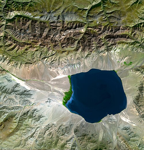
The Caspian Sea, a large inland basin