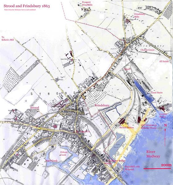
The Thames and Medway Canal is a disused canal in Kent, south east England, also known as the Gravesend and Rochester Canal. It was originally some 11 km (6.8 mi) long and cut across the neck of the Hoo peninsula, linking the River Thames at Gravesend with the River Medway at Strood. The canal was first mooted in 1778 as a shortcut for military craft from Deptford and Woolwich Dockyards on the Thames to Chatham Dockyard on the Medway, avoiding the 74 km (46 mi) journey round the peninsula and through the Thames estuary. The canal was also intended to take commercial traffic between the two rivers.
From the Strood basin (centre right), the canal disappeared almost immediately into the tunnel
The Higham portal to the straight tunnel
The passing place- now used by the railway
Thames and Medway canal in overgrown state, with railway line adjacent
The Hoo Peninsula is a peninsula in Kent, England, separating the estuaries of the rivers Thames and Medway. It is dominated by a line of chalk, clay and sand hills, surrounded by an extensive area of marshland composed of alluvial silt. The name Hoo is a Saxon word believed to mean 'spur of land' or refers to the 'distinct heel-shape of the ridge of hills' through Hoo. Hoo features in the Domesday Book. The peninsula is home to internationally and nationally protected wildlife sites as well as industrial facilities and energy industries.
Stoke Marshes, Hoo Peninsula
A poster of the opening of the Allhallows-on-Sea branch.


