The Californias
Videos
The Californias, occasionally known as The Three Californias or Two Californias, are a region of North America spanning the United States and Mexico, consisting of the U.S. state of California and the Mexican states of Baja California and Baja California Sur. Historically, the term Californias was used to define the vast northwestern region of Spanish America, as the Province of the Californias, and later as a collective term for Alta California and the Baja California Peninsula.
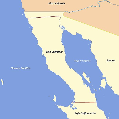
Evolution of the political boundaries of the Californias: Palóu Line (1804–1836) Gila River; border between Las Californias/Alta California and Sonora (1767–1847) Treaty of Guadalupe Hidalgo (1848–Present) Baja California Sur boundary (1931–Present)

Seal of the Government of the Department of the Californias, from 1836 to 1846.
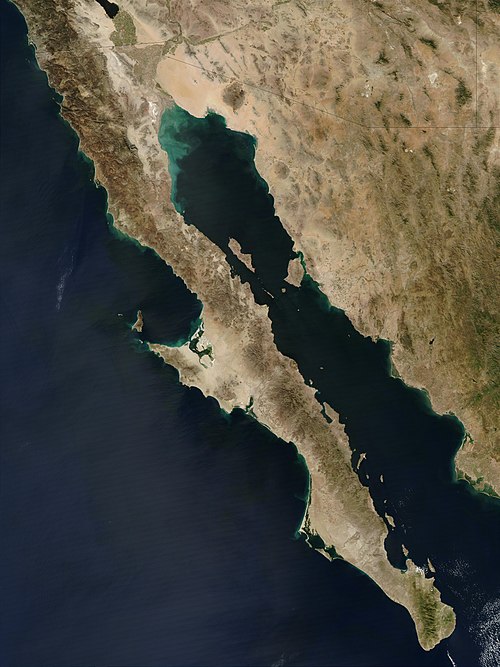
Baja California peninsula
Videos
The Baja California peninsula is a peninsula in northwestern Mexico. It separates the Gulf of California from the Pacific Ocean. The peninsula extends from Mexicali, Baja California, in the north to Cabo San Lucas, Baja California Sur, in the south.

Isla Partida, which is part of the San Lorenzo Marine Archipelago National Park

Port of Cabo San Lucas

Baja California as seen in April 1984, from the bay of a Space Shuttle (STS-41-C)