Theodolite
Videos
Page
A theodolite is a precision optical instrument for measuring angles between designated visible points in the horizontal and vertical planes. The traditional use has been for land surveying, but it is also used extensively for building and infrastructure construction, and some specialized applications such as meteorology and rocket launching.

A direct-readout theodolite, manufactured in the Soviet Union in 1958 and used for topographic surveying

Diagram of an optical readout theodolite

Jesse Ramsden's Great Theodolite of 1787

A theodolite of 1851, showing the open construction, and the altitude and azimuth scales which are read directly
Surveying
Videos
Page
Surveying or land surveying is the technique, profession, art, and science of determining the terrestrial two-dimensional or three-dimensional positions of points and the distances and angles between them. These points are usually on the surface of the Earth, and they are often used to establish maps and boundaries for ownership, locations, such as the designed positions of structural components for construction or the surface location of subsurface features, or other purposes required by government or civil law, such as property sales.

A surveyor using a total station

A student using a theodolite in field
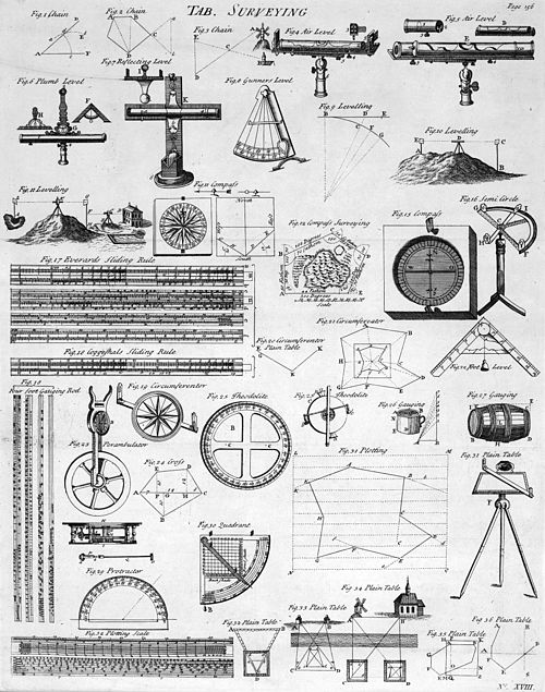
Table of Surveying, 1728 Cyclopaedia

A railroad surveying party at Russel's Tank, Arizona in the 1860s