Third voyage of James Cook
Videos
James Cook's third and final voyage took the route from Plymouth via Tenerife and Cape Town to New Zealand and the Hawaiian Islands, and along the North American coast to the Bering Strait.


William Bligh, 1775 by John Webber

A hand-coloured lithograph depicting a village visited by Captain James Cook near Waimea, Kauai, on his third voyage. Based on a 1778 etching by John Webber which was published by William Hodges, it is one of the few views of Hawaii made during Cook's third voyage (1776–1779).

Kealakekua Bay heiau (temple); illustration by William Ellis.
HMS Resolution (1771)
Videos
HMS Resolution was a sloop of the Royal Navy, a converted merchant collier purchased by the Navy and adapted, in which Captain James Cook made his second and third voyages of exploration in the Pacific. She impressed him enough that he called her "the ship of my choice", and "the fittest for service of any I have seen".
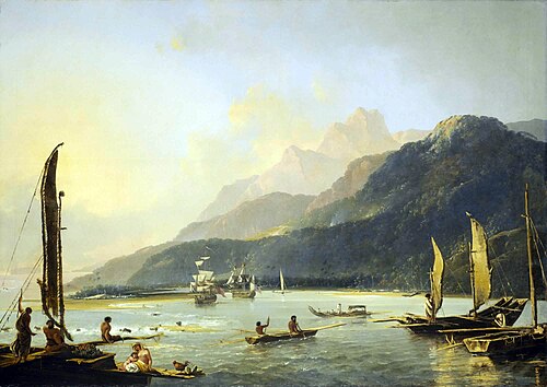
Resolution and Adventure with fishing craft in Matavai Bay by William Hodges, painted 1776, shows the two ships at anchor in Tahiti in August 1773.