Transport in Saudi Arabia
Transport in Saudi Arabia is facilitated through a relatively young system of roads, railways and seaways. Most of the network started construction after the discovery of oil in the Eastern Province in 1952, with the notable exception of Highway 40, which was built to connect the capital Riyadh to the economically productive Eastern Province, and later to the Islamic holy city of Mecca and the port city of Jeddah. With the economic growth of the 1970s, the Kingdom of Saudi Arabia has initiated many infrastructure development projects across the country, and the extensive development of the transportation network has followed suit in support of various economic developments.
Traffic on Medina Road in Jeddah
Interior of the King Fahd International Airport, the largest airport in the world by area
A Saudi Aramco Aviation Boeing 737 aircraft at Shaybah
A SAPTCO bus in Saqifah Bani Sa'idah, Medina
Highway 40 (Saudi Arabia)
Highway 40 is a major east–west six-lane controlled-access highway in Saudi Arabia, spanning 1,395 km. The highway connects Jeddah, the second-largest city in the kingdom, on the western coast of Saudi Arabia to Dammam, the sixth-largest city on the eastern coast and the largest in the Eastern Province. Apart from Jeddah and Dammam, Highway 40 also runs near or through Mecca, Ta'if, Riyadh, Abqaiq and Khobar along its length, and provides access to the Mahazat as-Sayd and Saja and Umm Al Ramth wildlife sanctuaries.
The Highway 40 passing through the Tuwaiq escarpment, west of Riyadh
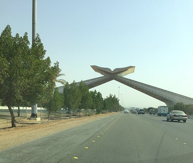
The Gate of Mecca (Arabic: بوابة مكة | Bawabat Makkah), under which Highway 40 passes, west of Mecca.
A sign on Highway 95 leading to the exit to Highway 40, with Mecca being denoted by the Kaaba and Medina denoted by the Green Dome