Tropical cyclone tracking chart
A tropical cyclone tracking chart is used by those within hurricane-threatened areas to track tropical cyclones worldwide. In the north Atlantic basin, they are known as hurricane tracking charts. New tropical cyclone information is available at least every six hours in the Northern Hemisphere and at least every twelve hours in the Southern Hemisphere. Charts include maps of the areas where tropical cyclones form and track within the various basins, include name lists for the year, basin-specific tropical cyclone definitions, rules of thumb for hurricane preparedness, emergency contact information, and numbers for figuring out where tropical cyclone shelters are open.
Cape Verde hurricane tracks
Chart with concurrent information for Hurricane Arlene and Tropical Storm Bret logged and plotted
Tropical cyclone preparedness
Cyclone mitigation encompasses the actions and planning taken before a tropical cyclone strikes to mitigate damage and injury from the storm. Knowledge of tropical cyclone impacts on an area help plan for future possibilities. Preparedness may involve preparations made by individuals as well as centralized efforts by governments or other organizations. Tracking storms during the tropical cyclone season helps individuals know current threats. Regional Specialized Meteorological Centers and Tropical Cyclone Warning Centers provide current information and forecasts to help individuals make the best decision possible.
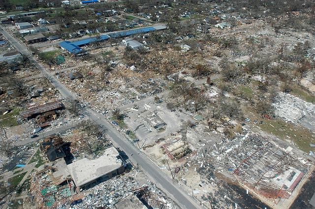
The aftermath of Hurricane Katrina in Gulfport, Mississippi.
Chart with concurrent information for Hurricane Arlene and Tropical Storm Bret logged and plotted
All but the most expensive bottles of water were sold out at this Publix supermarket before Hurricane Irma; in the week preceding the storm, water sold out soon after shipments arrived
Evacuation route sign on Tulane Avenue in New Orleans shows lines from long standing floodwaters after Hurricane Katrina


