1.
Green Country
–
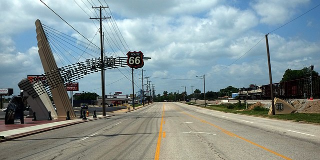
The region is noted for its mild rainy climate and beautiful scenery. In this case, the terms Tulsa Metropolitan Area and Green Country are used interchangeably, average precipitation totals in Green Country are generally above 40 inches per year, thus making it considerably wetter and greener than most of the state. The area is one of the most populous regions of Oklahoma. Northeastern Oklahoma has the most diversified economy in the state, as well as the states second largest city. In addition to the abundance of foliage and rolling hills, it has more lakes than any other geographical area of Oklahoma. Oklahoma is one of four states with more than 10 ecoregions. In its western counties, the far eastern extent of the Great Plains transition to woodlands through the Cross Timbers region, a small portion of the Ouachita Mountains extend into the southern areas of northeast Oklahoma, though the Ozark highlands are the primary range in the area. Northeast Oklahoma has an area of 13,247 square miles. The Region comprises about 19.3 percent of Oklahomas land area, based on commuting patterns, the adjacent micropolitan area of Bartlesville, is grouped together in the. The population of this region is 998, 438—more than one-fourth of Oklahomas population—as of 2012. The 2010 census population of Green Country was 1,301,716 inhabitants, the Tulsa International Airport is the primary commercial flight operation in Green Country, delivering flights to major cities in the United States. Also in the area, the Tulsa Port of Catoosa and Port of Muskogee are Oklahomas only seaports, from either of these two ports, goods may be transported via the Arkansas Rivers connection to the Mississippi River. The areas highway system is dominated by turnpikes, toll roads account for the primary highways in and out of the city of Tulsa in almost every direction. Interstate 44 is the thoroughfare, and runs diagonally through Green Country. All portions of the road through northeastern Oklahoma exists as a toll road, in addition, Historic U. S. Route 66 is an active road the entire way between the Kansas line and Stroud, the southwestern most town in the region
2.
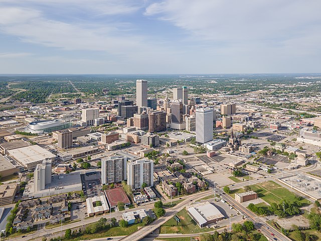
Tulsa, Oklahoma
–
Tulsa /ˈtʌlsə/ is the second-largest city in the state of Oklahoma and 47th-most populous city in the United States. As of July 2015, the population was 403,505 and it is the principal municipality of the Tulsa Metropolitan Area, a region with 981,005 residents in the MSA and 1,151,172 in the CSA. The city serves as the county seat of Tulsa County, the most densely populated county in Oklahoma, with urban development extending into Osage, Rogers, Tulsa was settled between 1828 and 1836 by the Lochapoka Band of Creek Native American tribe. For most of the 20th century, the city held the nickname Oil Capital of the World, once heavily dependent on the oil industry, Tulsa experienced economic downturn. Subsequent diversification efforts created a base in the energy, finance, aviation, telecommunications. The Tulsa Port of Catoosa, at the head of the McClellan-Kerr Arkansas River Navigation System, is the most inland port in the U. S. with access to international waterways. Two institutions of education within the city have sports teams at the NCAA Division I level, Oral Roberts University. It is situated on the Arkansas River at the foothills of the Ozark Mountains in northeast Oklahoma, the city has been called one of Americas most livable large cities by Partners for Livable Communities, Forbes, and Relocate America. FDi Magazine in 2009 ranked the city no.8 in the U. S. for cities of the future, in 2012, Tulsa was ranked among the top 50 best cities in the United States by BusinessWeek. People from Tulsa are called Tulsans, the area where Tulsa now exists was considered Indian Territory when it was first formally settled by the Lochapoka and Creek tribes in 1836. They established a settlement under the Creek Council Oak Tree at the present day intersection of Cheyenne Avenue. This area and this tree reminded Chief Tukabahchi and his group of trail of tear survivors of the bend in the river and their previous Creek Council Oak Tree back in the Talisi. They named their new settlement Tallasi, meaning old town in the Creek language, the area around Tulsa was also settled by members of the other so-called Five Civilized Tribes who had relocated to Oklahoma from the Southern United States. Most of modern Tulsa is located in the Creek Nation, with parts located in the Cherokee Nation, although Oklahoma was not yet a state during the Civil War, the Tulsa area did see its share of fighting. The Battle of Chusto-Talasah took place on the side of Tulsa. After the War, the tribes signed Reconstruction treaties with the government that in some cases required substantial land concessions. On January 18,1898, Tulsa was officially incorporated and elected its first mayor, Tulsa was a small town near the banks of the Arkansas River in 1901 when its first oil well, named Sue Bland No. Much of the oil was discovered on land whose mineral rights were owned by members of the Osage Nation under a system of headrights
3.
Broken Arrow, Oklahoma
–
Broken Arrow is a city located in the northeastern part of the U. S. state of Oklahoma, primarily in Tulsa County but also with a section of the city in western Wagoner County. It is the largest suburb of Tulsa, according to the 2010 census, Broken Arrow has a population of 98,850 residents and is the fourth-largest city in the state. However, a July 1,2015, estimate reports that the population of the city is 106,563, the city is part of the Tulsa Metropolitan Area, which has a population of 961,561 residents. The Missouri–Kansas–Texas Railroad sold lots for the site in 1902. The city was named for a Creek community settled by Creek Indians who had forced to relocate from Alabama to Oklahoma along the Trail of Tears. Though Broken Arrow was originally a community, its current economy is diverse. The city has the third-largest concentration of manufacturers in the state, the citys name comes from an old Creek community in Alabama. Members of that community were expelled from Alabama by the United States government, the Creek founded a new community in the Indian Territory, and named it after their old settlement in Alabama. The towns Creek name was Rekackv, meaning broken arrow, the new Creek settlement was located several miles south of present-day downtown Broken Arrow. In 1902 the Missouri–Kansas–Texas Railroad planned a railroad through the area and was granted town site privileges along the route and they sold three of the as-yet-unnamed sites to the Arkansas Valley Town Site Company. William S. Fears, secretary of that company, was allowed to choose and he selected a site about 18 miles southeast of Tulsa and about five miles north of the thlee-Kawtch-kuh settlement and named the new town site Broken Arrow, after the Indian settlement. The MKT railroad, which was completed in 1903, ran through the middle of the city and it still exists today and is now owned by Union Pacific which currently uses it for freight. For the first decades of Broken Arrows history, the economy was based mainly on agriculture. The coal industry also played an important role, with several coal mines located near the city in the early 20th century. The citys newspaper, the Broken Arrow Ledger, started within a couple of years after the citys founding, Broken Arrows first school was built in 1904. The city did not grow much during the first half of the 1900s, during this time Broken Arrows main commercial center was along Main Street. Most of the churches were also located on or near Main Street as well. A1907 government census listed Broken Arrows population at 1383, the Haskell State School of Agriculture opened in the Broken Arrow, Oklahoma Opera House on November 15,1909
4.
Owasso, Oklahoma
–
Owasso is a city in Rogers and Tulsa Counties in the U. S. state of Oklahoma, and a northern suburb of Tulsa. The population was 28,915 at the 2010 census, originally settled in 1881 in Indian Territory, the town incorporated in 1904 just prior to Oklahoma statehood and was chartered as a city in 1972. Scenes in The Outsiders film were shot in Owasso, Owasso began as a settlement in 1881, located in the Cooweescoowee District of the Cherokee Nation in Indian Territory, near what is now 66th Street North and North 129th East Avenue. It was called Elm Creek, and was named for Elm Creek, in June 1893, plans began for a rail line to be extended south from Bartlesville to the cattle ranches in the vicinity of Bird Creek. At that time, already several residences, a shop. Preston Ballard, owner of the store, established a post office in the general store on February 10,1898. The Joseph T. Barnes family moved to the settlement in 1897, Joseph and Luther Barnes bought the blacksmith shop in 1898. The first gas station was open in 1902 by Donovan Ranta, the depot was torn down in 1942. Late in 1898, Joseph and Luther Barnes moved their shop to the new community. The shop became a home for the Joseph Barnes family. It was the first residence officially moved to the new depot community, during 1898, many of the residents and businesses moved from the Elm Creek settlement to the new community. Preston Ballard moved his post office and general store during that time, the new community became known as Elm Creek, since the post office retained its name. The railroad completed its line in 1899 and its parent company, the Atchison, Topeka & Santa Fe Railway Company, took over the line and property. The first train came into Elm Creek on November 1,1899, the name of the Elm Creek post office was officially changed to Owasso on January 24,1900. The rail line was not extended into Tulsa until 1905, a plat of the original townsite of Owasso, Cherokee Nation, I. T. was signed by the Secretary of the Interior on March 26,1904, in connection with the towns incorporation. That plat shows three streets running north and south and eight streets running east and west and these names were later changed, east/west streets are now identified by street numbers, and north/south streets are now named after trees. The original street names were changed to their present names around 1960, by the time Oklahoma became a state on November 16,1907, Owasso had a population of 379 within the town limits. The first newspaper was The Owasso Ledger, and was first published on August 7,1903 by U. P. Wardrip, the subscription price was $1.00 per year, paid in advance
5.
Bixby, Oklahoma
–
Bixby is a city in Tulsa and Wagoner counties in the U. S. state of Oklahoma, and is a suburb of Tulsa. The population was 13,336 at the 2000 census and 20,884 in the 2010 census, in 2010, Bixby became the 19th largest city in Oklahoma. It is nicknamed The Garden Spot of Oklahoma for its rich agrarian heritage, though one of the fastest growing communities in Oklahoma, it remains a sod-growing center and a popular location for purchasing fresh vegetables. The per capita income of $36,257 is the highest in the Tulsa Metropolitan area and is more than 50 percent higher than the state average, in 2009, CNN Money. com placed Bixby No.67 on its list of 100 Best Places to Live. Alexander Posey, a member of the Muscogee nation, and his family settled in the now known as Bixby in the late 1800s. He founded a community that was known as Posey on Posey Creek. The town became a government town site with a post office in 1895, located in the Muscogee Nation, Indian Territory, Bixby was named in honor of Tams Bixby, a chairman of the Dawes Commission. The original 80-acre town site plat was approved by the Dawes Commission in 1902, many settlers were attracted to the area by the rich, though sometimes swampy river bottom land. In 1904 the Midland Valley Railroad laid tracks and built a depot about 1/2 mile north of the town of Bixby. This created factions that briefly split Bixby into two towns, the new part of town was deliberately surveyed so that the new streets did not align with the existing ones. However, businesses in the town soon moved to the new location. Bixby incorporated as an independent, self-governing town in 1906, with a population of 400, the first mayor, recorder and five aldermen were elected in February,1907. In 1911, a brick schoolhouse was built on Main Street. Bixby Central Elementary is now near the original site, a traffic bridge was built over the Arkansas River in 1911, and for a time was said to be the longest bridge west of the Mississippi River. The Bixby Bulletin, the towns first newspaper, began publication in February,1905, a second paper, the Bixby Journal existed only from 1907 until 1910. Bixby was impacted and enriched by the discovery of natural gas deposits in 1905-1906 and oil fields in 1913. Early farmers focused on production of cotton, wheat and alfalfa in the river bottom. During the 1930s, truck farming of vegetables slowly replaced those crops, in 1941 Bixby became an important regional center for shipping produce by railroad
6.
Bartlesville
–
Bartlesville is a city mostly in Washington County in the U. S. state of Oklahoma. The population was 35,750 at the 2010 census, with a 2015 estimate of 36,595 according to the US Census Bureau, Bartlesville is 47 miles north of Tulsa and 18 miles from Oklahomas northern border with Kansas. It is the county seat of Washington County, the Caney River runs through Bartlesville. Bartlesville is the city of the Bartlesville Micropolitan area, which consists of Washington County and has a population of 52,021 as of 2015. Bartlesville Micropolitan area is part of the Tulsa Combined Statistical Area with a population of 1,151,172 as of 2015. Bartlesville is notable as the home of Phillips Petroleum Company. The company merged with Conoco as ConocoPhillips and later split into the two independent companies Phillips 66 and ConocoPhillips, both companies have retained some operations in Bartlesville, however, they have moved their corporate headquarters to Houston. Frank Phillips founded Phillips Petroleum in Bartlesville in 1905 when the area was still Indian Territory and it is one of two places in Oklahoma where a Lenape Native American tribe lives, the other being Anadarko. Jacob Bartles, son-in-law of Delaware chief Charles Journeycake, moved from Wyandotte County and he settled first at Silver Lake, a natural lake south of the present city of Bartlesville. In 1874, he opened a trading post and post office on Turkey Creek, in the following year, he bought a grist mill on the Caney River and modified it to produce flour. Bartles then built a general store and residence, and added a rooming house, a blacksmith shop. Other settlers soon moved into the area, which was then called Bartles Town. In 1880, Bartles moved his Turkey Creek post office to this town, Bartles then provided the community with electricity, a telephone system and a water distribution system. Development of the present city began after William Johnstone and George B. Keeler opened a store on the south side of the Caney River in 1884. The first newspaper, The Weekly Magnet, began publication in March 1895, the town was incorporated in Indian Territory in January 1897. The town was surveyed and platted in 1898, and eighty acres were offered to the Atchison, Topeka, the railroad reached the town in 1899. The post office was moved from North Bartlesville in 1899, bypassed by the railroad, Jacob Bartles moved his store to Dewey, Oklahoma. In 1957, Bartlesville was the test site for the first experiment in pay cable television, the Bartlesville Telemovie System debuted with The Pajama Game, starring Doris Day, and aired it to an audience of 300 homes
7.
Tahlequah, Oklahoma
–
Tahlequah is a city in Cherokee County, Oklahoma, United States located at the foothills of the Ozark Mountains. The citys population was 15,753 at the 2010 census, the 2014 estimated population is 16,496. It is the county seat of Cherokee County, the main campus of Northeastern State University is located in the city. Tahlequah is the capital of the two federally recognized Cherokee tribes based in Oklahoma, the United Keetoowah Band of Cherokee Indians, many linguists believe the word Tahlequah and the word Teh-li-co are the same as di li gwa, the Cherokee word for grain or rice. Scholars report the Cherokee word di li gwa describes a type of grain with a red hue that grew in the flat open areas of east Tennessee. One area, Great Tellico, was named for the grass with the red seed tops, others interpret a word tel-i-quah as plains, however, there is no word for plains in the Cherokee lexicon, and the word tel-i-quah is not found in the lexicon. The idea that tahlequah means plains lends weight to the belief that the name refers to the open grassy areas of Great Tellico. Another explanation is the name Tahlequah came from the Cherokee words Ta-li, the story goes that when the Cherokee came to Tahlequah there were supposed to be 3 different Chiefs at the meeting. For whatever reason the 3rd Chief was delayed, the people said two is enough or ta-li-ye-li-quu which later became anglicanized to Tahlequah. When the Cherokee first arrived in the Tahlequah area, they noticed the native grasses that grew in the areas around the foothills of the Ozark Mountains. This reminded them of the grassy open areas of Tellico, so they called their new home di li gwa. Local legend states the name is derived from Cherokee words meaning just two or two is enough, supposedly three tribal elders had planned to meet to determine the location of the Cherokee Nations permanent capital. Two elders arrived and waited for the third, as dusk approached, they decided that two is enough. According to tribal elders and Cherokee County elders, this legend first began to circulate in the 1930s, Tahlequah was a settlement as early as 1832. After the Western Cherokee agreed in 1834 to let the newer migrants settle near them, Tahlequah was named long before it was chosen as the Cherokee capital. In 1839, Tahlequah was designated the capital of ancestors of both the Cherokee Nation and the United Keetoowah Band of Cherokee Indians, initially the government buildings were a complex of log or framed structures. Most of these buildings were destroyed during the Civil War, during which the Cherokee became divided into two opposing sides. After the war, a brick capitol was built and first occupied in 1870, in 1907, at the time of Oklahoma statehood, the building was converted into the Cherokee County courthouse
8.
Muskogee, Oklahoma
–
Muskogee is a city in and the county seat of Muskogee County, Oklahoma, United States. Home to Bacone College, it lies approximately 48 miles southeast of Tulsa, the population of the city was 39,223 as of the 2010 census, a 2.4 percent increase from 38,310 at the 2000 census, making it the eleventh-largest city in Oklahoma. The 1951 film Jim Thorpe, All American, starring Burt Lancaster, was filmed on the campus of Bacone Indian College at Muskogee, two feature films were recently shot in Muskogee, Salvation and Denizen. After the passage of the Indian Removal Act of 1830 under President Andrew Jackson and they were accompanied by their slaves to this area. The Indian Agency, a stone building, was built here in Muskogee. It was a site for meetings among the leaders of the Five Civilized Tribes, today it serves as a museum. At the top of what is known as Agency Hill, it is within Honor Heights Park on the west side of Muskogee, in 1872, the Missouri–Kansas–Texas Railroad was extended to the area. A federal court was established in Muskogee in 1889, around the time that Congress opened portions of Indian Territory to non-Native settlers via land rushes. The city was incorporated on March 19,1898, ohio native Charles N. Haskell moved to the city in March 1901. Haskell built the first five-story business block in Oklahoma Territory, he built, as Muskogee’s economic and business importance grew, so did its political power. In the years before the territory was admitted as a state and they met together August 21,1905 to propose the State of Sequoyah, to be controlled by Native Americans. They met in Muskogee to draft its constitution, planning to have Muskogee serve as the States capital, the proposal was vetoed by US President Theodore Roosevelt and mostly ignored by Congress, the proposed State of Sequoyah was never authorized. The US admitted the State of Oklahoma to the Union on November 16,1907 as the 46th State, Muskogee attracted national and international attention when, in May 2008, voters elected John Tyler Hammons as mayor. Nineteen years old at the time of his election, Hammons is among the youngest mayors in American history, Muskogee is an economic center for eastern Oklahoma and operates the Port of Muskogee on the Arkansas River, which is accessible from the Gulf of Mexico. According to the United States Census Bureau, the city has an area of 38.8 square miles. Muskogee is near the confluence of the Arkansas River, Verdigris River and Grand River. It is served by U. S. Route 62, U. S. Route 64, U. S. Route 69, Oklahoma State Highway 16, Oklahoma State Highway 165, Oklahoma State Highway 351 and the Muskogee Turnpike. Muskogee lies in the Arkansas River Valley and has a low, the city is on the boundary of the oak and hickory forest region of eastern Oklahoma and the prairie, Great Plains region of northeastern Oklahoma
9.
Washington County, Oklahoma
–
Washington County is a county located in the northeastern part of the U. S. state of Oklahoma. As of the 2010 census, the population was 50,976, named for President George Washington, it is the smallest county in Oklahoma in total area, adjacent to the largest county in Oklahoma, Osage County. Washington County comprises the Bartlesville, OK Micropolitan Statistical Area, which is included in the Tulsa-Muskogee-Bartlesville. It is located along the border with Kansas, the Osage ceded their land claims in 1825, and the Federal Government allowed the Western Cherokee to settle in this area in 1828. The 1835 Treaty of New Echota confirmed Cherokee ownership of the land, the area now covered by Washington County was part of the Cherokee Saline District between 1840 and 1856 and the Cooweescoowee District from 1856 to 1906. The first post office was established in 1859 at the confluence of Butler Creek, known as Little Verdigris, the settlement also had a trading post and a school. The Civil War caused most of the inhabitants to move away, in 1867, the Cherokees sold 157,600 acres to the Eastern Delaware In 1870, Nelson Carr built a grist mill along the Caney River, which he used to grind seed corn. In 1875, he sold the mill to Jacob Bartles, who modified the mill to produce wheat flour, other important agricultural crops included potatoes, sorghum and oats, as well as prairie hay and pecans. Cotton production was attempted in the early 1900s, but the soil proved unsuitable, the first commercial oil well in Oklahoma, designated as Nellie Johnstone Number One, was drilled near Bartlesville in 1897. Bartlesville became an oil boom town only after 1900, when the nearby Osage County oil fields were developed, in 1900, Phoenix Oil Company built a pipeline from Osage County to Bartlesvilles Atchison, Topeka and Santa Fe Railway depot, where there was an oil loading facility. Oil was shipped there to a refinery in Neodesha, Kansas in the same year. Several oil companies set up headquarters in the county, most notably Phillips Petroleum in Bartlesville, railroads came to this area at the turn of the 20th Century. The Atchison, Topeka and Santa Fe Railway opened a line from Owen to Owasso, the Missouri, Kansas and Texas Railroad opened a line from Stevens, Kansas to Dewey, Oklahoma in 1901-2 and another line from Hominy, Oklahoma to Bartlesville in 1903–04. According to the U. S. Census Bureau, the county has an area of 424 square miles. It is the second-smallest county in Oklahoma by land area and smallest by total area and it lies in the Eastern Lowlands physiographic region, and is drained by the Caney River. Lakes and reservoirs include Copan Lake, Silver Lake and Bar-Dew Lake, there were 23,451 housing units at an average density of 55.3 per square mile. Five percent of the population were Hispanic or Latino of any race, individuals living alone accounted for 28. 7% of households and individuals who were 65 years of age or older living alone accounted for 12. 9%. The average household size was 2.39 and the family size was 2.91
10.
Muskogee County, Oklahoma
–
Muskogee County is a county located in the U. S. state of Oklahoma. As of the 2010 census, the population was 70,990, the county and city were named for the Muscogee Nation. The official spelling of the name was changed to Muskogee by the post office in 1900, Muskogee County is part of the Muskogee, OK Micropolitan Statistical Area, which is included in the Tulsa-Muskogee-Bartlesville Combined Statistical Area. According to archaeological studies, prehistoric people lived in area as long ago as the Paleo-Indian period. However, archaeologists have made extensive studies of those people known as the Mound Builders who lived here during the Caddoan Stage. One of the first Europeans to come to this area was Jean Baptiste Bénard de la Harpe and he was a French explorer and trader who discovered a Wichita village in 1719. By the end of the 18th century the Wichita had been driven away by the more warlike Osage, auguste Pierre Chouteau and other fur traders had established a settlement at the Three Forks. Early in the 19th Century, Cherokee and Choctaw hunting parties made incursions that caused frequent conflict with the Osage, in 1824, the U. S. Army established Fort Gibson on the Grand River to dampen the conflict. The town of Fort Gibson that grew up just outside the claims to be the oldest town in Oklahoma. At the start of the U. S. Civil War, Confederate troops of the Cherokee and Creek Home Guards built Fort Davis, the county was formed at statehood with land from the Muskogee District of the Creek Nation and the Canadian and Illinois Districts of the Cherokee Nation. A post office named Muscogee had been established January 17,1872, the official spelling of the name was changed to Muskogee on July 19,1900. After the Civil War, the Five Civilized Tribes, which included the Creeks, among other provisions, they ceded their western lands back to the government and allowed rights of way to railroads. The Missouri, Kansas and Texas Railway built a line into Indian Territory, although railroad officials intended to build a depot at the site of Fort Davis, the terrain proved unsuitable, so they relocated the depot, which they named Muscogee, farther south. They also began the town of Oktaha 11 miles farther south, in 1874, the federal government consolidated all of the Five Civilized Tribes agencies into one Union Agency, located just west of Muscogee. In 1889, a district court was created in Muscogee. In 1894, the Dawes Commission also established its headquarters there, according to the U. S. Census Bureau, the county has a total area of 840 square miles, of which 810 square miles is land and 29 square miles is water. The western part of the county is grassland, while the eastern part rises into the Cookson Hills. The Arkansas, Verdigris and Grand rivers all converge in the county, webbers Falls Lake on the Arkansas River covers part of the county
11.
Cherokee County, Oklahoma
–
Cherokee County is a county located in the U. S. state of Oklahoma. As of the 2010 census, the population was 46,987 and its county seat is Tahlequah, which is also the capital of the Cherokee Nation. Cherokee County comprises the Tahlequah, OK Micropolitan Statistical Area, which is included in the Tulsa-Muskogee-Bartlesville, according to a historian, Cherokee County was established in 1907. However, the Encyclopedia of Oklahoma History and Culture, states that it was created from the Tahlequah District of the Cherokee Nation in 1906. The Cherokee moved to area as a result of the forced relocation brought about by the Indian Removal Act of 1830. The first significant settlements were at the site of Park Hill, where there was already a community, and Tahlequah. However the Civil War divided the tribe and caused many of the structures to be destroyed. Non-Indians began moving into the area starting in the mid-1870s. In 1851, the Cherokee Male Seminary opened in Tahlequah and the Cherokee Female Seminary opened in Park Hill, the latter burned down in 1887 and was rebuilt in Tahlequah. A1910 fire destroyed the Male Seminary, the Female Seminary became Northeastern State Normal School after statehood in 1907 and is now part of Northeastern State University. During 1901 –1903, The Ozark and Cherokee Central Railway and it boosted the shipment of farm products through the 1920s, but declined during the Great Depression. All rail service ceased in 1942, according to the U. S. Census Bureau, the county has a total area of 776 square miles, of which 749 square miles is land and 2.7 square miles is water. The county lies in the foothills of the Ozark Mountains and it includes most of Tenkiller Lake and part of Fort Gibson Lake. The principal river running through it is the Illinois River, grand River forms part of its western boundary. The population density was 57 people per square mile, there were 19,499 housing units at an average density of 26 per square mile. 4. 14% of the population were Hispanic or Latino of any race,92. 7% spoke English,3. 8% Spanish and 2. 7% Cherokee as their first language. 25. 30% of all households were made up of individuals and 9. 00% had someone living alone who was 65 years of age or older, the average household size was 2.52 and the average family size was 3.04. In the county, the population was out with 26. 30% under the age of 18,14. 60% from 18 to 24,25. 70% from 25 to 44,21. 50% from 45 to 64
12.
Oklahoma
–
Oklahoma is a state located in the South Central United States. Oklahoma is the 20th-most extensive and the 28th-most populous of the 50 United States, the states name is derived from the Choctaw words okla and humma, meaning red people. The name was settled upon statehood, Oklahoma Territory and Indian Territory were merged, on November 16,1907, Oklahoma became the 46th state to enter the union. Its residents are known as Oklahomans, or informally Okies, and its capital, a major producer of natural gas, oil, and agricultural products, Oklahoma relies on an economic base of aviation, energy, telecommunications, and biotechnology. In 2007, it had one of the economies in the United States, ranking among the top states in per capita income growth. Oklahoma City and Tulsa serve as Oklahomas primary economic anchors, with nearly two-thirds of Oklahomans living within their metropolitan statistical areas. With small mountain ranges, prairie, mesas, and eastern forests, most of Oklahoma lies in the Great Plains, Cross Timbers, interior Highlands—a region especially prone to severe weather. The name Oklahoma comes from the Choctaw phrase okla humma, literally meaning red people, equivalent to the English word Indian, okla humma was a phrase in the Choctaw language used to describe Native American people as a whole. Oklahoma later became the de facto name for Oklahoma Territory, and it was approved in 1890. Oklahoma is the 20th-largest state in the United States, covering an area of 69,898 square miles and it is one of six states on the Frontier Strip and lies partly in the Great Plains near the geographical center of the 48 contiguous states. It is bounded on the east by Arkansas and Missouri, on the north by Kansas, on the northwest by Colorado, on the far west by New Mexico, much of its border with Texas lies along the Southern Oklahoma Aulacogen, a failed continental rift. The geologic figure defines the placement of the Red River, the Oklahoma panhandles Western edge is out of alignment with its Texas border. The Oklahoma/New Mexico border is actually 2.1 to 2.2 miles east of the Texas line, the border between Texas and New Mexico was set first as a result of a survey by Spain in 1819. It was then set along the 103rd Meridian, in the 1890s, when Oklahoma was formally surveyed using more accurate surveying equipment and techniques, it was discovered the Texas line was not set along the 103rd Meridian. Surveying techniques were not as accurate in 1819, and the actual 103rd Meridian was approximately 2.2 miles to the east and it was much easier to leave the mistake than for Texas to cede land to New Mexico to correct the surveying error. The placement of the Oklahoma/New Mexico border represents the true 103rd Meridian, cimarron County in Oklahomas panhandle is the only county in the United States that touches four other states, New Mexico, Texas, Colorado and Kansas. Its highest and lowest points follow this trend, with its highest peak, Black Mesa, at 4,973 feet above sea level, situated near its far northwest corner in the Oklahoma Panhandle. The states lowest point is on the Little River near its far southeastern boundary near the town of Idabel, Oklahoma, which dips to 289 feet above sea level
13.
Tulsa County, Oklahoma
–
Tulsa County is a county located in the U. S. state of Oklahoma. As of the 2010 census, the population was 603,403, making it the second-most populous county in Oklahoma and its county seat and largest city is Tulsa, the second-largest city in the state. Founded at statehood, in 1907, it was named after the established city of Tulsa. Before statehood, the area was part of both the Creek Nation and the Cooweescoowee District of Cherokee Nation in Indian Territory, Tulsa County is included in the Tulsa, OK Metropolitan Statistical Area. Tulsa County is notable for being the most densely populated county in the state, Tulsa County also ranks as having the highest-income. The history of Tulsa County greatly overlaps the history of the city of Tulsa and this section addresses events that largely occurred outside the present city limits of Tulsa. Odells statement was based on finding both Wichita and French artifacts there during a dig in 1988. At first, Creek immigrants stayed close to Fort Gibson, near the confluence of the Arkansas, however, the government encouraged newer immigrants to move farther up the Arkansas. The Osage tribe had agreed to leave the land near the Verdigris, in 1831, a party led by Rev. Isaac McCoy and Lt. James L. Dawson blazed a trail up the north side of the Arkansas from Fort Gibson to its junction with the Cimarron River. In 1832, Dawson was sent again to select sites for military posts, one of his recommended sites was about two and a half miles downstream from the Cimarron River junction. The following year, Brevet Major George Birch and two companies of the 7th Infantry Regiment followed the Dawson Road to the aforementioned site, flattering his former commanding officer, General Matthew Arbuckle, Birch named the site Fort Arbuckle. According to Encyclopedia of Oklahoma History and Culture, the fort was about 8 miles west of the present city of Sand Springs, author James Gardner visited the site in the early 1930s. His article describing the visit includes an old map showing the fort located on the bank of the Arkansas River near Sand Creek, just south of the line separating Tulsa County. After ground was cleared and a built, Fort Arbuckle was abandoned November 11,1834. The remnants of stockade and some chimneys could still be seen nearly a years later. The site was submerged when Keystone Lake was built, main article Battle of Chusto-Talasah At the outbreak of the Civil War in 1861, many Creeks and Seminoles in Indian Territory, led by Opothleyahola, retained their allegiance to the U. S. Government. In November,1861, Confederate Col. Douglas H. Cooper led a Confederate force against the Union supporters with the purpose of either compelling their submission or driving out of the country. The first clash, known as the Battle of Round Mountain, although the Unionists successfully withstood the attack and mounted a counterattack, the Confederates claimed a strategic victory because the Unionists were forced to withdraw
14.
Rogers County, Oklahoma
–
Rogers County is a county located in the northeastern part of the U. S. state of Oklahoma. As of the 2010 census, the population was 86,905 and its county seat is Claremore, making it the sixth largest county in Oklahoma based on population. The county was created in 1907 from the western Saline District of the Cherokee Nation. However, the residents protested and the name was changed to Rogers County, after Clem Vann Rogers, Rogers County is included in the Tulsa, OK Metropolitan Statistical Area. Pasona was near a mound on the Verdigris River called Claremore Mound, in 1828, Cherokee tribes exchanged their Arkansas land for an area that included present-day Rogers County that had been ceded by the Osage in 1825. The area became the Saline District of the Cherokee Nation in Indian Territory, upon statehood, the county was created and designated Cooweescoowee County before being renamed Rogers County in honor of Clement Rogers. Shortly after statehood, Eastern University Preparatory School was established on College Hill, just west of Claremore, the Oklahoma Military Academy was established in 1919. The academy was closed and Claremore Junior College was opened in 1971, the state legislature renamed the institution Rogers State College and Rogers University before settling on Rogers State University in 1998. According to the U. S. Census Bureau, the county has an area of 711 square miles. The largest body of water is Lake Oologah, the main streams are the Caney River and the Verdigris River. However, there are a number of creeks and lakes in the county. The population density was 105 people per square mile, there were 27,476 housing units at an average density of 41 per square mile. The racial makeup of the county was 75. 3% White,1. 0% Black or African American,13. 1% Native American,1. 1% Asian,0. 1% Pacific Islander,1. 4% from other races, and 8. 1% from two or more races. 3. 7% of the population were Hispanic or Latino of any race,18. 1% were of German,13. 8% Irish,8. 7% English,3. 0% French,2. 5% Scottish, and 2. 2% Italian ancestries. 96. 7% spoke English,1. 7% Spanish, and 0. 4% German as their first language,19. 00% of all households were made up of individuals and 7. 50% had someone living alone who was 65 years of age or older. The average household size was 2.71 and the family size was 3.10. In the county, the population was out with 28. 70% under the age of 18,7. 40% from 18 to 24,28. 60% from 25 to 44,24. 00% from 45 to 64. The median age was 36 years, for every 100 females there were 96.80 males
15.
Wagoner County, Oklahoma
–
Wagoner County is a county located in the U. S. state of Oklahoma. As of the 2010 census, the population was 73,085, Wagoner County is included in the Tulsa, OK Metropolitan Statistical Area. According to archaeological studies, this area was inhabited by Caddoan Mound Builders during the period A. D.300 to 1200, the western area of Wagoner County was settled by the Creek after their forced removal in Alabama in the 1820s. The eastern portion of the county was settled by the Cherokee, during the Civil War in 1865, the present county was the scene of the Battle of Flat Rock. General Richard Gano captured 85 Union troops and killed more that were harvesting hay. In 1905, the Sequoyah Convention proposed creating two counties from this area, the western half would be named Coweta and the eastern half would have been named Tumechichee. However, failure of the attempt to create the state of Sequoyah negated the proposal, in 1907 at Oklahoma Statehood, Wagoner County was organized. The towns of Porter and Coweta vied with Wagoner as the county seat, the county was named after the town of Wagoner, which won the election. The town was named after Henry Bigfoot Wagoner, a Katy Railroad dispatcher from Parsons, according to the U. S. Census Bureau, the county has a total area of 591 square miles, of which 562 square miles is land and 29 square miles is water. It is part of the Ozark Highlands, the Verdigris River divides the east and west parts of the county. The Arkansas River forms part of the western and southern boundaries, grand River also flows south through the county. It was dammed in 1942 to create Fort Gibson Lake, rogers County Mayes County Cherokee County Muskogee County Tulsa County As of the census of 2010, there were 73,085 people, in the county. There were 29,694 housing units at a density of 55.9 per square mile. The racial makeup of the county was 80. 07% White,3. 75% Black or African American,9. 38% Native American,0. 51% Asian,0. 02% Pacific Islander,0. 85% from other races, and 5. 41% from two or more races. Hispanic or Latino of any race were 2. 50% of the population,17. 70% of all households were made up of individuals and 6. 70% had someone living alone who was 65 years of age or older. The average household size was 2.73 and the family size was 3.08. In the county, the population was out with 28. 10% under the age of 18,7. 90% from 18 to 24,28. 50% from 25 to 44,25. 40% from 45 to 64. The median age was 36 years, for every 100 females there were 97.70 males
16.
Osage County, Oklahoma
–
Osage County is the largest county by area in the state of Oklahoma in the United States. Created in 1907 when Oklahoma was admitted as a state, the county is named for and is home to the federally recognized Osage Nation, the county is contiguous with the Osage Nation Reservation, established by treaty in the 19th century when the Osage relocated here from Kansas. The county seat is in Pawhuska, Oklahoma, one of the first three towns established in the county, the total population of the county is 47,987. By the 19th century, the Osage and other Siouan tribes had been forced to move west from the Ohio Valley across the Mississippi River. The Osage became established as a nation in the areas of present-day Missouri. By 1760, they had increased their range to include the present Osage County, historically one of the most powerful Great Plains tribes, their numbers were reduced by infectious disease and warfare after encounter with Europeans. This treaty was to accomplish Cherokee removal to the Indian Territory, generally the Five Civilized Tribes were allied with the Confederacy. In 1870, the Osage finally prepared for removal from Kansas and they purchased 1.57 million acres of their former territory in present-day Oklahoma from the Cherokee. By owning it by title, they had a position in relation to the US government than did other tribes. The Osage Agency was established in 1872 at Deep Ford, later renamed as Pawhuska and it was designated as the county seat when Oklahoma was admitted as a state. The other chief settlements in the 1870s were Hominy and Fairfax, in 1875 the US designated their land as the Osage Reservation. Because the tribe owned the land directly, they retained control over their affairs than did tribes whose land was held in trust by the United States government. This reservation became part of the Oklahoma Territory under the Oklahoma Organic Act of 1890 and it became a semi-autonomous district by the Oklahoma Enabling Act of 1906, and Osage County at the time of Oklahoma Statehood in 1907. At that time, there were 2,229 registered Osage members, as owners, the Osage negotiated the retention of the communal mineral rights to their reservation lands. In October 1897, the Phoenix Oil Company drilled the first successful oil well on the Osage reservation and it was located along Butler Creek. In 1901, Phoenix Oil and Osage Oil companies combined their assets to form the Indian Territory Illuminating Oil Company and it arranged with the Bureau of Indian Affairs to sub-lease the eastern part of the Osage reservation until 1916. When ITIOs lease expired, the United States government supervised the public auctioning of leases for 160-acre tracts, all subsurface minerals, including oil, are owned by the Osage Nation and held in trust for them by the Federal Government. Each mineral lease was negotiated by the Osage National Council and approved by the U. S. Secretary of the Interior, other tribes were forced to give up such surplus and allow for sales to non-Indians
17.
Creek County, Oklahoma
–
Creek County is a county located in the U. S. state of Oklahoma. As of the 2010 census, the population was 69,967, Creek County is part of the Tulsa, OK Metropolitan Statistical Area. European explorers traveled through this early in the 19th Century. In 1825, the Osage Nation ceded the territory where the Federal Government planned to resettle the Creek Nation, the Creeks began migrating into this area, where they and their black slaves settled to begin farming and raising cattle. In 1835, Federal soldiers under Captain J. L. Dawson built the Dawson Road, railroads gave an important boost to the local economy. In 1886, the Atlantic and Pacific Railroad built a line from Red Fork to Sapulpa, in 1898, the St. Louis and Oklahoma City Railway connected Sapulpa and Oklahoma City. The present Creek County was established at the time of statehood, the town of Sapulpa was initially designated as the county seat. This decision was challenged by supporters of the town of Bristow, an election held August 12,1908 to choose a permanent seat was won by Sapulpa, but the dispute did not end there. After a series of cases, the Oklahoma Supreme Court ruled in favor of Sapulpa on August 1,1913. After oil was discovered at Glenn Pool in adjacent Tulsa County in 1905, the Cushing-Drumright Oil Field opened in 1912, creating boom towns Drumright, Kiefer and Oilton. By 1920, the county population had increased to 62,480, according to the U. S. Census Bureau, the county has a total area of 970 square miles, of which 950 square miles is land and 20 square miles is water. It is drained by the Cimarron River, and the Deep Fork, heyburn Lake is contained within the County. Keystone Lake is partially within Creek County, the population density was 70 people per square mile. There were 27,986 housing units at a density of 29 per square mile. The racial makeup of the county was 82. 27% White,2. 56% Black or African American,9. 08% Native American,0. 27% Asian,0. 03% Pacific Islander,0. 63% from other races, and 5. 16% from two or more races. 1. 90% of the population were Hispanic or Latino of any race,21. 60% of all households were made up of individuals and 9. 40% had someone living alone who was 65 years of age or older. The average household size was 2.64 and the family size was 3.06. In the county, the population was out with 27. 40% under the age of 18,8. 00% from 18 to 24,27. 30% from 25 to 44,24. 50% from 45 to 64
18.
Okmulgee County, Oklahoma
–
Okmulgee County is a county located in the U. S. state of Oklahoma. As of the 2010 census, the population was 40,069, formerly part of the Creek Nation, the county was created at statehood in 1907. The name Okmulgee is derived from the Hitichita word okimulgi, meaning boiling waters, Okmulgee County is included in the Tulsa, OK Metropolitan Statistical Area. The Creek Nation moved into part of Indian Territory after signing treaties exchanging their land in Georgia. The actual move occurred over the period from 1827 to 1836, the Creek Nation government, led by chief Samuel Checote, revised its constitution in 1867 and designated Okmulgee as its capital in 1868. Post Office opened in Okmulgee on April 29,1869, the Creek Nation built its council house in Okmulgee, a log building, in 1869. The building was rebuilt of stone in 1878, Okmulgee County was formed on July 16,1907, from Muskogee land, with a population of 14,362. County government offices were located in the Creek Council House until 1916, since then, the former council building has been used as a Muscogee Creek history museum. The countys population was 21,115 in 1910 and increased to a high of 56,558 by 1930. Railroads came to the area in 1900, when the St. Louis, Oklahoma and Southern Railway built a line from Sapulpa, the Shawnee, Oklahoma and Missouri Coal and Railway built a line from Muskogee to Okmulgee in 1902-03. The Missouri, Oklahoma and Gulf Railway ran through Dewar, Oklahoma beginning in 1909, in 1918, the line between Okmulgee and McIntosh counties was realigned, moving the towns of Grayson and Hoffman from McIntosh into Okmulgee County. According to the U. S. Census Bureau, the county has an area of 702 square miles. Okmulgee Lake and Okmulgee State Park lies southwest of the city of Okmulgee, the eastern part of the county is within the Eastern Lowlands physiographic region and the western part is in the Osage Plains. The Deep Fork of the Canadian River is the waterway in the county. Deep Fork National Wildlife Refuge lies within the county, there were 17,316 housing units at an average density of 10/km². 1. 95% of the population were Hispanic or Latino of any race,27. 10% of all households were made up of individuals and 12. 60% had someone living alone who was 65 years of age or older. The average household size was 2.53 and the family size was 3.06. In the county, the population was out with 26. 90% under the age of 18,9. 50% from 18 to 24,25. 30% from 25 to 44,23. 30% from 45 to 64
19.
Pawnee County, Oklahoma
–
Pawnee County is a county located in the U. S. state of Oklahoma. As of the 2010 census, the population was 16,577, the county is named after the Pawnee Tribe. Pawnee County is included in the Tulsa, OK Metropolitan Statistical Area, the Osage Tribe used the area that contains present day Pawnee County as buffalo hunting grounds. In 1825, The Osage ceded parts of present-day Missouri, Arkansas, after their forced removal from the Southeastern United States, the Cherokee received land in Eastern Oklahoma as well as the Cherokee Outlet in 1828, which included present-day Pawnee County. After the Civil War, the Cherokee agreed to allow other American Indians to settle in the portion of the Outlet. In 1873, the government began to relocate the Pawnee Tribe from Nebraska to a reservation here. In 1891, the Pawnee agreed to take land allotments from the reservation, Pawnee County was organized as County Q, and the future town of Pawnee, Townsite Number 13, was designated the county seat. In 1894, the voters chose the name Pawnee County over the name Platte County, the female bandit, Little Britches, companion in crime with Cattle Annie, lived for a time at Sinnett, site of the Creek Nation in Pawnee County. According to the U. S. Census Bureau, the county has an area of 595 square miles. The western third of the county is part of the Red Bed plains, the Cimarron and Arkansas Rivers drain the county. Black Bear Creek also extends through the county, lone Chimney Lake dam is also in Pawnee County, while the lake extends into Payne County. Osage County Tulsa County Creek County Payne County Noble County A magnitude 5.8 earthquake struck near the city of Pawnee and this was Oklahomas strongest quake in history, exceeding the 5. 7-magnitude quake near Prague on November 5,2011. Buildings in Pawnee were damaged, but there were no reports of deaths, a Pawnee resident was injured while shielding his child from debris falling from a chimney. State regulators in Oklahoma ordered 37 petroleum production wastewater disposal wells in the vicinity of the earthquake to be closed while assessments were made. As of the census of 2000, there were 16,612 people,6,383 households, there were 7,464 housing units at an average density of 5/km². 1. 16% of the population were Hispanic or Latino of any race,22. 80% of all households were made up of individuals and 11. 00% had someone living alone who was 65 years of age or older. The average household size was 2.58 and the family size was 3.02. In the county, the population was out with 26. 50% under the age of 18,7. 30% from 18 to 24,26. 20% from 25 to 44,25. 20% from 45 to 64
20.
Suburb
–
A suburb is a residential area or a mixed use area, either existing as part of a city or urban area or as a separate residential community within commuting distance of a city. In some areas, such as Australia, China, New Zealand, the United Kingdom, and a few U. S. states, new suburbs are routinely annexed by adjacent cities. In others, such as Arabia, Canada, France, and much of the United States, Suburbs first emerged on a large scale in the 19th and 20th centuries as a result of improved rail and road transport, which led to an increase in commuting. Suburbs tend to proliferate around cities that have an abundance of adjacent flat land, the English word is derived from the Old French subburbe, which is in turn derived from the Latin suburbium, formed from sub and urbs. The first recorded usage of the term in English, was made by John Wycliffe in 1380, in Australia and New Zealand, suburbs have become formalised as geographic subdivisions of a city and are used by postal services in addressing. In rural areas in both countries, their equivalents are called localities, the terms inner suburb and outer suburb are used to differentiate between the higher-density suburbs in proximity to the city center, and the lower-density suburbs on the outskirts of the urban area. The term middle suburbs is also used, Suburbs, in this sense, can range from areas that seem more like residential areas of a city proper to areas separated by open countryside from the city centre. In large cities such as London, suburbs include formerly separate towns and villages that have been gradually absorbed during a growth and expansion. In the United States and Canada, suburb can refer either to an residential area of a city or town or to a separate municipality or unincorporated area outside a town or city. The earliest appearance of suburbs coincided with the spread of the first urban settlements, large walled towns tended to be the focus around which smaller villages grew up in a symbiotic relationship with the market town. The word suburbani was first used by the Roman statesman Cicero in reference to the large villas, as populations grew during the Early Modern Period in Europe, urban towns swelled with a steady influx of people from the countryside. In some places, nearby settlements were swallowed up as the city expanded. The peripheral areas on the outskirts of the city were generally inhabited by the very poorest, by the mid-19th century, the first major suburban areas were springing up around London as the city became more overcrowded and unsanitary. A major catalyst in suburban growth came from the opening of the Metropolitan Railway in the 1860s, the line joined the capitals financial heart in the City to what were to become the suburbs of Middlesex. Harrow was reached in 1880, and the line extended as far as Verney Junction in Buckinghamshire, more than 50 miles from Baker Street. Unlike other railway companies, which were required to dispose of surplus land, in 1912, it was suggested that a specially formed company should take over from the Surplus Lands Committee and develop suburban estates near the railway. However, World War I delayed these plans and it was only in 1919, with expectation of a housing boom. The term Metro-land was coined by the Mets marketing department in 1915 when the Guide to the Extension Line became the Metro-land guide and this promoted the land served by the Met for the walker, visitor and later the house-hunter
21.
Urban sprawl
–
In addition to describing a particular form of urbanization, the term also relates to the social and environmental consequences associated with this development. In Continental Europe the term peri-urbanisation is often used to denote similar dynamics and phenomena, There is widespread disagreement about what constitutes sprawl and how to quantify it. For example, some commentators measure sprawl only with the number of residential units per acre in a given area. But others associate it with decentralization, discontinuity, segregation of uses, the term urban sprawl is highly politicized, and almost always has negative connotations. It is criticized for causing environmental degradation, and intensifying segregation and undermining the vitality of existing urban areas, due to the pejorative meaning of the term, few openly support urban sprawl as such. The term has become a cry for managing urban growth. Definitions of sprawl vary, researchers in the field acknowledge that the term lacks precision and he argued that a better way to identify sprawl was to use indicators rather than characteristics because this was a more flexible and less arbitrary method. He proposed using accessibility and functional space as indicators. Ewings approach has been criticized for assuming that sprawl is defined by negative characteristics, what constitutes sprawl may be considered a matter of degree and will always be somewhat subjective under many definitions of the term. The following characteristics are associated with sprawl, This refers to a situation where commercial, residential, institutional and industrial areas are separated from one another. Consequently, large tracts of land are devoted to a use and are segregated from one another by open space, infrastructure. The degree to which different land uses are mixed together is used as an indicator of sprawl in studies of the subject. Job sprawl is another land use symptom of urban sprawl and car-dependent communities, spatial mismatch is related to job sprawl and economic environmental justice. Job sprawl has been documented and measured in various ways and it has been shown to be a growing trend in Americas metropolitan areas. The Brookings Institution has published articles on the topic. In 2005, author Michael Stoll defined job sprawl simply as jobs located more than 5-mile radius from the CBD, and measured the concept based on year 2000 U. S. Census data. These two authors used three geographic rings limited to a 35-mile radius around the CBD,3 miles or less,3 to 10 miles and this compares to the year 1998 -23. 3%,34. 2%, and 42. 5% in those respective rings. The study shows CBD employment share shrinking, and job growth focused in the suburban and exurban outer metropolitan rings, Sprawl is often characterized as consisting of low-density development
22.
Catoosa, Oklahoma
–
Catoosa is a city in Rogers and Wagoner counties in the U. S. state of Oklahoma. The population was 7,159 at the 2010 census compared to 5,449 at the 2000 census and this was a 31.2 percent increase during the decade. The Cherokee Nation controlled the region during the 19th century, after the Atlantic and Pacific Railroad laid tracks in the early 1880s, the community became a cow town, with the establishment of William Halsells Bird Creek Ranch. In 1883, the Federal Government opened a post office here, the name of the city is derived from the Cherokee language, phonetically pronounced Ga-du-si or Ga-tu-si. Various interpretations of this word exist, including, between two hills, on the hill, into the hills, and possibly signifying a prominent hill or place thereon, Catoosa was home to Bluford Blue Duck, the infamous outlaw depicted in Lonesome Dove. He is buried in Dick Duck Cemetery located at the intersection of 193rd, the town grew from a population of 241 in 1900 to 410 by 1910. The local economy included an elevator, a cotton gin and mill. By 1930, the population was back down to 264, in 1971, the Tulsa Port of Catoosa opened and gave the town an economic boom. The ports 2, 000-acre industrial park provided jobs for over 2,600 workers by the 21st century, as of December 2013, it had 70 businesses with over 4,000 workers. The port connects to the Mississippi River and the Gulf of Mexico via the McClellan-Kerr Arkansas River Navigation System, Catoosa is located at 36°10′56″N 95°45′35″W,14 miles northeast of Tulsa, Oklahoma in Rogers County, Oklahoma. This location provides mid-America river shipping access at the Tulsa Port of Catoosa. According to the United States Census Bureau, the city has an area of 7.0 square miles. Catoosa has a seaport and the terminus of the Kerr-McClellan Arkansas River Navigation System. The Port of Catoosa is the second farthest inland seaport in the United States behind Duluth, Minnesota, linking Tulsa to the Arkansas River, Catoosa is located along historic Route 66. As of the 2010 census, there were 7,151 people,2,581 households, the population density was 639.2 people per square mile. The racial makeup of the city was 72. 0% White,1. 1% African American,13. 3% Native American,0. 8% Asian,4. 3% from other races, hispanic or Latino of any race were 8. 6% of the population. The median income for a household in the city was $50,050, the per capita income for the city was $26,289. About 14. 5% of the population were below the poverty line
23.
Jenks, Oklahoma
–
Jenks is a city in Tulsa County, Oklahoma, United States, and a suburb of Tulsa, in the northeastern part of the state. It is situated between the Arkansas River and U. S. Route 75, Jenks is one of the fastest growing cities in Oklahoma. As of the 2000 census, the city population was 9,557, but by 2010, the population was 16,924, Jenks began in 1904 as a community site established by the Midland Valley Railroad between Tulsa and Muskogee, alongside the Arkansas River. Though the river could only be utilized by shallow draft steamboats while the level was up. Jenks was named after William Henry Jenks the owner and director of the Midland Valley Railroad, according to a 1957 article in the Tulsa Tribune, an agent for the townsite company was told by the railroad home office to name a town for the director. The town was platted on July 15,1905. Also in 1905, a petroleum discovery was made, further bolstering the economy of the area. The Glenn Pool oil well and subsequent oil claims brought many people to the general area. In 1906, many oil depots were constructed in Jenks, by the time of statehood, Jenks had 465 inhabitants. As oil production waned, tank farms were dismantled, and agriculture became once again a major contributor to the Jenks economy, the economy of the area was further improved in the 1920s when many Bulgarian families immigrated to the area to farm. These immigrants established many vegetable farms, from 1904 through the 1950s, Jenks experienced many floods from the overflow of the Arkansas River and Polecat Creek. In the 1920s and 1930s floods were very severe, during one flood in the late 1920s the water was so deep that it completely covered every building but the roof of the three story high school. Everyone was evacuated except two men and one woman and they had one shotgun, one small boat, food and a tent on top of the school. They guarded the remains of Jenks for several weeks until the water receded, in 1948, the U. S. Army Corps of Engineers built a levee around Jenks, and the community subsequently grew as a result of the increased safety and security. This caused an evacuation order in Jenks and several other river communities. Jenks has served as a crossing point via several bridges over the past century. In 1910, a bridge was built and strengthened the economic success of the area. 1948 saw the construction of a replacement two-lane bridge which still stands today, the original 1910 bridge was destroyed and all that is left are a few columns and pieces of metal that are seen when the water level is low
24.
Sand Springs, Oklahoma
–
Sand Springs is a city in Osage and Tulsa counties in the U. S. state of Oklahoma. A suburb of Tulsa, it is located predominantly in Tulsa County, the population was 18,906 in the 2010 U. S. Census, an increase of 8.3 percent from 17,451 at the 2000 census. The city was founded in 1911, by Oklahoma philanthropist Charles Page and he helped found and develop Sand Springs as a model city that included all components of a total community. Wealthy businessman Charles Page bought 160 acres of land in Tulsa County, Oklahoma in 1908, the initial tent housing twenty seven children, abandoned by the Hook & Anchor Orphanage in Tulsa, was soon replaced by a frame building housing fifty children. In 1911, Page created the Sand Springs Railway, an interurban connecting Sand Springs to Tulsa, the townsite was laid out in 1911. Sand Springs was incorporated as a city in 1912, with a population of 400, Page built the Sand Springs Power Plant in 1911, on the southeast corner of Main Street and Morrow Road. It anchored an area that Page intended to use for industrial development, there were several significant additions to the facility, and it remained the sole source of electric power for Sand Springs until 1947. Some of the earliest manufacturing industries were, Kerr Glass Manufacturing, Commander Mills, Kerr, Hubbard and Kelley Lamp and Chimney, Southwest Box Company, Sand Springs became one center of glass production in Oklahoma. Kerr Glass Manufacturing moved to Sand Springs from Chicago in 1913, Kerr company, which made fruit jars, were the only glass companies remaining in business as recently as 1955. The Home that Charles Page started all those years ago is still there today, what used to be the Widows Colony now accepts single mothers with two or more children. An EF2 tornado hit Sand Springs on March 25,2015, killing one resident, Sand Springs is located at 36°8′23″N 96°6′32″W. According to the United States Census Bureau, the city has an area of 21.0 square miles. As of the census of 2000, there were 17,451 people,6,564 households, the population density was 934.2 people per square mile. There were 6,979 housing units at a density of 373.6 per square mile. The racial makeup of the city was 85. 85% White,1. 85% African American,7. 13% Native American,0. 44% Asian,0. 02% Pacific Islander,0. 47% from other races, and 4. 25% from two or more races. Hispanic or Latino of any race were 2. 06% of the population,22. 7% of all households were made up of individuals and 10. 2% had someone living alone who was 65 years of age or older. The average household size was 2.59 and the family size was 3.05. In the city, the population was out with 28. 4% under the age of 18,8. 3% from 18 to 24,28. 9% from 25 to 44,22. 2% from 45 to 64
25.
Sapulpa, Oklahoma
–
Sapulpa is a city in Creek and Tulsa counties in the U. S. state of Oklahoma. The population was 20,544 at the 2010 United States census, as of 2013 the estimated population was 20,836. It is the county seat of Creek County, the town was named after the areas first permanent settler, a full-blood Lower Creek Indian named Sapulpa, of the Kasihta Tribe, from Osocheetown, Alabama. About 1850, he established a trading post near the meeting of Polecat, when the Atlantic and Pacific Railroad built a spur to this area in 1886, it was known as Sapulpa Station. The Sapulpa post office was chartered July 1,1889, the town was incorporated March 31,1898. After Oklahoma became a state, each county held an election to determine the location of the county seat, Sapulpa competed with Bristow for county seat of Creek County. After five years of contested elections and court suits, the question was settled by the Oklahoma Supreme Court on August 1,1913, the county courthouse was completed in 1914, replacing an earlier structure built in 1902. The area around Sapulpa mainly produced walnuts when the town was founded, in 1898, the Sapulpa Pressed Brick was established, followed in a few years by the Sapulpa Brick Company. This began the clay products industry, the Frisco built a railyard in Sapulpa and by 1900 designated Sapulpa as the location of an overhaul base for its rolling stock. The founding of Premium Glass Company in 1912 marked Sapulpas entry to glass manufacturing, Premium Glass was absorbed into Liberty Glass Company in 1918. Other glass producers in the city were Bartlett-Collins Glass Company, Schram Glass Company, according to the Encyclopedia of Oklahoma History, Sapulpa became known as The Crystal City of the Southwest. Sapulpa is also the home of Frankoma Pottery, Sapulpa is located in the northeast corner of Creek County at 36°0′13″N 96°6′17″W. A small portion of the city north into Tulsa County. Downtown Tulsa is 14 miles to the northeast via Interstate 44, the Creek Turnpike branches east from I-44 in northeastern Sapulpa and provides a southern and eastern bypass of Tulsa. According to the United States Census Bureau, the city of Sapulpa has an area of 25.1 square miles, of which 24.3 square miles is land and 0.81 square miles. As of the 2010 census, there were 20,544 people,8,015 households, the population density was 844.3 people per square mile. There were 8,903 housing units at a density of 435.4 per square mile. The racial makeup of the city was 77. 5% White,3. 0% African American,10. 9% Native American,0. 6% Asian,0. 2% Pacific Islander,1. 5% from other races, and 6. 3% from two or more races
26.
Turley, Oklahoma
–
Turley is a census-designated place in Tulsa County, Oklahoma, United States. The population was 2,756 at the 2010 census, a loss of 14.7 percent from 3,231 at the 2000 census, turley was historically known as Flat Rock. Turley is located at 36°14′51″N 95°58′13″W, according to the United States Census Bureau, the CDP has a total area of 3.7 square miles, all of it land. As of the census of 2000, there were 3,231 people,1,253 households, the population density was 873.0 people per square mile. There were 1,449 housing units at a density of 391. 5/sq mi. The racial makeup of the CDP was 66. 95% White,14. 39% African American,11. 05% Native American,0. 37% Asian,0. 03% Pacific Islander,0. 84% from other races, and 6. 38% from two or more races. Hispanic or Latino of any race were 3. 81% of the population,25. 5% of all households were made up of individuals and 9. 8% had someone living alone who was 65 years of age or older. The average household size was 2.58 and the family size was 3.10. In the CDP, the population was out with 26. 3% under the age of 18,8. 7% from 18 to 24,28. 3% from 25 to 44,23. 1% from 45 to 64. The median age was 36 years, for every 100 females there were 97.9 males. For every 100 females age 18 and over, there were 96.7 males, the median income for a household in the CDP was $28,779, and the median income for a family was $31,573. Males had an income of $27,484 versus $22,400 for females. The per capita income for the CDP was $16,325, about 11. 1% of families and 11. 7% of the population were below the poverty line, including 11. 1% of those under age 18 and 10. 3% of those age 65 or over
27.
Claremore, Oklahoma
–
Claremore is a city and the county seat of Rogers County, Oklahoma, United States. The population was 18,581 at the 2010 census, a 17.1 percent increase from 15,873 at the 2000 census and it is part of the Tulsa Metropolitan Area and home to Rogers State University. It is best known as the home of entertainer Will Rogers, around 1802, a band of Osage Indians settled in the area of present-day Claremore. The area experienced minor damage during the American Civil War. After the Indian Removal Act of 1830 was passed by the United States, Claremore became part of Indian Territory, Claremore was a part of the Cooweescoowee District in the northwestern part of the Cherokee Nation. The Rogers family, for whom the county is named, was among the first settlers, clem Rogers, father of the famous Will Rogers, who, along with his family, is buried at the Will Rogers Memorial, moved to the county in 1856. His ranch, known as Dog Iron Ranch eventually was more than 60,000 acres, and his home, clem Rogers was a major advocate of Oklahoma statehood and was the oldest delegate to the states Constitutional Convention in 1907 at age 69. A post office was established on June 25,1874, the coming of railways to Indian Territory was the driving factor in Claremores early growth. Two early lines intersected in the center of town, the name of Claremore changed from Clermont to its present spelling on September 19,1882. A clerk recording the town as having a post office spelled the name incorrectly, the city was incorporated in the Cherokee Nation on May 2,1903. Another major factor in the growth of Claremore was a known as Radium Town. In 1903, a man named George Eaton owned an oil company in Claremore and he had moved his family to Claremore area in 1874, where his principal businesses were farming and cattle raising. He subsequently branched into the business, real estate and oil exploration. He was drilling just to the east of Claremore and struck an underground pool of water that smelled of sulfur, a local doctor, Dr. W. G. Williams, tested the water and marketed it as a cure. The water, known as Radium Water, contained no radium, Eaton then built a bath house and promoted this development as Radium Town. Bath houses sprang up all over this area of Claremore, Radium Town was centered on 9th Street between Seminole and Dorothy in present-day Claremore. Claremores first hospital was established on Will Rogers Boulevard, or Oklahoma State Highway 20, today it can be seen, with windows boarded up, just off the road. Claremores newspaper, the Claremore Daily Progress, was established in 1893 by cowboy Joe Klein and is published daily
28.
Okmulgee, Oklahoma
–
Okmulgee is a city in Okmulgee County, Oklahoma, United States. The population at the 2010 census was 12,321 a loss of 5.4 percent since the 2000 census figure of 13,022 and it has been the capital of the Muscogee Nation since the United States Civil War. The name is from the Creek word oki mulgee which means boiling waters in English, other translations put it as babbling brook or Effluvium. The site was chosen because of the rivers and springs. Okmulgee is 38 miles south of Tulsa and 13 miles north of Henryetta via US-75, Okmulgee was founded in 1868, when the Creek Nation began restoring order after the Civil War. In 1869, a post office was established, with Captain Frederick B. Severs as the first postmaster, the name of the post office was officially changed to the present spelling on November 15,1883. The Creeks initially built a two-story log council house to serve as their capital and this building burned in 1878 and was replaced with a stone building that stands today. It is on the National Register of Historic Places and now serves as a history museum. The St. Louis, Oklahoma and Southern Railway arrived in 1900, by the time of statehood in 1907, the town had 2,322 residents and had been named the seat of Okmulgee County. The present county court house was built in 1916, the discovery of oil nearby in 1907, further expanded Okmulgee, and brought several new industries to town. These included three glass factories, a factory, foundry and machine shops. The population was 4,176 in the 1920 census, Okmulgee is located at 35°37′28″N 95°57′48″W. According to the United States Census Bureau, the city has an area of 33.8 square miles. It is located in the heart of Oklahomas Green Country, in the North East Quadrant of Oklahoma, agriculture and coal mining originally supported the local economy. Cotton, corn, feed grains, and forage were the main crops, truck farming, dairying, and poultry raising were also important. Discovery of the Morris and Lucky oil pools in 1907 brought prosperity to Okmulgee, and attracted manufacturing facilities like foundries, machine shops glass factories and a bottling plant. In the 21st Century, the most important business sectors in Okmulgee are, construction, retail trade, health care and social assistance, okmulgees major employers include Muscogee Nation, Anchor Glass, Paccar Winch-Okmulgee, C. P. East Central Electric Cooperative, Great Plains Coca-Cola, Covington Aircraft, G&H Decoy, as of the census of 2000, there were 13,022 people,5,135 households, and 3,291 families residing in the city
29.
Glenpool, Oklahoma
–
Glenpool is a city in Tulsa County, Oklahoma, United States. It is part of the Tulsa Metropolitan Statistical Area, as of 2010, the population was 10,808. This was an increase of 33. 1% since the 2000 census, Glenpool is notable because the discovery of oil in 1905, which caused an economic boom that propelled the growth of Tulsa and its surroundings. Although the Glenn Pool field, for which the city was named, still produces an amount of oil. The discovery set off a boom of growth for the area, bringing in hordes of people, lease buyers, producers, millionaires, laborers, tool suppliers, drunks, swindlers, daily production soon exceeded 120,000 barrels. The nearby city of Tulsa benefited from the production, and Glenpool calls itself the town that made Tulsa famous, by 1906, a settlement of Glenn, consisting of twelve families had grown up nearby. In that year, the Midland Valley Railroad extended a track from Jenks, by 1907, nearly 3,000 people had moved to the area, but only about 500 people actually lived in the town in 1910. Lots were platted and a post office opened on January 31,1908, the new community was renamed Glenpool. Sometime after the discovery, Ida Glenn and her husband, Robert, sold their farm, population grew to 428 in 1920, but declined thereafter to 280 in 1950. A post-WWII building boom then pushed the population upward to 353 in 1960, during the 1970s and 1980s, urban sprawl of the city of Tulsa reached Glenpool, and the town became a bedroom suburb. By 1970 the population had risen to 770, then to 2,706 in 1980, an annual celebration called Black Gold Days is a 3-day family-friendly event with food, music, arts and crafts, a carnival, and a parade. It commemorates the years of Glenpools history. Glenpool is located in the corner of Oklahoma, about 15 miles south of downtown Tulsa on U. S. Route 75. The city is on the edge of the Cross Timbers ecoregion. According to the United States Census Bureau, the city has a land area of 9.3 square miles. Galbreath and Chesley had used their own money to pay for an oil drilling rig, with operator, by November 22,1905, they had drilled through the Red Fork Sand, the deepest known producing sand in the area without striking oil. There was a stream of natural gas at a depth of 1,450 feet. A few feet further down, the rig encountered a known as the Bartlesville Sand
30.
Collinsville, Oklahoma
–
Collinsville is a city in Rogers and Tulsa counties in the U. S. state of Oklahoma, and a part of the Tulsa, Oklahoma Metropolitan Statistical Area. It was named for Dr. A. H. Collins, the population was 5,606 according to the 2010 census, an increase of 37.5 percent from 4,077 at the 2000 census. A community that had existed here had no name until Dr. A. H. Collins. Henry P. Cook was the first postmaster, then it became known as either Collins or Collins Post Office. The name officially became Collinsville by June 1898 and it incorporated as a city in April 1899, the population in 1900 was 376. The Atchison, Topeka and Santa Fe routed its line from Kansas to Owasso, Oklahoma about a mile west of Collinsville in 1899, the towns buildings were moved on rollers to be nearer the track in 1899 and 1900. Collinsville originally was located in Rogers County, in 1918, the residents voted to be annexed by Tulsa County, in order to be nearer a county seat. It was only 20 miles north of Tulsa, an abundant supply of sulfur-free coal lay near the surface, which attracted fifteen hundred to two thousand miners. Oil and gas production and zinc smelting boomed briefly during the first two decades of the 20th Century, the local population swelled to around eight thousand people. But the population declined as these businesses ceased. By 1930, there were 2,249 residents, since the 1920s, the economy has been based primarily on agriculture. Several dairies located in Collinsville, many delivering products to Tulsa, in 1948, Oklahoma Agricultural and Mechanical University named Collinsville the Dairy Capital of Oklahoma. Several notable people hail from Collinsville, kelsey Cartwright- Former Miss Oklahoma Haley Ganzel- Trickrider and stuntwoman Rick Brinkley- politician Collinsville is located at 36°22′2″N 95°50′23″W. It is about 20 mi north of Tulsa, and lies within a triangle formed by the Caney River, Verdigris River and Bird Creek. According to the United States Census Bureau, the city has an area of 6.0 square miles. As of the census of 2010, there were 5,606 people,2,111 households, the population density was 785.7 people per square mile. There were 1,688 housing units at a density of 284. 8/sq mi. The racial makeup of the city was 76. 3% White,1. 2% African American,12. 2% Native American,2. 1% Asian,0. 01% Pacific Islander,0. 8% from other races, and 7. 3% from two or more races
31.
Wagoner, Oklahoma
–
Wagoner is a city in Wagoner County, Oklahoma, United States. The population was 8,323 at the 2010 census, compared to 7,669 at the 2000 census and it is the county seat of Wagoner County. It became the first city incorporated in Indian Territory on January 4,1896, by the next summer others had built two more hotels and two general stores. The town was named for railroad dispatcher Henry Big Foot Wagoner, the switch had been previously named Wagoners Switch. The switch soon relocated to the town and caused the development of a cattle shipping business. By 1894, the community had 642 names in a local census, a local newspaper began promoting the town in 1895, encouraging more people to move to there. By 1896, there were approximately 1,500 residents, in the fall of 1895, the community formed a commission that circulated a petition requesting incorporation under the statutes of Arkansas. Incorporation was granted by the U. S. District Court on January 4,1896, a privately funded courthouse was built in 1897, which housed a newly created U. S. The Dawes Commission turned Indian Territory land from tribal to individual ownership by members of each tribe, the individuals were allowed to sell their land to non-Indians, causing a real estate boom in farmland around the area. By statehood, the city had 2,950 residents and was named as the county seat of Wagoner County, the boom continued through 1910, when the population reached 4,018. The MKT had located a headquarters in the city, which then had three railroad trunk lines and twenty passenger trains a day. Industries included three grain elevators, a gin, cotton oil mill, iron foundry, hardwood company, cement plant. However, the boom ended in 1913, when the MKT moved its headquarters to Muskogee. The oil boom farther west and later, the Great Depression, caused a decline in the citys economy. World War II started a revival of Wagoners fortunes, the city lay between two war-related Federal Government projects, Camp Gruber to the south and the Oklahoma Ordnance Works to the north. After the war, several small manufacturing industries took root, completion of the nearby Fort Gibson Lake in 1950 stimulated the economy and turned Wagoner into a sports and retirement center. The McLellan-Kerr navigational channel made the area accessible by barges. Highway improvements made Wagoner a bedroom community for Tulsa and Muskogee, Wagoner is located at 35°57′20″N 95°22′41″W
32.
Coweta, Oklahoma
–
Coweta is a city in Wagoner County, Oklahoma, United States and is a suburb of Tulsa. As of 2010, the population was 9,943, part of the Creek Nation in Indian Territory before Oklahoma became a U. S. state, the town was first settled in 1840. Before statehood, when the Five Tribes or Five Civilized Tribes were moved to Oklahoma from the Eastern United States, Coweta was named after a Lower Creek town on the Chattahoochee River in southwestern Georgia and was first settled by Muscogees about 1840. In 1843 Robert Loughridge arrived in the area and established a mission, Loughridge left Koweta in 1850 to supervise the newly completed Tullahassee Manual Labor School. In 1867 after the Civil War, the Creek Indians adopted a constitution which divided their nation into six districts, everything northeast of the Arkansas River, including Tulsa, became the Coweta district. The political center of district was located in a log courthouse on Coweta Creek. The Post Office was established on May 24,1897, as a result of negotiations with the Congress appointed Dawes Commission regarding the allotment of tribal lands in 1898, the Creek courts’ jurisdiction was turned over to the Federal government. Many notable events occurred in 1903, along with the arrival of the Missouri-Kansas-Texas Railroad, Coweta’s first newspaper, The Courier, was started, the first school was built, and a telephone line was installed. Coweta is located at 35°57′47″N 95°39′42″W, according to the United States Census Bureau, the city has a total area of 7.7 square miles, of which,7.6 square miles of it is land and 0.1 square miles of it is water. Coweta has a climate of the humid subtropical variety with a yearly average precipitation of 43.9 inches. As of the census of 2000, there were 7,139 people,2,582 households, the population density was 942.1 people per square mile. There were 2,827 housing units at a density of 373.1 per square mile. The racial makeup of the city was 75. 78% White,4. 08% African American,11. 85% Native American,0. 21% Asian,0. 01% Pacific Islander,1. 75% from other races, and 6. 32% from two or more races. Hispanic or Latino of any race were 3. 80% of the population,19. 9% of all households were made up of individuals and 6. 6% had someone living alone who was 65 years of age or older. The average household size was 2.74 and the family size was 3.14. In the city, the population was out with 30. 9% under the age of 18,9. 6% from 18 to 24,31. 0% from 25 to 44,20. 0% from 45 to 64. The median age was 31 years, for every 100 females there were 95.1 males. For every 100 females age 18 and over, there were 90.5 males, the median income for a household in the city was $38,255, and the median income for a family was $41,786
33.
Skiatook, Oklahoma
–
Skiatook is a city in Osage and Tulsa counties in the U. S. state of Oklahoma. Located in the part of the state, about twenty miles north and west of Tulsa. The population was 7,397 at the 2010 census, an increase of 37.1 percent from 5,396 at the 2000 census, when a post office was established in Rogers store in the 1880s, the place was named Ski-a-took. An Osage Indian, Skiatooka, was a frequent trader at the post, in 1892, the name was changed from Ski-a-took to its present form. Historical records have conflicting data as to the origin of Skiatooks name, one story is that the town was founded on land which was the home of a prominent Osage Indian, Skiatooka, and the community around his home was called Skiatookas Settlement. Another story is that the name was Cherokee in origin meaning either big injun me or describing a man or a vast tract of land. Literally meaning, the sky had taken the settlement and this story is at least four generations old – and in native tradition – handed down by word of mouth. The first deed in town was granted to the Skiatook Bank, later known at the First National Bank, lumber was hauled in to build the bank building and in January 1905, the bank opened. Immediately after this day, despite the winter, active construction began. Also in 1904, the Midland Valley Railroad was built through the area and weekly newspaper, the town became incorporated during the summer of 1905, with A. E. Townsend as its first mayor. By the fall of 1906, the residents had the conveniences of natural gas, after Oklahoma Statehood in 1907, construction began on permanent roads and bridges. Several country schools had been scattered throughout the area, and Skiatook Schools began in 1905, the first church building constructed in Skiatook was the First Christian Church in 1907. Before this, congregations met in places in town, including homes and businesses. Cement sidewalks were constructed between 1909 and 1910, and in 1912 Skiatook received water, sewer and electric light improvements, the area experienced much growth in the oil, gas and farm industries. Increased traffic through town warranted better streets, and by the fall of 1919, in 1920, Skiatook had 2,000 residents and around 50 businesses. A road to Tulsa was paved in the early 1920s, and with good roads leading out in all directions, Skiatook became known as the Gateway to all points North, South, East and West. In the 1930s, Skiatook began purchasing water from Spavinaw, the Battle of Chustenahlah was fought just west of Skiatook, on December 26,1861, during the American Civil War. A band of 9,000 pro-Union Native Americans was forced to flee to Kansas in bitter cold, casualties were 9 killed and 40 wounded for the Confederates
34.
Inola, Oklahoma
–
Inola is also a spider genus. Inola is a town in Rogers County, Oklahoma, United States and it is included in the Tulsa Metropolitan Statistical Area. The population was 1,788 at the 2010 census, a 12.5 percent increase from 1,589 at the 2000 census, Inola is a Cherokee word meaning Black Fox. The town styles itself as The Hay Capital of the World and it is now considered a bedroom community for Tulsa. In 1889, the Kansas and Arkansas Valley Railway built a line from Wagoner, the area was then just inside the northeastern corner of the Creek Nation in Indian Territory. A post office was established in March 1890 with the name Foyil and it was closed in September 1890, but reopened in April 1891. By 1901, the population was estimated at 100 people, the Dawes Commission had the town platted in 1902, before the Creek allotment. Strip mines began producing coal nearby before statehood in 1907, causing a boom in population. Inolas population was 405 in 1920, as the coal industry began to decline, so did the towns population. The 1930 census reported only 399 residents, the decline continued through the post World War II era, reaching 294 in 1950. A turnaround began in the 1950s as residents began commuting to Tulsa, inolas population grew to 584 in 1960 and 984 in 1970. Growth continued despite the Black Fox Nuclear Power Plant, The 1980 census showed 1,550 residents, Inola is located at 36°7′59″N 95°31′26″W. According to the United States Census Bureau, the town has an area of 6.6 square miles. The Black Fox Nuclear Power Plant was a power plant proposed by the Public Service Company of Oklahoma in May 1973. The facility was to be built approximately 3 miles outside of Inola, Oklahoma, PSO pointed out to the citizens of Inola that there would be great economic growth and better schools. The residents, as well as outsiders, were convinced it would be a dangerous to locate such a facility in their backyards, after nine years of court battles, the decision was abandoned in 1982 and no complex was built. - Inola Public Schools Encyclopedia of Oklahoma History and Culture - Inola Official Inola, OK website
35.
Oil Capital of the World
–
The title of Oil Capital of the World is often used to refer to Tulsa, Oklahoma, and more recently to Houston, Texas. In mid-19th century, when Pennsylvania was the first center of production, Pittsburgh. In the later 19th century, before oil was discovered in Texas, Oklahoma, or the Middle East, Cleveland, Ohio had a claim to the title, with 86 or 88 refineries operating in the city in 1884. Tulsa claimed the early in the 20th century, after oil strikes at Red Fork. Tulsa continued to be known as the oil capital of the world into the 1950s and 1960s, in more recent times, Tulsas continued use of oil capital of the world is often characterized as nostalgic or historical. In 2010, Tulsa officially designated the part of its downtown as the Oil Capital Historic District for the purposes of a proposed registration in the National Register of Historic Places. The district, at 36. 151°N95. 990°W /36.151, -95.990, is bounded by Third Street on the north, Cincinnati Avenue on the east, Seventh Street on the south and Cheyenne Avenue on the west. It was officially listed on December 13,2010 under Criterion A for significance in Commerce, Oklahoma Digital Maps, Digital Collections of Oklahoma and Indian Territory U. S. Department of the Interior, National Register of Historic Places registration form, Oil Capital Historic District
36.
Tulsa Community College
–
Tulsa Community College, formerly known as Tulsa Junior College, was founded in 1970 to serve Tulsa, Oklahoma and the surrounding community. It is the largest two-year college in Oklahoma and serves approximately 30,000 students per semester in credit, TCC consists of four campuses and a conference center situated throughout the Tulsa metropolitan area with an annual budget of approximately $112 million. The college employs about 2,712 people, including 275 full-time faculty and 843 adjunct faculty, for the sixth consecutive year, TCC is ranked in the top three percent of more than 1,150 community colleges nationally in the number of associate degrees awarded in all disciplines. More than 36 percent of TCC students come from underserved underrepresented communities, TCC ranks first in the nation in granting associate degrees to Native American students. TCC students, through the Colleges community outreach and service learning programs, have made service contributions worth $1.5 million to the Greater Tulsa community over the past three years. The Signature Symphony at TCC plays throughout the year at the VanTrease Performing Arts Center for Education on the Southeast Campus, offering classical, the TCC Theatre Department at the PACE usually offers at least two plays per semester, with much impressive talent on display. TCC nursing graduates have a first-time 93 percent pass rate for the National Council Licensure Examination for Registered Nurses, tCC’s veterinary technology graduates maintain a 98 percent national and 100 percent state pass rate on credentialing examinations. TCC’s 2005 graduates rank the highest in Oklahoma and surpass the national averages in all testing categories, approximately 1,100 students are enrolled in Honors classes. TCC ranks 18th in the nation among 1,150 two-year colleges in the number of degrees granted. TCC ranks among the top 30 colleges nationally in granting education degrees, in fall 2005, TCC had 940 education majors. Twenty percent of the nurses are graduates of TCC’S nursing program. Tulsa Community College is accredited by the Oklahoma State Regents for Higher Education, first person interview conducted on February 23,2012, with Dr. Dean VanTrease about the formation of Tulsa Junior College and its transformation in to Tulsa Community College
37.
Oral Roberts University
–
Oral Roberts University, based in Tulsa, Oklahoma, in the United States, is an interdenominational, Christian, comprehensive liberal arts university with 4,000 students. Founded in 1963, the university is named after its founder, evangelist Oral Roberts, the school fronts on South Lewis Avenue between East 75th Street and East 81st Street in South Tulsa. Sitting on a 263-acre campus, ORU offers over 65 undergraduate degree programs along with a number of masters, ORU is classified as Masters University by the Carnegie Foundation for the Advancement of Teaching. ORU was also ranked as one of 123 institutions in the 2012 Best in the West regional list produced by The Princeton Review, the university also has a graduate seminary and fully accredited graduate programs in Business and Education. Students in the College of Science and Engineering with a GPA of 3.4 or higher have an 86% medical school acceptance rate, ORU students have been accepted into more than 70 medical schools nationally, including Johns Hopkins University, Washington University, and Duke University. ORU is also one of the few colleges in the southwest to have a human cadaver dissection class. While ORU is considered a Christian University, the College of Science, a major distinction of ORU is its high number of additional specialized program accreditations, especially for a university of its size. The following is a list of the colleges with the recognition of specialized accreditation. The university was founded by Oral Roberts in 1965 as a result of the evangelist Oral Roberts obeying God’s mandate to build a university on God’s authority and their work will exceed yours, and in this I am well pleased. The first students enrolled in 1965, the school was accredited in 1971 by the Higher Learning Commission of the North Central Association of Colleges and Schools. It is also accredited by the Association of Theological Schools in the United States, Oral Roberts son Richard Roberts was named president in 1993. In October 2007 Roberts took a leave of absence, citing a lawsuit filed by former ORU professors, in October 2007 the school was reportedly struggling financially with over $50 million in debt. ORUs operating budget for 2007-2008 was more than $82 million, on September 23,2009, it was announced at the end of the universitys chapel service that all of the universitys long-term debt obligations had been met and the school was debt-free. Rutland took office on July 1,2009 as the third president, ground was officially broken for Oral Roberts university in 1962 in the southern part of the city of Tulsa, Oklahoma. However, the tower, designed by architect Frank Wallace, was completed in 1967 at a cost of two dollars, a further source of contention. After the towers completion, Roberts called for a period of prayer. At the universitys dedication ceremony in 1967, the evangelist Billy Graham was the keynote speaker, the first partial graduation took place in 1968 and the first full graduation in 1969. The O. W. Coburn School of Law opened in 1979, in 1986 the university shut down its ailing law school and sent its library to Pat Robertsons Bible-based college in Virginia, which subsequently founded the Regent University School of Law
38.
University of Tulsa
–
The University of Tulsa is a private university located in Tulsa, Oklahoma, United States. The university is affiliated with the Presbyterian Church. The university is renowned for its programs in law, English, computer science, natural sciences, psychology and its faculty includes prominent scholars, scientists, and writers, including Russian dissident poet Yevgeny Yevtushenko, political scientist Robert Donaldson and others. The campuss design is predominantly Collegiate Gothic, the university manages the Gilcrease Museum, which includes one of the largest collections of American Western art in the world, and in 2016, The Bob Dylan Archive was placed at the university. TUs athletic teams are known as the Tulsa Golden Hurricane. The Presbyterian School for Girls was founded in Muskogee, Indian Territory, in 1894, the young school expanded to become Henry Kendall College, named in honor of Reverend Henry Kendall, secretary of the Presbyterian Board of Home Missions. The first president was William A. Caldwell, who served a brief, Kendall College, while still in Muskogee, granted the first post-secondary degree in Oklahoma in June 1898. Under King, the college was moved from its location in downtown Muskogee to a larger campus on lands donated by Creek Nation Chief Pleasant Porter. The opening of the new campus coincided with the start of the tenure of the third president, over the next ten years, Evans oversaw the struggling schools growth. At the request of the administration, the Synod of Indian Territory assumed control as trustees, when the administration was approached by the comparatively smaller town of Tulsa and offered a chance to move, the decision was made to relocate. The Tulsa Commercial Club decided to bid for the college, Club members who packaged a bid in 1907 to move the college to Tulsa included, B. Betters, H. O. McClure, L. N. Butts, W. L. North, James H. Hall, stebbins, Rev. Charles W. Kerr, C. H. Nicholson. The offer included $100,000,20 acres of real estate, the school opened to thirty-five students in September 1907, two months before Oklahoma became a state. These first students attended classes at the First Presbyterian Church until permanent buildings could be erected on the new campus and this became the start of higher education in Tulsa. Kendall Hall, the first building of the new school, was completed in 1908 and was followed by two other buildings. All three buildings have since demolished, with Kendall the last to be razed in 1972. The bell that hung in the Kendall Building tower was saved and displayed in Bayless Plaza. In 1918, the Methodist Church proposed building a college in Tulsa, the proposed college was to be named McFarlin College
39.
Tulsa International Airport
–
Tulsa International Airport is a civil-military airport five miles northeast of downtown Tulsa, in Tulsa County, Oklahoma. It was named Tulsa Municipal Airport when the city acquired it in 1929 and it got its present name in 1963. The 138th Fighter Wing of the Oklahoma Air National Guard is based at the co-located Tulsa Air National Guard Base, the airport is the global maintenance headquarters for American Airlines. Additionally, two Civil Air Patrol aircraft are based at TUL, a Cessna 172 and Cessna 182 respectively, during World War II Air Force Plant No.3 was built on the southeast side of the airport, and Douglas Aircraft manufactured several types of aircraft there. After the war this facility was used by Douglas and Rockwell International for aircraft manufacturing, modification, repair, spirit AeroSystems currently builds Commercial Airline parts for Boeing aircraft in part of the building and IC Bus Corporation assembles school buses in the other part. Spirit AeroSystems builds Boeing Wing and floor beam parts and Gulfstream Wing parts in a facility on the east side of the airport, the Tulsa Air and Space Museum is on the northwest side of the airport. Richard Lloyd Jones Jr. Airport serves as a reliever airport, duncan A. McIntyre, an early aviator and native of New Zealand, moved to Tulsa in 1919. His first airport was located at Apache and Memorial and opened August 22,1919 and he moved and established a private airport on an 80-acre tract at the corner of Admiral Place and Sheridan Avenue. McIntyre Field had three hangars to house 40 aircraft and a beacon for landings after sundown. McIntyre evidently closed his airport during the 1930s and merged it with R. F. Garland and he ran the airport and became the president of the new venture. This airport would become the Brown Airport (after a number of owners and names including the commercial airport before it moved to 61st. In 1940, McIntyre accepted a position with Lockheed Corporation and moved to California, charles Lindbergh landed at McIntyre Field on September 30,1927. He had been persuaded to visit Tulsa by William G. Skelly, in addition to being a wealthy oilman and founder of Skelly Oil Company, Skelly founded Spartan Aircraft Company. Lindbergh had already landed at Oklahoma City Municipal Airport, Bartlesville Municipal Airport, all of these were superior to the privately owned McIntyre Field. Lindbergh pointed this out at a given that night in his honor. The initial municipal airport facility was financed with a stud horse note. This was a note similar to those used by groups of farmers or horse breeders who would collectively underwrite the purchase of a promising stud horse. The note would be retired with the fees paid for use of the horse
40.
Tulsa Port of Catoosa
–
The Tulsa Port of Catoosa is near the city of Catoosa in Rogers County, just inside the municipal fenceline of Tulsa, Oklahoma, United States. Located at the head of navigation for the McClellan-Kerr Arkansas River Navigation System, TPOC offers year round, ice-free barge service with river flow levels controlled by the U. S. Army Corps of Engineers. It encompasses an area of 2,500 acres and employs over 4,000 people at over 70 companies in its industrial park, the port ships manufactured goods and agricultural products from Oklahoma to the rest of the world. Designated a foreign trade zone, it is an economic engine for the region with over 2.7 million tons of cargo shipped through the Port in 2013 alone. The notion of making Tulsa a port city on the MKARNS evolved during the early 1960s, a delegation of 23 Tulsa business people travelled to Ohio to evaluate the impact of the effects of the Ohio River Valley navigation systems on regional business growth. They concluded that it would stimulate business in Oklahoma, and convinced other Tulsa business leaders to support the concept, the Metropolitan Tulsa Chamber of Commerce appointed Early Cass to chair a committee, thereafter known as the City of Tulsa–Rogers County Port Authority. The port received its first commercial shipment in January 1971, It was officially opened for business on February 20,1970 and was dedicated by President Richard M. Nixon on June 5,1971. This port is the largest in Oklahoma and it is also one of the largest, most inland river-ports in the United States. It is located 8 miles from the Tulsa International Airport, and 15 miles from downtown Tulsa and it is a fully equipped multi-modal transportation center served by both the BNSF Railroad and the South Kansas and Oklahoma Railroad. The port also provides rail switching services with three dedicated Port-owned switch engines, in 1971, the port handled 86,654 tons of cargo. In 2013, it handled over 2.7 million tons, in 2016 the port added a new 720 foot dock accommodating a rail line and multiple cranes. The port has five public terminals that can transfer inbound and outbound bulk freight between barges, trucks and railroad cars, dry cargo terminals are owned by Tulsa Port of Catoosa. The dry break bulk cargo dock is operated by Tuloma Stevedoring, Inc. and primarily handles commodity iron, the dock is 720 feet long with a 230-foot wide concrete apron, and has various cranes and forklifts. It also features a 200-short-ton overhead traveling bridge crane, dry bulk freight terminal is a public terminal operated by Gavilon Fertilizer LLC, and which can handle materials ranging from pig iron to fertilizer. This terminal has two cranes and an outbound conveyor loading system. Both open and covered storage areas are available, roll-on/Roll-off low water wharf or Project Cargo is a public wharf operated by the Port Authority very large cargo (e. g. certain process equipment used in oil refineries. Often these cannot be shipped easily by truck or rail because of their weight or their overall dimensions, sometimes these are shipped internationally by sea, and must be transferred to or from ocean-going vessels at the Port of Houston or the Port of New Orleans. Bulk liquids terminals handle such commodities as chemicals, asphalt, refined petroleum products, there are seven such terminals at the Port
41.
2010 United States Census
–
The 2010 United States Census, is the twenty-third and currently most recent United States national census. National Census Day, the day used for the census, was April 1,2010. As part of a drive to increase the accuracy,635,000 temporary enumerators were hired. The population of the United States was counted as 308,745,538, as required by the United States Constitution, the U. S. census has been conducted every 10 years since 1790. The 2000 U. S. Census was the previous census completed, participation in the U. S. Census is required by law in Title 13 of the United States Code. On January 25,2010, Census Bureau Director Robert Groves personally inaugurated the 2010 Census enumeration by counting World War II veteran Clifton Jackson, more than 120 million census forms were delivered by the U. S. Post Office beginning March 15,2010, the number of forms mailed out or hand-delivered by the Census Bureau was approximately 134 million on April 1,2010. The 2010 Census national mail participation rate was 74%, from April through July 2010, census takers visited households that did not return a form, an operation called non-response follow-up. In December 2010, the Census Bureau delivered population information to the president for apportionment, personally identifiable information will be available in 2082. The Census Bureau did not use a form for the 2010 Census. In several previous censuses, one in six households received this long form, the 2010 Census used only a short form asking ten basic questions, How many people were living or staying in this house, apartment, or mobile home on April 1,2010. Were there any additional people staying here on April 1,2010 that you did not include in Question 1, mark all that apply, Is this house, apartment, or mobile home – What is your telephone number. What is Person 1s age and Person 1s date of birth, is Person 1 of Hispanic, Latino, or Spanish origin. Does Person 1 sometimes live or stay somewhere else, the form included space to repeat some or all of these questions for up to twelve residents total. In contrast to the 2000 census, an Internet response option was not offered, detailed socioeconomic information collected during past censuses will continue to be collected through the American Community Survey. The survey provides data about communities in the United States on a 1-year or 3-year cycle, depending on the size of the community, rather than once every 10 years. A small percentage of the population on a basis will receive the survey each year. In June 2009, the U. S. Census Bureau announced that it would count same-sex married couples, however, the final form did not contain a separate same-sex married couple option
42.
Bartlesville, Oklahoma
–
Bartlesville is a city mostly in Washington County in the U. S. state of Oklahoma. The population was 35,750 at the 2010 census, with a 2015 estimate of 36,595 according to the US Census Bureau, Bartlesville is 47 miles north of Tulsa and 18 miles from Oklahomas northern border with Kansas. It is the county seat of Washington County, the Caney River runs through Bartlesville. Bartlesville is the city of the Bartlesville Micropolitan area, which consists of Washington County and has a population of 52,021 as of 2015. Bartlesville Micropolitan area is part of the Tulsa Combined Statistical Area with a population of 1,151,172 as of 2015. Bartlesville is notable as the home of Phillips Petroleum Company. The company merged with Conoco as ConocoPhillips and later split into the two independent companies Phillips 66 and ConocoPhillips, both companies have retained some operations in Bartlesville, however, they have moved their corporate headquarters to Houston. Frank Phillips founded Phillips Petroleum in Bartlesville in 1905 when the area was still Indian Territory and it is one of two places in Oklahoma where a Lenape Native American tribe lives, the other being Anadarko. Jacob Bartles, son-in-law of Delaware chief Charles Journeycake, moved from Wyandotte County and he settled first at Silver Lake, a natural lake south of the present city of Bartlesville. In 1874, he opened a trading post and post office on Turkey Creek, in the following year, he bought a grist mill on the Caney River and modified it to produce flour. Bartles then built a general store and residence, and added a rooming house, a blacksmith shop. Other settlers soon moved into the area, which was then called Bartles Town. In 1880, Bartles moved his Turkey Creek post office to this town, Bartles then provided the community with electricity, a telephone system and a water distribution system. Development of the present city began after William Johnstone and George B. Keeler opened a store on the south side of the Caney River in 1884. The first newspaper, The Weekly Magnet, began publication in March 1895, the town was incorporated in Indian Territory in January 1897. The town was surveyed and platted in 1898, and eighty acres were offered to the Atchison, Topeka, the railroad reached the town in 1899. The post office was moved from North Bartlesville in 1899, bypassed by the railroad, Jacob Bartles moved his store to Dewey, Oklahoma. In 1957, Bartlesville was the test site for the first experiment in pay cable television, the Bartlesville Telemovie System debuted with The Pajama Game, starring Doris Day, and aired it to an audience of 300 homes
43.
Commuter town
–
A commuter town is a town whose residents normally work elsewhere, although they live, eat and sleep in these neighborhoods. The name also suggests that these communities have little commercial or industrial activity beyond a small amount of retail, oriented toward locals. A commuter town may also be known as an exurb, or a community, bedroom town or bedroom suburb. The phrase bedroom town has also adopted into the Japanese wasei-eigo word bed town. Suburbs and commuter towns often coincide, but not always, similar to college town, resort town, and mill town, the term commuter town describes the municipalitys predominant economic function. A suburb, in contrast, is a community of size, density, political power. A towns economic function may change, for example when improved transport brings commuters to industrial suburbs or railway towns in search of suburban living, commuter towns may be in rural or semi-rural areas, with a ring of green space separating them from the larger city or town. Where urban sprawl and conurbation have erased clear lines among towns and cities in large metropolitan areas, commuter towns can arise for a number of different reasons. Sometimes, as in Sleepy Hollow, New York or Tiburon, California, in other cases, a pleasant small town, such as Warwick, New York, over time attracts more residents but not large businesses to employ them, requiring denizens to commute to employment centers. Another cause, particularly relevant in the American South and West, is the growth of once-small cities. Owing largely to the creation of the Interstate Highway System. As a result, many cities were absorbed into the suburbs of these larger cities. Often, however, commuter towns form when workers in a region cannot afford to live where they work, the late 20th century dot-com bubble and United States housing bubble drove housing costs in Californian metropolitan areas to historic highs, spawning exurban growth in adjacent counties. For example, most cities in western Riverside County, California can be considered exurbs of Orange County, California and Los Angeles County, as of 2003, over 80% of the workforce of Tracy, California was employed in the San Francisco Bay Area. A related phenomenon is common in the towns of the American West that require large workforces, yet emphasize building larger single-family residences. In certain major European cites, such as Berlin and London, around London, several towns – such as Basildon, Crawley, Harlow, and Stevenage – were built for this purpose by the Commission for New Towns. In some cases, commuter towns can result from negative economic conditions, steubenville, Ohio, for instance, had its own regional identity along with neighboring Weirton, West Virginia until the collapse of the steel industry in the 1980s. In 2013, Jefferson County, Ohio was added to the Pittsburgh metropolitan area as part of its larger Combined Statistical Area, long-time residents may be displaced by new commuter residents due to rising house prices
44.
County seat
–
A county seat is an administrative center, seat of government, or capital city of a county or civil parish. The term is used in the United States, Canada, Romania, China, in the United Kingdom and Ireland, county towns have a similar function. In the United States, counties are the subdivisions of a state. Depending on the state, counties may provide services to the public, impose taxes. Some types of subdivisions, such as townships, may be incorporated or unincorporated. The city, town, or populated place that houses county government is known as the seat of its respective county, a county seat is usually, but not always, an incorporated municipality. The exceptions include the county seats of counties that have no incorporated municipalities within their borders, such as Arlington County, Virginia, likewise, some county seats may not be incorporated in their own right, but are located within incorporated municipalities. For example, Cape May Court House, New Jersey, though unincorporated, is a section of Middle Township, in some of the colonial states, county seats include or formerly included Court House as part of their name. Most counties have only one county seat, an example is Harrison County, Mississippi, which lists both Biloxi and Gulfport as county seats. The practice of multiple county seat towns dates from the days when travel was difficult, there have been few efforts to eliminate the two-seat arrangement, since a county seat is a source of pride for the towns involved. There are 36 counties with multiple county seats in 11 states, Coffee County, for example, the official county seat is Greensboro, but an additional courthouse has been located in nearby High Point since 1938. For example, Clearwater is the county seat of Pinellas County, Florida, in New England, the town, not the county, is the primary division of local government. Historically, counties in this region have served mainly as dividing lines for the judicial systems. Connecticut and Rhode Island have no county level of government and thus no county seats, in Vermont, Massachusetts, and Maine the county seats are legally designated shire towns. County government consists only of a Superior Court and Sheriff, both located in the shire town. Bennington County has two towns, but the Sheriff is located in Bennington. In Massachusetts, most government functions which would otherwise be performed by county governments in other states are performed by town governments. As such, Massachusetts has dissolved many of its county governments, two counties in South Dakota have their county seat and government services centered in a neighboring county
45.
Frank Lloyd Wright
–
Frank Lloyd Wright was an American architect, interior designer, writer, and educator, who designed more than 1,000 structures,532 of which were completed. Wright believed in designing structures that were in harmony with humanity and its environment and this philosophy was best exemplified by Fallingwater, which has been called the best all-time work of American architecture. Wright was a leader of the Prairie School movement of architecture and developed the concept of the Usonian home and his creative period spanned more than 70 years. In addition to his houses, Wright designed original and innovative offices, churches, schools, skyscrapers, hotels, museums and he often designed interior elements for these buildings as well, including furniture and stained glass. Wright wrote 20 books and many articles and was a lecturer in the United States. His colorful personal life made headlines, most notably for the 1914 fire. Wright was recognized in 1991 by the American Institute of Architects as the greatest American architect of all time, Frank Lloyd Wright was born Frank Lincoln Wright in the farming town of Richland Center, Wisconsin, United States, in 1867. His father, William Carey Wright, was an orator, music teacher, occasional lawyer, William Wright met and married Anna Lloyd Jones, a county school teacher, the previous year when he was employed as the superintendent of schools for Richland County. Originally from Massachusetts, William Wright had been a Baptist minister, Anna was a member of the large, prosperous and well-known Lloyd Jones family of Unitarians, who had emigrated from Wales to Spring Green, Wisconsin. One of Annas brothers was Jenkin Lloyd Jones, who would become an important figure in the spread of the Unitarian faith in the Western United States, both of Wrights parents were strong-willed individuals with idiosyncratic interests that they passed on to him. According to his biography, his mother declared when she was expecting that her first child would grow up to build beautiful buildings and she decorated his nursery with engravings of English cathedrals torn from a periodical to encourage the infants ambition. In 1870 the family moved to Weymouth, Massachusetts, where William ministered to a small congregation, in 1876, Anna visited the Centennial Exhibition in Philadelphia where she saw an exhibit of educational blocks created by Friedrich Wilhelm August Fröbel. The blocks, known as Froebel Gifts, were the foundation of his innovative kindergarten curriculum, Anna, a trained teacher, was excited by the program and bought a set with which young Wright spent much time playing. The blocks in the set were geometrically shaped and could be assembled in various combinations to form three-dimensional compositions, the Wright family struggled financially in Weymouth and returned to Spring Green, Wisconsin, where the supportive Lloyd Jones clan could help William find employment. They settled in Madison, where William taught music lessons and served as the secretary to the newly formed Unitarian society, although William was a distant parent, he shared his love of music, especially the works of Johann Sebastian Bach, with his children. Soon after Wright turned 14, his parents separated, Anna had been unhappy for some time with Williams inability to provide for his family and asked him to leave. The divorce was finalized in 1885 after William sued Anna for lack of physical affection, William left Wisconsin after the divorce and Wright claimed he never saw his father again. At this time he changed his name from Lincoln to Lloyd in honor of his mothers family
46.
Price Tower
–
The Price Tower is a nineteen-story, 221-foot-high tower at 510 South Dewey Avenue in Bartlesville, Oklahoma. It was built in 1956 to a design by Frank Lloyd Wright and it is the only realized skyscraper by Wright, and is one of only two vertically oriented Wright structures extant. The Price Tower was commissioned by Harold C, Price Company, a local oil pipeline and chemical firm. It opened to the public in February 1956, the Price Tower was commissioned by Harold Price, for use as a corporate headquarters for his Bartlesville company. His wife, Mary Lou Patteson Price, and his two sons, Harold, Jr. and Joe, rounded out the building committee. The Prices were directed to Frank Lloyd Wright by architect Bruce Goff, who was then Dean of Architecture at the University of Oklahoma and that relationship bonded into a lifelong patronage of both architects by the Price Family. Wright designed an Arizona home for the senior Prices and a Bartlesville home for Harold, Jr. his wife Carolyn Propps Price, and their six children. The Price Tower is supported by a trunk of four elevator shafts which are anchored in place by a deep central foundation. The nineteen floors of the building are cantilevered from this central core, the outer walls hang from the floors and are clad in patinated copper leaves. The building is asymmetrical, and like a tree, looks different from every angle, marks-in-the-Bowerie in downtown New York City. Following the effects of the Great Depression, the project was shelved and adapted by Wright for the Price Company in 1952. Wright, therefore, plucked his tree out of the crowded forest of Manhattan skyscrapers, the resulting design is a quadrant plan—one quadrant dedicated for double-height apartments, and three for offices. The lobby contains two inscriptions by Walt Whitman, one is from the concluding stanza of Salut au Monde, and the other from Song of the Broad-Axe. Inside the Price Tower there are paintings on the walls which consist of solid gold. People with claustrophobia may find it uncomfortable, due to the tight spaces towards the upper floors. Marks project for apartments, but his Price Tower was to be a building with business offices, shops. Price Company was the tenant, and the remaining office floors. Tenants included lawyers, accountants, physicians, dentists, insurance agents, and the architect Bruce Goff, who kept an office in the tower as well as rented one of the apartments
47.
Oklahoma Wesleyan University
–
Oklahoma Wesleyan University is an evangelical Christian university of the Wesleyan Church located in Bartlesville, in the U. S. state of Oklahoma. The President of Oklahoma Wesleyan University is Dr. Everett Piper, OKWU offers over 50 majors through its traditional campus program. It has 1205 undergraduate students, with approximately 600 on the campus in Bartlesville. In 2016, it was ranked #12 among Regional Colleges in the region, according to U. S. News. Oklahoma Wesleyan University was founded by the Wesleyan Church to provide education within a Christian environment for Wesleyan youth. Central Pilgrim College was renamed Bartlesville Wesleyan College in 1968, following a merger of the Pilgrim Holiness Church, in August 2001, Bartlesville Wesleyan College became Oklahoma Wesleyan University. In 1972, OKWU merged with a Kansas school, Miltonvale Wesleyan College, OKWU then became a four-year college having about 1300 students. 1910 – Colorado Springs Bible College is founded in Colorado Springs,1917 – Pilgrim Bible College is founded in Pasadena, California. 1932 – Holiness Evangelistic Institute is founded in El Monte, California,1959 – Colorado Springs Bible College, Pilgrim Bible College and Holiness Evangelistic Institute merge to become Central Pilgrim College in Bartlesville, Oklahoma. 1968 – The Pilgrim Holiness Church and Wesleyan Methodist Church merge to become the Wesleyan Church, Central Pilgrim College becomes Bartlesville Wesleyan College. 1972 – Miltonvale Wesleyan College and Bartlesville Wesleyan College merge and retain the Bartlesville Wesleyan College name,2001 – Bartlesville Wesleyan College becomes Oklahoma Wesleyan University. “In doing so CCCU has not adequately represented Oklahoma Wesleyan and our legal interests, ” President Everett Piper said. Calling the decision to withdraw a difficult one, Piper nonetheless said the decision had the support of the faculty, staff, and trustees. ”The suit is sponsored by the civil liberties organization. Mens sports include baseball, basketball, golf, soccer, cross country, womens sports include basketball, soccer, softball, track & field, golf, cross country, and volleyball
48.
Tulsa Zoo
–
The Tulsa Zoo is a 85-acre non-profit zoo located in Tulsa, Oklahoma, United States. The Tulsa Zoo is owned by the City of Tulsa, but since 2010 has been managed by Tulsa Zoo Management. The zoo is located in Mohawk Park, one of the largest municipal parks in the United States, the zoo is involved in many conservation efforts, such as a push to reduce the use of palm oil, FrogWatch USA, and efforts to encourage ocean conservation. The Tulsa Zoo is accredited by the Association of Zoos and Aquariums, in 2005, the Tulsa Zoo was named as Americas Favorite Zoo by Microsoft Game Studios and was granted $25,000 in a contest designed to promote the Zoo Tycoon 2 computer game. The contest counted votes from zoo visitors across the country for many of Americas top zoos, including the San Diego Zoo, as of spring 2013 each building focuses on animals from around the world and their adaptations to life in the water, desert, forest, and cold. Animals in this complex include Siberian cranes, bush baby, albino alligator, chinchilla, peccary, seahorses, encompasses a 2. 5-acre area for the zoos three elephants and includes an Elephant Interpretive Center which highlights of the life of the Asian elephant species. And includes a life size climbable elephant sculpture, visitors can view the elephants from both indoor and outdoor viewing areas and the exhibit includes an elephant demonstration yard. A living, naturalistic re-creation of a Central and South American rain forest environment and this walk through exhibit simulates the overall experience of the rainforest by maintaining 80 degree temperatures and a humidity level of 85%. Spanning 13,000 square feet of exhibit space, exotic species include black howler monkeys, a green anaconda, piranhas, dwarf caimans. Many species are not caged, including rainforest birds, two-toed sloths, throughout this dramatic exhibit is evidence of native cultures. From the colossal Olmec Head which marks the entrance to the exhibit, to murals, the roof itself is composed of translucent panels to illuminate the canopy of the rain forest, and a path that guides visitors through the 52 ft. high building. This large outdoor island habitat provides chimpanzee’s access to a climbing structure, cargo nets, ropes, caves. The cage-less open air allows the guests an unbarred view of this truly amazing social species. In 1991, the “Chimpanzee Connection” building was completed and this provides year-round, indoor viewing through an inch-and-a-quarter of glass. After the completion of the habitat, Dr. Goodall proclaimed the facility to be one of the “best she has ever seen”. A naturalistic habitat for California sea lions, opened in 2012, the exhibit features a saltwater pool, large underwater viewing window wall, waterfall, rock haul-out areas, themed holding building and a large covered seating area for visitors. A behavioral conditioning program, intended to provide visitors information about the resident sea lions, is demonstrated for the public midday on the weekend. The exhibit opened to the public in 2002 after a four-year fund-raising campaign, the design for the penguin habitat includes geo-thermal heating and cooling to regulate the water temperature for the warm water inhabitants