Tumon Bay
Videos
Photos
Tumon Bay is a bay in the United States territory of Guam, opening to the Philippine Sea. It is bounded to the north by Two Lovers Point and to the south by Ypao Point. The entirety of the bay falls within the Tumon Bay Marine Preserve, also known as the Tumon Bay Marine Preserve Area (MPA) and Tumon Preserve, one of five marine preserves on Guam. The Preserve measures 4.54 square kilometers and is roughly two miles long. The platform of the fringing reef that separates the open ocean from the lagoon is up to 1,450 feet (440 m) wide. and up to one mile from the shore. The bay is located off of the Tumon area, the tourist center of the island, in the village of Tamuning. The bay is extensively utilized for recreation and fishing.

Tumon Bay from the north, 2000

Fish and coral in Tumon Bay, 2008

Throw net fishing on Tumon Bay, 2006
Guam
Videos
Photos
Guam is an organized, unincorporated territory of the United States in the Micronesia subregion of the western Pacific Ocean. Guam's capital is Hagåtña, and the most populous village is Dededo. It is the westernmost point and territory of the United States, reckoned from the geographic center of the U.S. In Oceania, Guam is the largest and southernmost of the Mariana Islands and the largest island in Micronesia.

Reception of the Manila Galleon by the Chamorro in the Ladrones Islands, c. 1590 Boxer Codex

The main street of Hagåtña c. 1899–1900

U.S. Marines walk through the ruins of Hagåtña, July 1944.
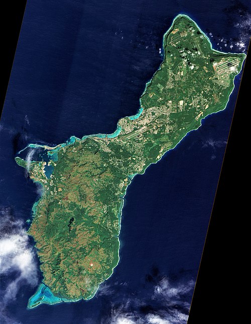
A photograph of Guam from space captured by NASA's now decommissioned Earth observation satellite, Earth Observing-1 (EO-1), December 2011