1.
Geographic coordinate system
–
A geographic coordinate system is a coordinate system used in geography that enables every location on Earth to be specified by a set of numbers, letters or symbols. The coordinates are chosen such that one of the numbers represents a vertical position. A common choice of coordinates is latitude, longitude and elevation, to specify a location on a two-dimensional map requires a map projection. The invention of a coordinate system is generally credited to Eratosthenes of Cyrene. Ptolemy credited him with the adoption of longitude and latitude. Ptolemys 2nd-century Geography used the prime meridian but measured latitude from the equator instead. Mathematical cartography resumed in Europe following Maximus Planudes recovery of Ptolemys text a little before 1300, in 1884, the United States hosted the International Meridian Conference, attended by representatives from twenty-five nations. Twenty-two of them agreed to adopt the longitude of the Royal Observatory in Greenwich, the Dominican Republic voted against the motion, while France and Brazil abstained. France adopted Greenwich Mean Time in place of local determinations by the Paris Observatory in 1911, the latitude of a point on Earths surface is the angle between the equatorial plane and the straight line that passes through that point and through the center of the Earth. Lines joining points of the same latitude trace circles on the surface of Earth called parallels, as they are parallel to the equator, the north pole is 90° N, the south pole is 90° S. The 0° parallel of latitude is designated the equator, the plane of all geographic coordinate systems. The equator divides the globe into Northern and Southern Hemispheres, the longitude of a point on Earths surface is the angle east or west of a reference meridian to another meridian that passes through that point. All meridians are halves of great ellipses, which converge at the north and south poles, the prime meridian determines the proper Eastern and Western Hemispheres, although maps often divide these hemispheres further west in order to keep the Old World on a single side. The antipodal meridian of Greenwich is both 180°W and 180°E, the combination of these two components specifies the position of any location on the surface of Earth, without consideration of altitude or depth. The grid formed by lines of latitude and longitude is known as a graticule, the origin/zero point of this system is located in the Gulf of Guinea about 625 km south of Tema, Ghana. To completely specify a location of a feature on, in, or above Earth. Earth is not a sphere, but a shape approximating a biaxial ellipsoid. It is nearly spherical, but has an equatorial bulge making the radius at the equator about 0. 3% larger than the radius measured through the poles, the shorter axis approximately coincides with the axis of rotation
2.
Russia
–
Russia, also officially the Russian Federation, is a country in Eurasia. The European western part of the country is more populated and urbanised than the eastern. Russias capital Moscow is one of the largest cities in the world, other urban centers include Saint Petersburg, Novosibirsk, Yekaterinburg, Nizhny Novgorod. Extending across the entirety of Northern Asia and much of Eastern Europe, Russia spans eleven time zones and incorporates a range of environments. It shares maritime borders with Japan by the Sea of Okhotsk, the East Slavs emerged as a recognizable group in Europe between the 3rd and 8th centuries AD. Founded and ruled by a Varangian warrior elite and their descendants, in 988 it adopted Orthodox Christianity from the Byzantine Empire, beginning the synthesis of Byzantine and Slavic cultures that defined Russian culture for the next millennium. Rus ultimately disintegrated into a number of states, most of the Rus lands were overrun by the Mongol invasion. The Soviet Union played a role in the Allied victory in World War II. The Soviet era saw some of the most significant technological achievements of the 20th century, including the worlds first human-made satellite and the launching of the first humans in space. By the end of 1990, the Soviet Union had the second largest economy, largest standing military in the world. It is governed as a federal semi-presidential republic, the Russian economy ranks as the twelfth largest by nominal GDP and sixth largest by purchasing power parity in 2015. Russias extensive mineral and energy resources are the largest such reserves in the world, making it one of the producers of oil. The country is one of the five recognized nuclear weapons states and possesses the largest stockpile of weapons of mass destruction, Russia is a great power as well as a regional power and has been characterised as a potential superpower. The name Russia is derived from Rus, a state populated mostly by the East Slavs. However, this name became more prominent in the later history, and the country typically was called by its inhabitants Русская Земля. In order to distinguish this state from other states derived from it, it is denoted as Kievan Rus by modern historiography, an old Latin version of the name Rus was Ruthenia, mostly applied to the western and southern regions of Rus that were adjacent to Catholic Europe. The current name of the country, Россия, comes from the Byzantine Greek designation of the Kievan Rus, the standard way to refer to citizens of Russia is Russians in English and rossiyane in Russian. There are two Russian words which are translated into English as Russians
3.
Federal districts of Russia
–
The federal districts are groupings of the federal subjects of Russia. Plenipotentiary Representatives are appointed by the President and are employees of the Presidential Administration, source, President Vladimir Putin established seven federal districts in May 2000. On January 19,2010 the new North Caucasian Federal District split from the Southern Federal District, on March 2014, after the Russian military intervention in and annexation of Crimea, the Crimean Federal District was established. The legality of this annexation is disputed by most states as well as NATO, on July 28,2016 the Crimean Federal District was abolished and merged into the Southern Federal District in order to improve the governance
4.
Central Federal District
–
The Central Federal District is one of the eight federal districts of Russia. The word Central has a political and historical meaning, being the core of the Russian state and its predecessor, geographically, the district is situated in the extreme west of present-day Russia, although it can be considered as the central region of European Russia. The district covers an area of 650,200 square kilometers, the Presidential Envoy to the Central Federal District is Alexander Beglov
5.
Economic regions of Russia
–
No federal subject can belong to more than one economic region. Economic regions are grouped into economic zones. An economic region or its parts can belong to more than one economic zone, establishment and abolition of economic regions and economic zones or any changes in their composition are decided upon by the federal government of Russia. The following is the list and composition of the economic regions, sorted by population
6.
Central economic region
–
Central Economic Region is one of twelve economic regions of Russia. Central Economic Region is located in the portion of the European part of Russia. A great number of automobile and railroads intersect on the territory of this region and this flat, rolling country, with Moscow as its center, forms a major industrial region. Besides Moscow, major cities include Smolensk, Yaroslavl, Vladimir, Tula, Dzerzhinsk, trucks, ships, railway rolling stock, machine tools, electronic equipment, cotton and woolen textiles, and chemicals are the principal industrial products. The Volga and Oka Rivers are the water routes. Many rail lines serve the area, the region specializes in machine building, chemical and textile industries. Long-fibered flax, potatoes, and vegetables are the most typical of the regions agriculture, cattle breeding for milking is also common. The machine building industry is mostly science-intensive, instrument-making, radio, electrotechnic, and electronic production prevail. Companies manufacturing metal-working machines and instruments, steam boilers, turbines, current generators, cities of Bryansk, Moscow, and Serpukhov are the centers of car-building industry. Trains and train cars are manufactured in Kolomna, Lyudinovo, Rybinsk is a shipbuilding center of the region. Tractors and other machinery are produced in Bezhetsk, Lyubertsy, Ryazan, Tula. Chemical industry includes the production of plastics, chemical fibers, rubber resin and tires. Textile industry is the industry of the region. Most of the production is concentrated in Ivanovo, Kostroma, and Moscow Oblasts, while the region imports most of the raw metals, metallurgy is still somewhat developed. There are metallurgical plants in Elektrostal, Moscow, and in Tula Oblast, electric power is generated by fossil fuels and nuclear power plants. Fossil fuel are imported from other regions of Russia. Other developed industries include manufacturing of footwear, pottery, glass, cement, construction materials, regions temperate zone climate allows for growing of a great variety of crops. As the soils are mostly of podsolic and grey forest types, melioration, most common natural resources of the region include phosphorites, brown coal, construction materials, and peat
7.
Tver
–
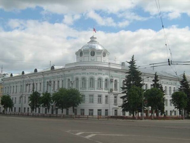
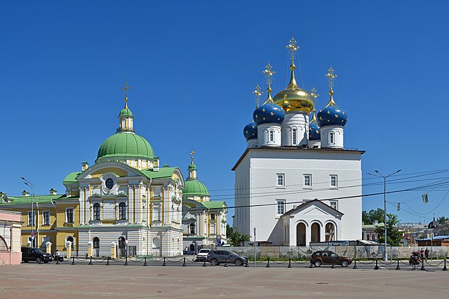
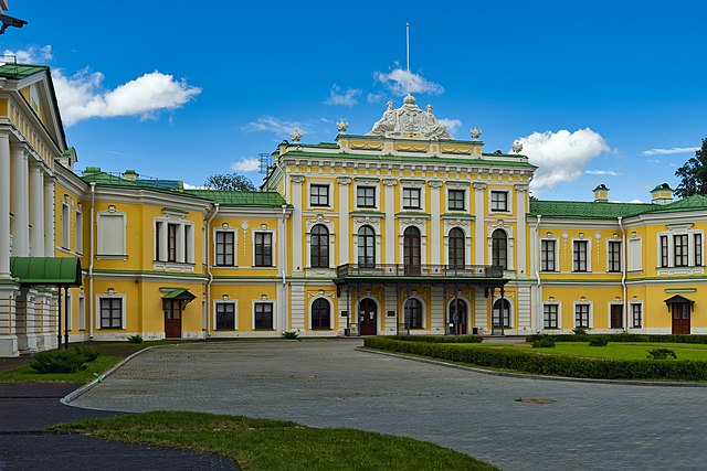
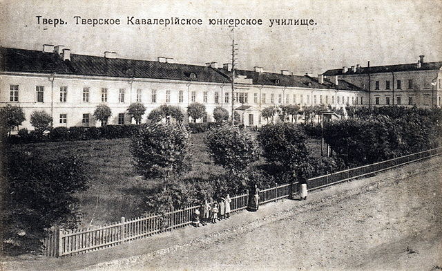
Tver is a city and the administrative center of Tver Oblast, Russia. It is situated at the confluence of the Volga and Tvertsa Rivers, the city was known as Kalinin from 1931 to 1990. Tver’s foundation year is accepted to be 1135, although there is no universal agreement on this date. Originally a minor settlement of Novgorodian traders, it passed to the Grand Prince of Vladimir in 1209, in 1246, Alexander Nevsky granted it to his younger brother Yaroslav Yaroslavich, from whom a dynasty of local princes descended. Four of them were killed by the Golden Horde and were proclaimed saints by the Russian Orthodox church, formerly a land of woods and bogs, the Principality of Tver was quickly transformed into one of the richest and most populous Russian states. As the area was accessible for Tatar raids, there was a great influx of population from the recently devastated south. By the end of the century, it was ready to vie with Moscow for supremacy in Russia, both Tver and Moscow were young cities, so the outcome of their rivalry was far from being certain. Mikhail, the Grand Prince of Tver, who ascended the throne of Vladimir in 1305, was one of the most beloved of medieval Russian rulers and his policy of open conflict with the Golden Horde led to his assassination there in 1318. His son Dmitry the Terrible Eyes succeeded him, and, concluding an alliance with the mighty Grand Duchy of Lithuania, exasperated by Dmitrys influence, Prince Ivan Kalita of the Grand Duchy of Moscow engineered his murder by the Mongols in 1326. On hearing the news of crime, the city revolted against the Horde. The Horde joined its forces with Muscovites and brutally repressed the rebellion, many citizens were killed, enslaved or deported. This was the blow to Tver’s aspirations for supremacy in Russia. In the second half of the 14th century, Tver was further weakened by struggles between its princes. Two senior branches of the house, those of Kashin and Kholmsky. The claimers were backed up by Moscow and eventually settled at the Moscow Kremlin court, during the Great Feudal War in the Grand Duchy of Moscow, Tver once again rose to prominence and concluded defensive alliances with Lithuania, Novgorod, Byzantium, and the Golden Horde. Grand Prince Boris of Tver sent one of his men, Afanasy Nikitin, to search for gold, nikitin’s travelogue, describing his journey from 1466 to 1472, is probably the first ever firsthand account of India by a European. A monument to Nikitin was opened on the Volga embankment in 1955, at last, on September 12,1485, the forces of Ivan the Great seized the city. The principality was given as an appanage to Ivan’s grandson, only to be abolished several decades later, last scions of the ruling dynasty were executed by Ivan the Terrible during the Oprichnina
8.
Federal subjects of Russia
–
Since March 18,2014, the Russian Federation constitutionally consists of 85 federal subjects, although the two most recently added subjects are internationally recognized as part of Ukraine. Three Russian cities of importance have a status of both city and separate federal subject which comprises other cities and towns within federal city keeping old structure of postal address. In 1993, there were 89 federal subjects listed, by 2008, the number of federal subjects had been decreased to 83 because of several mergers. In 2014, Sevastopol and the Republic of Crimea became the 84th and 85th federal subjects of Russia, every federal subject has its own head, a parliament, and a constitutional court. Federal subjects have their own constitution and legislation, subjects have equal rights in relations with federal government bodies. The federal subjects have equal representation—two delegates each—in the Federation Council and they do, however, differ in the degree of autonomy they enjoy. Composition of post-Soviet Russia was formed during the history of the Russian Soviet Federative Socialist Republic within the USSR, the Federation Treaty was included in the text of the 1978 Constitution of the Russian SFSR. In the late 1990s and early 2000s, the system became de jure closer to other modern federal states with a republican form of government in the world. There are several groupings of Russian regions, Federal subjects should not be confused with the eight Federal districts which are not subdivisions of Russia, are much larger and each encompass many federal subjects. Federal districts were created by Executive Order of the President of Russia specially for presidential envoys, an official government translation of the Constitution of Russia in Article 5 states,1. Another translation of the Constitution of Russia gives for article 65, each federal subject belongs to one of the following types, b. ^ According to Article 13 of the Charter of Leningrad Oblast, however, St. Petersburg is not officially named to be the administrative center of the oblast. ^ According to Article 24 of the Charter of Moscow Oblast, however, Moscow is not officially named to be the administrative center of the oblast. ^ Not recognized internationally as a part of Russia, the merging process was finished on March 1,2008. No new mergers have been planned since March 2008, Федерального конституционного закона №7-ФКЗ от30 декабря2008 г. Вступил в силу со дня официального опубликования, Опубликован, Российская газета, №237,25 декабря1993 г
9.
Time in Russia
–
There are eleven time zones in Russia, which currently observe times ranging from UTC+02,00 to UTC+12,00. Daylight saving time is not used in Russia, since 4 December 2016, the time zones are as follows, Daylight saving time in Russia was originally introduced on 30 June 1917 by a decree of the Russian Provisional Government. However, it was abandoned by a Decree of the Soviet government five months later, Daylight saving time was re-introduced in the USSR on 1 April 1981, by a decision of the Council of Ministers of the USSR. The usage of daylight saving time continued after the Soviet collapse but ended in 2011, on 27 March 2011, clocks were advanced as usual, but they did not go back on 30 October 2011, effectively making Moscow Time UTC+4 permanently. In the Russian Empire, most of the observed solar time. During the late 19th century, Moscow Mean Time was introduced on 1 January 1880,2,30,17 corresponds to 37. 6166667°, the longitude of Moscow. Other parts of Russia kept solar time for several years. At this time, Russia had the Julian calendar with 12 or 13 days less date compared to Western Europe, so it is possible to say the Moscow actually had GMT-285,29,43, GMT-309,29,43 and GMT-309,28,41. Russia adopted the Gregorian calendar on Thursday,14 February 1918, after the Soviet Union was created, Moscow Time became UTC+2 and the various other time zones were introduced throughout Russia and the rest of the Soviet Union, for example Irkutsk Time GMT+7. Between 1917-1922 the time was ordered, with daylight savings time some of those years. On 21 June 1930, the Soviet Union advanced all clocks by one hour, Moscow Time was now GMT+3 and Irkutsk Time GMT+8. On 1 April 1981, daylight saving time was re-introduced, clocks were moved one hour forward on 1 April, on 1 April 1981,00,00,00, Oymyakonsky District changed its time zone from MSK+6 to MSK+8. The change occurred during DST effectively changing the offset from UTC+9 to UTC+12, on 1 April 1982,00,00,00, Chukotka Autonomous Okrug changed its time zone from MSK+10 to MSK+9, thus eliminating Anadyr Time. The change occurred during DST effectively changing the offset from UTC+14 to UTC+13, on 27 March 1988,02,00,00, Saratov and Volgograd oblasts changed its time zone from MSK+1 to MSK. The change occurred during DST effectively changing the offset from UTC+5 to UTC+4, on 23 May 1993,00,00,00, Novosibirsk Oblast changed its time zone from MSK+4 to MSK+3. The change occurred during DST effectively changing the offset from UTC+8 to UTC+7, on 28 May 1995,00,00,00, Altai Krai and Altai Republic changed its time zone from MSK+4 to MSK+3. On 30 March 1997,02,00,00, Sakhalin Oblast changed its time zone from MSK+8 to MSK+7, on 1 May 2002,03,00,00, Tomsk Oblast changed its time zone from MSK+4 to MSK+3. On 1 January 2004,00,00,00, New Siberian Islands, Tomponsky District, the following time zone changes occurred on 28 March 2010, which, in particular, led to abolition of two of the eleven time zones
10.
Vehicle registration plates of Russia
–
Vehicle registration plates are the mandatory number plates used to display the registration mark of a vehicle, and have existed in Russia for many decades. Most motor vehicles which are used on roads are required by law to display them. The current format uses a letter followed by 3 digits and two more letters, to improve legibility of the numbers for Russian cars abroad, only a small subset of Cyrillic characters that look like Latin characters are used. Finally, the number and letters RUS are included, as well as the national flag. There is a different format for trailers, motorcycles, mopeds and scooters plates are made of square reflective plates and its format is 4 digits at the top and two letters at the bottom. Some autonomous regions are not required to have the flag on the licence plates, vehicles used by certain organisations or categories of persons carry special plates, Special plates in the above categories never carry the Russian flag, except for trailers. There are special reserved for government officials. The license plates for government officials originally had a larger flag instead of the regional code. Rich businessmen, prominent politicians and crime lords often use para-legally acquired special licence plates to get preferential treatment from the transport police, often, this is used in conjunction with a flashing siren. The Society of Blue Buckets is a protest movement that opposes this trend, as of 2014, there are new codes for Russian plates, number 82 for the Republic of Crimea and 92 for Sevastopol. The Russian Federation then officially annexed Crimea from Ukraine and now administers it as two federal subjects, the Republic of Crimea and the city of Sevastopol. Ukraine, backed by most of the community, refuses to accept the annexation. As per GOST provision, only 1,726,272 combinations may be issued within one administration unit, in certain regions, the amount of vehicles exceeds that number, and the combination may not be reused after a vehicle was taken off the registration. All this creates an issue of running out of numbers, a short-term solution was introducing more codes for those regions. Introduction of new license plate is being considered as a future solution. In the following years some codes were reassigned or discontinued, as the populous regions started running out of license plate combinations, new codes past code 89 were assigned to them as well. Additional triple-digit codes were created by adding a 1 or a 7 to the regional code. According to the Ministry of Internal Affairs Order 282 from March 28,2002, 1Code 059 is a former code for Syria
11.
Russian language
–
Russian is an East Slavic language and an official language in Russia, Belarus, Kazakhstan, Kyrgyzstan and many minor or unrecognised territories. Russian belongs to the family of Indo-European languages and is one of the four living members of the East Slavic languages, written examples of Old East Slavonic are attested from the 10th century and beyond. It is the most geographically widespread language of Eurasia and the most widely spoken of the Slavic languages and it is also the largest native language in Europe, with 144 million native speakers in Russia, Ukraine and Belarus. Russian is the eighth most spoken language in the world by number of native speakers, the language is one of the six official languages of the United Nations. Russian is also the second most widespread language on the Internet after English, Russian distinguishes between consonant phonemes with palatal secondary articulation and those without, the so-called soft and hard sounds. This distinction is found between pairs of almost all consonants and is one of the most distinguishing features of the language, another important aspect is the reduction of unstressed vowels. Russian is a Slavic language of the Indo-European family and it is a lineal descendant of the language used in Kievan Rus. From the point of view of the language, its closest relatives are Ukrainian, Belarusian, and Rusyn. An East Slavic Old Novgorod dialect, although vanished during the 15th or 16th century, is considered to have played a significant role in the formation of modern Russian. In the 19th century, the language was often called Great Russian to distinguish it from Belarusian, then called White Russian and Ukrainian, however, the East Slavic forms have tended to be used exclusively in the various dialects that are experiencing a rapid decline. In some cases, both the East Slavic and the Church Slavonic forms are in use, with different meanings. For details, see Russian phonology and History of the Russian language and it is also regarded by the United States Intelligence Community as a hard target language, due to both its difficulty to master for English speakers and its critical role in American world policy. The standard form of Russian is generally regarded as the modern Russian literary language, mikhail Lomonosov first compiled a normalizing grammar book in 1755, in 1783 the Russian Academys first explanatory Russian dictionary appeared. By the mid-20th century, such dialects were forced out with the introduction of the education system that was established by the Soviet government. Despite the formalization of Standard Russian, some nonstandard dialectal features are observed in colloquial speech. Thus, the Russian language is the 6th largest in the world by number of speakers, after English, Mandarin, Hindi/Urdu, Spanish, Russian is one of the six official languages of the United Nations. Education in Russian is still a choice for both Russian as a second language and native speakers in Russia as well as many of the former Soviet republics. Russian is still seen as an important language for children to learn in most of the former Soviet republics, samuel P. Huntington wrote in the Clash of Civilizations, During the heyday of the Soviet Union, Russian was the lingua franca from Prague to Hanoi
12.
Mikhail Kalinin
–
Mikhail Ivanovich Kalinin, known familiarly by Soviet citizens as Kalinych, was a Bolshevik revolutionary and Marxist–Leninist functionary. He served as head of state of the Russian Soviet Federative Socialist Republic, from 1926, he was a member of the Politburo of the Communist Party of the Soviet Union. Kalinin was born to a peasant family of ethnic Russian origin in the village of Verkhnyaya Troitsa, Tver Governorate and he was the elder brother of Fedor Kalinin. Kalinin finished his education at a school in 1889 and worked for a time on a farm. He moved to Saint Petersburg, where he found employment as a worker in 1895. He also worked as a butler and then as a worker at Tbilisi depot, where he met Sergei Alliluyev. In 1906, he married the ethnic Estonian Ekaterina Lorberg (Russian, Kalinin joined the Russian Social Democratic Labour Party in 1898, the year of its foundation. He came to know Stalin through the Alliluyev family, during the Russian Revolution of 1905, Kalinin worked for the Bolshevik party and on the staff of the Central Union of Metal Workers. He later became active on behalf of the RSDLP in Tiflis, Georgia, Reval, Estonia, in April 1906 he served as a delegate at the 4th Congress of the Russian Social Democratic Labour Party. Kalinin was an early and devoted adherent of the Bolshevik faction of the RSDLP and he was a delegate to the 1912 Bolshevik Party Conference held in Prague, where he was elected an alternate member of the governing Central Committee and sent to work inside Russia. He did not become a member because he was suspected of being an Okhrana agent. Kalinin was arrested for his activities in 1916 and freed during the February Revolution of 1917. Kalinin joined the Petrograd Bolshevik committee and assisted in the organization of the party daily Pravda and he continued to oppose an armed uprising to overthrow the government of Alexander Kerensky throughout that summer. In the elections held for the Petrograd City Duma in autumn 1917, Kalinin was chosen as mayor of the city, in 1919, Kalinin was elected a member of the governing Central Committee of the Russian Communist Party as well as a candidate member of the Politburo. He was promoted to membership on the Politburo in January 1926. When Yakov Sverdlov died in March 1919 Kalinin replaced him as President of the All-Russian Central Executive Committee, the name of this position was changed to Chairman of the Central Executive Committee of the USSR in 1922 and to Chairman of the Presidium of the Supreme Soviet in 1938. Kalinin continued to hold the post without interruption until his retirement at the end of World War II, in 1920, Kalinin attended the Second World Congress of the Communist International in Moscow as part of the Russian delegation. He was seated on the rostrum and took an active part in the debates
13.
Russian Census (2010)
–
The Russian Census of 2010 is the first census of the Russian Federation population since 2002 and the second after the dissolution of the Soviet Union. Preparations for the census began in 2007 and it took place between October 14 and October 25, the census was originally scheduled for October 2010, but was moved to 2013 allegedly for financial reasons, although it was also speculated that political motives were influential in the decision. However, in late 2009 Russian Prime Minister Vladimir Putin announced that the Government of Russia allocated 10.5 billion rubles in order to conduct the census as originally scheduled, Results showed the population to stand at 142.9 million. Since the previous 2002 census, population has decreased by 2.3 million, according to the 2010 census, urban population is 105.3 million, rural population is 37.5 million. The urbanisation rate is currently 73. 7%, the median age is 38 years. The ethnic composition is dominated by Russians, demographics of Russia Russian Census 2010 final results Results of 2010 All-Russia population census Official website of the 2010 Census
14.
Lake Seliger
–
It has the absolute height of 205 metres, the area of 212 square kilometres, and the average depth of 5.8 metres. Lake Seliger is a system of lakes linked by effluents, has many small islands and is surrounded by forests, including pine woods with many berries. It is one of the biggest natural lakes of Central Russia, the only outflow of the lake, the Selizharovka River, has its source at the southern end of the lake and drains into the Volga. The drainage basin of the lake includes the part of Ostashkovsky District, south of Demyansky District. Seliger is situated within a landscape of forests and hills. The lake is a nature reserve and is sometimes known as the European Baikal due to the diversity of its unique flora and fauna. Valdaysky National Park covers the part of the lake. Every Year, Seliger camp forums bring together people to study and discuss issues in political science, economics, art. Ostashkov is the town on the lake and is one of the most popular resorts in central Russia. Nikolo-Stolobensky Monastery is located on Stolobny Island, the closed urban-type settlement of Solnechny which is a military base occupies Gorodomlya Island. Tourism in Seliger area Travel and Tourism to Seliger Lake Map of Lake Seliger
15.
Valdai Hills
–
The hills are a northward extension of the Central Russian Upland. The ridge is overlain by deposited glacial materials in the form of terminal moraines, the Valdai Hills reach their maximum height of 346.9 m near Vyshny Volochyok. The Volga, the Daugava, the Lovat, the Msta, the Dnieper, the Syas, the region thus is divided between the drainage basins of the Caspian Sea, the Black Sea, and the Baltic Sea. It is a place of lakes, among them Lake Volgo, Lake Peno, Lake Seliger, Lake Brosno. The Valdai Hills are a popular tourist destination, particularly for fishing, the towns of Ostashkov and Valday are also remarkable for their historical associations. Valdaysky National Park was established in 1990 in the part of Novgorod Oblast to protect the landscapes of the highest part of the hills. The park includes Lake Valdayskoye and the section of Lake Seliger. Since 2004, the National Park has the status of a UNESCO Biosphere Reserve
16.
Volga River
–
The Volga is the longest river in Europe. It is also Europes largest river in terms of discharge and watershed, the river flows through central Russia and into the Caspian Sea, and is widely regarded as the national river of Russia. Eleven of the twenty largest cities of Russia, including the capital, some of the largest reservoirs in the world can be found along the Volga. The river has a meaning in Russian culture and is often referred to as Волга-матушка Volga-Matushka in Russian literature and folklore. The Slavic name is a translation of earlier Scythian Rā Volga, literally wetness, cognate with Avestan Raŋhā mythical stream and Sanskrit rasā́- dew, liquid, juice. The Scythian name survives in modern Mordvin Rav Volga, the Turkic peoples living along the river formerly referred to it as Itil or Atil big river. In modern Turkic languages, the Volga is known as İdel in Tatar, Атăл in Chuvash, Idhel in Bashkir, Edil in Kazakh, the Turkic peoples associated the Itils origin with the Kama. Thus, a tributary to the Kama was named the Aq Itil White Itil which unites with the Kara Itil Black Itil at the modern city of Ufa. The name Indyl is used in Adyge language, among Asians, the river was known by its other Turkic name Sarı-su yellow water, but the Oirats also used their own name, Ijil mörön or adaptation river. Presently the Mari, another Uralic group, call the river Jul, formerly, they called the river Volgydo, a borrowing from Old Russian. The Volga is the longest river in Europe and it belongs to the closed basin of the Caspian Sea, being the longest river to flow into a closed basin. From there it turns south, flows past Ulyanovsk, Tolyatti, Samara, Saratov and Volgograd, at its most strategic point, it bends toward the Don. Volgograd, formerly Stalingrad, is located there, the Volga has many tributaries, most importantly the rivers Kama, the Oka, the Vetluga, and the Sura. The Volga and its tributaries form the Volga river system, which flows through an area of about 1,350,000 square kilometres in the most heavily populated part of Russia. The Volga Delta has a length of about 160 kilometres and includes as many as 500 channels, the largest estuary in Europe, it is the only place in Russia where pelicans, flamingos, and lotuses may be found. The Volga freezes for most of its length for three each year. The Volga drains most of Western Russia and its many large reservoirs provide irrigation and hydroelectric power. The Moscow Canal, the Volga–Don Canal, and the Volga–Baltic Waterway form navigable waterways connecting Moscow to the White Sea, the Baltic Sea, the Caspian Sea, the Sea of Azov, high levels of chemical pollution have adversely affected the river and its habitats
17.
Daugava
–
The River Daugava or Western Dvina is a river rising in the Valdai Hills, Russia, flowing through Russia, Belarus, and Latvia and into the Gulf of Riga. The total length of the river is 1,020 km,325 km in Russia,338 km in Belarus, within Latvia it flows through Latgale, Zemgale, Vidzeme and Riga, before flowing into the Gulf of Riga. The total catchment area of the river is 87,900 km2,33,150 km2 of which are within Belarus. According to the Max Vasmers Etymological Dictionary, the toponym Dvina clearly cannot stem from a Uralic language, the river began experiencing environmental deterioration in the era of Soviet collective agriculture and a wave of hydroelectric power projects. Ruba, Vitebsk, Beshankovichy, Polotsk with Boris stones strewn in the vicinity, Navapolatsk, Dzisna, Verkhnedvinsk, krāslava, Daugavpils, Līvāni, Jēkabpils, Pļaviņas, Aizkraukle, Jaunjelgava, Lielvārde, Kegums, Ogre, Ikšķile, Salaspils and Riga. Beginning around the sixth century AD, Viking explorers crossed the Baltic Sea and entered the Daugava River, in medieval times the Daugava was an important navigation trading route for transport of furs from the north and Byzantine silver. In Belarus, water pollution of the Daugava is considered severe, with the chief sources being treated wastewater, fish-farming. Daugava River photos at flickr Richard C, francis W. Carter and David Turnock. Environmental problems of East Central Europe
18.
Dnieper
–
It is the longest river of Ukraine and Belarus and the fourth longest river in Europe. The total length ranges between 2,145 km and 2,201 km with a basin of 504,000 square kilometres. The river is noted for its dams and hydroelectric stations, the Dnieper is an important navigable waterway for the economy of Ukraine and is connected via the Dnieper–Bug Canal to other waterways in Europe. In antiquity, the river was known to the Greeks as the Borysthenes and was part of the Amber Road, Arheimar, a capital of the Goths, was located on the Dnieper, according to the Hervarar saga. The name Dnieper is derived from Sarmatian Dānu apara the river on the far side, according to V. Abaev the name Dnieper derives from Scythian Dānu apr deep river, while the name Dniester is combination of Scythian Dānu and Thracian Ister, the old name of Dniester. In the three countries through which it flows it has essentially the name, albeit pronounced differently, Russian, Днепр, Belarusian, Дняпро or Днепр, Ukrainian. The late Greek and Roman authors called it Δάναπρις - Danapris and Danaper respectively - and its Old East Slavic name used at the time of Kievan Rus was Slavuta or Slavutych, the Huns called it Var, and Bulgars - Buri-Chai. The name in Crimean Tatar, Özü, the total length of the river is 2,145 kilometres, of which 485 km are within Russia,700 km are within Belarus, and 1,095 km are within Ukraine. Its basin covers 504,000 square kilometres, of which 289,000 km2 are within Ukraine,118,360 km2 are within Belarus, the source of the Dnieper is the sedge bogs of the Valdai Hills in central Russia, at an elevation of 220 m. For 115 km of its length, it serves as the border between Belarus and Ukraine and its estuary, or liman, used to be defended by the strong fortress of Ochakiv. On the Dnepr River to the south of Komarin urban-type settlement, Braghin District, the Dnieper has many tributaries with 89 being rivers of 100+ km. The water resources of the Dnieper basin compose around 80% out of all Ukraine, Dnieper Rapids were part of trade route from the Varangians to the Greeks, first mentioned in the Kiev Chronicle. The route was established in the late eighth and early ninth centuries. On the Dnieper the Varangians had to portage their ships round seven rapids, after Dnieper Hydroelectric Station was built in 1932, they were inundated by Dnieper Reservoir. The river is part of the Quagga mussels native range, the mussel has been accidentally introduced around the world where it has become an invasive species. From the mouth of the Prypiat River to the Kakhovka Hydroelectric Station, there are six sets of dams and hydroelectric stations, the first constructed was the Dnieper Hydroelectric Station near Zaporizhia, built in 1927–1932 with an output of 558 MW. It was destroyed during World War II, but was rebuilt in 1948 with an output of 750 MW, the Dnieper River in different regions Major cities, over 100,000 in population, are in bold script. Cities and towns located on the Dnieper are listed in order from the source to its mouth, Arheimar
19.
Torzhok
–
Torzhok is a town in Tver Oblast, Russia, located on the Tvertsa River along the federal highway M10 and a branch of the Oktyabrskaya Railway division of the Russian Railways. The town is famous for its folk craft of goldwork embroidery, Torzhok was first mentioned in a chronicle in 1139 as Novy Torg. The Mongols burned it in 1238, but did not proceed northward to Novgorod, at that time, the town commanded the only route whereby grain was delivered to Novgorod. Once Torzhok blocked the route, a shortage of grain. Consequently, Torzhok was known as a key to the Novgorod Republic, the town was incorporated into the Grand Duchy of Moscow with the rest of the Novgorod Republic in 1478. The Polish army frequently ravaged it during the Time of Troubles, during the imperial period, Torzhok was known as an important post station on the highway from Moscow to St. Petersburg. Alexander Pushkin, for instance, used to pass through Torzhok on a number of occasions, in the course of the administrative reform carried out in 1708 by Peter the Great, Torzhok was included into Ingermanlandia Governorate, and in 1727 Novgorod Governorate split off. In 1775, Novotorzhsky Uyezd was established, with the center in Torzhok, on July 12,1929 the governorates and uyezds were abolished. Novotorzhsky District, with the center in Torzhok, was established within Tver Okrug of Moscow Oblast. On July 23,1930, the okrugs were abolished, on January 29,1935 Kalinin Oblast was established, and Novotorzhsky District was transferred to Kalinin Oblast. On March 4,1964 Likhoslavlsky District, and on January 12,1965 Kuvshinovsky District were re-established, Torzhoksky District retained the new name. In 1990, Kalinin Oblast was renamed Tver Oblast, within the framework of administrative divisions, Torzhok serves as the administrative center of Torzhoksky District, even though it is not a part of it. As an administrative division, it is incorporated separately as Torzhok Okrug—an administrative unit with the equal to that of the districts. As a municipal division, Torzhok Okrug is incorporated as Torzhok Urban Okrug, Torzhok has twenty-two large and medium-sized industrial enterprises. Two of them are especially significant, JSC Pozhtekhnika and OAO Torzhok Plant Printing Inks account for 70% of all industrial output. A railway line which connects Likhoslavl with Soblago via Selizharovo runs through Torzhok, another railway line branches off in Torzhok and heads south to Rzhev via Vysokoye. Both lines are served by infrequent passenger traffic, the M10 highway, which connects Moscow and St. Petersburg, passes close to Torzhok. A road to Ostashkov branches off to the west, there is also a road connecting Torzhok with Staritsa
20.
Toropets
–
Toropets is a town and the administrative center of Toropetsky District in Tver Oblast, Russia, located where the Toropa River enters Lake Solomennoye. In 1074, when the town was first mentioned in chronicles, by 1167, it was large enough to have its own princes. The most famous of its rulers was Mstislav the Bold, whose grandson Alexander Nevsky wed Alexandra of Polotsk in Toropets in 1239. In the mid-14th century the town passed to the Grand Duchy of Lithuania, in the early 17th century, Toropets was ransacked by the Polish army. In the course of the administrative reform carried out in 1708 by Peter the Great, in 1727, separate Novgorod Governorate was split off. Toropets was included into Velikiye Luki Province, in 1772, as a result of the First Partition of Poland, Inflanty Voivodeship and eastern Belarus were transferred to Russia. In order to accommodate these areas, Pskov Governorate was created, the town of Opochka was made the administrative center of the governorate. Pskov Governorate has proven to be too big to be administered properly, and in 1776 and it divided the governorate into Pskov and Polotsk Governorates. Pskov was made the center of Pskov Governorate, and Toropets remained in Pskov Governorate. In 1777, Pskov Governorate was transformed into Pskov Viceroyalty, which was administered from Novgorod by Jacob Sievers, in 1796, the viceroyalty was abolished, and on 31 December 1796 the emperor Paul I issued a decree restoring Pskov Governorate. Toropets was the center of Toropetsky Uyezd of Pskov Governorate, the Soviet authority in Toropets was established on October 30,1917. On August 1,1927 Pskov Governorate was abolished, and Leningrad Oblast was established, Toropetsky Uyezd was abolished as well, and Toropetsky District, with the administrative center in Toropets, was established. It belonged to Velikiye Luki Okrug of Leningrad Oblast, on June 17,1929, the district was transferred to Western Oblast. On August 1,1930 the okrugs were abolished, and the districts were subordinated directly to the oblast, on January 29,1935 Kalinin Oblast was established, and Toropetsky District was transferred to Kalinin Oblast. The town was occupied by the Wehrmacht during WWII, from August 29,1941 until January 21,1942, on August 22,1944, the district was transferred to newly established Velikiye Luki Oblast. On October 2,1957, Velikiye Luki Oblast was abolished, in 1990, Kalinin Oblast was renamed Tver Oblast. Within the framework of administrative divisions, Toropets serves as the center of Toropetsky District. As an administrative division, it is incorporated within Toropetsky District as Toropets Urban Settlement, as a municipal division, this administrative unit also has urban settlement status and is a part of Toropetsky Municipal District
21.
Zubtsov
–
Zubtsov was first mentioned in a chronicle in 1216. Due to its location on the Volga, it controlled one of the versions of the Trade route from the Varangians to the Greeks, in the Middle Ages, it was a border fortress of Principality of Tver. Between 1318 and 1460, separate Zubtsov Principality existed with the seat in Zubtsov and it was subordinate to the Tver principality. In 1460, it was abolished and merged back to Principality of Tver, the Grand Duchy of Moscow annexed it with the rest of Principality of Tver in 1485. Subsequently, the town was important chiefly as a flax trade market and its Neoclassical cathedral was constructed in 1801. In the course of the administrative reform carried out in 1708 by Peter the Great, Zubtsov was included into Ingermanlandia Governorate, in 1775, Zubtsovsky Uyezd was established, with the center in Zubtsov. On 30 May 1922, Zubtsovsky Uyezd was abolished and merged into Rzhevsky Uyezd, on 12 July 1929, governorates and uyezds were abolished, and Zubtsovsky District with the administrative center in Zubtsov was established. It belonged to Rzhev Okrug of Western Oblast, on August 1,1930 the okrugs were abolished, and the districts were subordinated directly to the oblast. On 29 January 1935 Kalinin Oblast was established, and Zubtsovsky District was transferred to Kalinin Oblast, during World War II, in 1941—1943, the town was occupied by German troops from October 11,1941 to August 23,1942 and almost razed to the ground. It was a place of fighting of the Battle of Rzhev. About 15,000 of Red Army soldiers are buried at the Zubtsovs memorial, the town was revitalized after the Vazuza Reservoir project was started in the 1970s. The reservoir currently provides Moscow with one quarter of its drinking water, in February 1963, during the abortive administrative reform by Nikita Khrushchev, Zubtsovsky District was merged into Rzhevsky District, but on 12 January 1965 it was re-established. In 1990, Kalinin Oblast was renamed Tver Oblast, within the framework of administrative divisions, Zubtsov serves as the administrative center of Zubtsovsky District. As an administrative division, it is incorporated within Zubtsovsky District as Zubtsov Urban Settlement, as a municipal division, this administrative unit also has urban settlement status and is a part of Zubtsovsky Municipal District. There are enterprises of timber industry and of metallurgy in Zubtsov, the railroad which connects Moscow and Riga via Rzhev, runs through Zubtsov. The M9 highway connecting Moscow with Riga also passes Zobtsov, another road to Gagarin branches off south. There are also local roads with bus traffic originating from Zubtsov, the Volga is navigable, however, there is no passenger navigation. Zubtsov contains four cultural heritage monuments of significance and additionally twenty-two objects classified as cultural and historical heritage of local significance
22.
Kashin (town)
–
Kashin is a town and the administrative center of Kashinsky District in Tver Oblast, Russia, located around a rural agricultural area on the Kashinka River. Kashin was first mentioned in a chronicle under the year of 1238 and it was given by Grand Duke Mikhail Yaroslavich as an appanage to his son Vasily, who founded a short-lived dynasty of local princes. Her relics are preserved in the Ascension Cathedral of Kashin, in 1382, Kashin was annexed by Principality of Tver. From 1399 to 1426, it was held by a dynasty of Kashin princes. In 1452, Kashin withstood a siege by Dmitry Shemyaka and it finally passed to the Grand Duchy of Moscow in 1486 with the rest of the Principality of Tver. In 1708, the became a part of Ingermanland Governorate. In 1775, Tver Viceroyalty was formed from the lands which belonged to Moscow and Novgorod Governorates. In 1796, Tver Viceroyalty was transformed into Tver Governorate, on October 3,1927, Kashinsky Uyezd was abolished and split between Bezhetsky and Kimrsky Uyezds. On July 12,1929, Kashinsky District, with the center in the Kashin, was established within Bezhetsk Okrug of Moscow Oblast. On July 23,1930, the okrugs were abolished and the districts were subordinated to the oblast. On January 29,1935, Kalinin Oblast was established and Kashin was transferred to it, in 1990, Kalinin Oblast was renamed Tver Oblast. Within the framework of administrative divisions, Kashin serves as the center of Kashinsky District. As an administrative division, it is incorporated within Kashinsky District as Kashin Urban Settlement, as a municipal division, this administrative unit also has urban settlement status and is a part of Kashinsky Municipal District. The mean temperature in Kashin is −11 °C in January and +18 °C in July, the town is an important part of the oblasts economy. It is home to Veresk, one of the largest alcoholic drink producing companies in the region, another major business is the mineral water company ERA, which produces the Kashinskaya brand of mineral water. There are also an electric equipment company, a factory. Several times a week, a market is organized in the square of the town where residents can sell various items. Also, fruit and vegetables from nearby farms are sold
23.
Vyshny Volochyok
–
Vyshny Volochyok or Vyshny Volochok is a town in Tver Oblast, Russia. The town is located 119 kilometers northwest of Tver, in the Valdai Hills, hence the towns name is translated from Russian as Upper Portage. The portage between the Tsna and the Tvertsa existed from the times as confirmed by archaeological artifacts found in the area. Vyshny Volochyok as a settlement was mentioned in chronicles in 1471, in 1703-1722, Peter the Great had a canal constructed to link the two rivers. In the 1740, the road connecting Moscow and Saint Petersburg was built and these two events gave a start to the fast economic development of Vyshny Volochyok, which later also became a major center of textile manufacture and glass production. In 1772, the first fair was held, and in the first half of the 19th century the road was rebuilt in stone, in 1851, the railroad construction followed. In the course of the administrative reform carried out in 1708 by Peter the Great, Vyshny Volochyok was included into Ingermanlandia Governorate, and in 1727 Novgorod Governorate split off. On May 28,1770 Vyshny Volochyok was granted town rights, on July 12,1929 the governorates and uyezds were abolished. Vyshnevolotsky District, with the center in Vyshny Volochyok, was established within Tver Okrug of Moscow Oblast. On July 23,1930, the okrugs were abolished, on January 29,1935 Kalinin Oblast was established, and Vyshny Volochyok was transferred to Kalinin Oblast. In 1990, Kalinin Oblast was renamed Tver Oblast, within the framework of administrative divisions, Vyshny Volochyok serves as the administrative center of Vyshnevolotsky District, even though it is not a part of it. As an administrative division, it is incorporated separately as Vyshny Volochyok Okrug—an administrative unit with the equal to that of the districts. As a municipal division, Vyshny Volochyok Okrug is incorporated as Vyshny Volochyok Urban Okrug, the economy of Vyshny Volochyok is based on timber, glassmaking, and textile industries. The railroad connecting Moscow and Saint Petersburg passes through Vyshny Volochyok, the M10 highway, which connects Moscow and St. Petersburg, passes theough the city as well. A road connecting to Maksatikha, Bezhetsk, and Rybinsk branches out east, there are local roads as well, with the bus traffic originating from Vyshny Volochyok. Currently, there is no passenger navigation, Vyshny Volochyok contains twenty-four cultural heritage monuments of federal significance and additionally forty-four objects classified as cultural and historical heritage of local significance. Vyshny Volochyok hosts a museum which was open in 1932. In the episode Limerick of Cabin Pressure, Vyshny Volochyok is mentioned at the start and has a devoted to it near the end
24.
Kalyazin
–
A sloboda appeared on the site of modern Kalyazin in the 12th century. Its importance grew significantly with the foundation of the Makaryevsky Monastery on the bank of the Volga in the 15th century. This abbey used to be the most conspicuous landmark of Kalyazin and comprised numerous buildings of historic interest, the name of the town originates from certain Kolyaga, a land proprietor in the 15th century. In the 18th century, the area was included into Moscow Governorate, in 1775, Kalyazin was granted town rights and Kalyazinsky Uyezd was established. It was a part of newly established Tver Viceroyalty, in 1796, the Viceroyalty was abolished and transformed into Tver Governorate. Kalyazinsky Uyezd was abolished, but in 1803, it was re-established, on May 30,1922, Kalyazinsky Uyezd was abolished and merged into Kashinsky Uyezd. On October 3,1927, Kashinsky Uyezd itself was abolished, on August 12,1929, Tver Governorate was abolished, with its territory transferred to Moscow Oblast. Uyezds were abolished as well, and Kalyazinsky District, with the center in Kalyazin, was established within Kimry Okrug of Moscow Oblast. On July 23,1930, the okrugs were abolished and the districts were subordinated to the oblast. On January 29,1935, Kalinin Oblast was established, in 1940, the monastery and most of the old town were submerged under water during the construction of the Uglich Hydroelectric Station, which created the Uglich Reservoir. After that, the town was relocated to a new. On February 13,1963, during the abortive Khrushchevs administrative reform, Kalyazinsky District was merged into Kimrsky District, in July 1990, Kalinin Oblast was renamed Tver Oblast. On November 19,2001, a chartered IRS Aero Ilyushin Il-18 airplane crashed in Kalyazin, on August 26,2010, dozens of Central Asian guest workers were deported from the town after mass clashes with the locals. Their construction site jobs were given to locals instead, within the framework of administrative divisions, Kalyazin serves as the administrative center of Kalyazinsky District. As an administrative division, it is incorporated within Kalyazinsky District as Kalyazin Urban Settlement, as a municipal division, this administrative unit also has urban settlement status and is a part of Kalyazinsky Municipal District. Two factories in Kalyazin—one producing oil extraction equipment and another one manufacturing some parts of MiG airplanes—are responsible for 42% of the industrial production of the district. Chemical, food, leather, and textile industry are present as well, Kalyazin is home to one of the largest railway stations in Tver Oblast. Trains from St. Petersburg, Moscow, Kashin, Uglich, Rybinsk, Sonkovo, Savyolovo, Kalyazin is connected by roads with Sergiyev Posad, Uglich, and with Tver and Kimry via Kashin
25.
Rzhev
–
Rzhev is a town in Tver Oblast, Russia, located 49 kilometers southwest of Staritsa and 126 kilometers from Tver, on the highway and railway connecting Moscow and Riga. It is the uppermost town situated on the Volga River, Rzhev was founded in the Middle Ages and rivals Toropets as the oldest town in the region. Rzhevians usually point out that their town is mentioned in the Novgorod laws as early as 1019. Their neighbors from Toropets, on the hand, give more credence to Rzhevs first mention in a major chronicle under 1216. Following the Mongol invasion, Rzhev passed to a branch of the Smolensk dynasty. Later the princes divided the town in two parts, which are called the Prince-Dmitrys Side and Prince-Theodors Side. In the mid-14th century, they had a hard time repelling attacks from Algirdas of Lithuania and Grand Princes of Tver, finally, they left for Moscow, where their descendants have become comic characters of many a joke. In the meantime, the town was occupied for a space by Tver, Poland-Lithuania. In the course of the administrative reform carried out in 1708 by Peter the Great, Rzhev was included into Ingermanlandia Governorate, in 1775, Rzhevsky Uyezd was established, with the center in Rzhev. In the 18th century, local merchants, mainly of Old Believer confession, on 12 July 1929, governorates and uyezds were abolished, and Rzhevsky District with the administrative center in the town of Rzhev was established. It belonged to Rzhev Okrug of Western Oblast, on August 1,1930 the okrugs were abolished, and the districts were subordinated directly to the oblast. On 29 January 1935 Kalinin Oblast was established, and Rzhev was transferred to Kalinin Oblast, in 1990, Kalinin Oblast was renamed Tver Oblast. During World War II, Rzhev was occupied by German troops from 14 October 1941 to 3 March 1943. During this occupation, the area of Rzhev, Sychyovka. These operations, which resulted in a loss of civilian and military life, are commonly referred to as the Battles of Rzhev. Almost no old architecture survived these battles, within the framework of administrative divisions, Rzhev serves as the administrative center of Rzhevsky District, even though it is not a part of it. As an administrative division, it is incorporated separately as Rzhev Okrug—an administrative unit with the equal to that of the districts. As a municipal division, Rzhev Okrug is incorporated as Rzhev Urban Okrug, Rzhev produces most of the cranes used in constructing apartment buildings and shopping malls in Moscow
26.
Battles of Rzhev
–
The operations took place in the general area of Rzhev, Sychyovka and Vyazma against German forces. As a result, a salient was formed along the front line in the direction of the capital and it was strategically important for the German Army Group Centre due to the threat it posed to Moscow, and was therefore heavily fortified and strongly defended. The intent was for the 22nd Army, 29th Army and 39th Armies supported by the 11th Cavalry Corps to attack West of Rzhev, and penetrate deep into the western flank of Army Group Centres 9th Army. This was achieved in January, and by the end of the month the cavalry corps found itself 110 km in the depth of the German flank. To eliminate this threat to the rear of the Army Group Centres 9th Army, the cutting of a major highway to Rzhev by the cavalry signalled the commencement of the Toropets–Kholm Offensive. The offensive was conducted in late 1942 and this offensive was conducted by the Western Front against the Wehrmachts 4th Panzer Army and the 4th Army. A Soviet airborne operation, conducted by the 4th Airborne Corps in seven separate landing zones, five of them intended to cut major road, in the aftermath of the Soviet winter counteroffensive of 1941–42, substantial Soviet forces remained in the rear of the German Ninth Army. These forces maintained a hold on the forested swamp region between Rzhev and Bely. On July 2,1942, Ninth Army under General Model launched Operation Seydlitz to clear the Soviet forces out, the Germans first blocked the natural breakout route through the Obsha valley and then split the Soviet forces into two isolated pockets. The battle lasted eleven days and ended with the elimination of the encircled Soviet forces, the next Rzhev-Sychyovka Offensive codenamed Operation Mars. An NKVD double agent known as Heine provided information about the offensive to the OKH as part of the plan to divert German forces from any relief of those trapped at Stalingrad. German forces in the salient were eventually withdrawn by Hitler during Operation Büffel to provide greater force for the German offensive operation at Kursk, fighting in the area remained mostly static for 14 months. Losses and setbacks elsewhere along the front finally compelled the Germans to abandon the salient in order to free up reserves for the front as a whole, defending the salient required 29 divisions. Its abandonment freed up 22 of those divisions and created a reserve which allowed the Germans to stabilize the front. The retreat of the Germans in Operation Büffel was tactically and militarily successful, the Soviet Army paid a high price for their defeat at Rzhev, but with the Germans were forced to withdraw from an important bridgehead which enabled the Germans to threaten Moscow. Losses for the series of operations around the Rzhev salient from 1941 to 1943 are difficult to calculate. These operations cover a series of battles and defensive operations over a wide area involving many formations on both sides. For the whole series of Rzhev battles, the numbers are not clear yet, but, since the mobilized manpower of both sides were enormous and the fighting is violent, casualties should be very high
27.
World War II
–
World War II, also known as the Second World War, was a global war that lasted from 1939 to 1945, although related conflicts began earlier. It involved the vast majority of the worlds countries—including all of the great powers—eventually forming two opposing alliances, the Allies and the Axis. It was the most widespread war in history, and directly involved more than 100 million people from over 30 countries. Marked by mass deaths of civilians, including the Holocaust and the bombing of industrial and population centres. These made World War II the deadliest conflict in human history, from late 1939 to early 1941, in a series of campaigns and treaties, Germany conquered or controlled much of continental Europe, and formed the Axis alliance with Italy and Japan. Under the Molotov–Ribbentrop Pact of August 1939, Germany and the Soviet Union partitioned and annexed territories of their European neighbours, Poland, Finland, Romania and the Baltic states. In December 1941, Japan attacked the United States and European colonies in the Pacific Ocean, and quickly conquered much of the Western Pacific. The Axis advance halted in 1942 when Japan lost the critical Battle of Midway, near Hawaii, in 1944, the Western Allies invaded German-occupied France, while the Soviet Union regained all of its territorial losses and invaded Germany and its allies. During 1944 and 1945 the Japanese suffered major reverses in mainland Asia in South Central China and Burma, while the Allies crippled the Japanese Navy, thus ended the war in Asia, cementing the total victory of the Allies. World War II altered the political alignment and social structure of the world, the United Nations was established to foster international co-operation and prevent future conflicts. The victorious great powers—the United States, the Soviet Union, China, the United Kingdom, the Soviet Union and the United States emerged as rival superpowers, setting the stage for the Cold War, which lasted for the next 46 years. Meanwhile, the influence of European great powers waned, while the decolonisation of Asia, most countries whose industries had been damaged moved towards economic recovery. Political integration, especially in Europe, emerged as an effort to end pre-war enmities, the start of the war in Europe is generally held to be 1 September 1939, beginning with the German invasion of Poland, Britain and France declared war on Germany two days later. The dates for the beginning of war in the Pacific include the start of the Second Sino-Japanese War on 7 July 1937, or even the Japanese invasion of Manchuria on 19 September 1931. Others follow the British historian A. J. P. Taylor, who held that the Sino-Japanese War and war in Europe and its colonies occurred simultaneously and this article uses the conventional dating. Other starting dates sometimes used for World War II include the Italian invasion of Abyssinia on 3 October 1935. The British historian Antony Beevor views the beginning of World War II as the Battles of Khalkhin Gol fought between Japan and the forces of Mongolia and the Soviet Union from May to September 1939, the exact date of the wars end is also not universally agreed upon. It was generally accepted at the time that the war ended with the armistice of 14 August 1945, rather than the formal surrender of Japan
28.
Staritsa (town), Tver Oblast
–
Staritsa is a town and the administrative center of Staritsky District in Tver Oblast, Russia, located on the Volga River,77 kilometers from Tver, the administrative center of the oblast. The town was established in 1297 under the name of Gorodok, in 1365, it was moved from the more elevated right to the lower left bank of the Volga River. Since the 15th century, the town has been called Staritsa, the name was misinterpreted by heraldists who represented on Staritsas coat of arms an image of aged nun, which is another meaning of the Russian word staritsa. In the 14th century, it belonged to the Principality of Zubtsov, in 1485 it was formally annexed by the Grand Duchy of Moscow. The Golden Age of the town began, between 1519 and 1597 the Principality of Staritsa, subordinate to Moscow, existed with the capital in Staritsa. The principality was ruled by Ivan IIIs son Andrey, and then by Andreys son Vladimir, while Ivan the Terrible had no children, Vladimir was regarded by boyars as his only heir. As the Tsar suspected Staritsas ruler of plotting against him, Vladimir, the opulence of Staritsa during Vladimirs reign can be seen in the Dormition Monastery. In the course of the administrative reform carried out in 1708 by Peter the Great, the area was included into Ingermanlandia Governorate, in 1775, Staritsky Uyezd was established, with the center in Staritsa. Much of the area of the district belonged to Staritsky Uyezd, the southern part of the District belonged to Zubtsovsky Uyezd, also established in 1775. On 3 March 1924, Staritsky Uyezd was abolished and split between Novotorzhsky, Rzhevsky, and Tverskoy Uyezds, on 12 July 1929, governorates and uyezds were abolished, and Staritsky District with the administrative center in the town of Staritsa was established. It belonged to Rzhev Okrug of Western Oblast, on August 1,1930 the okrugs were abolished, and the districts were subordinated directly to the oblast. On 29 January 1935 Kalinin Oblast was established, and Staritsky District was transferred to Kalinin Oblast, during World War II, between 12 October 1941 and 1 January 1942, the town was occupied by the German army. In 1990, Kalinin Oblast was renamed Tver Oblast, within the framework of administrative divisions, Staritsa serves as the administrative center of Staritsky District. As an administrative division, it is incorporated within Staritsky District as Staritsa Urban Settlement, as a municipal division, this administrative unit also has urban settlement status and is a part of Staritsky Municipal District. Main industries in Staritsa are a factory, a flax-manufacturing factory, as well as mechanical. A railway connecting Torzhok and Rzhev has the Staritsa railway station, a paved road connecting Tver to Rzhev crosses the district and passes through Staritsa, where there is a bridge over the Volga. Another road connects Staritsa with Torzhok via Bernovo, there are also local roads with bus traffic originating from Staritsa. The Volga is navigable but there is no passenger navigation, the town is split by the river into two parts, the larger left and the smaller right
29.
Ostashkov
–
The island of Klichen was first mentioned in a letter sent by Grand Duke Algirdas of Lithuania to the Ecumenical Patriarch of Constantinople in 1371. The former belonged to the Moscow Patriarchs, and the latter—to the Joseph-Volokolamsk Monastery, in 1770, both villages were merged into the town of Ostashkov. Ostashkov is commonly regarded as one of the finest Russian provincial towns and its main streets were laid out in Neoclassical style after the plans of Ivan Starov. Local landmarks include the Ascension Church, the Trinity Cathedral, the Monastery of the Sign, there is also a fanciful column erected by people of Ostashkov in 1787 to mark a spot where a wooden fort used to stand. The towns pleasant architecture and attractive setting by the combine to make Ostashkov one of the most popular resorts in Western Russia. The well-known Nilov Monastery is located on Stolobny Island, about 10 kilometers north from Ostashkov and it was the place where the Ostashkov Special Camp of the NKVD was located and where roughly 6,300 Polish policemen and prisoners of war were kept prior to their execution in Tver. Approximately 4,300 of their comrades, held in Kozelsk were around this time executed in Smolensk Oblast, in 1772, Ostashkov was granted town status, and Ostashkovsky Uyezd of Novgorod Governorate was established, with the seat in Ostashkov. On 1 October 1929, governorates and uyezds were abolished, and it belonged to Velikiye Luki Okrug of Western Oblast. On August 1,1930 the okrugs were abolished, and the districts were subordinated directly to the oblast, on January 29,1935 Kalinin Oblast was established, and Ostashkovsky District was transferred to Kalinin Oblast. In February 1963, during the administrative reform by Nikita Khrushchev. During World War II, Ostashkov was not occupied by German troops, soviet flotilla on the lake Seliger was involved in evacuation of Leningrad and Kalinin industrial equipment, military supplies, wounded and refugees. On 25 September 1941 the frontline approached the town and local authorities ordered to evacuate all the industrial equipement from Ostashkov to Beliy Gorodok, only flotilla which were still involved in evacuation of the town, were left. The barges and ships were under constant bombings by Luftwaffe, after the Germans entered the Selizharovo village, all the barges were dispersed along the river and covered by trees and bushes. Crews were ready to destroy their barges with explosives, however Germans failed to capture Ostashkov and the front line stabilized. Due to German occupation of Kalinin the only way to supply the troops near Ostashkov was lake Seliger waterway, soviet lake flotilla command faced German bombardments in harsh winter conditions when the barges were blocked by ice. During spring 1942 flotilla faced the threat to be crushed by ice, however all the barges survived the spring and became ready to the 1942 navigation. As the northern shore was occupied, all the northern waterways were under shelling by German artillery. The new waterways across the Khrestnoye, Seremo and Glubokoye lakes, during the German air raids steamers and barges were hiding near the islands
30.
East European Plain
–
The East European Plain is a vast interior plain extending east of the North European Plain, and comprising several plateaus stretching roughly from 25 degrees longitude eastward. It includes the westernmost Volhynian-Podolian Upland, than the Central Russian Upland, the plain includes also a series of major river basins such as the Dnepr Basin, the Oka-Don Lowland, and the Volga Basin. Along the southernmost point of the East European Plain are the Caucasus, together with the North European Plain covering much of central Poland, Estonia, Latvia and Lithuania, it constitutes the European Plain, the mountain-free part of the European landscape. The East European Plain covers all or most of the Baltic states, Belarus, Ukraine, Moldova, Romania, the plain spans approximately 4,000,000 km2 and averages about 170 m in elevation. The highest point of the plain, located in the Valdai Hills is 346.9 metres, west, Baltic Sea, Oder and Lusatian Neisse, Sudetenland, Carpathians. South, Balkan Mountains, Crimean Mountains, Caucasus, black Sea, Sea of Azov and The Caspian Sea, Ustyurt Plateau. East, Ural Mountains and Turan Depression, North, White Sea, Barents Sea, Kara Sea, Scandinavian Mountains
31.
Yaroslavl Oblast
–
Yaroslavl Oblast is a federal subject of Russia, which is located in the Central Federal District, surrounded by Tver, Moscow, Ivanovo, Vladimir, Kostroma, and Vologda Oblasts. This geographic location affords the oblast the advantages of proximity to Moscow, additionally, the administrative center of the oblast—the city of Yaroslavl—is an intersection of major highways, railroads, and waterways. The climate of Yaroslavl Oblast is temperate continental, with long, cold and snowy winters, Average January temperature is about −12 °C, while average Julys is +18 °C. Formerly almost all territory was covered with conifer forest, but now a large portion of it has been replaced with birch-and-aspen secondary forests. Large animals have been reduced in numbers, but there are still some bears, wolves, foxes, moose. A great number of birds live and nest in the oblast. In cities, most common birds are pigeons, jackdaws, hooded crows, rooks, house sparrows, the Volga River flows through Yaroslavl Oblast, with two major dams constructed at Uglich and Rybinsk. Mineral resources are limited to construction materials and peat, there are also mineral water springs and wells. First people settled in the area of the modern day Yaroslavl Oblast during the Paleolithic Era with the end of the last glacial period, agriculture was introduced in the region not later than the beginning of the 2nd millennium BC with the arrival of the Fatyanovo–Balanovo culture. The oblast belonged to the core of the Russian lands since the early Middle Ages, Rostov, the oldest city in the region, was first mentioned in 862. It soon became the political and religious centers of the Northeast Kievan Rus. Many notable Rurikid princes had their fief in Rostov, among them were St. Boris and Yaroslav the Wise, in 1054 Rostov and other North-Eastern lands were inherited by Yaroslavs son Vsevolod who also ruled the southern Principality of Pereyaslavl. Remaining in their distant capital the princes of Pereyaslavl had to rule the province through their viceregents and that period was most memorable for the 1071 smerd rebellion led by still powerful magi of Yarsolavl during which bishop Leontius of Rostov was murdered. In early 12th century Rostov got its own prince, Yuri Dolgoruky and he moved his capital to Suzdal in 1125 diminishing the influence of Rostov as a result. During his reign Dolgoruky founded many cities of the Northeast Rus. Prince Andrey Bogolyubsky who succeeded his father Yury as a ruler of the Rostov-Suzdal lands in 1157 was the first Russian ruler to give up his claims for the thrones of Kiev and Pereyaslavl. He proclaimed himself a Grand Prince and moved his capital to the city of Vladimir near Suzdal marking the beginning of history of the Vladimir-Suzdal Principality, after the death of Andreys brother Vsevolod the Big Nest in 1212 Russian North-East entered a continuous stage of feudal fragmentation. Rostov, Yaroslavl, Pereslavl and Uglich became principalities on their own right still recognizing formal suzerainty of the Grand Princes of Vladimir, northeastern Rus was attacked by the Mongol-Tatar armies in the winter of 1238
32.
Vologda Oblast
–
Vologda Oblast is a federal subject of Russia. The largest city is Cherepovets, the home of the Severstal metallurgical plant, large reserves of wood and fresh water are the main natural resources. The area of Vologda Oblast was settled by Finno-Ugric peoples since prehistory, Vepsians still living in the west of the Oblast are the descendants of that population. Subsequently, the area was colonized by the Russians, Belozersk has been mentioned in chronicles in 862 as one of the oldest towns in Russia. Much of the area was controlled by the Novgorod Republic, in particular, Veliky Ustyug and the west of the current territory of the Oblast, with Belozersk and Ustyuzhna, belonged to the Vladimir-Suzdal Principality and were constantly threatened by Novgorod. Not later than in the 13th century the Novgorod merchants already reached the White Sea and they penetrated the area using the waterways. In the 13th century, minor principalities started to proliferate, first, the Principality of Beloozero separated from Rostov. It northern and northeastern parts in the 15th century became quasi-independent, many smaller principalities are only mentioned once in chronicles, and the very existence of these principalities is questionable. Vologda between 1452 and 1481 was the center of the Principality of Vologda, the last independent principality in Vologda lands, by the end of the 15th century, all these lands were a part of the Great Duchy of Moscow. In the 14th and the 15th centuries, the lands around Vologda became attractive for monks looking for desolate areas, the princes, in their turn, viewed the monasteries as means to keep the influence of the Grand Duchy of Moscow in its remote areas. A number of monasteries, including Spaso-Prilutsky, Pavlo-Obnorsky, Kirillo-Belozersky. Kirillo-Belozersky Monastery soon became one of the most prominent Russian monasteries, with a lot of political influence, during the Time of Troubles, the area was ravaged by Polish troops, who at some point besieged Vologda but did not succeed in conquering the city. In the 17th century, Vologda was a city located on the main trading route from Moscow to Western Europe. During the reign of Tsar Peter the Great in the 18th century, Vologda became a shipbuilding center, however, the importance of Vologda as a trade center was diminished after Saint Petersburg was founded in 1703, and the foreign trade was rerouted to the Baltic Sea. Peter even imposed restrictions to the White Sea trade, Vologda was the northernmost territory where serfdom existed in Russia. In the lands west and south of Vologda, estates existed, but to the north and to the east of Vologda serfdom was never implemented, in 1708, Peter the Great issued an edict which established seven governorates. The description of the borders of the governorates was not given, instead, their area was defined as a set of towns, in the present area of Vologda oblast, two of the governorates — Archangelgorod Governorate and Ingermanland Governorate — were located. Vologda was part of Archangelgorod Governorate, subsequently, the western part of the Oblast was transferred to Novgorod Governorate
33.
Novgorod Oblast
–
Novgorod Oblast is a federal subject of Russia. Its administrative center is the city of Veliky Novgorod, some of the oldest Russian cities, including Veliky Novgorod and Staraya Russa, are located in the oblast. The historic monuments of Veliky Novgorod and surroundings have been declared a UNESCO World Heritage Site. Novgorod Oblast borders with Leningrad Oblast in the north and in the northwest, Vologda Oblast in the east, Tver Oblast in the southeast and in the south, the western part is a lowland around Lake Ilmen, while the eastern part is a highland. The highest point is Mount Ryzhokha in the Valdai Hills, in the center of the oblast is Lake Ilmen, one of the largest lakes in Central Russia. The only outflow of the lake is the Volkhov, a tributary of Lake Ladoga. Almost all of the oblast belongs to the basin of the Volkhov. Sorted by the discharge, the biggest rivers of the oblast are the Volkhov, the Mologa, the Msta, the Lovat, the Syas, the south and the southeast of the oblast contain one of the largest lake districts in European Russia. The biggest lake in the area, Lake Seliger, is divided between Novgorod and Tver Oblasts, other big lakes in the area include Lake Valdayskoye, Lake Shlino, Lake Velyo, Lake Piros, and Lake Meglino. Two areas in Novgorod Oblast have been designated as protected areas of federal significance. Novgorod was one of the oldest centers of Russian civilization, Novgorod is indicated in the chronicles as the site where Rurik settled and founded the Rurik Dynasty in 862. Subsequently Ruriks successor, Oleg, moved the capital to Kiev, in 1136, Novgorod evicted the prince and became the center of the Novgorod Republic, which included the major part of what is currently northwestern Russia. It was an example of a republic, in which decisions were taken by veche - a meeting of the city population -. Novgorod was one of the few areas of Rus not affected by the Mongol invasions and it was also an important cultural center, and the majority of monuments preserved in Russia from the 11th through the 14th century are those standing in Veliky Novgorod. Towards the end of the 15th century Novgorod was defeated by the army of Ivan III, the prince of Moscow, in 1560, Ivan the Terrible, fearing treason, sent his army to sack the city. This event, known as the Massacre of Novgorod, had consequences for the city. Additionally, in the beginning of the 17th century, during the Time of Troubles, december 29,1708 Tsar Peter the Great issued an edict which established seven governorates. The present area of Novgorod oblast was a part of Ingermanland Governorate, in 1727, a separate Novgorod Governorate was established
34.
Moscow Oblast
–
Moscow Oblast, or Podmoskovye, is a federal subject of Russia. With a population of 7,095,120 living in an area of 44,300 square kilometers, the oblast has no official administrative center, its public authorities are located in Moscow and across other locations in the oblast. In the center stands the city of Moscow, which is a separate federal subject in its own right. The oblast is highly industrialized, with its main branches being metallurgy, oil refining, and mechanical engineering, food, energy. The oblast is flat, with some hills with the height of about 160 meters in the western. The western and northern parts of the oblast contain the Moscow Uplands and their average height peaks at about 300 meters near Dmitrov and the upper point of 310 meters lies near the village of Shapkino in Mozhaysky District. The northern part of the Moscow Uplands is steeper than the southern part, the uplands contain lakes of glacial origin, such as Lakes Nerskoye and Krugloye. To the north of the Moscow Uplands lies the alluvial Verhnevolzhsk Depression, It is marshy, to the south stretches a hilly area of the Moskvoretsko-Oksk plain. Its greatest height of 254 meters lies in the area of Tyoply Stan, the plain has clearly defined river valleys, especially in the south parts, and occasional karst relief, mostly in Serpukhovsky District. In the extreme south, after the Oka River, lies the Central Russian Upland and it contains numerous gullies and ravines and has average height above 200 m with the maximum of 236 m near Pushchino. Most of the part of Moscow Oblast is taken by the vast Meshchera Lowlands with much wetland in their eastern part. Their highest hill peaks at 214 meters but the heights are 120–150 meters. Most lakes of the lowlands, such as Lakes Chyornoye and Svyatoye, are of glacial origin, here lies the lowest natural elevation of the region, the water level of Oka River at 97 meters. Moscow Oblast is located in the part of the East European craton. Like all cratons, the latter is composed of the crystalline basement, the basement consists of Archaean and Proterozoic rocks and the cover is deposited in the Palaeozoic, Mesozoic and Cenozoic eras. The lowest depth of the basement is to the south of Serebryanye Prudy, in the south area of the oblast. Tertiary deposits are almost absent within the oblast, significantly more abundant are deposits of the Carboniferous and Jurassic periods. In the Cretaceous period, a sea was covering Moscow Oblast, as evidenced by phosphate deposits, Cretaceous sediments are most common in the north of the oblast
35.
Smolensk Oblast
–
Smolensk Oblast is a federal subject of Russia. Its administrative center is the city of Smolensk, as of the 2010 Census, its population was 985,537. The oblast was founded on September 27,1937, the main river of the region is the Dnieper River and its tributaries, Desna, Vop, Vyazma. By the rivers of the Volga basin and its tributary Vazuza Gzhat and tributary of the Oka river, to the north-west flows a short section of the Western Dvina River and its tributary river Kasplya. The climate of Smolensk Oblast is humid continental, similar to the climate of Moscow Oblast, summers are short, warm and rainy, while winters are long, cold and snowy. Average temperatures range from −9 °C in January to 17 °C in July, annual precipitation varies from 630 to 730 millimeters per year. Since 1991, CPSU lost all the power, and the head of the Oblast administration, the Charter of Smolensk Oblast is the fundamental law of the region. The Legislative Assembly of Smolensk is the provinces standing legislative body, the Legislative Assembly exercises its authority by passing laws, resolutions, and other legal acts and by supervising the implementation and observance of the laws and other legal acts passed by it. Smolensk Oblast is divided into 25 districts and 2 cities, which are divided into 15 towns,12 urban-type settlements. It is estimated that the proportion of ethnicities in this group is the same as that of the declared group, according to a 2012 official survey 19. 4% are members of the Catholic Church. In addition, 45% of the population declares to be spiritual but not religious, 13% is atheist, Областной закон №37-з от15 мая2001 г. Областного закона №162-з от26 ноября2015 г, «О поправке к уставу Смоленской области». Вступил в силу со дня официального опубликования, Опубликован, Рабочий путь, №116–117,24 мая2001 г. Official website of Smolensk Oblast Official website of Smolensk Oblast News of Smolensk Oblast
36.
Pskov Oblast
–
Pskov Oblast is a federal subject of Russia, located in the west of the country. Its administrative center is the city of Pskov, as of the 2010 Census, its population was 673,423. Pskov Oblast is the westernmost federal subject of contiguous Russia, in the northwest, Pskov Oblast is limited by Lake Peipus, which makes up most of the state border with Estonia. The oblast is located in the Baltic Sea drainage basin, mostly in the basin of the Narva River, the biggest river of this basin is the Velikaya, which flows across the whole oblast from south to north and drains into Lake Peipus. The drainage basin of the Velikaya covers the territory of the oblast, with the exception of relatively minor areas in its southern, eastern. The rivers in the southeast drain into the Lovat, which has its source in Belarus and crosses Pskov Oblast from south to north, the Lovat is a major tributary of Lake Ilmen and is itself in the Neva Rivers basin. Another tributary of Lake Ilmen is the Shelon River, which flows in the part of the oblast. Finally, minor areas in the lie in the basin of the Western Dvina. A short stretch of the Western Dvina makes up the border between Pskov and Tver Oblasts, the north of the oblast is flat and swampy, whereas the central and the southern parts are formed by glacial landscapes. There are many lakes, especially in the south, the biggest one, after Lake Peipus, is Lake Zhizhitskoye, with an area of 51.3 square kilometers. It is located in the southeast of the oblast, in the basin of the Western Dvina, wood is one of the most important natural resources in the oblast, with forests taking up to one third of the territory. Total wood reserves as of January 1,2005 were estimated to be at 331,200,000 cubic meters, Pskov lands had significant importance in Russian history. Until the 1230s Pskov was a principality, and subsequently was subordinated to Novgorod and became a republic, in Pskov Republic the highest authority belonged to the assembly of citizens. In 1348, the Treaty of Bolotovo was concluded, recognizing independence of Pskov, however, Pskov quickly run into dependence from the Grand Duchy of Moscow, the emerging regional superpower, and after 1399 Moscow appointed vice-roys to Pskov. The formal independence ended in 1510, when Pskov was occupied by the troops of Vasili III of Russia, throughout the history, Pskov Lands were always located in the west of Russian Lands and were almost constantly at war. In particular, in 1242 the Battle of the Ice on Lake Peipus stopped the expansion of the Teutonic Knights to the East, during the Livonian War in 1581, the Polish troops laid siege to Pskov. The southeastern part of the oblast was a part of the Principality of Toropets before it was appended to Moscow in the 15th century, december 29,1708 Tsar Peter the Great issued an edict which established seven governorates. The north of the present area of Pskov Oblast, which at the time belonged to Russia, was a part of Ingermanland Governorate, in 1727, a separate Novgorod Governorate was established, and the area was transferred there
37.
Swamp
–
A swamp is a wetland that is forested. Many swamps occur along rivers where they are critically dependent upon natural water level fluctuations. Other swamps occur on the shores of large lakes, some swamps have hammocks, or dry-land protrusions, covered by aquatic vegetation, or vegetation that tolerates periodic inundation. The two main types of swamp are true or swamp forests and transitional or shrub swamps, in the boreal regions of Canada, the word swamp is colloquially used for what is more correctly termed a bog or muskeg. The water of a swamp may be water, brackish water or seawater. Some of the worlds largest swamps are found along rivers such as the Amazon, the Mississippi. Swamps are characterized by slow-moving to stagnant waters and they are usually associated with adjacent rivers or lakes. Swamps are features of areas with very low topographic relief, historically, humans have drained swamps to provide additional land for agriculture and to reduce the threat of diseases borne by swamp insects and similar animals. Many swamps have also undergone intensive logging, requiring the construction of drainage ditches and these ditches and canals contributed to drainage and, along the coast, allowed salt water to intrude, converting swamps to marsh or even to open water. Large areas of swamp were therefore lost or degraded, louisiana provides a classic example of wetland loss from these combined factors. Europe has probably lost nearly half its wetlands, New Zealand lost 90 percent of its wetlands over a period of 150 years. Ecologists recognise that swamps provide valuable ecological services including flood control, fish production, water purification, carbon storage, in many parts of the world authorities protect swamps. In parts of Europe and North America, swamp restoration projects are becoming widespread, often the simplest steps to restoring swamps involve plugging drainage ditches and removing levees. Swamps and other wetlands have traditionally held a very low property value compared to fields, prairies and they have a reputation for being unproductive land that cannot easily be utilized for human activities, other than perhaps hunting and trapping. Farmers, for example, typically drained swamps next to their fields so as to more land usable for planting crops. Many societies now realize that swamps are important to providing fresh water and oxygen to all life. Indeed, floodplain swamps are important in fish production. Government environmental agencies are taking steps to protect and preserve swamps, in Europe, major effort is being invested in the restoration of swamp forests along rivers
38.
Lignite
–
Lignite, often referred to as brown coal, is a soft brown combustible sedimentary rock formed from naturally compressed peat. It is considered the lowest rank of coal due to its low heat content. It has a carbon content around 60–70 percent and it is mined all around the world and is used almost exclusively as a fuel for steam-electric power generation, but is also mined for its germanium content in China. The energy content of lignite ranges from 10 to 20 MJ/kg on a moist, the energy content of lignite consumed in the United States averages 15 MJ/kg, on the as-received basis. The energy content of lignite consumed in Victoria, Australia, averages 8.4 MJ/kg, lignite has a high content of volatile matter which makes it easier to convert into gas and liquid petroleum products than higher-ranking coals. Unfortunately, its moisture content and susceptibility to spontaneous combustion can cause problems in transportation. However, removing the moisture increases the cost of the final lignite fuel, because of its low energy density and typically high moisture content, brown coal is inefficient to transport and is not traded extensively on the world market compared with higher coal grades. It is often burned in power stations near the mines, such as in Australias Latrobe Valley, the operation of traditional brown-coal plants, particularly in combination with strip mining, can be politically contentious due to environmental concerns. An environmentally beneficial use of lignite can be found in its use in cultivation and distribution of biological control microbes that suppress plant disease causing microbes, lignite begins as an accumulation of partially decayed plant material, or peat. Burial by other sediments results in increasing temperature, depending on the geothermal gradient and tectonic setting. This causes compaction of the material and loss of some of the water and this process, called coalification, concentrates the carbon content, and thus the heat content, of the material. Deeper burial and the passage of time result in expulsion of moisture and volatile matter, eventually transforming the material into higher rank coals such as bituminous. Lignite deposits are younger than higher-ranked coals, with the majority of them having formed during the Tertiary period. The Latrobe Valley in the state of Victoria, Australia, contains estimated reserves of some 65 billion tonnes of brown coal, the deposit is equivalent to 25 percent of known world reserves. The coal seams are up to 100 metres thick, with coal seams often giving virtually continuous brown coal thickness of up to 230 metres. Seams are covered by little overburden. Lignite can be separated into two types, the first is xyloid lignite or fossil wood and the second form is the compact lignite or perfect lignite. Although xyloid lignite may sometimes have the tenacity and the appearance of ordinary wood and it is reducible to a fine powder by trituration, and if submitted to the action of a weak solution of potash, it yields a considerable quantity of humic acid
39.
Peat
–
Peat, also called turf, is an accumulation of partially decayed vegetation or organic matter that is unique to natural areas called peatlands, bogs, mires, moors, or muskegs. The peatland ecosystem is the most efficient carbon sink on the planet because peatland plants capture the CO2 which is released from the peat. Sphagnum moss is one of the most common components in peat, soils that contain mostly peat are known as histosols. Peat forms in wetland conditions, where flooding obstructs flows of oxygen from the atmosphere, Peatlands, particularly bogs, are the most important source of peat. That said, other less common types, including fens, pocosins. Landscapes covered in peat are home to specific kinds of plants including Sphagnum moss, ericaceous shrubs, because organic matter accumulates over thousands of years, peat deposits also provide records of past vegetation and climates stored in plant remains like pollen. This allows humans to reconstruct past environments and study changes in land use. Peat is harvested as an important source of fuel in certain parts of the world, by volume, there are about 4 trillion cubic metres of peat in the world, covering a total of around 2% of the global land area, containing about 8 billion terajoules of energy. Over time, the formation of peat is often the first step in the formation of other fossil fuels such as coal. This is also the commonly used in the peat industry. At 106 g CO2/MJ, the carbon dioxide emission intensity of peat is higher than that of coal and natural gas, lastly, peat fires have been responsible for large public health disasters including the 1997 Southeast Asian haze. Peat forms when plant material does not fully decay in acidic and anaerobic conditions and it is composed mainly of wetland vegetation, principally bog plants including mosses, sedges, and shrubs. As it accumulates, the peat holds water and this slowly creates wetter conditions that allow the area of wetland to expand. Peatland features can include ponds, ridges, and raised bogs, most modern peat bogs formed 12,000 years ago in high latitudes after the glaciers retreated at the end of the last ice age. Peat usually accumulates slowly at the rate of about a millimetre per year, using Carbon-dating, scientists found that Peat in peatlands started forming 360 million years ago based on it currently containing 550 Gt of carbon. Peat material is either fibric, hemic, or sapric, fibric peats are the least decomposed and consist of intact fiber. Hemic peats are partially decomposed and sapric are the most decomposed, Phragmites peat is one composed of reed grass, Phragmites australis, and other grasses. It is denser than other types of peat
40.
European Russia
–
Russia is not proportionately populated between the smaller western portion of the country that is considered part of Europe, and the larger eastern portion that is part of Asia. European Russia contains about 77% of the population in an area comprising almost 4 million km2. This territory makes up 38% of Europe and its eastern border is defined by the Ural Mountains and in the south, it is defined by the border with Kazakhstan. This area includes Moscow and Saint Petersburg, the two largest cities in Russia, the eastern portion of Russia, mostly Siberia, is part of Asia and makes up more than 75% of the territory with 22% of the countrys population at 2.5 persons per km2. The term “European Russia” was used in the Russian Empire to refer to traditional East Slavic territories under Russian control, including what is now Belarus, administrative districts do not exactly line up with European Russia, but they are decent approximations, depending on exactly how Europe is defined. There are two trends, one to use administrative divisions north of the terminus of the Ural River. Similarly, the imaginary line if straight, could include parts of very sparsely populated Northwestern Federal District
41.
Tile
–
A tile is a manufactured piece of hard-wearing material such as ceramic, stone, metal, or even glass, generally used for covering roofs, floors, walls, showers, or other objects such as tabletops. Alternatively, tile can sometimes refer to units made from lightweight materials such as perlite, wood. In another sense, a tile is a tile or similar object. The word is derived from the French word tuile, which is, in turn, from the Latin word tegula, Tiles are often used to form wall and floor coverings, and can range from simple square tiles to complex mosaics. Tiling stone is marble, onyx, granite or slate. Thinner tiles can be used on walls than on floors, which require more durable surfaces that will resist impacts, the earliest evidence of glazed brick is the discovery of glazed bricks in the Elamite Temple at Chogha Zanbil, dated to the 13th century BC. Glazed and colored bricks were used to make low reliefs in Ancient Mesopotamia, most famously the Ishtar Gate of Babylon, now reconstructed in Berlin. Mesopotamian craftsmen were imported for the palaces of the Persian Empire such as Persepolis, tiling was used in the second century by the Sinhalese kings of ancient Sri Lanka, using smoothed and polished stone laid on floors and in swimming pools. Historians consider the techniques and tools for tiling as well advanced, evidenced by the fine workmanship, tiling from this period can be seen Ruwanwelisaya and Kuttam Pokuna in the city of Anuradhapura. The Achaemenid Empire decorated buildings with glazed tiles, including Darius the Greats palace at Susa. The succeeding Sassanid Empire used tiles patterned with geometric designs, flowers, plants, birds and human beings, early Islamic mosaics in Iran consist mainly of geometric decorations in mosques and mausoleums, made of glazed brick. Typical turquoise tiling becomes popular in 10th-11th century and is used mostly for Kufic inscriptions on mosque walls, seyyed Mosque in Isfahan, Dome of Maraqeh and the Jame Mosque of Gonabad are among the finest examples. The dome of Jame Atiq Mosque of Qazvin is also dated to this period, the golden age of Persian tilework began during the reign the Timurid Empire. In the moraq technique, single-color tiles were cut into small geometric pieces, after hardening, these panels were assembled on the walls of buildings. But the mosaic was not limited to flat areas, Tiles were used to cover both the interior and exterior surfaces of domes. Prominent Timurid examples of this include the Jame Mosque of Yazd, Goharshad Mosque, the Madrassa of Khan in Shiraz. Other important tile techniques of time include girih tiles, with their characteristic white girih. Mihrabs, being the points of mosques, were usually the places where most sophisticated tilework was placed
42.
Brick
–
A brick is building material used to make walls, pavements and other elements in masonry construction. Traditionally, the term referred to a unit composed of clay. A brick can be composed of clay-bearing soil, sand, and lime, Bricks are produced in numerous classes, types, materials, and sizes which vary with region and time period, and are produced in bulk quantities. Two basic categories of bricks are fired and non-fired bricks, block is a similar term referring to a rectangular building unit composed of similar materials, but is usually larger than a brick. Lightweight bricks are made from expanded clay aggregate, fired bricks are one of the longest-lasting and strongest building materials, sometimes referred to as artificial stone, and have been used since circa 5000 BC. Air-dried bricks, also known as mudbricks, have an older than fired bricks. Bricks are laid in courses and numerous patterns known as bonds, collectively known as brickwork, the earliest bricks were dried brick, meaning that they were formed from clay-bearing earth or mud and dried until they were strong enough for use. The oldest discovered bricks, originally made from shaped mud and dating before 7500 BC, were found at Tell Aswad, in the upper Tigris region, ceramic, or fired brick was used as early as 3000 BC in early Indus Valley cities. In pre-modern China, bricks were being used from the 2nd millennium BCE at a site near Xian, the carpenters manual Yingzao Fashi, published in 1103 at the time of the Song dynasty described the brick making process and glazing techniques then in use. He also had to know when to quench the kiln with water so as to produce the surface glaze, Early civilisations around the Mediterranean adopted the use of fired bricks, including the Ancient Greeks and Romans. The Roman legions operated mobile kilns, and built large brick structures throughout the Roman Empire, during the Early Middle Ages the use of bricks in construction became popular in Northern Europe, after being introduced there from Northern-Western Italy. An independent style of architecture, known as brick Gothic flourished in places that lacked indigenous sources of rocks. Examples of this style can be found in modern-day Denmark, Germany, Poland. A clear distinction between the two styles developed at the transition to Baroque architecture. In Lübeck, for example, Brick Renaissance is clearly recognisable in buildings equipped with terracotta reliefs by the artist Statius von Düren, production of bricks increased massively with the onset of the Industrial Revolution and the rise in factory building in England. For reasons of speed and economy, bricks were increasingly preferred as building material to stone and it was at this time in London, that bright red brick was chosen for construction to make the buildings more visible in the heavy fog and to help prevent traffic accidents. The transition from the method of production known as hand-moulding to a mechanised form of mass-production slowly took place during the first half of the nineteenth century. His mechanical apparatus soon achieved widespread attention after it was adopted for use by the South Eastern Railway Company for brick-making at their factory near Folkestone, the Bradley & Craven Ltd ‘Stiff-Plastic Brickmaking Machine’ was patented in 1853, apparently predating Clayton