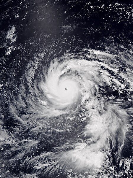
Typhoon Jebi, known in the Philippines as Super Typhoon Maymay, was the costliest typhoon in Japan's history in terms of insured losses. Jebi formed from a tropical disturbance south-southwest of Wake Island on August 26 and became the twenty-first named storm of the 2018 Pacific typhoon season on August 27. Amid favorable environmental conditions, Jebi quickly strengthened into a typhoon on August 29 as it headed west and rapidly intensified as it passed the Northern Mariana Islands on August 30. Jebi reached its peak intensity as a Category 5-equivalent typhoon on August 31, with 10-minute sustained winds of 195 km/h (120 mph), 1-minute sustained winds of 285 km/h (180 mph), and a minimum pressure of 915 hPa. Afterwards, Jebi began a slow weakening trend as it turned northwest, briefly passing through the Philippine Area of Responsibility on September 2. Jebi accelerated north-northeast towards Japan on September 3 as it interacted with the westerlies, and made landfalls over Shikoku and near Kobe early on September 4. Jebi quickly weakened over land and became an extratropical cyclone later that day over the Sea of Japan. Its remnants moved over the Russian Far East before dissipating on September 9.

Jebi at peak intensity northwest of Guam on August 31
Jebi on September 3, a day before landfall in Japan
The torii of the Fushimi Inari Shrine in Kyoto, damaged by fallen trees
Collapsed scaffolding in Osaka near Higobashi Station
A typhoon is a tropical cyclone that develops between 180° and 100°E in the Northern Hemisphere and which produces sustained hurricane-force winds of at least 119 km/h (74 mph). This region is referred to as the Northwestern Pacific Basin, accounting for almost one third of the world's tropical cyclones. The term hurricane refers to a tropical cyclone in the north central and northeast Pacific, and the north Atlantic. In all of the preceding regions, weaker tropical cyclones are called tropical storms. For organizational purposes, the northern Pacific Ocean is divided into three regions: the eastern, central, and western. The Regional Specialized Meteorological Center (RSMC) for tropical cyclone forecasts is in Japan, with other tropical cyclone warning centres for the northwest Pacific in Hawaii, the Philippines, and Hong Kong. Although the RSMC names each system, the main name list itself is coordinated among 18 countries that have territories threatened by typhoons each year.

Satellite image of Typhoon Mangkhut
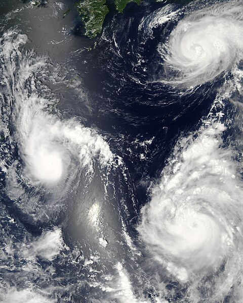
Three different tropical cyclones active over the Western Pacific Ocean on August 7, 2006 (Maria, Bopha, and Saomai). The cyclones on the lower and upper right are typhoons.
Tracks of all tropical cyclones in the northernwestern Pacific Ocean between 1980 and 2005. The vertical line to the right is the International Date Line.


