Typhoons in the Philippines
The Philippines is a typhoon-prone country, with approximately 20 typhoons entering its area of responsibility each year. Locally known generally as bagyo, typhoons regularly form in the Philippine Sea and less regularly, in the South China Sea, with the months of June to September being the most active, August being the month with the most activity. Each year, at least ten typhoons are expected to hit the island nation, with five expected to be destructive and powerful. In 2013, Time declared the country as the "most exposed country in the world to tropical storms".
Typhoon Angela (Rosing) prior to landfall in November 1995
Tropical Storm Ketsana (Ondoy) over the Philippines in September 2009
Typhoon Kujira near peak intensity on May 4, 2009
The Philippines, officially the Republic of the Philippines, is an archipelagic country in Southeast Asia. In the western Pacific Ocean, it consists of 7,641 islands, with a total area of 300,000 square kilometers, which are broadly categorized in three main geographical divisions from north to south: Luzon, Visayas, and Mindanao. The Philippines is bounded by the South China Sea to the west, the Philippine Sea to the east, and the Celebes Sea to the south. It shares maritime borders with Taiwan to the north, Japan to the northeast, Palau to the east and southeast, Indonesia to the south, Malaysia to the southwest, Vietnam to the west, and China to the northwest. It is the world's twelfth-most-populous country, with diverse ethnicities and cultures. Manila is the country's capital, and its most populated city is Quezon City. Both are within Metro Manila.
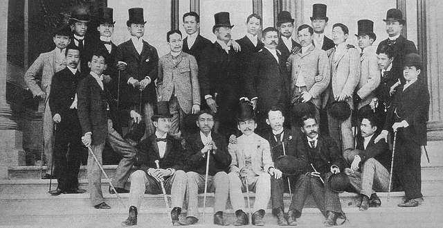
Ilustrados in Madrid around 1890
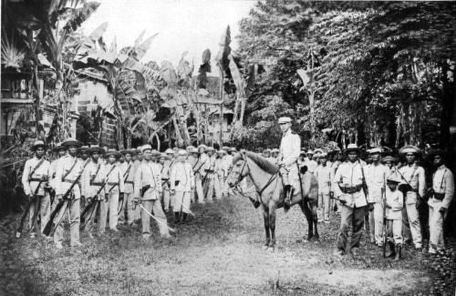
Filipino General Gregorio del Pilar and his troops in Pampanga around 1898, during the Philippine-American War
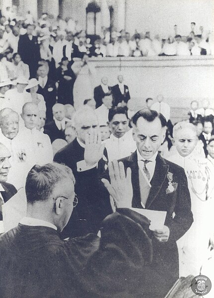
The Inauguration of Manuel L. Quezon as President of the Commonwealth of the Philippines on Nov 15, 1935
General Douglas MacArthur and Sergio Osmeña (left) coming ashore during the Battle of Leyte on October 20, 1944


