U.S. Route 54 in Texas is a U.S. Highway that travels through two portions of the state: one in the far western point, and the other in the far northwest Panhandle.
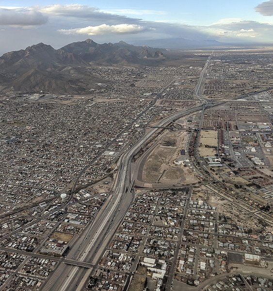
US Highway 54 in El Paso, aerial view from above the Mexico–United States border. The old route of the highway, now Bus. US 54-A, El Paso's Dyer Street, is visible just to the left of the North–South Freeway, as Highway 54 is also known in El Paso.
Texas State Highway Loop 375
Loop 375 is a beltway that partially encircles the city of El Paso, Texas. The beltway is mostly a freeway, except for its northern section, which includes at-grade intersections. The highway passes through various areas of El Paso, funneling traffic within and around the city. The road is known locally under different names, as Woodrow Bean Transmountain Drive in the northern section, Purple Heart Memorial Freeway in the northeastern section, Joe Battle Boulevard in the eastern section, the César Chávez Border Highway in the southern section, and the Border West Expressway on the southwest section.

A panoramic view from Sun Bowl Drive at the University of Texas at El Paso, toward the nearby residential neighborhood of Ciudad Juárez, Chihuahua, Mexico, about 350 m away. This pass full of transportation arteries is the "Paso del Norte" after which El Paso is named, the route of the Camino Real de Tierra Adentro (royal road of the interior land) from Mexico to Santa Fe. In this narrow valley are the Interstate 10 freeway, the under-construction (in August 2018)
January 2019 construction progress. Note the new ramp behind the UTEP Miners' pickaxe sculpture. This ramp and elevated roadway will carry the westbound lanes of the new expressway; the eastbound lanes are at grade, on the far side of the train tracks.
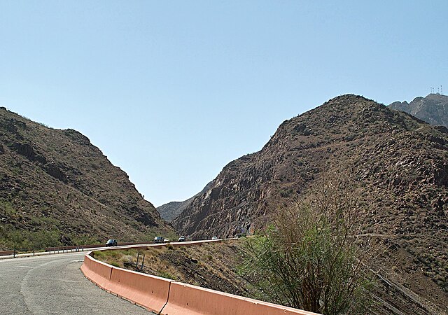
The largest road cut on Transmountain Drive, at the mile-high crest of Smuggler's Pass
Border West Expressway and I-10 in west El Paso