U.S. Route 6 in Iowa
Videos
Page
U.S. Highway 6 (US 6) is an east–west United States Numbered Highway which runs 322 miles (518 km) across the U.S. state of Iowa. The route is signed in places as the Grand Army of the Republic Highway. Like all state highways in Iowa, it is maintained by the Iowa Department of Transportation. The route begins at the Missouri River crossing at Council Bluffs. From there, it travels east through Oakland and Atlantic. North of Atlantic, the highway overlaps Interstate 80 (I-80) until De Soto. Between De Soto and Adel, the highway overlaps US 169 before splitting off to the east toward Des Moines. Through the Des Moines area, the highway runs about one mile (1.6 km) north or south of the I-35/I-80 corridor.

US 6 between Newton and Grinnell

The White Pole Road in Casey
Council Bluffs, Iowa
Videos
Page
Council Bluffs is a city in and the county seat of Pottawattamie County, Iowa, United States. Its population was 62,799 as of the 2020 census, making it the state's tenth most populous city, and the most populous city in Southwest Iowa. The Omaha metropolitan region of which Council Bluffs is a part, is the 58th largest in the United States, with an estimated population of 967,604 (2020). It is located on the east bank of the Missouri River, across from Omaha, Nebraska. Until about 1853 Council Bluffs was known as Kanesville. Kanesville was the historic starting point of the Mormon Trail. Kanesville is also the northernmost anchor town of the other emigrant trails because there was a steam-powered boat which ferried the settlers' wagons and cattle across the Missouri River. In 1869, the first transcontinental railroad to California was connected to the existing U.S. rail network at Council Bluffs.

Haymarket Historic District (2015)
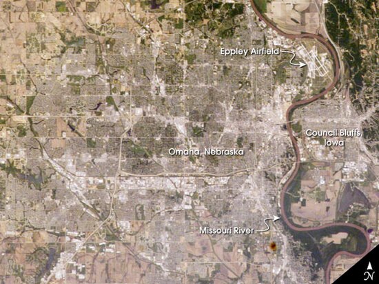
Satellite photo showing Council Bluffs and Omaha, Nebraska

Courthouse, 1915
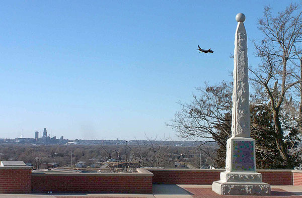
Lincoln Memorial at Council Bluffs, marking where President Abraham Lincoln was said to have selected the site as the eastern terminus of the Transcontinental Railroad.