The Uinta Basin is a physiographic section of the larger Colorado Plateaus province, which in turn is part of the larger Intermontane Plateaus physiographic division. It is also a geologic structural basin in eastern Utah, east of the Wasatch Mountains and south of the Uinta Mountains. The Uinta Basin is fed by creeks and rivers flowing south from the Uinta Mountains. Many of the principal rivers flow into the Duchesne River which feeds the Green River—a tributary of the Colorado River. The Uinta Mountains form the northern border of the Uinta Basin. They contain the highest point in Utah, Kings Peak, with a summit 13,528 feet above sea level.
The climate of the Uinta Basin is semi-arid, with occasionally severe winter cold.
Freedom Bridge over Starvation Reservoir on U.S. Route 40 in Duchesne County, Utah.
Blue Mountain, east of Jensen, Utah.
The Uinta Mountains form the northern boundary of the Uinta Basin.
Drilling at night in Uinta Basin
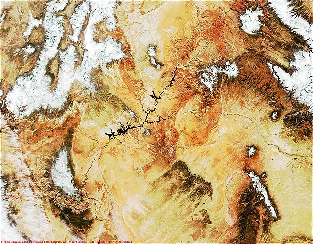
The Colorado Plateau, also known as the Colorado Plateau Province, is a physiographic and desert region of the Intermontane Plateaus, roughly centered on the Four Corners region of the southwestern United States. This province covers an area of 336,700 km2 (130,000 mi2) within western Colorado, northwestern New Mexico, southern and eastern Utah, northern Arizona, and a tiny fraction in the extreme southeast of Nevada. About 90% of the area is drained by the Colorado River and its main tributaries: the Green, San Juan, and Little Colorado. Most of the remainder of the plateau is drained by the Rio Grande and its tributaries.
The Four Corners region and the Colorado Plateau.
The Book Cliffs of Utah
The Green River runs north to south from Wyoming, briefly through Colorado, and converges with the Colorado River in southeastern Utah.
MODIS satellite image of Grand Canyon (lower left), Lake Powell (black, left of center) and the Colorado Plateau. White areas are snow-capped.


