Union Square is a historic intersection and surrounding neighborhood in Manhattan, New York City, United States, located where Broadway and the former Bowery Road – now Fourth Avenue – came together in the early 19th century. Its name denotes that "here was the union of the two principal thoroughfares of the island". The current Union Square Park is bounded by 14th Street on the south, 17th Street on the north, and Union Square West and Union Square East to the west and east respectively. 17th Street links together Broadway and Park Avenue South on the north end of the park, while Union Square East connects Park Avenue South to Fourth Avenue and the continuation of Broadway on the park's south side. The park is maintained by the New York City Department of Parks and Recreation.
Union Square seen from 14th Street in May 2010
Union Park New York (East side), an 1892 illustration
George Washington (Henry Kirke Brown, 1856) in the middle of Fourth Avenue at 14th Street, c.1870
Union Square in 1908
Broadway is a road in the U.S. state of New York. Broadway runs from the south at State Street at Bowling Green for 13 mi (20.9 km) through the borough of Manhattan, over the Broadway Bridge, and 2 mi (3.2 km) through the Bronx, exiting north from New York City to run an additional 18 mi (29.0 km) through the Westchester County municipalities of Yonkers, Hastings-On-Hudson, Dobbs Ferry, Irvington, Tarrytown, and Sleepy Hollow, after which the road continues, but is no longer called "Broadway". The latter portion of Broadway comprises a portion of U.S. Route 9.
Broadway (Manhattan)
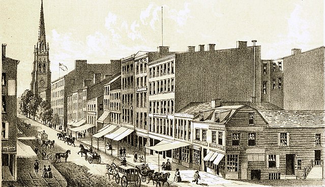
An 1834 illustration of Broadway
Broadway in 1860
A mid-19th century illustration of Somerindyke House on Bloomingdale Road


