United States Army Corps of Topographical Engineers
Videos
Photos
The U.S. Army Corps of Topographical Engineers was a branch of the United States Army authorized on 4 July 1838. It consisted only of officers who were handpicked from West Point and was used for mapping and the design and construction of federal civil works such as lighthouses and other coastal fortifications and navigational routes. Members included such officers as George Meade, John C. Frémont, Thomas J. Cram and Stephen Long. It was merged with the United States Army Corps of Engineers on 31 March 1863, at which point the Corps of Engineers also assumed the Lakes Survey for the Great Lakes. In the mid-19th century, Corps of Engineers' officers ran Lighthouse Districts in tandem with U.S. Naval officers.

The headquarters for the Corps of Topographical Engineers, ca. 1860-1865

Topographical Engineers at work during the Yorktown campaign, May 1862.
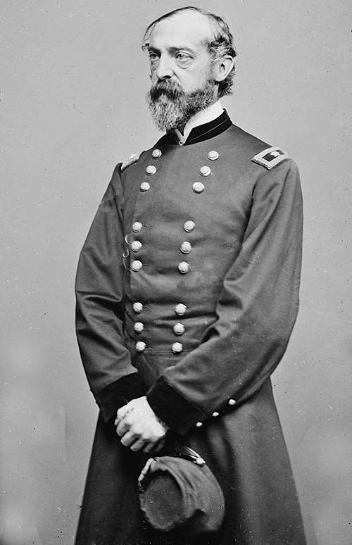
George Meade
Videos
Photos
George Gordon Meade was a United States Army Major General who commanded the Army of the Potomac during the American Civil War from 1863 to 1865. He fought in many of the key battles of the Eastern theater and defeated the Confederate Army of Northern Virginia led by General Robert E. Lee at the Battle of Gettysburg.
A portrait of Meade by Mathew Brady

Meade photographed by Mathew Brady or Levin C. Handy

General Meade's horse, Old Baldy

Engraving by James E. Kelly of Meade and the Council of War - July 2, 1863