Urmston
Videos
Photos
Urmston is a town in Trafford, Greater Manchester, England, which had a population of 41,825 at the 2011 Census. Historically in Lancashire, it is 5 miles (8 km) southwest of Manchester city centre. The southern boundary is the River Mersey, with Stretford lying to the east and Flixton to the west. Davyhulme lies to the north of the town centre. Urmston covers an area of 4,799 acres (19.42 km2).

St Clement's Church, Urmston

Urmston Cemetery

A milestone erected to commemorate the opening of Bowfell Road, in 1937
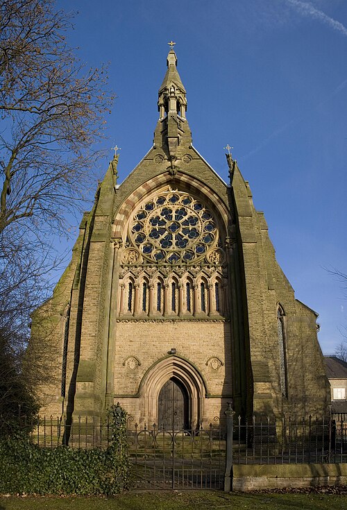
Church of All Saints.
Trafford
Videos
Photos
Trafford is a metropolitan borough of Greater Manchester, England, with an estimated population of 236,301 in 2022. It covers 106 square kilometres (41 sq mi) and includes the area of Old Trafford and the towns of Altrincham, Stretford, Urmston, Partington and Sale. The borough was formed in 1974 as a merger of six former districts and part of a seventh. The River Mersey flows through the borough, separating North Trafford from South Trafford, and the historic counties of Lancashire and Cheshire. Trafford is the seventh-most populous district in Greater Manchester.

Trafford Town Hall

The boundary of the historic counties of Lancashire and Cheshire is marked along the River Mersey in Trafford.
The Church of All Saints, Urmston, is a Grade I listed building.

The Imperial War Museum North in Trafford Park