Vai or more accurately Vaï, Greek for "palm," is a region of east Crete between Cape Sidero and Cape Plaka, just south of the site of ancient Itanus but north of the villages that surround and are part of Palaikastro. Vai does not belong to them nor is it part of any civic unit of the local civic division of Greece. It is not itself an official village. The region is somewhat isolated on the isolated northeast peninsula, connecting only to Eparchos odos moni Toplou, the only road between Palaikastro and Toplou Monastery. The entire distance is essentially trackless and deserted, as the name of one of the beaches at Itanus suggests, Eremoupolis, "deserted city".
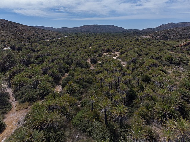
The open forest is shown with Phoenix theophrasti in all stages of development from free-standing trees to small maquis-type bush trees.
The central beach from the palm line showing the sun shelters.
A view to the west up the valley. The access road is on the left. The region of Vai Villa is out of sight over the pass ahead, in the agricultural land of Toplou Monastery.
Wetlands of the lower forest
Cape Sideros or Cape Sidero is a cape at the eastern end of the island of Crete, Greece. Anciently it was known as Samonium or Samonion, Sammonium or Sammonion, Salmonium or Salmonion (Σαλμώνιον) and Salmone (Σαλμώνη). The cape shares the name Sideros or Sidero with the island-like peninsula of which it is a projection, but which had the name first remains unknown, as does the provenance of either name. Cape Sidero is often not confined to the peninsula Sideros, but might refer to the entire northeast promontory.
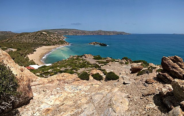
Vai beach in the center, Cape Sidero in the background. View from the south headland over the beach, eastern Crete.
This N-S alignment of Crete depicts the NE promontory at the top. Left-to-right: Dionysades Islands, Sideros Promontory showing the joined "islands" Sideros (or Mavromouri) and Kyriamadi, the joined Itanos Peninsula, Elasa Island, and Cape Plakas.
Cape Sidero from the road along Itanos. Both Sideros and Kyriamadi are clearly visible.
The town of Zakros in the region called epano Zakros, "upper Zakros" seen from the southeast, the vicinity of the Zakros Gorge parking lot. The highest part of the Zakros range, the easternmost range of Crete, is seen above the town. Sitia is in a straight line from the observer to the town over the hills.


