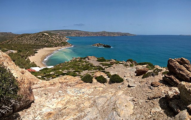
Cape Sideros or Cape Sidero is a cape at the eastern end of the island of Crete, Greece. Anciently it was known as Samonium or Samonion, Sammonium or Sammonion, Salmonium or Salmonion (Σαλμώνιον) and Salmone (Σαλμώνη). The cape shares the name Sideros or Sidero with the island-like peninsula of which it is a projection, but which had the name first remains unknown, as does the provenance of either name. Cape Sidero is often not confined to the peninsula Sideros, but might refer to the entire northeast promontory.
Vai beach in the center, Cape Sidero in the background. View from the south headland over the beach, eastern Crete.
This N-S alignment of Crete depicts the NE promontory at the top. Left-to-right: Dionysades Islands, Sideros Promontory showing the joined "islands" Sideros (or Mavromouri) and Kyriamadi, the joined Itanos Peninsula, Elasa Island, and Cape Plakas.
Cape Sidero from the road along Itanos. Both Sideros and Kyriamadi are clearly visible.
The town of Zakros in the region called epano Zakros, "upper Zakros" seen from the southeast, the vicinity of the Zakros Gorge parking lot. The highest part of the Zakros range, the easternmost range of Crete, is seen above the town. Sitia is in a straight line from the observer to the town over the hills.
Crete is the largest and most populous of the Greek islands, the 88th largest island in the world and the fifth largest island in the Mediterranean Sea, after Sicily, Sardinia, Cyprus, and Corsica. Crete rests about 160 km (99 mi) south of the Greek mainland, and about 100 km (62 mi) southwest of Anatolia. Crete has an area of 8,450 km2 (3,260 sq mi) and a coastline of 1,046 km (650 mi). It bounds the southern border of the Aegean Sea, with the Sea of Crete to the north and the Libyan Sea to the south. Crete covers 260 km from west to east but is narrow from north to south, spanning three longitudes but only half a latitude.
NASA photograph of Crete
Messara Plain
The palm beach of Vai
Lefka Ori


