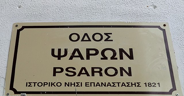
1.
Greek language
–
Greek is an independent branch of the Indo-European family of languages, native to Greece and other parts of the Eastern Mediterranean. It has the longest documented history of any living language, spanning 34 centuries of written records and its writing system has been the Greek alphabet for the major part of its history, other systems, such as Linear B and the Cypriot syllabary, were used previously. The alphabet arose from the Phoenician script and was in turn the basis of the Latin, Cyrillic, Armenian, Coptic, Gothic and many other writing systems. Together with the Latin texts and traditions of the Roman world, during antiquity, Greek was a widely spoken lingua franca in the Mediterranean world and many places beyond. It would eventually become the official parlance of the Byzantine Empire, the language is spoken by at least 13.2 million people today in Greece, Cyprus, Italy, Albania, Turkey, and the Greek diaspora. Greek roots are used to coin new words for other languages, Greek. Greek has been spoken in the Balkan peninsula since around the 3rd millennium BC, the earliest written evidence is a Linear B clay tablet found in Messenia that dates to between 1450 and 1350 BC, making Greek the worlds oldest recorded living language. Among the Indo-European languages, its date of earliest written attestation is matched only by the now extinct Anatolian languages, the Greek language is conventionally divided into the following periods, Proto-Greek, the unrecorded but assumed last ancestor of all known varieties of Greek. The unity of Proto-Greek would have ended as Hellenic migrants entered the Greek peninsula sometime in the Neolithic era or the Bronze Age, Mycenaean Greek, the language of the Mycenaean civilisation. It is recorded in the Linear B script on tablets dating from the 15th century BC onwards, Ancient Greek, in its various dialects, the language of the Archaic and Classical periods of the ancient Greek civilisation. It was widely known throughout the Roman Empire, after the Roman conquest of Greece, an unofficial bilingualism of Greek and Latin was established in the city of Rome and Koine Greek became a first or second language in the Roman Empire. The origin of Christianity can also be traced through Koine Greek, Medieval Greek, also known as Byzantine Greek, the continuation of Koine Greek in Byzantine Greece, up to the demise of the Byzantine Empire in the 15th century. Much of the written Greek that was used as the language of the Byzantine Empire was an eclectic middle-ground variety based on the tradition of written Koine. Modern Greek, Stemming from Medieval Greek, Modern Greek usages can be traced in the Byzantine period and it is the language used by the modern Greeks, and, apart from Standard Modern Greek, there are several dialects of it. In the modern era, the Greek language entered a state of diglossia, the historical unity and continuing identity between the various stages of the Greek language is often emphasised. Greek speakers today still tend to regard literary works of ancient Greek as part of their own rather than a foreign language and it is also often stated that the historical changes have been relatively slight compared with some other languages. According to one estimation, Homeric Greek is probably closer to demotic than 12-century Middle English is to modern spoken English, Greek is spoken by about 13 million people, mainly in Greece, Albania and Cyprus, but also worldwide by the large Greek diaspora. Greek is the language of Greece, where it is spoken by almost the entire population
2.
NASA
–
President Dwight D. Eisenhower established NASA in 1958 with a distinctly civilian orientation encouraging peaceful applications in space science. The National Aeronautics and Space Act was passed on July 29,1958, disestablishing NASAs predecessor, the new agency became operational on October 1,1958. Since that time, most US space exploration efforts have led by NASA, including the Apollo Moon landing missions, the Skylab space station. Currently, NASA is supporting the International Space Station and is overseeing the development of the Orion Multi-Purpose Crew Vehicle, the agency is also responsible for the Launch Services Program which provides oversight of launch operations and countdown management for unmanned NASA launches. NASA shares data with various national and international such as from the Greenhouse Gases Observing Satellite. Since 2011, NASA has been criticized for low cost efficiency, from 1946, the National Advisory Committee for Aeronautics had been experimenting with rocket planes such as the supersonic Bell X-1. In the early 1950s, there was challenge to launch a satellite for the International Geophysical Year. An effort for this was the American Project Vanguard, after the Soviet launch of the worlds first artificial satellite on October 4,1957, the attention of the United States turned toward its own fledgling space efforts. This led to an agreement that a new federal agency based on NACA was needed to conduct all non-military activity in space. The Advanced Research Projects Agency was created in February 1958 to develop technology for military application. On July 29,1958, Eisenhower signed the National Aeronautics and Space Act, a NASA seal was approved by President Eisenhower in 1959. Elements of the Army Ballistic Missile Agency and the United States Naval Research Laboratory were incorporated into NASA, earlier research efforts within the US Air Force and many of ARPAs early space programs were also transferred to NASA. In December 1958, NASA gained control of the Jet Propulsion Laboratory, NASA has conducted many manned and unmanned spaceflight programs throughout its history. Some missions include both manned and unmanned aspects, such as the Galileo probe, which was deployed by astronauts in Earth orbit before being sent unmanned to Jupiter, the experimental rocket-powered aircraft programs started by NACA were extended by NASA as support for manned spaceflight. This was followed by a space capsule program, and in turn by a two-man capsule program. This goal was met in 1969 by the Apollo program, however, reduction of the perceived threat and changing political priorities almost immediately caused the termination of most of these plans. NASA turned its attention to an Apollo-derived temporary space laboratory, to date, NASA has launched a total of 166 manned space missions on rockets, and thirteen X-15 rocket flights above the USAF definition of spaceflight altitude,260,000 feet. The X-15 was an NACA experimental rocket-powered hypersonic research aircraft, developed in conjunction with the US Air Force, the design featured a slender fuselage with fairings along the side containing fuel and early computerized control systems
3.
Geographic coordinate system
–
A geographic coordinate system is a coordinate system used in geography that enables every location on Earth to be specified by a set of numbers, letters or symbols. The coordinates are chosen such that one of the numbers represents a vertical position. A common choice of coordinates is latitude, longitude and elevation, to specify a location on a two-dimensional map requires a map projection. The invention of a coordinate system is generally credited to Eratosthenes of Cyrene. Ptolemy credited him with the adoption of longitude and latitude. Ptolemys 2nd-century Geography used the prime meridian but measured latitude from the equator instead. Mathematical cartography resumed in Europe following Maximus Planudes recovery of Ptolemys text a little before 1300, in 1884, the United States hosted the International Meridian Conference, attended by representatives from twenty-five nations. Twenty-two of them agreed to adopt the longitude of the Royal Observatory in Greenwich, the Dominican Republic voted against the motion, while France and Brazil abstained. France adopted Greenwich Mean Time in place of local determinations by the Paris Observatory in 1911, the latitude of a point on Earths surface is the angle between the equatorial plane and the straight line that passes through that point and through the center of the Earth. Lines joining points of the same latitude trace circles on the surface of Earth called parallels, as they are parallel to the equator, the north pole is 90° N, the south pole is 90° S. The 0° parallel of latitude is designated the equator, the plane of all geographic coordinate systems. The equator divides the globe into Northern and Southern Hemispheres, the longitude of a point on Earths surface is the angle east or west of a reference meridian to another meridian that passes through that point. All meridians are halves of great ellipses, which converge at the north and south poles, the prime meridian determines the proper Eastern and Western Hemispheres, although maps often divide these hemispheres further west in order to keep the Old World on a single side. The antipodal meridian of Greenwich is both 180°W and 180°E, the combination of these two components specifies the position of any location on the surface of Earth, without consideration of altitude or depth. The grid formed by lines of latitude and longitude is known as a graticule, the origin/zero point of this system is located in the Gulf of Guinea about 625 km south of Tema, Ghana. To completely specify a location of a feature on, in, or above Earth. Earth is not a sphere, but a shape approximating a biaxial ellipsoid. It is nearly spherical, but has an equatorial bulge making the radius at the equator about 0. 3% larger than the radius measured through the poles, the shorter axis approximately coincides with the axis of rotation
4.
Mount Ida (Crete)
–
Mount Ida, known variously as Idha, Ídhi, Idi, Ita and now Psiloritis, at a height of 2,456 m, is the highest mountain on Crete. Located in the Rethymno regional unit, it was sacred to the Greek Titaness Rhea and its summit has the highest topographic prominence in Greece. A natural park which includes Mt. Ida is a member of UNESCOs Global Geoparks Network, the Skinakas observatory of the University of Crete is located on the secondary peak Skinakas at 1750 m. It has two telescopes including a 1.3 m Modified Ritchey-Chrétien instrument, Mount Ida is the locus for a race of legendary ancient metal workers, whose roots are also associated with Cyprus. The Nida plateau is found to the east of the mountain, on the summit of Ida is the little chapel of the Holy Cross, Timios Stavros. On the plateau are some shepherds huts built only of local stones, in ancient times the Idaean cave, cave of the Goddess was venerated by Minoans and Hellenes alike. By Greek times the cave was rededicated to Zeus, the cave where Zeus was nurtured is variously stated to be this cave, or another of the same name, or the Dictaean cave. Votive seals and ivories have been found in the cave, like the Dictaean cave, the Idaean cave was known as a place of initiations. It may have served as the site of an oracle, symbolized by the frequent depiction of a tripod on coins of nearby Axos,243 Ida, an asteroid named after the mountain Mount Ida, known as the Phrygian Ida in classical antiquity Mount Kedros
5.
Greece
–
Greece, officially the Hellenic Republic, historically also known as Hellas, is a country in southeastern Europe, with a population of approximately 11 million as of 2015. Athens is the capital and largest city, followed by Thessaloniki. Greece is strategically located at the crossroads of Europe, Asia, situated on the southern tip of the Balkan peninsula, it shares land borders with Albania to the northwest, the Republic of Macedonia and Bulgaria to the north, and Turkey to the northeast. Greece consists of nine regions, Macedonia, Central Greece, the Peloponnese, Thessaly, Epirus, the Aegean Islands, Thrace, Crete. The Aegean Sea lies to the east of the mainland, the Ionian Sea to the west, the Cretan Sea and the Mediterranean Sea to the south. Greece has the longest coastline on the Mediterranean Basin and the 11th longest coastline in the world at 13,676 km in length, featuring a vast number of islands, eighty percent of Greece is mountainous, with Mount Olympus being the highest peak at 2,918 metres. From the eighth century BC, the Greeks were organised into various independent city-states, known as polis, which spanned the entire Mediterranean region and the Black Sea. Greece was annexed by Rome in the second century BC, becoming a part of the Roman Empire and its successor. The Greek Orthodox Church also shaped modern Greek identity and transmitted Greek traditions to the wider Orthodox World, falling under Ottoman dominion in the mid-15th century, the modern nation state of Greece emerged in 1830 following a war of independence. Greeces rich historical legacy is reflected by its 18 UNESCO World Heritage Sites, among the most in Europe, Greece is a democratic and developed country with an advanced high-income economy, a high quality of life, and a very high standard of living. A founding member of the United Nations, Greece was the member to join the European Communities and has been part of the Eurozone since 2001. Greeces unique cultural heritage, large industry, prominent shipping sector. It is the largest economy in the Balkans, where it is an important regional investor, the names for the nation of Greece and the Greek people differ from the names used in other languages, locations and cultures. The earliest evidence of the presence of human ancestors in the southern Balkans, dated to 270,000 BC, is to be found in the Petralona cave, all three stages of the stone age are represented in Greece, for example in the Franchthi Cave. Neolithic settlements in Greece, dating from the 7th millennium BC, are the oldest in Europe by several centuries and these civilizations possessed writing, the Minoans writing in an undeciphered script known as Linear A, and the Mycenaeans in Linear B, an early form of Greek. The Mycenaeans gradually absorbed the Minoans, but collapsed violently around 1200 BC and this ushered in a period known as the Greek Dark Ages, from which written records are absent. The end of the Dark Ages is traditionally dated to 776 BC, the Iliad and the Odyssey, the foundational texts of Western literature, are believed to have been composed by Homer in the 7th or 8th centuries BC. With the end of the Dark Ages, there emerged various kingdoms and city-states across the Greek peninsula, in 508 BC, Cleisthenes instituted the worlds first democratic system of government in Athens
6.
Administrative regions of Greece
–
The administrative regions of Greece are the countrys thirteen first-level administrative entities, each comprising several second-level units, originally prefectures and, since 2011, regional units. The current regions were established in July 1986, by decision of then-Interior Minister Menios Koutsogiorgas as a second-level administrative entities, as part of a decentralization process inspired by then-Interior Minister Alekos Papadopoulos, they were accorded more powers in the 1997 Kapodistrias reform of local and regional government. They were transformed into separate entities by the 2010 Kallikratis Plan. In the 2011 changes, the general secretary was replaced with a popularly elected regional governor. Many powers of the prefectures, which were abolished or reformed into regional units, were transferred to the region level. The regional organs of the government were in turn replaced by seven decentralized administrations. Bordering the region of Central Macedonia there is one region, Mount Athos. It is located on the easternmost of the three large peninsulas jutting into the Aegean from the Chalcidice Peninsula, ISO 3166-2, GR Administrative divisions of Greece
7.
Heraklion
–
Heraklion is the largest city and the administrative capital of the island of Crete. It is the fourth largest city in Greece.3 km2, Heraklion is the capital of Heraklion regional unit. The Bronze Age palace of Knossos, also known as the Palace of Minos, is located nearby. The Arab raiders from Andalusia who founded the Emirate of Crete moved the capital from Gortyna to a new castle they called ربض الخندق rabḍ al-ḫandaq Castle of the Moat in the 820s. After the Byzantine reconquest, the city was known as Megalo Kastro or Castro. The ancient name Ηράκλειον was revived in the 19th century and comes from the nearby Roman port of Heracleum, english usage formerly preferred the classicizing transliterations Heraklion or Heraclion, but the form Iraklion is becoming more common. Heraklion is close to the ruins of the palace of Knossos, though there is no archaeological evidence of it, Knossos might well have had a port at the site of Heraklion as early as 2000 BC. They built a moat around the city for protection, and named the city ربض الخندق and it became the capital of the Emirate of Crete. The Saracens allowed the port to be used as a haven for pirates who operated against Imperial shipping. In 961, Byzantine forces under the command of Nikephoros Phokas, later to become Emperor, landed in Crete, after a prolonged siege, the city fell. The Saracen inhabitants were slaughtered, the city looted and burned to the ground, soon rebuilt, the town was renamed Χάνδαξ, Chandax, and remained under Greek control for the next 243 years. Chandax was renamed Candia and became the seat of the Duke of Candia, the city retained the name of Candia for centuries and the same name was often used to refer to the whole island of Crete as well. To secure their rule, Venetians began in 1212 to settle families from Venice on Crete, after the Venetians came the Ottoman Empire. During the Cretan War, the Ottomans besieged the city for 21 years, from 1648 to 1669, in its final phase, which lasted for 22 months,70,000 Turks,38,000 Cretans and slaves and 29,088 of the citys Christian defenders perished. The Ottoman army under an Albanian grand vizier, Köprülü Fazıl Ahmed Pasha conquered the city in 1669, under the Ottomans, the city was known officially as Kandiye but informally in Greek as Megalo Castro. During the Ottoman period, the harbour silted up, so most shipping shifted to Chania in the west of the island, in 1898, the autonomous Cretan State was created, under Ottoman suzerainty, with Prince George of Greece as its High Commissioner and under international supervision. During the period of occupation of the island by the Great Powers. At this time, the city was renamed Heraklion, after the Roman port of Heracleum, in 1913, with the rest of Crete, Heraklion was incorporated into the Kingdom of Greece
8.
Greeks
–
The Greeks or Hellenes are an ethnic group native to Greece, Cyprus, southern Albania, Turkey, Sicily, Egypt and, to a lesser extent, other countries surrounding the Mediterranean Sea. They also form a significant diaspora, with Greek communities established around the world, many of these regions coincided to a large extent with the borders of the Byzantine Empire of the late 11th century and the Eastern Mediterranean areas of ancient Greek colonization. The cultural centers of the Greeks have included Athens, Thessalonica, Alexandria, Smyrna, most ethnic Greeks live nowadays within the borders of the modern Greek state and Cyprus. The Greek genocide and population exchange between Greece and Turkey nearly ended the three millennia-old Greek presence in Asia Minor, other longstanding Greek populations can be found from southern Italy to the Caucasus and southern Russia and Ukraine and in the Greek diaspora communities in a number of other countries. Today, most Greeks are officially registered as members of the Greek Orthodox Church, the Greeks speak the Greek language, which forms its own unique branch within the Indo-European family of languages, the Hellenic. They are part of a group of ethnicities, described by Anthony D. Smith as an archetypal diaspora people. Both migrations occur at incisive periods, the Mycenaean at the transition to the Late Bronze Age, the Mycenaeans quickly penetrated the Aegean Sea and, by the 15th century BC, had reached Rhodes, Crete, Cyprus and the shores of Asia Minor. Around 1200 BC, the Dorians, another Greek-speaking people, followed from Epirus, the Dorian invasion was followed by a poorly attested period of migrations, appropriately called the Greek Dark Ages, but by 800 BC the landscape of Archaic and Classical Greece was discernible. The Greeks of classical antiquity idealized their Mycenaean ancestors and the Mycenaean period as an era of heroes, closeness of the gods. The Homeric Epics were especially and generally accepted as part of the Greek past, as part of the Mycenaean heritage that survived, the names of the gods and goddesses of Mycenaean Greece became major figures of the Olympian Pantheon of later antiquity. The ethnogenesis of the Greek nation is linked to the development of Pan-Hellenism in the 8th century BC, the works of Homer and Hesiod were written in the 8th century BC, becoming the basis of the national religion, ethos, history and mythology. The Oracle of Apollo at Delphi was established in this period, the classical period of Greek civilization covers a time spanning from the early 5th century BC to the death of Alexander the Great, in 323 BC. It is so named because it set the standards by which Greek civilization would be judged in later eras, the Peloponnesian War, the large scale civil war between the two most powerful Greek city-states Athens and Sparta and their allies, left both greatly weakened. Many Greeks settled in Hellenistic cities like Alexandria, Antioch and Seleucia, two thousand years later, there are still communities in Pakistan and Afghanistan, like the Kalash, who claim to be descended from Greek settlers. The Hellenistic civilization was the period of Greek civilization, the beginnings of which are usually placed at Alexanders death. This Hellenistic age, so called because it saw the partial Hellenization of many non-Greek cultures and this age saw the Greeks move towards larger cities and a reduction in the importance of the city-state. These larger cities were parts of the still larger Kingdoms of the Diadochi, Greeks, however, remained aware of their past, chiefly through the study of the works of Homer and the classical authors. An important factor in maintaining Greek identity was contact with barbarian peoples and this led to a strong desire among Greeks to organize the transmission of the Hellenic paideia to the next generation
9.
Ancient Greek
–
Ancient Greek includes the forms of Greek used in ancient Greece and the ancient world from around the 9th century BC to the 6th century AD. It is often divided into the Archaic period, Classical period. It is antedated in the second millennium BC by Mycenaean Greek, the language of the Hellenistic phase is known as Koine. Koine is regarded as a historical stage of its own, although in its earliest form it closely resembled Attic Greek. Prior to the Koine period, Greek of the classic and earlier periods included several regional dialects, Ancient Greek was the language of Homer and of fifth-century Athenian historians, playwrights, and philosophers. It has contributed many words to English vocabulary and has been a subject of study in educational institutions of the Western world since the Renaissance. This article primarily contains information about the Epic and Classical phases of the language, Ancient Greek was a pluricentric language, divided into many dialects. The main dialect groups are Attic and Ionic, Aeolic, Arcadocypriot, some dialects are found in standardized literary forms used in literature, while others are attested only in inscriptions. There are also several historical forms, homeric Greek is a literary form of Archaic Greek used in the epic poems, the Iliad and Odyssey, and in later poems by other authors. Homeric Greek had significant differences in grammar and pronunciation from Classical Attic, the origins, early form and development of the Hellenic language family are not well understood because of a lack of contemporaneous evidence. Several theories exist about what Hellenic dialect groups may have existed between the divergence of early Greek-like speech from the common Proto-Indo-European language and the Classical period and they have the same general outline, but differ in some of the detail. The invasion would not be Dorian unless the invaders had some relationship to the historical Dorians. The invasion is known to have displaced population to the later Attic-Ionic regions, the Greeks of this period believed there were three major divisions of all Greek people—Dorians, Aeolians, and Ionians, each with their own defining and distinctive dialects. Often non-west is called East Greek, Arcadocypriot apparently descended more closely from the Mycenaean Greek of the Bronze Age. Boeotian had come under a strong Northwest Greek influence, and can in some respects be considered a transitional dialect, thessalian likewise had come under Northwest Greek influence, though to a lesser degree. Most of the dialect sub-groups listed above had further subdivisions, generally equivalent to a city-state and its surrounding territory, Doric notably had several intermediate divisions as well, into Island Doric, Southern Peloponnesus Doric, and Northern Peloponnesus Doric. The Lesbian dialect was Aeolic Greek and this dialect slowly replaced most of the older dialects, although Doric dialect has survived in the Tsakonian language, which is spoken in the region of modern Sparta. Doric has also passed down its aorist terminations into most verbs of Demotic Greek, by about the 6th century AD, the Koine had slowly metamorphosized into Medieval Greek
10.
Mediterranean Sea
–
The sea is sometimes considered a part of the Atlantic Ocean, although it is usually identified as a separate body of water. The name Mediterranean is derived from the Latin mediterraneus, meaning inland or in the middle of land and it covers an approximate area of 2.5 million km2, but its connection to the Atlantic is only 14 km wide. The Strait of Gibraltar is a strait that connects the Atlantic Ocean to the Mediterranean Sea and separates Gibraltar. In oceanography, it is called the Eurafrican Mediterranean Sea or the European Mediterranean Sea to distinguish it from mediterranean seas elsewhere. The Mediterranean Sea has a depth of 1,500 m. The sea is bordered on the north by Europe, the east by Asia and it is located between latitudes 30° and 46° N and longitudes 6° W and 36° E. Its west-east length, from the Strait of Gibraltar to the Gulf of Iskenderun, the seas average north-south length, from Croatia’s southern shore to Libya, is approximately 800 km. The Mediterranean Sea, including the Sea of Marmara, has an area of approximately 2,510,000 square km. The sea was an important route for merchants and travelers of ancient times that allowed for trade, the history of the Mediterranean region is crucial to understanding the origins and development of many modern societies. In addition, the Gaza Strip and the British Overseas Territories of Gibraltar and Akrotiri, the term Mediterranean derives from the Latin word mediterraneus, meaning amid the earth or between land, as it is between the continents of Africa, Asia and Europe. The Ancient Greek name Mesogeios, is similarly from μέσο, between + γη, land, earth) and it can be compared with the Ancient Greek name Mesopotamia, meaning between rivers. The Mediterranean Sea has historically had several names, for example, the Carthaginians called it the Syrian Sea and latter Romans commonly called it Mare Nostrum, and occasionally Mare Internum. Another name was the Sea of the Philistines, from the people inhabiting a large portion of its shores near the Israelites, the sea is also called the Great Sea in the General Prologue by Geoffrey Chaucer. In Ottoman Turkish, it has also been called Bahr-i Sefid, in Modern Hebrew, it has been called HaYam HaTikhon, the Middle Sea, reflecting the Seas name in ancient Greek, Latin, and modern languages in both Europe and the Middle East. Similarly, in Modern Arabic, it is known as al-Baḥr al-Mutawassiṭ, in Turkish, it is known as Akdeniz, the White Sea since among Turks the white colour represents the west. Several ancient civilisations were located around the Mediterranean shores, and were influenced by their proximity to the sea. It provided routes for trade, colonisation, and war, as well as food for numerous communities throughout the ages, due to the shared climate, geology, and access to the sea, cultures centered on the Mediterranean tended to have some extent of intertwined culture and history. Two of the most notable Mediterranean civilisations in classical antiquity were the Greek city states, later, when Augustus founded the Roman Empire, the Romans referred to the Mediterranean as Mare Nostrum
11.
Sicily
–
Sicily is the largest island in the Mediterranean Sea. It is an autonomous Region of Italy, along with surrounding minor islands, Sicily is located in the central Mediterranean Sea, south of the Italian Peninsula, from which it is separated by the narrow Strait of Messina. Its most prominent landmark is Mount Etna, the tallest active volcano in Europe, the island has a typical Mediterranean climate. The earliest archaeological evidence of activity on the island dates from as early as 12,000 BC. It became part of Italy in 1860 following the Expedition of the Thousand, a revolt led by Giuseppe Garibaldi during the Italian unification, Sicily was given special status as an autonomous region after the Italian constitutional referendum of 1946. Sicily has a rich and unique culture, especially regard to the arts, music, literature, cuisine. It is also home to important archaeological and ancient sites, such as the Necropolis of Pantalica, the Valley of the Temples, Sicily has a roughly triangular shape, earning it the name Trinacria. To the east, it is separated from the Italian mainland by the Strait of Messina, about 3 km wide in the north, and about 16 km wide in the southern part. The northern and southern coasts are each about 280 km long measured as a line, while the eastern coast measures around 180 km. The total area of the island is 25,711 km2, the terrain of inland Sicily is mostly hilly and is intensively cultivated wherever possible. Along the northern coast, the ranges of Madonie,2,000 m, Nebrodi,1,800 m. The cone of Mount Etna dominates the eastern coast, in the southeast lie the lower Hyblaean Mountains,1,000 m. The mines of the Enna and Caltanissetta districts were part of a leading sulphur-producing area throughout the 19th century, Sicily and its surrounding small islands have some highly active volcanoes. Mount Etna is the largest active volcano in Europe and still casts black ash over the island with its ever-present eruptions and it currently stands 3,329 metres high, though this varies with summit eruptions, the mountain is 21 m lower now than it was in 1981. It is the highest mountain in Italy south of the Alps, Etna covers an area of 1,190 km2 with a basal circumference of 140 km. This makes it by far the largest of the three volcanoes in Italy, being about two and a half times the height of the next largest, Mount Vesuvius. In Greek Mythology, the deadly monster Typhon was trapped under the mountain by Zeus, Mount Etna is widely regarded as a cultural symbol and icon of Sicily. The Aeolian Islands in the Tyrrhenian Sea, to the northeast of mainland Sicily form a volcanic complex, the three volcanoes of Vulcano, Vulcanello and Lipari are also currently active, although the latter is usually dormant
12.
Sardinia
–
Sardinia is the second largest island in the Mediterranean Sea and an autonomous region of Italy. It is located in the Western Mediterranean, just south of the French island of Corsica, the regions official name is Regione Autonoma della Sardegna / Regione Autònoma de Sardigna, and its capital and largest city is Cagliari. It is divided into four provinces and a metropolitan city and its indigenous language and the other minority languages spoken by the Sardinians enjoy equal dignity with Italian under regional law. The name Sardinia is from the pre-Roman noun *srd-, later romanised as sardus and it makes its first appearance on the Nora Stone, where the word Šrdn testifies to the names existence when the Phoenician merchants first arrived. According to Timaeus, one of Platos dialogues, Sardinia and its people as well might have named after Sardò. There has also been speculation that identifies the ancient Nuragic Sards with the Sherden, in Classical antiquity, Sardinia was called Ichnusa, Σανδάλιον Sandal, Sardinia and Sardó. Sardinia is the second-largest island in the Mediterranean Sea, with an area of 24,100 square kilometres and it is situated between 38°51 and 41°18 latitude north and 8°8 and 9°50 east longitude. To the west of Sardinia is the Sea of Sardinia, a unit of the Mediterranean Sea, to Sardinias east is the Tyrrhenian Sea, the nearest land masses are the island of Corsica, the Italian Peninsula, Sicily, Tunisia, the Balearic Islands, and Provence. The Tyrrhenian Sea portion of the Mediterranean Sea is directly to the east of Sardinia between the Sardinian east coast and the west coast of the Italian mainland peninsula, the Strait of Bonifacio is directly north of Sardinia and separates Sardinia from the French island of Corsica. The island has an ancient geoformation and, unlike Sicily and mainland Italy, is not earthquake-prone and its rocks date in fact from the Palaeozoic Era. Due to long erosion processes, the highlands, formed of granite, schist, trachyte, basalt, sandstone and dolomite limestone. The highest peak is Punta La Marmora, part of the Gennargentu Ranges in the centre of the island. The islands ranges and plateaux are separated by wide valleys and flatlands. Sardinia has few rivers, the largest being the Tirso,151 km long, which flows into the Sea of Sardinia, the Coghinas. There are 54 artificial lakes and dams that supply water and electricity, the main ones are Lake Omodeo and Lake Coghinas. The only natural lake is Lago di Baratz. A number of large, shallow, salt-water lagoons and pools are located along the 1,850 km of the coastline, the climate of the island is variable from area to area, due to several factors including the extension in latitude and the elevation. During the year there is a concentration of rainfall in the winter and autumn, some heavy showers in the spring
13.
Cyprus
–
Cyprus, officially the Republic of Cyprus, is an island country in the Eastern Mediterranean and the third largest and third most populous island in the Mediterranean. It is located south of Turkey, west of Syria and Lebanon, northwest of Israel and Palestine, north of Egypt, the earliest known human activity on the island dates to around the 10th millennium BC. Archaeological remains from this include the well-preserved Neolithic village of Khirokitia. Cyprus was settled by Mycenaean Greeks in two waves in the 2nd millennium BC, Cyprus was placed under British administration based on Cyprus Convention in 1878 and formally annexed by Britain in 1914. While Turkish Cypriots made up 18% of the population, the partition of Cyprus and creation of a Turkish state in the north became a policy of Turkish Cypriot leaders, following nationalist violence in the 1950s, Cyprus was granted independence in 1960. On 15 July 1974, a coup détat was staged by Greek Cypriot nationalists and elements of the Greek military junta in an attempt at enosis and these events and the resulting political situation are matters of a continuing dispute. The Cyprus Republic has de jure sovereignty over the island of Cyprus, as well as its territorial sea and exclusive economic area, another nearly 4% of the islands area is covered by the UN buffer zone. The international community considers the part of the island as territory of the Republic of Cyprus occupied by Turkish forces. The occupation is viewed as illegal under law, amounting to illegal occupation of EU territory since Cyprus became a member of the European Union. Cyprus is a major tourist destination in the Mediterranean, on 1 January 2008, the Republic of Cyprus joined the eurozone. The earliest attested reference to Cyprus is the 15th century BC Mycenaean Greek
14.
Corsica
–
Corsica is an island in the Mediterranean Sea and one of the 13 regions of France. It is located west of the Italian Peninsula, southeast of the French mainland, a single chain of mountains make up two-thirds of the island. While being part of France, Corsica is also designated as a territorial collectivity by law, as a territorial collectivity, Corsica enjoys a greater degree of autonomy than other French regions, for example, the Corsican Assembly is able to exercise limited executive powers. The island formed a single department until it was split in 1975 into two departments, Haute-Corse and Corse-du-Sud, with its capital in Ajaccio, the prefecture city of Corse-du-Sud. Bastia, the city of Haute-Corse, is the second-largest settlement in Corsica. After being ruled by the Republic of Genoa since 1284, Corsica was briefly an independent Corsican Republic from 1755 until it was conquered by France in 1769. Due to Corsicas historical ties with the Italian peninsula, the island retains to this day many elements of the culture of Italy, the native Corsican language, whose northern variant is closely related to the Italian language, is recognised as a regional language by the French government. This Mediterranean island was ruled by various nations over the course of history but had several periods of independence. Napoleon was born in 1769 in the Corsican capital of Ajaccio and his ancestral home, Maison Bonaparte, is today used as a museum. The origin of the name Corsica is subject to much debate, to the Ancient Greeks it was known as Kalliste, Corsis, Cyrnos, Cernealis, or Cirné. Of these Cyrnos, Cernealis, or Cirné derive from a corruption of the most ancient Greek name of the island, Σειρηνούσσαι, the claim that latter Greek names are based on the Phoenician word for peninsula are highly unlikely. Corsica has been occupied continuously since the Mesolithic era and it acquired an indigenous population that was influential in the Mediterranean during its long prehistory. The Romans, who built a colony in Aléria, considered Corsica as one of the most backward regions of the Roman world, the island produced sheep, honey, resin and wax, and exported many slaves, not well considered because of their fierce and rebellious character. Moreover, it was known for its wines, exported to Rome. Administratively, the island was divided in pagi, which in the Middle Ages became the pievi, Corsica was integrated by Emperor Diocletian in Roman Italy. In the 5th century, the half of the Roman Empire collapsed, and the island was invaded by the Vandals. Briefly recovered by the Byzantines, it became part of the Kingdom of the Lombards—this made it a dependency of the March of Tuscany. Pepin the Short, king of the Franks and Charlemagnes father, expelled the Lombards, in the first quarter of the 11th century, Pisa and Genoa together freed the island from the threat of Arab invasion
15.
Cretan music
–
The music of Crete, also called kritika, refers to traditional forms of Greek folk music prevalent on the island of Crete in Greece. Cretan traditional music includes instrumental music, a capella songs known as the rizitika, Erotokritos, Cretan urban songs, as well as other miscellaneous songs, historically, there have been significant variations in the music across the island. Some of this continues today and in the late-twentieth and early-twenty-first centuries has received greater attention by scholars. Nonetheless, over the course of the twentieth-century, the sense of a single, much Cretan music includes the use of instruments. Lyra, violin, and laouto predominate, but other instruments include the mandolin, oud, thiampoli, askomandoura, classical guitar, boulgari. There is also an instrument known as the viololyra, a hybrid of the violin and lyra, Cretan music has been largely heterophonic in texture or accompanied by drones and fifth chords on Cretan lute, classical guitar, mandolin, boulgari, and so forth. Drones are also played simultaneously on melody instruments such as the lyra and it is much more common today for the lyra to be accompanied by one or more other instruments, and for lyra players to employ a violin bow. Like fiddle tunes in various traditions, Cretan dance music often involves repeated melodies or repeated pairings of melodies. Another musical construction common to Cretan music is the taximi, a rhythmically free, much Cretan music is improvisational, especially in terms of its lyrics. Each line of a mantinada is divided into two hemistichs, the first of eight syllables and the second of seven, and separated by a caesura. For this reason, sometimes when mantinadas are transcribed, they are broken into four lines in a rhyme scheme of ABCB as opposed to the traditional form of a couplet. There may be variations in meter. For example, Τα κρητικά τα χώματα, όπου και αν τα σκάψεις, αίμα παλικαριών θα βρείς, ta Kritika ta chomata opou kai an ta skapseis Aima palikarion tha vreis, kokala tha ksethapseis. ΅Wherever you happen to dig in Cretan soil, You will find the blood of stout-hearted men, mantinadas are written about a variety of subjects. Many focus on love, employ pastoral imagery, and use Cretan idiomatic Greek, numerous folklorists since the early twentieth century have published large collections of mantinadas. Since the mid-twentieth century, some prolific mantinada composers have published their mantinadas. Some mantinadas are excerpted as stand-alone rhyming couplets from longer poems, particularly the Erotokritos, singers, professional and amateur alike, frequently improvise in the moment which mantinadas they sing or improvise entirely new ones on the spot. Sometimes a certain pairing of a particular mantinada with a particular melody will also congeal among much of the population, a common musical accompaniment for the improvisation of large numbers of mantinadas is called a kontilia, a four-measure melody
16.
Minoan civilization
–
The Minoan civilization was an Aegean Bronze Age civilization on the island of Crete and other Aegean islands which flourished from about 2600 to 1100 BC. It preceded the Mycenaean civilization of Ancient Greece, the civilization was rediscovered at the beginning of the 20th century through the work of British archaeologist Arthur Evans. It has been described as the earliest of its kind in Europe, the term Minoan, which refers to the mythical King Minos, originally described the pottery of the period. Minos was associated in Greek mythology with the labyrinth and the Minotaur, according to Homer, Crete once had 90 cities. The Minoan period saw trade between Crete and Aegean and Mediterranean settlements, particularly the Near East, traders and artists, the Minoan cultural influence reached beyond Crete to the Cyclades, Egypts Old Kingdom, copper-bearing Cyprus, Canaan and the Levantine coast, and Anatolia. Some of its best art is preserved in the city of Akrotiri on the island of Santorini, although the Minoan language and writing systems remain undecipherable and are subjects of academic dispute, they apparently conveyed a language entirely different from the later Greek. The reason for the end of the Minoan period is unclear, theories include Mycenaean invasions from mainland Greece, the term Minoan refers to the mythical King Minos of Knossos. Its origin is debated, but it is attributed to archeologist Arthur Evans. Minos was associated in Greek mythology with the labyrinth, which Evans identified with the site at Knossos. However, Karl Hoeck had already used the title Das Minoische Kreta in 1825 for volume two of his Kreta, this appears to be the first known use of the word Minoan to mean ancient Cretan, Evans said that applied it, not invented it. Hoeck, with no idea that the archaeological Crete had existed, had in mind the Crete of mythology, although Evans 1931 claim that the term was unminted before he used it was called a brazen suggestion by Karadimas and Momigliano, he coined its archaeological meaning. Instead of dating the Minoan period, archaeologists use two systems of relative chronology, the first, created by Evans and modified by later archaeologists, is based on pottery styles and imported Egyptian artifacts. Evans system divides the Minoan period into three eras, early, middle and late. These eras are subdivided—for example, Early Minoan I, II and III, another dating system, proposed by Greek archaeologist Nicolas Platon, is based on the development of architectural complexes known as palaces at Knossos, Phaistos, Malia and Kato Zakros. Platon divides the Minoan period into pre-, proto-, neo-, the relationship between the systems in the table includes approximate calendar dates from Warren and Hankey. The Thera eruption occurred during a phase of the LM IA period. Efforts to establish the volcanic eruptions date have been controversial, the eruption is identified as a natural event catastrophic for the culture, leading to its rapid collapse. Although stone-tool evidence exists that hominins may have reached Crete as early as 130,000 years ago, evidence for the first anatomically-modern human presence dates to 10, the oldest evidence of modern human habitation on Crete are pre-ceramic Neolithic farming-community remains which date to about 7000 BC
17.
Civilization
–
Historically, a civilization was a so-called advanced culture in contrast to more supposedly primitive cultures. As an uncountable noun, civilization also refers to the process of a society developing into a centralized, urbanized, stratified structure, Civilization concentrates power, extending human control over the rest of nature, including over other human beings. The earlier neolithic technology and lifestyle was established first in the Middle East, and later in the Yangtze and Yellow River basins in China, similar pre-civilized neolithic revolutions also began independently from 7,000 BCE in such places as northwestern South America and Mesoamerica. These were among the six civilizations worldwide that arose independently, Mesopotamia is the site of the earliest developments of the Neolithic Revolution from around 10,000 BCE, with civilizations developing from 6,500 years ago. Towards the end of the Neolithic period, various elitist Chalcolithic civilizations began to rise in various cradles from around 3300 BCE. Chalcolithic civilizations, as defined above, also developed in Pre-Columbian Americas and, despite an early start in Egypt, Axum and Kush, the English word civilization comes from the 16th-century French civilisé, from Latin civilis, related to civis and civitas. The fundamental treatise is Norbert Eliass The Civilizing Process, which traces social mores from medieval courtly society to the Early Modern period, in The Philosophy of Civilization, Albert Schweitzer outlines two opinions, one purely material and the other material and ethical. Adjectives like civility developed in the mid-16th century, the abstract noun civilization, meaning civilized condition, came in the 1760s, again from French. The word was therefore opposed to barbarism or rudeness, in the pursuit of progress characteristic of the Age of Enlightenment. In the late 1700s and early 1800s, during the French revolution, civilization was used in the singular, never in the plural and this is still the case in French. The use of civilizations as a noun was in occasional use in the 19th century. Only in this sense does it become possible to speak of a medieval civilization. Already in the 18th century, civilization was not always seen as an improvement, one historically important distinction between culture and civilization is from the writings of Rousseau, particularly his work about education, Emile. From this, a new approach was developed, especially in Germany, first by Johann Gottfried Herder and this sees cultures as natural organisms, not defined by conscious, rational, deliberative acts, but a kind of pre-rational folk spirit. Civilization, in contrast, though more rational and more successful in material progress, is unnatural and leads to vices of social life such as guile, hypocrisy, envy and avarice. In World War II, Leo Strauss, having fled Germany, argued in New York that this opinion of civilization was behind Nazism, Social scientists such as V. Gordon Childe have named a number of traits that distinguish a civilization from other kinds of society. Andrew Nikiforuk argues that civilizations relied on shackled human muscle and it took the energy of slaves to plant crops, clothe emperors, and build cities and considers slavery to be a common feature of pre-modern civilizations. All civilizations have depended on agriculture for subsistence, grain farms can result in accumulated storage and a surplus of food, particularly when people use intensive agricultural techniques such as artificial fertilization, irrigation and crop rotation
18.
Europe
–
Europe is a continent that comprises the westernmost part of Eurasia. Europe is bordered by the Arctic Ocean to the north, the Atlantic Ocean to the west, yet the non-oceanic borders of Europe—a concept dating back to classical antiquity—are arbitrary. Europe covers about 10,180,000 square kilometres, or 2% of the Earths surface, politically, Europe is divided into about fifty sovereign states of which the Russian Federation is the largest and most populous, spanning 39% of the continent and comprising 15% of its population. Europe had a population of about 740 million as of 2015. Further from the sea, seasonal differences are more noticeable than close to the coast, Europe, in particular ancient Greece, was the birthplace of Western civilization. The fall of the Western Roman Empire, during the period, marked the end of ancient history. Renaissance humanism, exploration, art, and science led to the modern era, from the Age of Discovery onwards, Europe played a predominant role in global affairs. Between the 16th and 20th centuries, European powers controlled at times the Americas, most of Africa, Oceania. The Industrial Revolution, which began in Great Britain at the end of the 18th century, gave rise to economic, cultural, and social change in Western Europe. During the Cold War, Europe was divided along the Iron Curtain between NATO in the west and the Warsaw Pact in the east, until the revolutions of 1989 and fall of the Berlin Wall. In 1955, the Council of Europe was formed following a speech by Sir Winston Churchill and it includes all states except for Belarus, Kazakhstan and Vatican City. Further European integration by some states led to the formation of the European Union, the EU originated in Western Europe but has been expanding eastward since the fall of the Soviet Union in 1991. The European Anthem is Ode to Joy and states celebrate peace, in classical Greek mythology, Europa is the name of either a Phoenician princess or of a queen of Crete. The name contains the elements εὐρύς, wide, broad and ὤψ eye, broad has been an epithet of Earth herself in the reconstructed Proto-Indo-European religion and the poetry devoted to it. For the second part also the divine attributes of grey-eyed Athena or ox-eyed Hera. The same naming motive according to cartographic convention appears in Greek Ανατολή, Martin Litchfield West stated that phonologically, the match between Europas name and any form of the Semitic word is very poor. Next to these there is also a Proto-Indo-European root *h1regʷos, meaning darkness. Most major world languages use words derived from Eurṓpē or Europa to refer to the continent, in some Turkic languages the originally Persian name Frangistan is used casually in referring to much of Europe, besides official names such as Avrupa or Evropa
19.
Syria
–
Syrias capital and largest city is Damascus. Religious groups include Sunnis, Christians, Alawites, Druze, Mandeans, Shiites, Salafis, Sunni Arabs make up the largest religious group in Syria. Its capital Damascus and largest city Aleppo are among the oldest continuously inhabited cities in the world, in the Islamic era, Damascus was the seat of the Umayyad Caliphate and a provincial capital of the Mamluk Sultanate in Egypt. The post-independence period was tumultuous, and a number of military coups. In 1958, Syria entered a union with Egypt called the United Arab Republic. Syria was under Emergency Law from 1963 to 2011, effectively suspending most constitutional protections for citizens, Bashar al-Assad has been president since 2000 and was preceded by his father Hafez al-Assad, who was in office from 1970 to 2000. Mainstream modern academic opinion strongly favours the argument that the Greek word is related to the cognate Ἀσσυρία, Assyria, in the past, others believed that it was derived from Siryon, the name that the Sidonians gave to Mount Hermon. However, the discovery of the inscription in 2000 seems to support the theory that the term Syria derives from Assyria. The area designated by the word has changed over time, since approximately 10,000 BC, Syria was one of centers of Neolithic culture where agriculture and cattle breeding appeared for the first time in the world. The following Neolithic period is represented by houses of Mureybet culture. At the time of the pre-pottery Neolithic, people used vessels made of stone, gyps, finds of obsidian tools from Anatolia are evidences of early trade relations. Cities of Hamoukar and Emar played an important role during the late Neolithic, archaeologists have demonstrated that civilization in Syria was one of the most ancient on earth, perhaps preceded by only those of Mesopotamia. The earliest recorded indigenous civilisation in the region was the Kingdom of Ebla near present-day Idlib, gifts from Pharaohs, found during excavations, confirm Eblas contact with Egypt. One of the earliest written texts from Syria is an agreement between Vizier Ibrium of Ebla and an ambiguous kingdom called Abarsal c.2300 BC. The Northwest Semitic language of the Amorites is the earliest attested of the Canaanite languages, Mari reemerged during this period, and saw renewed prosperity until conquered by Hammurabi of Babylon. Ugarit also arose during this time, circa 1800 BC, close to modern Latakia, Ugaritic was a Semitic language loosely related to the Canaanite languages, and developed the Ugaritic alphabet. The Ugarites kingdom survived until its destruction at the hands of the marauding Indo-European Sea Peoples in the 12th century BC, Yamhad was described in the tablets of Mari as the mightiest state in the near east and as having more vassals than Hammurabi of Babylon. Yamhad imposed its authority over Alalakh, Qatna, the Hurrians states, the army of Yamhad campaigned as far away as Dēr on the border of Elam
20.
Mari, Syria
–
Mari, was an ancient Semitic city in Syria. Its remains constitute a tell located 11 kilometers north-west of Abu Kamal on the Euphrates river western bank and it flourished as a trade center and hegemonic state between 2900 BC and 1759 BC. Mari was first abandoned in the middle of the 26th century BC but was rebuilt and this second Mari engaged in a long war with its rival Ebla, and is known for its strong affinity with the Sumerian culture. It was destroyed in the 23rd century BC by the Akkadians who allowed the city to be rebuilt, the governors later became independent with the rapid disintegration of the Akkadian empire and rebuilt the city as a regional center in the middle Euphrates valley. The Shakkanakkus ruled Mari until the half of the 19th century BC when the dynasty collapsed for unknown reasons. A short time after the Shakkanakku collapse, Mari became the capital of the Amorite Lim dynasty, the Mariotes worshiped both Semitic and Sumerian deities and established their city as a center of old trade. The Amorites were West-Semites who began to settle the area before the 21st century BC, by the Lim dynastys era and they also revealed the wide trading networks of the 18th century BC, which connected areas as far as Afghanistan in Southern Asia and Crete in the Mediterranean region. The city is difficult to excavate, as it is buried deep under the layers of habitation. A defensive system against floods, composed of an embankment was unearthed. Other findings include one of the city gates, a beginning at the center and ending at the gate. The city was abandoned at the end of the Early Dynastic period II c.2550 BC for unknown reasons, around the beginning of the Early Dynastic period III, Mari was rebuilt and populated again. The new city kept many of the first city exterior features, including the internal rampart and gate. Also kept was the outer circular embankment measuring 1.9 km in diameter, at the heart of the city, a royal palace was built which also served as a temple. Four successive architectural levels from the second kingdoms palace have been unearthed, the first two levels were excavated, the findings include a temple named Enceinte Sacrée, which was the largest in the city but it is unknown for whom it was dedicated. Also unearthed were a pillared throne room and a hall that have three double wood pillars leading to the temple, six more temples were discovered in the city, including the temple called the Massif Rouge, and temples dedicated for Ninni-Zaza, Ishtarat, Ishtar, Ninhursag and Shamash. 2350 BC, which was sent to Irkab-Damu of Ebla, and in it, however, the reading of this letter is still problematic and many interpretations have been presented by scholars. The next king mentioned in the letter is Saʿumu, who conquered the lands of Raak and Nirum, the war continued with Išhtup-Išar of Mari conquest of Emar, at a time of Eblaite weakness in the mid-24th century BC. King Igrish-Halam of Ebla had to pay tribute to Iblul-Il of Mari, Enna-Dagan also received tribute, and his reign fell entirely within the reign of Irkab-Damu of Ebla, who managed to defeat Mari and end the tribute
21.
Neo-Assyrian Empire
–
The Neo-Assyrian Empire was an Iron Age Mesopotamian empire, in existence between 911 and 612 BC. The Assyrians perfected early techniques of imperial rule, many of which became standard in later empires, the Neo-Assyrian Empire succeeded the Old Assyrian Empire, and the Middle Assyrian Empire of the Late Bronze Age. During this period, Aramaic was also made a language of the empire. Upon the death of Ashurbanipal in 627 BC, the empire began to due to a brutal. In 616 BC, Cyaxares king of the Medes and Persians made alliances with Nabopolassar ruler of the Babylonians and Chaldeans, Assyria was originally an Akkadian kingdom which evolved in the 25th to 24th centuries BC. The urbanised Akkadian speaking nation of Assyria emerged in the mid 21st century BC, during the 20th century BC, it established colonies in Asia Minor, and under the 20th century BC King Ilushuma, Assyria conducted many successful raids against the states of the south. Ashur-uballit extended Assyrian control over the farming lands of Nineveh. Tiglath-Pileser controlled the caravan routes that crossed the fertile crescent from the Mediterranean to the Persian Gulf. Much campaigning by Tiglath-Pileser and succeeding kings was directed against Aramaean pastoralist groups in Syria, by the end of the 2nd millennium BC, the Aramaean expansion had resulted in the loss of much Assyrian territory in Upper Mesopotamia. After the death of Tiglath-Pileser I in 1076 BC, Assyria was in decline for the next 150 years. The period from 1200 BC to 900 BC was an age for the entire Near East, North Africa, Caucasus, Mediterranean and Balkan regions, with great upheavals. Adad-nirari II and his successors campaigned on a basis for part of every year with an exceptionally well-organized army. He subjugated the areas previously under only nominal Assyrian vassalage, conquering and deporting Aramean and Hurrian populations in the north to far-off places. Adadinirari II then twice attacked and defeated Shamash-mudammiq of Babylonia, annexing an area of land north of the Diyala river. He made further gains over Babylonia under Nabu-shuma-ukin I later in his reign and he was succeeded by Tukulti-Ninurta II in 891 BC, who further consolidated Assyrias position and expanded northwards into Asia Minor and the Zagros Mountains during his short reign. The next king, Ashurnasirpal II, embarked on a vast program of expansion, during his rule, Assyria recovered much of the territory that it had lost around 1100 BC at the end of the Middle Assyrian period. Ashurnasirpal II also campaigned in the Zagros Mountains in modern Iran, repressing a revolt against Assyrian rule by the Lullubi, the Assyrians began boasting in their ruthlessness around this time. Ashurnasirpal II also moved his capital to the city of Kalhu, the palaces, temples and other buildings raised by him bear witness to a considerable development of wealth and art
22.
Bible
–
The Bible is a collection of sacred texts or scriptures that Jews and Christians consider to be a product of divine inspiration and a record of the relationship between God and humans. Many different authors contributed to the Bible, what is regarded as canonical text differs depending on traditions and groups, a number of Bible canons have evolved, with overlapping and diverging contents. The Christian Old Testament overlaps with the Hebrew Bible and the Greek Septuagint, the New Testament is a collection of writings by early Christians, believed to be mostly Jewish disciples of Christ, written in first-century Koine Greek. These early Christian Greek writings consist of narratives, letters, among Christian denominations there is some disagreement about the contents of the canon, primarily the Apocrypha, a list of works that are regarded with varying levels of respect. Attitudes towards the Bible also differ amongst Christian groups and this concept arose during the Protestant Reformation, and many denominations today support the use of the Bible as the only source of Christian teaching. With estimated total sales of over 5 billion copies, the Bible is widely considered to be the book of all time. It has estimated sales of 100 million copies, and has been a major influence on literature and history, especially in the West. The English word Bible is from the Latin biblia, from the word in Medieval Latin and Late Latin. Medieval Latin biblia is short for biblia sacra holy book, while biblia in Greek and it gradually came to be regarded as a feminine singular noun in medieval Latin, and so the word was loaned as a singular into the vernaculars of Western Europe. Latin biblia sacra holy books translates Greek τὰ βιβλία τὰ ἅγια ta biblia ta hagia, the word βιβλίον itself had the literal meaning of paper or scroll and came to be used as the ordinary word for book. It is the diminutive of βύβλος byblos, Egyptian papyrus, possibly so called from the name of the Phoenician sea port Byblos from whence Egyptian papyrus was exported to Greece, the Greek ta biblia was an expression Hellenistic Jews used to describe their sacred books. Christian use of the term can be traced to c.223 CE, bruce notes that Chrysostom appears to be the first writer to use the Greek phrase ta biblia to describe both the Old and New Testaments together. The division of the Hebrew Bible into verses is based on the sof passuk cantillation mark used by the 10th-century Masoretes to record the verse divisions used in oral traditions. The oldest extant copy of a complete Bible is an early 4th-century parchment book preserved in the Vatican Library, the oldest copy of the Tanakh in Hebrew and Aramaic dates from the 10th century CE. The oldest copy of a complete Latin Bible is the Codex Amiatinus and he states that it is not a magical book, nor was it literally written by God and passed to mankind. In Christian Bibles, the New Testament Gospels were derived from traditions in the second half of the first century CE. Riches says that, Scholars have attempted to reconstruct something of the history of the oral traditions behind the Gospels, the period of transmission is short, less than 40 years passed between the death of Jesus and the writing of Marks Gospel. This means that there was time for oral traditions to assume fixed form
23.
Caphtor
–
Caphtor is a locality mentioned in the Bible, in which its people are called Caphtorites and are named as a division of the ancient Egyptians. Caphtor is also mentioned in ancient inscriptions from Egypt, Mari, traditional sources placed Caphtor in the region of Pelusium, though modern sources tend to associate it with localities such as Cilicia, Cyprus, or Crete. The Caphtorites are mentioned in the Table of Nations, Genesis 10, josephus using extra-Biblical accounts provides context for the migration from Caphtor to Philistia. He records that the Caphtorites were one of the Egyptian peoples whose cities were destroyed during the Ethiopic War, the Midrash Rabbah on Genesis 37,5 says that the Caphtorim were dwarfs. However Goliath, is a giant Philistine warrior, a location called Kaptar is mentioned in several texts of the Mari Tablets and is understood to be reference to Caphtor. 1780-1760 BCE mentions a man from Caphtor who received tin from Mari, another Mari text from the same period mentions a Caphtorite weapon. Another records a Caphtorite object which had been sent by king Zimrilim of the same period, a text in connection with Hammurabi mentions Caphtorite fabric that was sent to Mesopotamia via Mari. An inventory thought to be from the era as the previous texts mentions a Caphtorite vessel. DUGUD. RI. KUR is a determinative indicating a country, while one possible reading of the sign DUGUD is kabtu, whence the name of the place would be Kabturi, which resembles Caphtor. Prior to the discovery of the reference to H-k-p-t scholars had already considered the possibility of iy Caphtor found in Jeremiah being the Semitic cognate of Egypt. The name k-p-t-ȝ-r is found written in hieroglyphics in a list of locations in the Ptolemaic temple of Kom Ombo in Upper Egypt and is regarded as a reference to Caphtor. Attempts to identify Caphtor with Keftiu go back to the 19h century, however the name k-p-t-ȝ-r more closely resembling Caphtor is from the Ptolemaic era and still has the r and references to Keftiu occur separately at the same site. Those arguing for the identification suggest that k-p-t-ȝ-r is an Egyptian transliteration of the Semitic form of the name, sayce had however already argued in the 19th century that the names in the text in which k-p-t-ȝ-r occurs were not transliterations of the Semitic forms. Other scholars have disagreed whether this can be said for the occurrence of k-p-t-ȝ-r. The equation of Keftiu with Caphtor commonly features in interpretations that equate Caphtor with Crete, Cyprus and this issue is not settled though. There is possibly an etymological relationship between Caphtor and Qift, the Targums translate Caphtor into Aramaic as Kaputkai, Kapudka or similar i. e. Caphutkia explained by Maimonides as being Damietta. Referencing Katpatuka, the Septuagint translated the name as Kappadokias and the Vulgate similarly renders it as Cappadocia, the seventeenth-century scholar Samuel Bochart understood this as a reference to Cappadocia in Anatolia but John Gill noted that these translations relate to Caphutkia. The name Caphtor is identical to the Biblical Hebrew word for a knob-like structure and these included identification with Coptus, Colchis, Cyprus, Cappadocia in Asia Minor, Cilicia, and Crete
24.
Egyptian language
–
The language spoken in ancient Egypt was a branch of the Afroasiatic language family. The earliest known complete sentence in the Egyptian language has been dated to about 2690 BCE, making it one of the oldest recorded languages known. Egyptian was spoken until the seventeenth century in the form of Coptic. The national language of modern Egypt is Egyptian Arabic, which gradually replaced Coptic as the language of life in the centuries after the Muslim conquest of Egypt. Coptic is still used as the language of the Coptic Orthodox Church of Alexandria. It has several hundred fluent speakers today, the Egyptian language belongs to the Afroasiatic language family. Of the other Afroasiatic branches, Egyptian shows its greatest affinities with Semitic, in Egyptian, the Proto-Afroasiatic voiced consonants */d z ð/ developed into pharyngeal ⟨ꜥ⟩ /ʕ/, e. g. Eg. Afroasiatic */l/ merged with Egyptian ⟨n⟩, ⟨r⟩, ⟨ꜣ⟩, and ⟨j⟩ in the dialect on which the language was based. Original */k g ḳ/ palatalize to ⟨ṯ j ḏ⟩ in some environments and are preserved as ⟨k g q⟩ in others, Egyptian has many biradical and perhaps monoradical roots, in contrast to the Semitic preference for triradical roots. Egyptian probably is more archaic in this regard, whereas Semitic likely underwent later regularizations converting roots into the triradical pattern, scholars group the Egyptian language into six major chronological divisions, Archaic Egyptian language Old Egyptian language Middle Egyptian language, characterizing Middle Kingdom. Demotic Coptic The earliest Egyptian glyphs date back to around 3300 BC and these early texts are generally lumped together under the general term Archaic Egyptian. They record names, titles and labels, but a few of them show morphological and syntactic features familiar from later, more complete, Old Egyptian is dated from the oldest known complete sentence, found in the tomb of Seth-Peribsen and dated to around 2690 BCE. It reads, dmḏ. n. f t3wj n z3. f nswt-bjt pr-jb. snj He has united the Two Lands for his son, extensive texts appear from about 2600 BCE. Demotic first appears about 650 BCE and survived as a written language until the fifth century CE and it probably survived in the Egyptian countryside as a spoken language for several centuries after that. Bohairic Coptic is still used by the Coptic Churches, Old, Middle, and Late Egyptian were all written using hieroglyphs and hieratic. Demotic was written using a script derived from hieratic, its appearance is similar to modern Arabic script and is also written from right to left. Coptic is written using the Coptic alphabet, a form of the Greek alphabet with a number of symbols borrowed from Demotic for sounds that did not occur in ancient Greek. Arabic became the language of Egypts political administration soon after the early Muslim conquests in the seventh century, today, Coptic survives as the sacred language of the Coptic Orthodox Church of Alexandria and the Coptic Catholic Church
25.
Mycenaean Greek
–
The language is preserved in inscriptions in Linear B, a script first attested on Crete before the 14th century. Most inscriptions are on tablets found in Knossos, in central Crete, as well as in Pylos. Other tablets have found at Mycenae itself, Tiryns and Thebes and at Chania. The language is named after Mycenae, one of the centres of Mycenaean Greece. The tablets long remained undeciphered, and many languages were suggested for them, the texts on the tablets are mostly lists and inventories. No prose narrative survives, much less myth or poetry, still, much may be glimpsed from these records about the people who produced them and about Mycenaean Greece, the period before the so-called Greek Dark Ages. The Mycenaean language is preserved in Linear B writing, which consists of about 200 syllabic signs, since Linear B was derived from Linear A, the script of an undeciphered Minoan language probably unrelated to Greek, it does not reflect fully the phonetics of Mycenaean. In essence, a number of syllabic signs must represent a much greater number of produced syllables. Orthographic simplifications therefore had to be made, There is no disambiguation for the Greek categories of voice and aspiration except the dentals d, t,
26.
Linear B
–
Linear B is a syllabic script that was used for writing Mycenaean Greek, the earliest attested form of Greek. The script predates the Greek alphabet by several centuries, the oldest Mycenaean writing dates to about 1450 BC. It is descended from the older Linear A, an earlier script used for writing the Minoan language, as is the later Cypriot syllabary. Linear B, found mainly in the archives at Knossos, Cydonia, Pylos, Thebes and Mycenae. The succeeding period, known as the Greek Dark Ages, provides no evidence of the use of writing and it is also the only one of the prehistoric Aegean scripts to have been deciphered, by English architect and self-taught linguist Michael Ventris. Linear B consists of around 87 syllabic signs and over 100 ideographic signs and these ideograms or signifying signs symbolize objects or commodities. They have no value and are never used as word signs in writing a sentence. The application of Linear B appears to have been confined to administrative contexts, in all the thousands of clay tablets, a relatively small number of different hands have been detected,45 in Pylos and 66 in Knossos. It is possible that the script was used only by a guild of professional scribes who served the central palaces, once the palaces were destroyed, the script disappeared. Linear B has roughly 200 signs, divided into syllabic signs with phonetic values, the representations and naming of these signs have been standardized by a series of international colloquia starting with the first in Paris in 1956. Colloquia continue, the 13th occurred in 2010 in Paris, many of the signs are identical or similar to those in Linear A, however, Linear A encodes an as-yet unknown language, and it is uncertain whether similar signs had the same phonetic values. The grid developed during decipherment by Michael Ventris and John Chadwick of phonetic values for syllabic signs is shown below, initial consonants are in the leftmost column, vowels are in the top row beneath the title. The transcription of the syllable is listed next to the sign along with Bennetts identifying number for the sign preceded by an asterisk, in cases where the transcription of the sign remains in doubt, Bennetts number serves to identify the sign. The signs on the tablets and sealings often show considerable variation from each other, discovery of the reasons for the variation and possible semantic differences is a topic of ongoing debate in Mycenaean studies. Many of these were identified by the edition and are shown in the special values below. The second edition relates, It may be taken as axiomatic that there are no true homophones, the unconfirmed identifications of *34 and *35 as ai2 and ai3 were removed. Other values remain unknown, mainly because of scarcity of evidence concerning them, note that *34 and *35 are mirror images of each other but whether this graphic relationship indicates a phonetic one remains unconfirmed. In recent times, CIPEM inherited the authority of Bennett
27.
Homer
–
Homer is the name ascribed by the ancient Greeks to the semi-legendary author of the Iliad and the Odyssey, two epic poems which are the central works of Greek literature. The Odyssey focuses on the home of Odysseus, king of Ithaca. Many accounts of Homers life circulated in classical antiquity, the most widespread being that he was a bard from Ionia. The modern scholarly consensus is that these traditions do not have any historical value, the Homeric question - by whom, when, where and under what circumstances were the Iliad and Odyssey composed - continues to be debated. Broadly speaking, modern scholarly opinion on the authorship question falls into two camps, one group holds that most of the Iliad and the Odyssey is the work of a single poet of genius. The other considers the Homeric poems to be the crystallization of a process of working and re-working by many contributors and it is generally accepted that the poems were composed at some point around the late eighth or early seventh century B. C. Most researchers believe that the poems were transmitted orally. The Homeric epics were the greatest influence on ancient Greek culture and education, to Plato, the chronological period of Homer depends on the meaning to be assigned to the word Homer. Was Homer a single person, an imaginary person representing a group of poets and this information is often called the world of Homer. The Homeric period would in that cover a number of historical periods, especially the Mycenaean Age. Considered word-for-word, the texts as we know them are the product of the scholars of the last three centuries. Each edition of the Iliad or Odyssey is a different, as the editors rely on different manuscripts and fragments. The term accuracy reveals a belief in an original uniform text. The manuscripts of the work currently available date to no earlier than the 10th century. These are at the end of a missing thousand-year chain of copies made as each generation of manuscripts disintegrated or were lost or destroyed and these numerous manuscripts are so similar that a single original can be postulated. The time gap in the chain is bridged by the scholia, or notes, on the existing manuscripts, librarian of the Library of Alexandria, he had noticed a wide divergence in the works attributed to Homer, and was trying to restore a more authentic copy. He had collected several manuscripts, which he named, the Sinopic, the one he selected for correction was the koine, which Murray translates as the Vulgate. Aristarchus was known for his selection of material
28.
Odyssey
–
The Odyssey is one of two major ancient Greek epic poems attributed to Homer. It is, in part, a sequel to the Iliad, the Odyssey is fundamental to the modern Western canon, and is the second-oldest extant work of Western literature, the Iliad is the oldest. Scholars believe the Odyssey was composed near the end of the 8th century BC, somewhere in Ionia, the poem mainly focuses on the Greek hero Odysseus, king of Ithaca, and his journey home after the fall of Troy. It takes Odysseus ten years to reach Ithaca after the ten-year Trojan War. In his absence, it is assumed Odysseus has died, and his wife Penelope and son Telemachus must deal with a group of suitors, the Mnesteres or Proci. The Odyssey continues to be read in the Homeric Greek and translated into languages around the world. Many scholars believe the poem was composed in an oral tradition by an aoidos, perhaps a rhapsode. The details of the ancient oral performance and the conversion to a written work inspire continual debate among scholars. The Odyssey was written in a dialect of Greek—a literary amalgam of Aeolic Greek, Ionic Greek. Among the most noteworthy elements of the text are its non-linear plot, in the English language as well as many others, the word odyssey has come to refer to an epic voyage. The Odyssey has a lost sequel, the Telegony, which was not written by Homer and it was usually attributed in antiquity to Cinaethon of Sparta. In one source, the Telegony was said to have stolen from Musaeus by either Eugamon or Eugammon of Cyrene. The Odyssey begins ten years after the end of the ten-year Trojan War, and Odysseus has still not returned home from the war. Odysseus protectress, the goddess Athena, requests to Zeus, king of the gods, to finally allow Odysseus to return home when Odysseus enemy, then, disguised as a Taphian chieftain named Mentes, she visits Telemachus to urge him to search for news of his father. He offers her hospitality, they observe the suitors dining rowdily while the bard Phemius performs a poem for them. Penelope objects to Phemius theme, the Return from Troy, because it reminds her of her missing husband and that night Athena, disguised as Telemachus, finds a ship and crew for the true prince. The next morning, Telemachus calls an assembly of citizens of Ithaca to discuss what should be done with the suitors. Accompanied by Athena, he departs for the Greek mainland and the household of Nestor, most venerable of the Greek warriors at Troy, now at home in Pylos
29.
Luwian language
–
Luwian is an ancient language or group of languages of the Anatolian branch of the Indo-European language family. The two varieties of Luwian are named for the scripts that they were written in, Cuneiform Luwian, as to whether these were one language or two, there is no consensus. Several other languages in Anatolia have been identified as being most similar to Luwian, some linguists name the branch the Luwian Group or just Luwian and, in that sense, Luwian means all of the Luwian languages. Other linguists, following Melchert, prefer to use Luwic for the branch, the name Luwian comes from the name of the land, Luwiya, where the speakers lived. It is mentioned in the Hittite laws, the region was later called Lydia. Luwian is closely related to Hittite, Luwian has been deduced as one of the likely candidates for the language spoken by the Trojans. Some fringe hypotheses rejected by historical linguistics are a relationship with Lemnian, a Thracian connection. According to James Mellaart, the earliest Indo-Europeans in northwest Anatolia were the horse-riders who came to this region from the north and they were ancestors of the Luwians who inhabited Troy II, and spread widely in the Anatolian peninsula. He cited the distribution of a new type of pottery, Red Slip Wares. According to Mellaart, the migrations to Anatolia came in several distinct waves over many centuries. The current trend is to see such migrations as mostly peaceful, Luwian was among the languages spoken during the 2nd and 1st millennia BC by groups in central and western Anatolia and northern Syria. In the Old Hittite version of the Hittite Code, some, if not all, widmer has argued that the Mycenaean term ru-wa-ni-jo, attested in Linear B, refers to the same area. In the post-Hittite era, the region of Arzawa came to be known as Lydia, the name Lydia has been derived from the name Luwiya, which further argues in favour of the location of Luwiya in the west. Beginning in the 14th century BC, Luwian-speakers came to constitute the majority in the Hittite capital Hattusa and it appears that by the time of the collapse of the Hittite Empire ca.1180 BC, the Hittite king and royal family were fully bilingual in Luwian. Cuneiform Luwian is a term refers to the corpus of Luwian texts attested in the tablet archives of Hattusa. In Laroches Catalog of Hittite Texts, the corpus of Hittite cuneiform texts with Luwian insertions runs from CTH 757–773, Cuneiform Luwian texts are written in several dialects, of which the most easily identifiable are Kizzuwatna Luwian, Istanuwa Luwian, and Empire Luwian. The last dialect represents the vernacular of Hattusan scribes of the 14th–13th centuries BC and is attested through Glossenkeil words in Hittite texts. Hieroglyphic Luwian is a term refers to the corpus of Luwian texts written in a native script
30.
Classical Latin
–
Classical Latin is the modern term used to describe the form of the Latin language recognized as standard by writers of the late Roman Republic and the Roman Empire. In some later periods, it was regarded as good Latin, the word Latin is now taken by default as meaning Classical Latin, so that, for example, modern Latin textbooks describe classical Latin. Latinitas was spoken as well as written, moreover, it was the language taught by the schools. Prescriptive rules therefore applied to it, and where a subject was concerned, such as poetry or rhetoric. No authors are noted for the type of rigidity evidenced by stylized art, except possibly the repetitious abbreviations, good Latin in philology is classical Latin literature. The term classicus was devised by the Romans themselves to translate Greek ἐγκριθέντες, select, before then, classis, in addition to being a naval fleet, was a social class in one of the diachronic divisions of Roman society according to property ownership by the Roman constitution. The word is a transliteration of Greek κλῆσις calling, used to rank army draftees by property from first to fifth class, classicus is anything primae classis, first class, such as the authors of the polished works of Latinitas, or sermo urbanus. It had nuances of the certified and the authentic, testis classicus and it was in this sense that Marcus Cornelius Fronto in the 2nd century AD used scriptores classici, first-class or reliable authors whose works could be relied upon as model of good Latin. This is the first known reference, possibly innovated at this time, aulus Gellius includes many authors, such as Plautus, who are currently considered writers of Old Latin and not strictly in the period of classical Latin. The classical Romans distinguished Old Latin as prisca Latinitas and not sermo vulgaris, each author in the Roman lists was considered equivalent to one in the Greek, for example Ennius was the Latin Homer, the Aeneid was a new Iliad, and so on. The lists of authors were as far as the Roman grammarians went in developing a philology. The Renaissance brought a revival of interest in restoring as much of Roman culture as could be restored and with it the return of the concept of classic, the best. Thomas Sébillet in 1548 referred to les bons et classiques poètes françois, meaning Jean de Meun and Alain Chartier, according to Merriam Websters Collegiate Dictionary, the term classical, from classicus, entered modern English in 1599, some 50 years after its re-introduction on the continent. In 1715 Laurence Echards Classical Geographical Dictionary was published, in 1736 Robert Ainsworths Thesaurus Linguae Latinae Compendarius turned English words and expressions into proper and classical Latin. In 1768 David Ruhnken recast the mold of the view of the classical by applying the word canon to the pinakes of orators, Ruhnken had a kind of secular catechism in mind. The practice and Teuffels classification, with modifications, are still in use and his work was translated into English as soon as published in German by Wilhelm Wagner, who corresponded with Teuffel. Wagner published the English translation in 1873, Teuffel divides the chronology of classical Latin authors into several periods according to political events, rather than by style. Regarding the style of the literary Latin of those periods he had, Teuffel was to go on with other editions of his history, but meanwhile it had come out in English almost as soon as it did in German and found immediate favorable reception
31.
Arabic
–
Arabic is a Central Semitic language that was first spoken in Iron Age northwestern Arabia and is now the lingua franca of the Arab world. Arabic is also the language of 1.7 billion Muslims. It is one of six languages of the United Nations. The modern written language is derived from the language of the Quran and it is widely taught in schools and universities, and is used to varying degrees in workplaces, government, and the media. The two formal varieties are grouped together as Literary Arabic, which is the language of 26 states. Modern Standard Arabic largely follows the standards of Quranic Arabic. Much of the new vocabulary is used to denote concepts that have arisen in the post-Quranic era, Arabic has influenced many languages around the globe throughout its history. During the Middle Ages, Literary Arabic was a vehicle of culture in Europe, especially in science, mathematics. As a result, many European languages have borrowed many words from it. Many words of Arabic origin are found in ancient languages like Latin. Balkan languages, including Greek, have acquired a significant number of Arabic words through contact with Ottoman Turkish. Arabic has also borrowed words from languages including Greek and Persian in medieval times. Arabic is a Central Semitic language, closely related to the Northwest Semitic languages, the Ancient South Arabian languages, the Semitic languages changed a great deal between Proto-Semitic and the establishment of the Central Semitic languages, particularly in grammar. Innovations of the Central Semitic languages—all maintained in Arabic—include, The conversion of the suffix-conjugated stative formation into a past tense, the conversion of the prefix-conjugated preterite-tense formation into a present tense. The elimination of other prefix-conjugated mood/aspect forms in favor of new moods formed by endings attached to the prefix-conjugation forms, the development of an internal passive. These features are evidence of descent from a hypothetical ancestor. In the southwest, various Central Semitic languages both belonging to and outside of the Ancient South Arabian family were spoken and it is also believed that the ancestors of the Modern South Arabian languages were also spoken in southern Arabia at this time. To the north, in the oases of northern Hijaz, Dadanitic and Taymanitic held some prestige as inscriptional languages, in Najd and parts of western Arabia, a language known to scholars as Thamudic C is attested
32.
Emirate of Crete
–
The Emirate of Crete was a Muslim state that existed on the Mediterranean island of Crete from the late 820s to the Byzantine reconquest of the island in 961. Although the emirate recognized the suzerainty of the Abbasid Caliphate and maintained ties with Tulunid Egypt. A group of Andalusian exiles conquered Crete in c.824 or in 827/828, the Byzantines launched a campaign that took most of the island back in 842 and 843 under Theoktistos, but the reconquest was not completed and was soon reversed. Later attempts by the Byzantine Empire to recover the island failed, and for the approximately 135 years of its existence, the emirate was one of the major foes of Byzantium. Crete commanded the sea lanes of the Eastern Mediterranean and functioned as a forward base, the emirates internal history is less well-known, but all accounts point to considerable prosperity deriving not only from piracy but also from extensive trade and agriculture. The emirate was brought to an end by Nikephoros Phokas, who launched a campaign against it in 960–961. Crete had been the target of Muslim attacks since the first wave of the Muslim conquests in the mid-7th century and it had suffered a first raid in 654 and again in 674/675, and parts of the island were temporarily occupied during the reign of the Umayyad Caliph al-Walid I. At some point in the half of the reign of Byzantine Emperor Michael II. These exiles had a history of wanderings behind them. Traditionally they have described as the survivors of a failed revolt against the emir al-Hakam I of Córdoba in 818. In the aftermath of its suppression, the citizens of the Córdoban suburb of al-Rabad were exiled en masse, the exact chronology of the Andalusians landing in Crete is uncertain. Following the Muslim sources, it is dated to 827 or 828. Byzantine sources however seem to contradict this, placing their landing soon after the suppression of the revolt of Thomas the Slav. Under the terms of their agreement with Ibn Tahir, the Andalusians, historian Warren Treadgold estimates them at some 12,000 people, of whom about 3,000 would be fighting men. According to Byzantine historians, the Andalusians were already familiar with Crete and they also claim that the Muslim landing was initially intended as a raid, and was transformed into a bid for conquest when Abu Hafs himself set fire to their ships. However, as the Andalusian exiles had brought their families along, the first expedition, under Photeinos, strategos of the Anatolic Theme, and Damian, Count of the Stable, was defeated in open battle, where Damian was killed. The next expedition was sent a year later and comprised 70 ships under the strategos of the Cibyrrhaeots Krateros and it was initially victorious, but the overconfident Byzantines were then routed in a night attack. Krateros managed to flee to Kos, but there he was captured by the Arabs, makrypoulias suggests that these campaigns must have taken place before the Andalusians completed their construction of Chandax, where they transferred the capital from the inland site of Gortyn
33.
Ottoman Empire
–
After 1354, the Ottomans crossed into Europe, and with the conquest of the Balkans the Ottoman Beylik was transformed into a transcontinental empire. The Ottomans ended the Byzantine Empire with the 1453 conquest of Constantinople by Mehmed the Conqueror, at the beginning of the 17th century the empire contained 32 provinces and numerous vassal states. Some of these were later absorbed into the Ottoman Empire, while others were granted various types of autonomy during the course of centuries. With Constantinople as its capital and control of lands around the Mediterranean basin, while the empire was once thought to have entered a period of decline following the death of Suleiman the Magnificent, this view is no longer supported by the majority of academic historians. The empire continued to maintain a flexible and strong economy, society, however, during a long period of peace from 1740 to 1768, the Ottoman military system fell behind that of their European rivals, the Habsburg and Russian Empires. While the Empire was able to hold its own during the conflict, it was struggling with internal dissent. Starting before World War I, but growing increasingly common and violent during it, major atrocities were committed by the Ottoman government against the Armenians, Assyrians and Pontic Greeks. The word Ottoman is an anglicisation of the name of Osman I. Osmans name in turn was the Turkish form of the Arabic name ʿUthmān, in Ottoman Turkish, the empire was referred to as Devlet-i ʿAlīye-yi ʿOsmānīye, or alternatively ʿOsmānlı Devleti. In Modern Turkish, it is known as Osmanlı İmparatorluğu or Osmanlı Devleti, the Turkish word for Ottoman originally referred to the tribal followers of Osman in the fourteenth century, and subsequently came to be used to refer to the empires military-administrative elite. In contrast, the term Turk was used to refer to the Anatolian peasant and tribal population, the term Rūmī was also used to refer to Turkish-speakers by the other Muslim peoples of the empire and beyond. In Western Europe, the two names Ottoman Empire and Turkey were often used interchangeably, with Turkey being increasingly favored both in formal and informal situations and this dichotomy was officially ended in 1920–23, when the newly established Ankara-based Turkish government chose Turkey as the sole official name. Most scholarly historians avoid the terms Turkey, Turks, and Turkish when referring to the Ottomans, as the power of the Seljuk Sultanate of Rum declined in the 13th century, Anatolia was divided into a patchwork of independent Turkish principalities known as the Anatolian Beyliks. One of these beyliks, in the region of Bithynia on the frontier of the Byzantine Empire, was led by the Turkish tribal leader Osman, osmans early followers consisted both of Turkish tribal groups and Byzantine renegades, many but not all converts to Islam. Osman extended the control of his principality by conquering Byzantine towns along the Sakarya River and it is not well understood how the early Ottomans came to dominate their neighbours, due to the scarcity of the sources which survive from this period. One school of thought which was popular during the twentieth century argued that the Ottomans achieved success by rallying religious warriors to fight for them in the name of Islam, in the century after the death of Osman I, Ottoman rule began to extend over Anatolia and the Balkans. Osmans son, Orhan, captured the northwestern Anatolian city of Bursa in 1326 and this conquest meant the loss of Byzantine control over northwestern Anatolia. The important city of Thessaloniki was captured from the Venetians in 1387, the Ottoman victory at Kosovo in 1389 effectively marked the end of Serbian power in the region, paving the way for Ottoman expansion into Europe
34.
Geography of Greece
–
Greece is a country in Southern Europe, located at the crossroads of Europe, Asia, and Africa. The country consists of a mainland and two additional smaller peninsulas projecting from it, the Chalkidice and the Peloponnese, which is separated from the mainland by the Isthmus of Corinth. Greece also features a number of islands, of various sizes, both large ones including Crete, Euboea, Rhodes and Corfu, and groups of smaller ones such as the Dodecanese. According to the CIA World Factbook, Greece has 13,676 kilometres of coastline, Greece is largely mountainous, with its latitude ranging from 35°00′N to 42°00′N and in longitude from 19°00′E to 28°30′E. As a result, the country has considerable climatic variation, Greeces climate is divided into three main classes, A Mediterranean climate features mild, wet winters and hot, dry summers. Temperatures rarely reach extremes, although snowfalls do occur even in Athens. An alpine climate is primarily in Western Greece. A temperate climate is found in Central and Eastern Macedonia and parts of Thrace, including Komotini, Xanthi and this climate is characterized by cold, damp winters and hot, dry summers. Greeces largest island, Crete, due to its position and vast size. As such, the climate in Crete is primarily temperate, the atmosphere can be quite humid, depending on the proximity to the sea, while winter is fairly mild. Snowfall is common on the mountains between November and May, but rare in low-lying areas, especially near the coast, during the summer, average temperatures may reach the low 30s °C, with maxima touching the mid 40s. The south coast of the island, including the Mesara Plain and Asterousia Mountains, falls in the North African climatic zone, in southern Crete, date palms bear fruit and swallows remain all year round, without migrating to Africa. Greece is located in Southern Europe, bordering the Ionian Sea and it is a peninsular country, possessing an archipelago of about 3,000 islands. It has an area of 131,957 km2, of which land area is 130,647 km2. Land boundaries with Albania, Republic of Macedonia, Bulgaria and Turkey measure approximately 1,110 km in total. Of the countrys territory,83. 33% or 110,496 km2 is mainland territory. Greeces coastline measures 13,676 km. 80% of Greece is mountainous, the Pindus mountain range lies across the center of the country in a northwest-to-southeast direction, with a maximum elevation of 2,637 m. Mount Olympus is the highest point in Greece and the fourth highest in relative prominence in Europe
35.
Lefka Ori
–
Lefka Ori or Madares is a mountain range located in Western Crete, in the Chania prefecture. The White Mountains or Lefka Ori occupy a part of the centre of West Crete and are the main feature of the region. They consist mainly of limestone, from grey to bluish or black color. The highest summit is Pachnes with 2,453 m and there are over 30 summits that are over 2,000 m high, the Lefka Ori also have about 50 gorges, the most famous being the Samaria Gorge. Pachnes is the second tallest peak in Crete, after Mount Ida, which is known as Psiloritis. There are only a few roads leading into the White Mountains. From the north the roads to Omalos and the entrance of the Samaria Gorge, There are also a few other minor roads leading to higher altitudes. The central and southern part of the Lefka Ori lying at an altitude of 1,800 m and this is technically called a high desert. It is unique in the northern hemisphere, the prominence of the Lefka Ori range can be seen in the aerial footage below of the Hania province from space, There are four refuges in Lefka Ori. The Volikas Refuge was built in 1958 and it is located above the village Kampi Keramion, at an altitude of 1,450 metres. It can accommodate up to 30 persons, the Kallergi Refuge was built in 1970. Its altitude is 1,650 m and it can accommodate 45 persons and it is located 5 km from Omalos. The Tavris Refuge was built in 1992 and it is located near Ammoudari,7.5 km from Askyfou and it can accommodate up to 45 persons. The Svourichti Refuge was built in 1994 and it is located seven hours from Anopolis at 1,980 m and it can accommodate 20 persons. The Lefka Ori has a history as a hiding place for rebels during Cretan uprisings against the Venetian and Ottoman rulers. The Lefka Ori are home to both of Greeces caves with depths greater than one kilometer, Gourgouthakas and the Cave of the Lion
36.
Aegean Sea
–
The Aegean Sea is an elongated embayment of the Mediterranean Sea located between the Greek and Anatolian peninsulas, i. e. between the mainlands of Greece and Turkey. In the north, it is connected to the Marmara Sea and Black Sea by the Dardanelles, the Aegean Islands are within the sea and some bound it on its southern periphery, including Crete and Rhodes. The sea was known as Archipelago, but in English this words meaning has changed to refer to the Aegean Islands and, generally. In ancient times, there were various explanations for the name Aegean, a possible etymology is a derivation from the Greek word αἶγες – aiges = waves, hence wavy sea, cf. also αἰγιαλός, hence meaning sea-shore. The Venetians, who ruled many Greek islands in the High and Late Middle Ages, popularized the name Archipelago, in some South Slavic languages the Aegean is often called White Sea. The Aegean Sea covers about 214,000 square kilometres in area, the seas maximum depth is 3,543 metres, east of Crete. The Aegean Islands are found within its waters, with the following islands delimiting the sea on the south, Kythera, Antikythera, Crete, Kasos, Karpathos, many of the Aegean Islands, or chains of islands, are actually extensions of the mountains on the mainland. One chain extends across the sea to Chios, another extends across Euboea to Samos, the International Hydrographic Organization defines the limits of the Aegean Sea as follows, On the South. In the Dardanelles. A line joining Kum Kale and Cape Helles, the dense Mediterranean water sinks below the Black Sea inflow to a depth of 23–30 metres, then flows through the Dardanelles Strait and into the Sea of Marmara at velocities of 5–15 cm/s. The Black Sea outflow moves westward along the northern Aegean Sea, Aegean Sea Intermediate Water – Aegean Sea Intermediate Water extends from 40–50 m to 200–300 metres with temperatures ranging from 11–18 °C. Aegean Sea Bottom Water – occurring at depths below 500–1000 m with a uniform temperature. The current coastline dates back to about 4000 BC, before that time, at the peak of the last ice age sea levels everywhere were 130 metres lower, and there were large well-watered coastal plains instead of much of the northern Aegean. When they were first occupied, the islands including Milos with its important obsidian production were probably still connected to the mainland. The present coastal arrangement appeared c.7000 BC, with post-ice age sea levels continuing to rise for another 3,000 years after that, the subsequent Bronze Age civilizations of Greece and the Aegean Sea have given rise to the general term Aegean civilization. In ancient times, the sea was the birthplace of two ancient civilizations – the Minoans of Crete and the Mycenean Civilization of the Peloponnese, later arose the city-states of Athens and Sparta among many others that constituted the Athenian Empire and Hellenic Civilization. Plato described the Greeks living round the Aegean like frogs around a pond, the Aegean Sea was later invaded by the Persians and the Romans, and inhabited by the Byzantine Empire, the Bulgarians, the Venetians, the Genoese, the Seljuq Turks, and the Ottoman Empire. The Aegean was the site of the democracies, and its seaways were the means of contact among several diverse civilizations of the Eastern Mediterranean. Many of the islands in the Aegean have safe harbours and bays, in ancient times, navigation through the sea was easier than travelling across the rough terrain of the Greek mainland
37.
Libyan Sea
–
The Libyan Sea is the portion of the Mediterranean Sea, north of the African coast of ancient Libya, i. e. Cyrenaica and Marmarica. This designation was used by ancient geographers describing the southern Mediterranean, except from Crete other islands in Libyan sea are Gavdos, Gavdopoula, Koufonisi and Chrysi. To the east is the Levantine Sea, to the north the Ionian Sea, and to the west the Strait of Sicily
38.
Vai (Crete)
–
The palm beach of Vai is one of the largest attractions of the Mediterranean island of Crete. It features the largest natural palm forest in Europe, made up of Cretan Date Palm, at the beginning of the 1980s Vai was full of backpacker tourists from the whole world, leading to a mixture of chaotic campground and garbage dump. Vai was enclosed and declared as a protected area, the unique forest recovered, the beach became clean. It is now a big tourist attraction and in August it is difficult to find a spot on the beach or indeed anywhere to park, lf you need the toilets you have to pay a euro or two. Because it is necessary to pay for parking, people park on the road so access can be difficult, the palm beach, which belongs to the Moni Toplou, is the touristic center of East Crete, with thousands of visitors each year. Vai lies close to Palekastro, Sitia and the Dionysades islands
39.
Ierapetra
–
Ierapetra is a town and municipality in the southeast of the Greek island of Crete. The town of Ierapetra is located on the southeast coast of Crete and it lies south of Agios Nikolaos and southwest of Sitia and is an important regional centre. With its 16,139 inhabitants it is the most populous town in the unit of Lasithi. Ierapetra is nicknamed bride of the Libyan Sea because of its position as the town on the south coast of Crete. Ierapetra has had a place in the history of Crete since the Minoan period, the Greek and later Roman town of Hierapytna was on the same site as present day Ierapetra. In the Classical Age Hierapytna became the strongest town of eastern Crete and as a Dorian city in continual rivalry with Praisos and its importance as independent state ended when it was conquered by the Romans in 67 BC and was surpassed by the city of Gortyn. The Roman conquest of Ierapetra occurred about the time as that of Knossos, Cydonia. Today remains of the Roman harbor can still be seen in the shallow bay, in AD824 it was destroyed by Arab invaders, only to be rebuilt as a base for pirates again. In the Venetian Age, from the 13th to the 17th centuries, in July 1798 Ierapetra made a small step into world history, Napoleon stayed with a local family after the Battle of the Pyramids in Egypt. The house where he stayed can still be seen, in the Ottoman period a mosque was built in the town. Finds from Ierapetras past can be found in the local Museum of Antiquities, the centrepiece of the exhibition is a well-preserved statue of Persephone. Present day Ierapetra consists of two distinct parts, Kato Mera and Pano Mera. Kato Mera is the old town on the southwestern headland and it is characterized by a medieval street layout with narrow alleyways, cul-de-sacs and small houses, creating a village-like atmosphere. The former mosque and the house of Napoleon can be found in this neighbourhood and it is considered one of the most interesting churches of Crete. The ceiling of the church has many blind domes and those, as well as the central dome, are wooden. Pano Mera is the much bigger new town, with wider streets, Pano Mera is still expanding towards the west, north and east. Ierapetras main shopping street is Koundouriotou, in the centre the town hall, the museum and two cinemas can be found. The local hospital lies in Pano Mera, further east is a short beach with bars and restaurants, followed by the quay for ferries to Chrissi
40.
Sea of Crete
–
The Sea of Crete is a sea, part of the Aegean Sea, located in its Southern extremity. The sea stretches to the North of the island of Crete, East of the islands of Kythera and Antikythera, South of the Cyclades, the bounding sea to the West is the Ionian Sea. To the Northwest is the Myrtoan Sea - between Peloponnese and the Cyclades, also part of the Aegean Sea, to the East-SE is the rest of the Mediterranean Sea, sometimes credited as the Levantine Sea. Across the island of Crete, to the shore of it begins the Libyan Sea. Ferry routes to and from Piraeus and Heraklion, as well as the Southern islands of the Aegean and the Dodecanese, run in this area. Just off the coastline of Northeastern Crete the sea reaches a depth of near 3,294 m Other sources show a maximum depth of 2,591 m. Michael Hogan & Steve Baum. National Council for Science and Environment
41.
Mount Kedros
–
Mount Kedros, is a mountain on the island of Crete in Greece. It is located southwest of the Ida massif with which it forms the two flanks of the Amari Valley, Mount Kedros is conical-shaped and made of limestone. Its landscape abounds with canyons and rock cliffs and is almost barren, with dry scrubs, owing to the significance of its flora and fauna, Mount Kedros is a node of the Natura 2000 network of protected areas. An E4 mountain footpath climbs up to the highest peak of the site, to the north of Kedros are located the plateau Gious Kampos and the Kissano gorge. A belt of villages known as the Kedros villages are built on its slopes at altitudes ranging between 400 and 600 m. During WW II, their dwellers supported the resistance fighters who used Mt. Kedros as their hideout. In reprisal, the German occupation forces destroyed the Kedros villages, holocaust of Kedros Mt. Kedros photos E4 in Rethymno
42.
Dikti
–
Dikti or Dicte is a mountain range on the east of the island of Crete in the regional unit of Lasithi. On the west it extends to the unit of Heraklion. According to some Greek mythology, Zeus was reared on this mountain in a cave called Dictaeon Antron, on the north of the main massif, the Lasithi Plateau is located. The topology of the range is rich with plateaus, valleys. The main massif forms a horseshoe around the valley of Selakano, large parts of the mountain area, including the Selakano valley, are forested with pines, Kermes oaks, cypresses, Holm Oaks and Cretan Maples. The fertile valleys and plateaus of Dikti/Dicte are of significant importance in the local economy, the dominant feature of Dikti is the Lasithi Plateau, the largest plateau in Crete. It is a place with a long history, diktaion Antron, is located here, a cave where -according to one legend- Zeus was born. Britomartis Diktynna Dittany Greek Mountain Flora
43.
Lasithi Plateau
–
The Lasithi Plateau, sometimes spelt Lassithi Plateau is a high endorheic plateau, located in the Lasithi regional unit in eastern Crete, Greece. Since the 1997 Kapodistrias reform, it is a municipality seat is its largest village. The municipality has an area of 129.976 km2, the Lasithi Plateau stretches 11 km in the E-W direction and 6 km in the N-S direction. It is approximately 70 km east from Heraklion and lies at an altitude of 840 m. Winters can be harsh and snow on the plain and surrounding mountains can persist until mid-spring, the plateau is famous for its white-sailed windmills, made to a local design, that have been used for two centuries to irrigate the land. Despite their being around 10,000, in the past, most of them have been abandoned nowadays in favour of modern diesel and electric pumps. Because the water table is close to the surface of the ground, all burials in cemeteries are above ground, in a stone mausoleum and this is because the plateau is endorheic, and there is impermeable rock just below the surface of the ground. The fertile soil of the plateau, due to alluvial run-off from melting snow, has attracted inhabitants since Neolithic times, a Venetian manuscript of the thirteenth century describes the troublesome plateau of Lasithi as spina nel cuore - a thorn in the heart of Venice. Later, in the early 15th century, Venetian rulers allowed refugees from the Greek mainland to settle in the plain, to ensure good crops, Venetians designed a large system of drainage ditches that were constructed between 1514 -1560 and are still in use. The ditches transfer the water to Honos, a sinkhole in the west edge of the plateau, in May 1867 during the great Cretan revolt, Ottoman and Egyptian forces under the command of Pashas Omar and Ismail Selim marched towards the Lasithi plateau. Their aim was to strike a blow on the revolutionaries who used it as their hideout. After fierce fighting, the rebels were defeated and forced to retreat to the slopes of Dikti. Between 21 and 29 of May, many village dwellers were slaughtered or taken slaves, their homes were set ablaze after being looted and livestock, the monastery of Kroustalenia that was the seat of the revolutionary committee was also demolished. During the Axis occupation of Greece in 1941–1944, the surrounding the plateau were used as hideouts by local resistance fighters. There are several caves of archaeological interest in the plateau and surrounding mountains, Diktaion Andron near the village of Psychro is reputedly the birthplace of Zeus according to Greek Mythology. Zeus is also said to have used Diktaion Andron as his place after abducting Europa. The archeological site of Karfi, believed to be the last outpost of the Minoan civilization is located in the mountains north of the plateau. Permanent residents derive most of their income from agriculture and animal farming, because of its isolated nature, the Lasithi plateau has attracted the attention of population geneticists