Vermilion River (Illinois River tributary)
The Vermilion River is a 74.8-mile-long (120.4 km) tributary of the Illinois River in the state of Illinois, United States. The river flows north, in contrast to a second Vermilion River in Illinois, which flows south to the Wabash River. The Illinois and Wabash rivers each have a tributary named the Little Vermilion River as well.
Vermilion River (Illinois River tributary)
Vermilion River in Pontiac, Livingston County, IL
The Illinois River is a principal tributary of the Mississippi River at approximately 273 miles (439 km) in length. Located in the U.S. state of Illinois, the river has a drainage basin of 28,756.6 square miles (74,479 km2). The Illinois River begins with the confluence of the Des Plaines and Kankakee rivers in the Chicago metropolitan area, and it generally flows to the southwest across Illinois, until it empties into the Mississippi near Grafton, Illinois. Its drainage basin extends into southeastern Wisconsin, northwestern Indiana, and a very small area of southwestern Michigan in addition to central Illinois. Along its shores are several river ports, including Peoria, Illinois. Historic and recreation areas on the river include Starved Rock, and the internationally important wetlands of the Emiquon Complex and Dixon Waterfowl Refuge.
Illinois River valley, Abraham Lincoln Memorial Bridge, and LaSalle Rail Bridge near LaSalle, Illinois
Peoria, Illinois is the largest city on the river
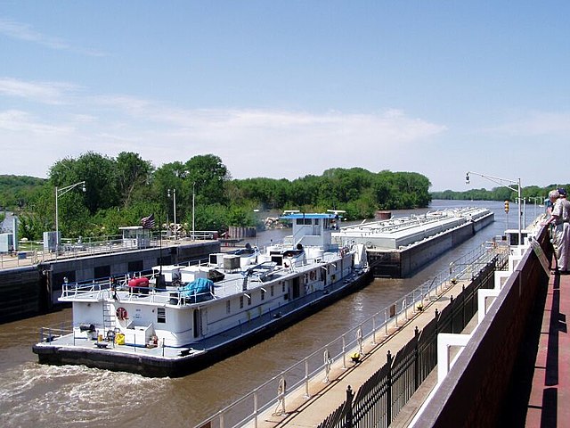
River tow leaving the Starved Rock Lock headed down river.
The Illinois River, as seen from Starved Rock State Park. The dam (upper-left center) is part of the infrastructure of the Illinois Waterway