The city Milan, Italy, has had three different systems of defending walls. The oldest, Roman walls were developed in two stages, the first in the Republican and the second in the Imperial era. The second wall system was realized in the Middle Ages, after the destruction of the city by Frederick I Barbarossa. Finally, the latest wall system was built by the Spanish rulers. While very little remains of these walls, their structure is clearly reflected in the urbanistic layout of the city. In particular, modern Milan has two roughly circular rings of streets, namely the "Cerchia dei Navigli" and the "Cerchia dei Bastioni", which essentially correspond to the Medieval and Spanish walls, respectively. Note that a third ring of roads just beyond the Inner Ring Road, called the External Ring Road, does not owe itself to any old city walls; but was part of the 1884 Beruto Plan for the city of Milan, created and named after a municipal engineer and public servant to the local city government.

The Maximian tower in the courtyard of the Archaeological Museum of Milan
"Porta Ticinese", one of the remaining gates from the medieval walls of Milan
"Pusterla di Sant'Ambrogio", one of the remaining medieval posterns
Milan in 1573
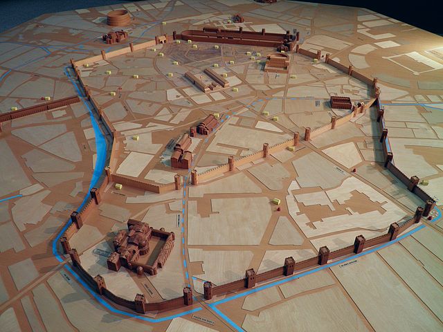
Mediolanum, the ancient city where Milan now stands, was originally an Insubrian city, but afterwards became an important Roman city in Northern Italy.
Wooden model preserved at the Civic Archaeological Museum of Milan showing a reconstruction of the imperial Mediolanum
A section of Roman wall (11 m high) with a 24-sided tower
Ruins of the Emperor's palace 45°27′54.43″N 09°10′50.15″E / 45.4651194°N 9.1805972°E / 45.4651194; 9.1805972 in Milan. Here Constantine and Licinius issued the Edict of Milan.
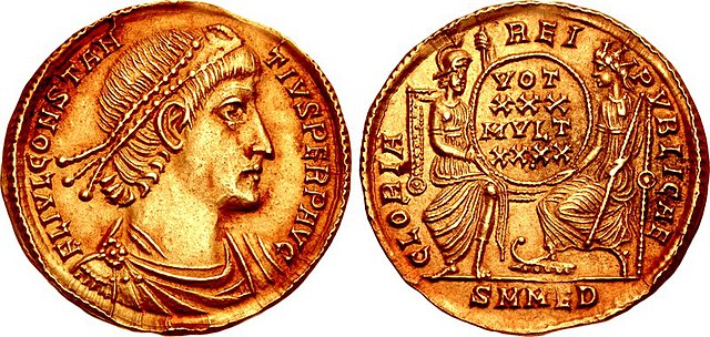
Roman solidus coin (picturing Emperor Constantius II) struck at the Mediolanum mint, circa 354-357 A.D.


