Washington State Route 536
State Route 536 (SR 536) is a 5.38-mile-long (8.66 km) state highway serving Skagit County in the U.S. state of Washington. The highway travels southeast from SR 20 near Fredonia through Mount Vernon to an interchange with Interstate 5 (I-5) on the east side of downtown Mount Vernon. SR 536 was created during the 1964 highway renumbering as a replacement for the Anacortes branch of Primary State Highway 1 (PSH 1). SR 536 was shortened to its current route in 1973 after SR 20 was extended west and a spur route was established to serve Anacortes.
I-5 northbound approaching its interchange with SR 536 in Mount Vernon.
Washington State Route 20
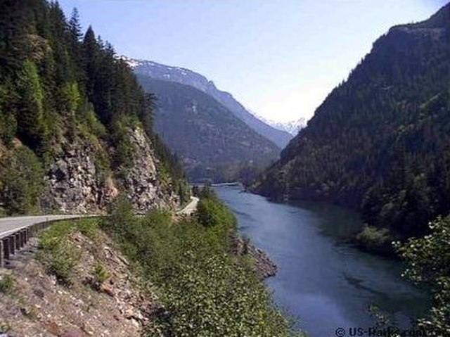
State Route 20 (SR 20), also known as the North Cascades Highway, is a state highway that traverses the U.S. state of Washington. It is the state's longest highway, traveling 436 miles (702 km) across the northern areas of Washington, from U.S. Route 101 (US 101) at Discovery Bay on the Olympic Peninsula to US 2 near the Idaho state border in Newport. The highway travels across Whidbey Island, North Cascades National Park, the Okanagan Highland, the Kettle River Range, and the Selkirk Mountains. SR 20 connects several major north–south state highways, including Interstate 5 (I-5) in Burlington, US 97 through the Okanogan–Omak area, SR 21 in Republic, and US 395 from Kettle Falls to Colville.
North Cascades Highway
Liberty Bell Mountain from 5,477-foot (1,669 m) elevation Washington Pass on North Cascades Highway
Kangaroo Ridge is due east of Washington Pass.
North Cascades Highway approaching Silver Star Mountain