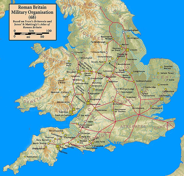
Watling Street is a historic route in England that crosses the River Thames at London and which was used in Classical Antiquity, Late Antiquity, and throughout the Middle Ages. It was used by the ancient Britons and paved as one of the main Roman roads in Britannia. The route linked Dover and London in the southeast, and continued northwest via St Albans to Wroxeter. The line of the road was later the southwestern border of the Danelaw with Wessex and Mercia, and Watling Street was numbered as one of the major highways of medieval England.
A stretch of modern-day Watling Street in Buckinghamshire
Watling Street near Crick in Northamptonshire
The road at Richborough Castle, one of the Romans' Kentish ports and a Saxon Shore fort.
Modern Watling Street in Canterbury
Roman roads in Britannia were initially designed for military use, created by the Roman army during the nearly four centuries (AD 43–410) that Britannia was a province of the Roman Empire.
Roman Britain military infrastructure in 68 AD
A Roman lighthouse at Dover Castle, 3rd century. Dubris was the starting point of Watling Street to London and Wroxeter
The Via Appia, near Rome, the oldest major Roman route in Italy, opened 312 BC
A Roman milestone from St Margarethen, Austria, dedicated in 201 to the Emperor Septimius Severus (ruled 193–212)


