West Philadelphia
Videos
West Philadelphia, nicknamed West Philly, is a section of the city of Philadelphia. Although there are no officially defined boundaries, it is generally considered to reach from the western shore of the Schuylkill River, to City Avenue to the northwest, Cobbs Creek to the southwest, and the SEPTA Media/Wawa Line to the south. An alternate definition includes all city land west of the Schuylkill; this would also include Southwest Philadelphia and its neighborhoods. The eastern side of West Philadelphia is also known as University City.
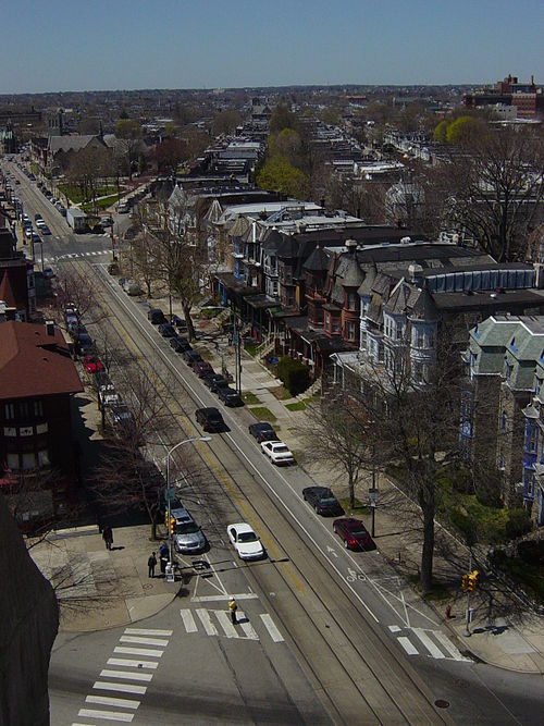

View of West Philadelphia from One Liberty Observation Deck in Center City Philadelphia

Calvary United Methodist Church, built in 1905, at 801 48th Street in West Philadelphia

A common style of Queen Anne house with a wrap-around porch
MOVE, originally the Christian Movement for Life, is a communal organization that advocates for nature laws and natural living, founded in 1972 in Philadelphia, Pennsylvania, United States, by John Africa. The name, styled in all capital letters, is not an acronym. MOVE lived in a communal setting in West Philadelphia, abiding by philosophies of anarcho-primitivism. The group combined revolutionary ideology, similar to that of the Black Panthers, with work for animal rights.
