Westland Tai Poutini National Park
Videos
Photos
Westland Tai Poutini National Park is a national park located on the western coast of New Zealand's South Island. Established in 1960 as Westland National Park to commemorate the centenary of the European settlement of Westland District, it covers 1,320 square kilometres of largely mountainous terrain and forest. The park borders the Aoraki / Mount Cook National Park along the Main Divide of the Southern Alps, and includes many of the West Coast's glaciers, most notably including the Fox / Te Moeka o Tuawe and Franz Josef / Kā Roimata o Hine Hukatere glaciers.

Franz Josef Glacier in 2011

A view of the Baird Range, located in the park.

The natural hot pools located at Welcome Flat

A view across Peters Pool toward the Franz Josef / Kā Roimata o Hine Hukatere
South Island
Videos
Photos
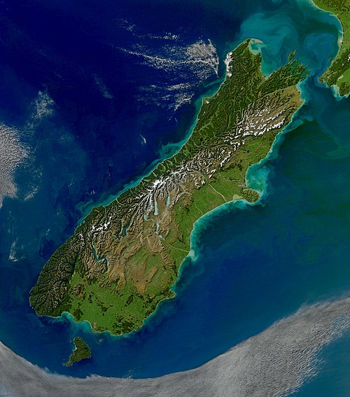
The South Island, also named Te Waipounamu in Māori, is the larger of the two major islands of New Zealand in surface area, the other being the smaller but more populous North Island. It is bordered to the north by Cook Strait, to the west by the Tasman Sea, and to the south and east by the Pacific Ocean. The South Island covers 150,437 square kilometres (58,084 sq mi), making it the world's 12th-largest island, constituting 56% of New Zealand's land area. At low altitude, it has an oceanic climate.
South Island

Charcoal rock drawing at Carters rockpool on the Ōpihi River

First European impression of Māori, at Murderers' Bay, 1642

Ships in what is likely to be Akaroa Harbour some time in the early 19th century