Grassington
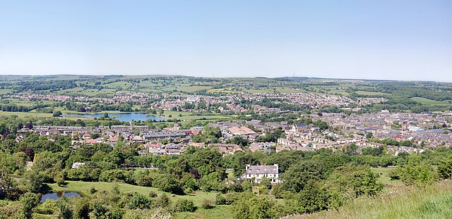
Grassington is a market town and civil parish in the Craven district of North Yorkshire, England. The population at the 2011 Census was 1,126. Part of the West Riding of Yorkshire, the town is situated in Wharfedale, about 8 miles north-west from Bolton Abbey, is surrounded by limestone scenery. Nearby villages include Linton, Hebden and Kilnsey; the Domesday Book lists Grassington as part of the estate of Gamal Barn including 7 carucates of ploughland including Grassington and Threshfield. The Norman conquest of England made it part of the lands of Gilbert Tison, but by 1118 Tison had suffered a demotion and his lands returned to the king given to Lord Percy. The settlement was spelt as Gherinstone and was documented as Garsington or Gersington; the name Grassington derives variously from the Scandinavian, Anglo-Saxon and Gothic languages and means either the town of the grassy ings or a farmstead surrounded by grass. Grassington was a township in the parish of Linton in the West Riding of Yorkshire.
It became a separate civil parish in 1866, was transferred to North Yorkshire in 1974. Although described by local people as a village, Grassington was granted a Royal Charter for a market and fair in 1282 giving it market town status; the market was held until about 1860. A change in land use from the early 17th century, when lead mining began to assume more importance, brought some prosperity, but Grassington's heyday arrived during the late 18th and early 19th centuries; the opening of the Yorkshire Dales Railway to Threshfield in 1902 brought new visitors, many of whom settled, some finding work in Skipton or in the developing limestone quarries. The Old Hall at Grassington is reputedly the oldest house in Yorkshire, dating from the late 13th or early 14th century. Grassington & Threshfield Golf Club was founded in 1908; the club continued until the Second World War. Grassington is the main residential and tourist centre in Upper Wharfedale. Centred on its small cobbled square are shops, public houses, the village museum, small cafes and hotels.
Grassington Folk Museum houses a collection. It is an independent museum managed by volunteers; the area is popular with walkers, one of the most popular routes is a circular walk that includes Burnsall. Upper Wharfedale Fell Rescue Association, based in Grassington, is a voluntary mountain rescue organisation which rescues people in trouble on the surrounding fells and in caves. Grassington Festival is a two-week-long annual event started in 1980, with music and visual arts, held in a number of venues around the village; every September since 2011, Grassington has held a 1940s themed weekend. Events include war re-enactments, dances and a variety of military and civilian vehicles on display from the period. In the winter Grassington holds the Dickensian Festival, with period costumes, Christmas activities and commercial selling. A Yorkshire Dales National Park information centre is on Hebden Road. Three miles north of Grassington, at Kilnsey, is the glacially carved overhang of Kilnsey Crag. Grass Wood, an area of ancient woodland including the Iron-Age fort, Fort Gregory, is situated just over 3 miles north-west of Grassington.
Grassington is served by the B6265, which runs between Skipton and Green Hammerton via Pateley Bridge and Boroughbridge. Buses connect Grassington with Ilkley and Skipton operating a moderate service to Skipton, but only a three-day a week service to Ilkley; the town used to have a joint railway station terminus with Threshfield on the Yorkshire Dales Railway. The station was located on the west side of the River Wharfe, so it was not in Grassington; the line closed down in September 1930 after only 28 years of service. The station remained open to freight and railtour traffic until 1969 when the tracks were removed south as far as the limestone quarry at Swinden; the site of the railway station is now a housing estate, but the Campaign for Better Transport have listed the Skipton to Grassington line as one which they wish to see re-opened to passenger traffic. Grassington has a Church of England primary school located in the town and there is another primary school in nearby Threshfield. Secondary education is either at the Upper Wharfedale School, a non-selective specialist sports college, or in Skipton at Ermysted's Grammar School and Skipton Girls High School, both of which are selective.
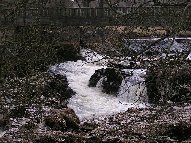
In 1909 Grassington received its first electricity from a hydroelectric plant at Linton Falls, which continued to operate until 1948 when the National Grid arrived in the area. In March 2012 a new hydroelectric power plant was opened using the same but restored turbine house, which provides 500,000 kWh of electricity a year, using two Archimedean screws. Map of the Grass Wood Grassington Lead Mining Trail by Craven & Pendle Geological Society Lead mines – Meerstones of Grassington Moor
Pool-in-Wharfedale
Pool-in-Wharfedale or Pool in Wharfedale abbreviated to Pool, is a village and civil parish in the Lower Wharfedale area, 10 miles north of Leeds city centre and 2 miles east of Otley. It is in the City of Leeds metropolitan borough, West Yorkshire and within the historic boundaries of the West Riding of Yorkshire, it is in the LS21 postcode district. Pool is surrounding areas by trunk roads and buses, it had a railway station, which linked the village to Leeds, until it closed as part of the Beeching Axe, but Weeton railway station is nearby. It had a population of 2,284 at the 2011 Census, up from 1,785 in 2001. Pool is a scenic village and enjoys views in most directions, including The Chevin, the Arthington Viaduct and Almscliffe Crag. Running past the outskirts of Pool is the River Wharfe, prone to flooding. Nearby is Pool Bank, a steep hill; the village amenities include two pubs, a post office, a garage, one primary school, a petrol station, a sports and social club and the village hall.
It has two parks and miles of riverside walks. The church of St Wilfred was built in 1839. There is the lowest tier of local government. In recent years the village has increased in size with the construction of many new homes. On 5 July 2014, the Tour de France Stage 1 from Leeds to Harrogate passed through the village; the ancient parish of Otley: historical and genealogical information at GENUKI
City of Leeds
The City of Leeds is a local government district of West Yorkshire, governed by Leeds City Council, with the status of a city and metropolitan borough. The metropolitan district includes the administrative centre Leeds and the ten towns of Farsley, Guiseley, Morley, Pudsey, Rothwell and Yeadon, it has a population of 784,800, making it technically the second largest city in England by population behind Birmingham. The current city boundaries were set on 1 April 1974 by the provisions of the Local Government Act 1972, as part a reform of local government in England; the city is a merger of eleven former local government districts. For its first 12 years the city had a two-tier system of local government. Since the Local Government Act 1985 Leeds City Council has been a unitary authority, serving as the sole executive and legislative body responsible for local policy, setting council tax, allocating budget in the city, is a member of the Leeds City Region Partnership; the City of Leeds is divided into a single unparished area.
The Borough of Leeds was created in 1207, when Maurice Paynel, lord of the manor, granted a charter covering a small area adjacent to a crossing of the River Aire, between the old settlement centred on Leeds Parish Church to the east and the manor house and mills to the west. In 1626 a charter was granted by Charles I; the parish and borough included the chapelries of Chapel Allerton, Beeston, Farnley, Headingley cum Burley, Hunslet, Leeds and Wortley. The borough was located in the West Riding of Yorkshire and gained city status in 1893; when a county council was formed for the riding in 1889, Leeds was excluded from its area of responsibility and formed a county borough. The borough made a significant number of territorial expansions, expanding from 21,593 acres in 1911 to 40,612 acres in 1961. A review of local government arrangements completed in 1969 proposed the creation of a new large district centred on Leeds, occupying 317,000 acres and including 840,000 people; the proposed area was reduced in a 1971 white paper.
The final proposal reduced the area further and following the enactment of the Local Government Act 1972, the county borough was abolished on 1 April 1974 and its former area was combined with that of the municipal boroughs of Morley and Pudsey. The new district gained both city status, as had been held by the county borough; the district and its settlements are situated in the eastern foothills of the Pennines astride the River Aire whose valley, the Aire Gap, provides a road and rail corridor that facilitates communications with cities to the west of the Pennines. The district extends 15 miles from east to west and 13 miles from north to south; the highest point, at 1,115 feet, is at its north western extremity on the eastern slopes of Rombalds Moor, better known as Ilkley Moor, on the boundary with the City of Bradford. The lowest points are at around 33 feet, in the east: where River Wharfe crosses the boundary with North Yorkshire south of Thorp Arch Trading Estate and where the River Aire meets the North Yorkshire boundary near Fairburn Ings.
To the north and east Leeds is bordered by North Yorkshire: Harrogate district to the north and Selby district to the east. The remaining borders are with other districts of West Yorkshire: Wakefield to the south, Kirklees to the south west, Bradford to the west. Leeds City Council is the local authority of the district; the council is composed of three for each of the city's wards. Elections are held three years out on the first Thursday of May. One third of the councillors are elected, in each election. 2004 saw all seats up for election due to boundary changes. It is run by a Labour administration. Before the 2011 election, the council had been under no overall control since 2004; the Chief Executive of Leeds City Council is Tom Riordan while the Leader of the Council is Councillor Judith Blake of the Labour Party. As a metropolitan county, West Yorkshire does not have a county council, so Leeds City Council is the primary provider of local government services; the district forms the Humber region of England.
Most of the district is an unparished area, comprising Leeds itself, Garforth and the area of the former urban district of Aireborough. In the unparished area there is no lower tier of government. Outside the unparished area there are 31 civil parishes, represented by parish councils; these form the lowest tier of local government and absorb
Addingham
Addingham is a village and civil parish in the English county of West Yorkshire. It is situated near the A65, 6 miles south east of Skipton, 3 miles west of Ilkley, 19 miles north west of Bradford and around 20 miles north west of Leeds. Part of the West Riding of Yorkshire, it is located in the valley of the River Wharfe and is only 1 mile from the Yorkshire Dales National Park; the name is thought to mean "homestead associated with a man called Adda", although in the Domesday Book, the village was referred to as "Ediham", which may have referred to Earl Edwin of Bolton Abbey. The 2001 census numbered Addingham's population at 3,599; the area around Addingham is thought to have been populated from at least Bronze Age times, indicated by the'cup and ring' carved stones that can be found on Addingham Moor. Its beginnings may date back to the late Mesolithic period, as evidenced by the scattered remains of early flint tools across Rombald's Moor to the south; the earliest of the existing houses were built in the 17th century when the village was a farming community, but the real growth began in the late 18th century and early 19th century when the textile industry arrived and five working mills, plus other loomshops and weaving sheds, were established, the village developed into a busy industrial community.
The village grew up around three centres. This is thought to be one of the reasons the village used to be known as "Long Addingham". Since the decline of the textile industry during the 20th century, the village has now become a commuter and retirement community, it is home to an award-winning Medical Centre, a public park, four public houses, several retirement homes and a solitary school, Addingham Primary School. There is evidence of civilisation around Addingham as far back as the late Mesolithic and early Bronze Ages, as indicated by the remains of early man in the form of flint tools on Rombald's Moor, which may date back to around 11,000 BC; the first'fixed' artefacts are the'cup and ring' marked stones, several of which can be found on top of Addingham Moor and Ilkley Moor to the east, which date back to the early Bronze Age, around 1800 BC. The first evidence of settlements come from the Iron Age – evidence of major tree clearance dating back to 700 BC has been found, as well as quern-stones on Addingham Moorside.
Remains of an Iron Age settlement can be found on Addingham Low Moor. Little evidence remains of the 350 years of Roman occupation, save for the Roman road towards Skipton which, up until the 1800s, was still the primary route between the two settlements; the Domesday Book in 1086 places the village in the region of Burghshire and refers to the village as "Ediham". The Lord in 1066 was Earl Edwin of Bolton Abbey, Lord of several other surrounding settlements ranging as far west as Skipton and Anley, may have given his name to the village; the weir of a medieval corn mill, located near modern-day High Mill has been dated back to 1315, is one of the oldest medieval structures in the village. Despite this, the main occupation in the 1370s, when poll tax was levied, was agriculture, iron smelting and blacksmithing. During the Reformation, Henry VIII dissolved the monastery in Bolton Abbey, while most of Addingham accepted the Reformation, Richard Kirkham remained faithful to Catholicism and was subsequently arrested in 1578, executed in York alongside William Lacy.
The Roman Catholic Church "Our Lady and of the English Martyrs", built in 1927 on Bolton Road, is dedicated to him and to other Catholics persecuted by Henry VIII. During the English Civil War in 1642, Addingham was mainly Royalist, as several villagers are thought to have helped to defend Skipton Castle from the Parliamentarians; the earliest indications of the textile industry in the village can be found in the will of William Atkinson in 1568, in which it states that he left a solitary loom to his son-in-law. The cloth making industry remained stagnant, until the 18th century, when revolutionary weaving inventions such as John Kay's Flying shuttle and water-powered machines such as Crompton's Spinning mule, allowed the textile industry in Addingham to leap forward as it entered the 19th century. John Cunliffe, a cloth manufacturer, John Cockshott, a glazier and woolstapler, took advantage of the new developments in technology and leased land on the side of the River Wharfe in 1787 at the site now known as Low Mill.
They built a spinning mill which enabled yarn to be spun more than by hand and thus increased the production of cloth. A weir was constructed on a wheel installed to provide the power, it was the first successful worsted mill in the world. The start of the 19th century saw the textile industry begin to thrive in the village – existing mills, such as the one at High Mill, built in 1787 to produce corn, were converted and extended and used for linen, cotton and silk spinning, while other new mills were built, such as Town Head Mill and Fentimans, the latter of, built in 1802 to spin cotton and was converted into a sawmill in the 1860s. Several small workshops were built, as well as three storey high workers' houses, in which the lower two floors would be for domestic use, the top floor would house the looms, with inter-connecting doors along the row of houses; these buildings still exist today, examples can be seen on Stockinger Lane. In 1826, Low Mill, now under the tenancy of Jeremiah Horsfall, was the scene of a Luddite uprising.
I
Church of England
The Church of England is the established church of England. The Archbishop of Canterbury is the most senior cleric, although the monarch is the supreme governor; the Church of England is the mother church of the international Anglican Communion. It traces its history to the Christian church recorded as existing in the Roman province of Britain by the third century, to the 6th-century Gregorian mission to Kent led by Augustine of Canterbury; the English church renounced papal authority when Henry VIII failed to secure an annulment of his marriage to Catherine of Aragon in 1534. The English Reformation accelerated under Edward VI's regents, before a brief restoration of papal authority under Queen Mary I and King Philip; the Act of Supremacy 1558 renewed the breach, the Elizabethan Settlement charted a course enabling the English church to describe itself as both catholic and reformed: catholic in that it views itself as a part of the universal church of Jesus Christ in unbroken continuity with the early apostolic church.
This is expressed in its emphasis on the teachings of the early Church Fathers, as formalised in the Apostles', Athanasian creeds. Reformed in that it has been shaped by some of the doctrinal principles of the 16th-century Protestant Reformation, in particular in the Thirty-Nine Articles of Religion and the Book of Common Prayer. In the earlier phase of the English Reformation there were both Catholic martyrs and radical Protestant martyrs; the phases saw the Penal Laws punish Roman Catholic and nonconforming Protestants. In the 17th century, the Puritan and Presbyterian factions continued to challenge the leadership of the Church which under the Stuarts veered towards a more catholic interpretation of the Elizabethan Settlement under Archbishop Laud and the rise of the concept of Anglicanism as the via media. After the victory of the Parliamentarians the Prayer Book was abolished and the Presbyterian and Independent factions dominated; the Episcopacy was abolished. The Restoration restored the Church of England and the Prayer Book.
Papal recognition of George III in 1766 led to greater religious tolerance. Since the English Reformation, the Church of England has used a liturgy in English; the church contains several doctrinal strands, the main three known as Anglo-Catholic and Broad Church. Tensions between theological conservatives and progressives find expression in debates over the ordination of women and homosexuality; the church includes both liberal and conservative members. The governing structure of the church is based on dioceses, each presided over by a bishop. Within each diocese are local parishes; the General Synod of the Church of England is the legislative body for the church and comprises bishops, other clergy and laity. Its measures must be approved by both Houses of Parliament. According to tradition, Christianity arrived in Britain in the 1st or 2nd century, during which time southern Britain became part of the Roman Empire; the earliest historical evidence of Christianity among the native Britons is found in the writings of such early Christian Fathers as Tertullian and Origen in the first years of the 3rd century.
Three Romano-British bishops, including Restitutus, are known to have been present at the Council of Arles in 314. Others attended the Council of Serdica in 347 and that of Ariminum in 360, a number of references to the church in Roman Britain are found in the writings of 4th century Christian fathers. Britain was the home of Pelagius. While Christianity was long established as the religion of the Britons at the time of the Anglo-Saxon invasion, Christian Britons made little progress in converting the newcomers from their native paganism. In 597, Pope Gregory I sent the prior of the Abbey of St Andrew's from Rome to evangelise the Angles; this event is known as the Gregorian mission and is the date the Church of England marks as the beginning of its formal history. With the help of Christians residing in Kent, Augustine established his church at Canterbury, the capital of the Kingdom of Kent, became the first in the series of Archbishops of Canterbury in 598. A archbishop, the Greek Theodore of Tarsus contributed to the organisation of Christianity in England.
The Church of England has been in continuous existence since the days of St Augustine, with the Archbishop of Canterbury as its episcopal head. Despite the various disruptions of the Reformation and the English Civil War, the Church of England considers itself to be the same church, more formally organised by Augustine. While some Celtic Christian practices were changed at the Synod of Whitby, the Christian in the British Isles was under papal authority from earliest times. Queen Bertha of Kent was among the Christians in England who recognised papal authority before Augustine arrived, Celtic Christians were carrying out missionary work with papal approval long before the Synod of Whitby; the Synod of Whitby established the Roman date for Easter and the Roman style of monastic tonsure in England. This meeting of the ecclesiastics with Roman customs with local bishops was summoned in 664 at Saint Hilda's double monastery of Streonshalh called Whitby Abbey, it was presided over by King Oswiu, who made the final ruling.
The final ruling was decided in favor of Roman tradition because St. Peter holds the keys to the gate of Heaven. In 1534, King Henry VIII separated the English Church from Rome. A theological separation had been foreshadowed by various movements within the English Church, such as Lollardy, but the English Reformation gained political support when Henry VIII wanted an a
Election
An election is a formal group decision-making process by which a population chooses an individual to hold public office. Elections have been the usual mechanism by which modern representative democracy has operated since the 17th century. Elections may fill offices in the legislature, sometimes in the executive and judiciary, for regional and local government; this process is used in many other private and business organizations, from clubs to voluntary associations and corporations. The universal use of elections as a tool for selecting representatives in modern representative democracies is in contrast with the practice in the democratic archetype, ancient Athens, where the Elections were not used were considered an oligarchic institution and most political offices were filled using sortition known as allotment, by which officeholders were chosen by lot. Electoral reform describes the process of introducing fair electoral systems where they are not in place, or improving the fairness or effectiveness of existing systems.
Psephology is the study of other statistics relating to elections. To elect means "to choose or make a decision", so sometimes other forms of ballot such as referendums are referred to as elections in the United States. Elections were used as early in history as ancient Greece and ancient Rome, throughout the Medieval period to select rulers such as the Holy Roman Emperor and the pope. In Vedic period of India, the Raja of a gana was elected by the gana; the Raja belonged to the noble Kshatriya varna, was a son of the previous Raja. However, the gana members had the final say in his elections. During the Sangam Period people elected their representatives by casting their votes and the ballot boxes were tied by rope and sealed. After the election the votes were counted; the Pala King Gopala in early medieval Bengal was elected by a group of feudal chieftains. Such elections were quite common in contemporary societies of the region. In the Chola Empire, around 920 CE, in Uthiramerur, palm leaves were used for selecting the village committee members.
The leaves, with candidate names written on them, were put inside a mud pot. To select the committee members, a young boy was asked to take out as many leaves as the number of positions available; this was known as the Kudavolai system. The modern "election", which consists of public elections of government officials, didn't emerge until the beginning of the 17th century when the idea of representative government took hold in North America and Europe. Questions of suffrage suffrage for minority groups, have dominated the history of elections. Males, the dominant cultural group in North America and Europe dominated the electorate and continue to do so in many countries. Early elections in countries such as the United Kingdom and the United States were dominated by landed or ruling class males. However, by 1920 all Western European and North American democracies had universal adult male suffrage and many countries began to consider women's suffrage. Despite mandated universal suffrage for adult males, political barriers were sometimes erected to prevent fair access to elections.
The question of who may vote is a central issue in elections. The electorate does not include the entire population. In Australia, Aboriginal people were not given the right to vote until 1962 and in 2010 the federal government removed the rights of prisoners serving for 3 years or more to vote. Suffrage is only for citizens of the country, though further limits may be imposed. However, in the European Union, one can vote in municipal elections if one lives in the municipality and is an EU citizen. In some countries, voting is required by law. In Western Australia, the penalty for a first time offender failing to vote is a $20.00 fine, which increases to $50.00 if the offender refused to vote prior. A representative democracy requires a procedure to govern nomination for political office. In many cases, nomination for office is mediated through preselection processes in organized political parties. Non-partisan systems tend to differ from partisan systems as concerns nominations. In a direct democracy, one type of non-partisan democracy, any eligible person can be nominated.
Although elections were used in ancient Athens, in Rome, in the selection of popes and Holy Roman emperors, the origins of elections in the contemporary world lie in the gradual emergence of representative government in Europe and North America beginning in the 17th century. In some systems no nominations take place at all, with voters free to choose any person at the time of voting—with some possible exceptions such as through a minimum age requirement—in the jurisdiction. In such cases, it is not required that the members of the electorate be familiar with all of the eligible persons, though such systems may involve indirect elections at larger geographic levels to ensure that some first-hand familiarity among potential electees can exist at these levels; as far as partisan systems, in some countries, only members of a particular party can be no
Bolton Abbey
Bolton Abbey in Wharfedale, North Yorkshire, takes its name from the ruins of the 12th-century Augustinian monastery now known as Bolton Priory. The priory, closed in the 1539 Dissolution of the Monasteries ordered by King Henry VIII, is in the Yorkshire Dales, next to the village of Bolton Abbey; the estate is open to visitors, includes many miles of all-weather walking routes. The Embsay & Bolton Abbey Steam Railway terminates at Bolton Abbey station one and a half miles/2.5 km from Bolton Priory. The monastery was founded at Embsay in 1120. Led by a prior, Bolton Abbey was technically a priory, despite its name, it was founded in 1154 on the banks of the River Wharfe. The land at Bolton, as well as other resources, were given to the order by Lady Alice de Romille of Skipton Castle in 1154. In the early 14th century Scottish raiders caused the temporary abandonment of the site and serious structural damage to the priory; the seal of the priory featured the Blessed Virgin Mary and the Child and the phrase sigillum sancte Marie de Bolton.
The nave of the abbey church was in use as a parish church from about 1170 onwards, survived the Dissolution of the Monasteries. Building work was still going on at the abbey when the Dissolution of the Monasteries resulted in the termination of the priory in January 1540; the east end remains in ruins. A tower, begun in 1520, was left half-standing, its base was given a bell-turret and converted into an entrance porch. Most of the remaining church is in the Gothic style of architecture, but more work was done in the Victorian era, including windows by August Pugin, it is still holding services on Sundays and religious holidays. Bolton Abbey churchyard contains the war grave of a Royal Flying Corps officer of the First World War; the Domesday Book lists Bolton Abbey as the caput manor of a multiple estate including 77 carucates of ploughland belonging to Edwin, Earl of Mercia. The estate comprised Bolton Abbey, Halton East, Draughton, they were all laid waste in the Harrying of the North after the defeat of the rebellion of Edwin, Earl of Mercia and classified as the Clamores of Yorkshire until around 1090, when they were transferred to Robert de Romille, who moved its administrative centre to Skipton Castle.
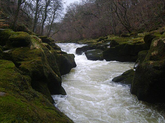
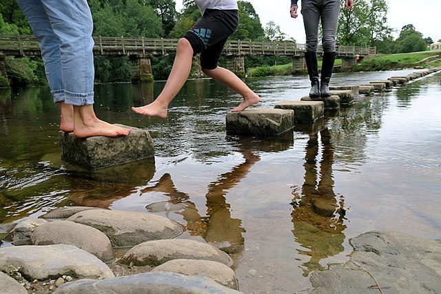
The Romille line died out around 1310, Edward II granted the estates to Robert Clifford. In 1748 Baroness Clifford married William Cavendish and Bolton Abbey Estate thereafter belonged to the Dukes of Devonshire, until a trust was set up by the 11th Duke of Devonshire turning it over to the Chatsworth Settlement Trustees to steward. Today, the 33,000 acre estate contains six areas designated as Sites of Special Scientific Interest, including Strid Wood, an ancient woodland, which contains the length of the River Wharfe known as The Strid, a marine fossil quarry; the estate encompasses 8 miles of river, 84 farms, 84 buildings of architectural interest, four Grade I listed buildings. The iconic stepping stones cross the River Wharfe near the Abbey ruins; the estate includes extensive grouse moors, including Barden Moor on the west side of Wharfedale and Barden Fell on the east side of the dale. There is a pheasant shoot. Apart from people employed within these businesses, the estate employs about 120 staff to work on the upkeep of the estate.
Much of the estate is open to the public. A charge is made for car parking; the Dales Way passes through the estate on a permissive path. Barden Moor and Barden Fell, which includes the prominent crag of Simon's Seat, are on access land, permissive paths lead up to the moors. Access to the moors may be closed to the public during the shooting season. Bolton Abbey Hall the gatehouse of the priory, was converted into a house by the Cavendish family; the hall is a Grade II* listed building. As well as Bolton Abbey, the Cavendish family own the Chatsworth and Lismore Castle estates. In the early nineteenth century, a cow known as the Craven Heifer was bred on the Bolton Abbey estate. Weighing 312 stone, measuring 11 ft 4ins in length and over 7 ft in height, she to this day remains Britain's largest cow; the Priory Church of St. Mary and St. Cuthbert, Bolton Abbey, is an active Church of England church, serving the village and parish of Bolton Abbey, with a full calendar of liturgical events, a full-time rector who lives in the adjacent Rectory.
The current church is the surviving part of the otherwise ruined 12th-century Augustinian religious community — known as Bolton. It is situated within the Bolton Abbey estate; the remains of the priory can still be seen, the setting is immortalised in both art and poetry. These include a painting by Edwin Landseer and watercolours by J. M. W. Turner one of which, Bolton Abbey, Yorkshire, is held at the British Museum; the young Brontë visited the estate while Landseer was in residence at'the gatehouse'. The following year Charlotte Brontë exhibited a drawing'Bolton Abbey' alongside stars of the day at the Royal Northern Festival of Arts, Leeds; when first discovered by Jane Sellars and Christine Alexander in 1994, it was thought based on Turner's view of 1809, but further research, detail of a drifting heron relates the drawing more to Landseer's oil-ske