The Wollondilly River, an Australian perennial river that is part of the Hawkesbury–Nepean catchment, is located in the Southern Tablelands and Southern Highlands regions of New South Wales. The river meanders from its western slopes near Crookwell, flowing south-east through Goulburn, turning north-east to near Bullio, flowing north-west to Barrallier, before finally heading north-easterly into its mouth at Lake Burragorang.
A trek crossing the river, circa 1900. Picture from the Powerhouse Museum.
The Hawkesbury River, or Hawkesbury-Nepean River, is a river located northwest of Sydney, New South Wales, Australia. The Hawkesbury River and its associated main tributary, the Nepean River, almost encircle the metropolitan region of Sydney. Between Wisemans Ferry and the Pacific Ocean marks the boundary of Greater Metropolitan Sydney in the south and the Central Coast region to the north.
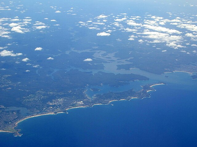
Aerial photograph showing the mouth of the Hawkesbury River as it flows into Broken Bay and out into the Tasman Sea, as seen looking across Sydney's Northern Beaches
Looking north-east across the Hawkesbury River, with Dangar Island to the right of the image.
Looking south-east across the Hawkesbury River, from near Brooklyn.
The Hawkesbury River was renamed by Governor Phillip in 1789


