The Yuba River is a tributary of the Feather River in the Sierra Nevada and eastern Sacramento Valley, in the U.S. state of California. The main stem of the river is about 40 miles (64 km) long, and its headwaters are split into three major forks. The Yuba River proper is formed at the North Yuba and Middle Yuba rivers' confluence, with the South Yuba joining a short distance downstream. Measured to the head of the North Yuba River, the Yuba River is just over 100 miles (160 km) long.
At South Yuba River State Park
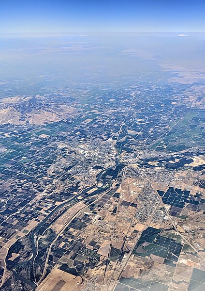
Satellite view of the lower Yuba River - Yuba City/Marysville and the Feather River lie near the bottom left; Yuba Goldfields are in the upper right center
Large gold nugget from the Yuba River placers, weight 182 g.
Yuba River at Parks Bar, 1991
The Feather River is the principal tributary of the Sacramento River, in the Sacramento Valley of Northern California. The river's main stem is about 73 miles (117 km) long. Its length to its most distant headwater tributary is just over 210 miles (340 km). The main stem Feather River begins in Lake Oroville, where its four long tributary forks join—the South Fork, Middle Fork, North Fork, and West Branch Feather Rivers. These and other tributaries drain part of the northern Sierra Nevada, and the extreme southern Cascades, as well as a small portion of the Sacramento Valley. The total drainage basin is about 6,200 square miles (16,000 km2), with approximately 3,604 square miles (9,330 km2) above Lake Oroville.
The Feather River near its confluence with the Bear River
Buzzard Springs, partial source of the North Fork Feather River, near Rice Creek and with Lassen Peak in the background
Frazier Creek Falls in Plumas National Forest is part of the Middle Fork watershed
Aerial view of the region of the confluence of the Feather and Yuba rivers at Marysville and Yuba City