Missouri Bootheel
Videos
Page
The Missouri Bootheel is a salient (protrusion) located in the southeasternmost part of the U.S. state of Missouri, extending south of 36°30′ north latitude, so called because its shape in relation to the rest of the state resembles the heel of a boot. Strictly speaking, it is composed of some or all of the counties of Dunklin, New Madrid, and Pemiscot. However, the term is locally used to refer to the entire southeastern lowlands of Missouri located within the Mississippi Embayment, which includes parts of Butler, Mississippi, Ripley, Scott, Stoddard and extreme southern portions of Cape Girardeau and Bollinger counties. The largest city in the region is Kennett.

A typical Bootheel scene: the Mississippi floodplain in southern Pemiscot County
Missouri
Videos
Page
Missouri is a landlocked state in the Midwestern region of the United States. Ranking 21st in land area, it borders Iowa to the north, Illinois, Kentucky and Tennessee to the east, Arkansas to the south and Oklahoma, Kansas, and Nebraska to the west. In the south are the Ozarks, a forested highland, providing timber, minerals, and recreation. The Missouri River, after which the state is named, flows through the center and into the Mississippi River, which makes up the eastern border. With over six million residents, it is the 18th-most populous state of the country. The largest urban areas are St. Louis, Kansas City, Springfield, and Columbia; the capital is Jefferson City.

Missouri
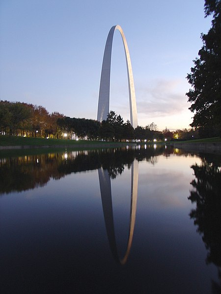
The Gateway Arch in St. Louis

Fur Traders Descending the Missouri by Missouri painter George Caleb Bingham
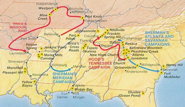
Price's Raid in the Trans-Mississippi Theater, 1864