Oxley Highway
Videos
Page
Oxley Highway is a rural highway in New South Wales, Australia, linking Nevertire, Gilgandra, Coonabarabran, Tamworth, and Walcha to Port Macquarie, on the coast of the Tasman Sea. It was named to commemorate John Oxley, the first European to explore much of inland New South Wales in 1818.
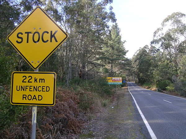
Signs, Oxley Highway.
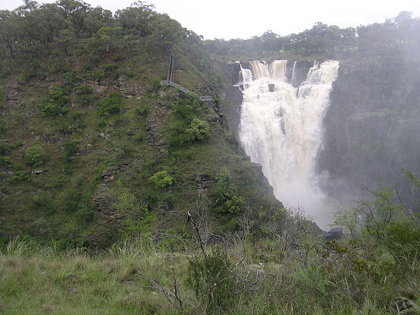
The Apsley Falls are located adjacent to the Oxley Highway, near Walcha.
Gilgandra, New South Wales
Videos
Page
Gilgandra is a country town in the Orana region of New South Wales, Australia, and services the surrounding agricultural area where wheat is grown extensively together with other cereal crops, and sheep and beef cattle are raised. Sitting at the junction of the Newell, Oxley and Castlereagh highways, the town is located in a wide bend of the Castlereagh River downstream from its source near Coonabarabran, directly downstream from Mendooran, and upstream from Gulargambone and Coonamble. It is 432 km north-west of Sydney, and is located approximately halfway on the inland route from Melbourne to Brisbane. The town is the administrative seat of the Gilgandra Shire.
It is known as the town of windmills and the home of the 'Coo-ees', and is a gateway to the Warrumbungles National Park.

The main street of Gilgandra