Stack interchange
Videos
Page
A directional interchange, colloquially known as a stack interchange, is a type of grade-separated junction between two controlled-access highways that allows for free-flowing movement to and from all directions of traffic. These interchanges eliminate the problems of weaving, have the highest vehicle capacity, and vehicles travel shorter distances when compared to different types of interchanges.
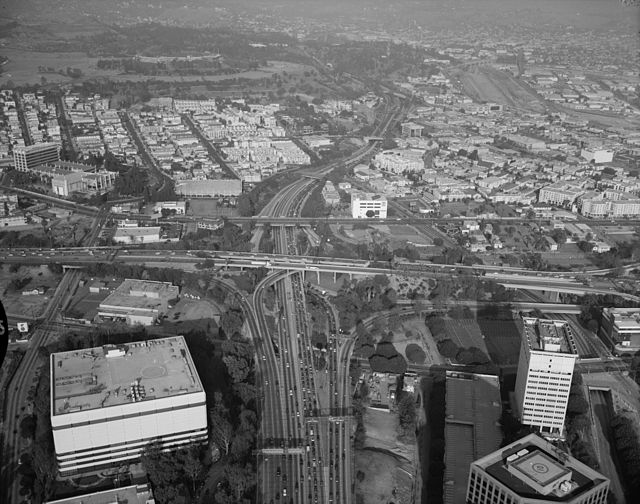
The Four Level Interchange of Arroyo Seco Parkway and Highway 101, looking northeast, in Los Angeles, California. It was the first stack interchange in the world.
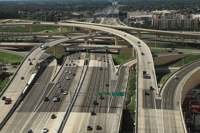
Highway Interchange between Dolphin Expressway and Palmetto Expressway (Dolphin–Palmetto Interchange) in Greater Miami, Florida, United States

Partially used stack interchange over I‑84 in Connecticut
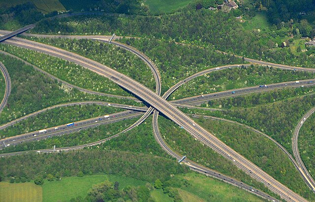
M23 and M25 interchange, UK
Interchange (road)
Videos
Page
In the field of road transport, an interchange or a grade-separated junction is a road junction that uses grade separations to allow for the movement of traffic between two or more roadways or highways, using a system of interconnecting roadways to permit traffic on at least one of the routes to pass through the junction without interruption from crossing traffic streams. It differs from a standard intersection, where roads cross at grade. Interchanges are almost always used when at least one road is a controlled-access highway or a limited-access divided highway (expressway), though they are sometimes used at junctions between surface streets.

The High Five in Dallas, Texas. This is a complicated five-level stack interchange, due to the proximity of frontage roads and segregated high-occupancy vehicle lanes. This hybrid design is based on parts of a four-level stack for highways, with a three-level-diamond interchange to handle the frontage roads. 32°55′27.2″N 96°45′50.0″W / 32.924222°N 96.763889°W / 32.924222; -96.763889
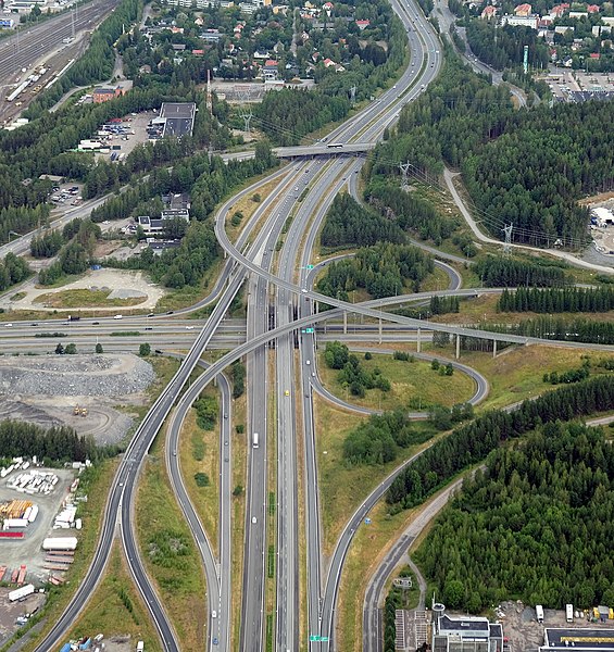
An aerial view of the Lakalaiva interchange in the Tampere Ring Road between the Highway 3 (E12) and Highway 9 (E63) near city of Tampere. 61°27′46″N 23°46′10″E / 61.46278°N 23.76944°E / 61.46278; 23.76944
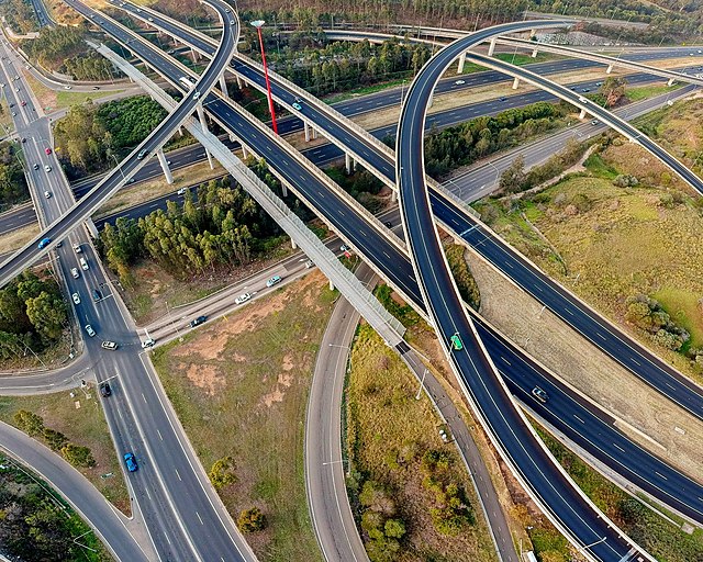
The Light Horse Interchange in Sydney, the largest in Australia. 33°47′53″S 150°51′15″E / 33.79806°S 150.85417°E / -33.79806; 150.85417

A full cloverleaf interchange between APD-40 and U.S. Route 64 near Cleveland, Tennessee 35°08′59.4″N 84°50′52.3″W / 35.149833°N 84.847861°W / 35.149833; -84.847861