1969 Santa Barbara oil spill
Videos
Page
The Santa Barbara oil spill occurred in January and February 1969 in the Santa Barbara Channel, near the city of Santa Barbara in Southern California. It was the largest oil spill in United States waters at the time, and now ranks third after the 2010 Deepwater Horizon and 1989 Exxon Valdez spills. It remains the largest oil spill to have occurred in the waters off California.

Platform A in 2006
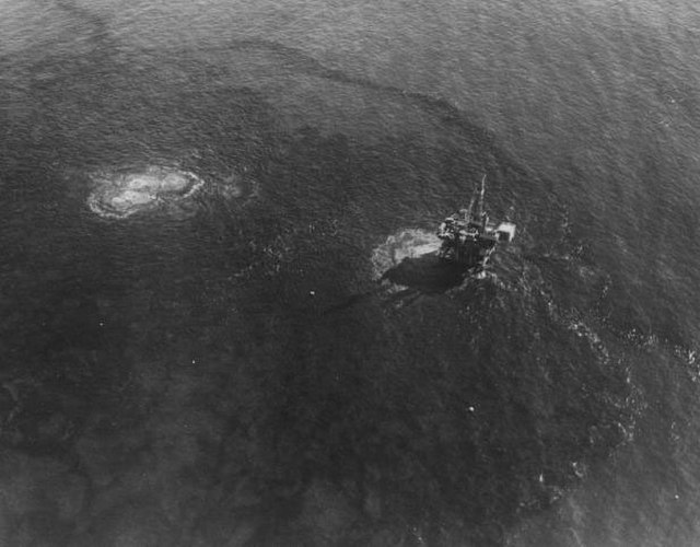
Aerial view of the spill from Platform A. After the well was plugged on the rig, the high-pressure oil and gas left the well bore, ripping through the floor of the ocean itself 200 feet (61 m) down; this is causing the surface disturbance to the left of the rig.

Extent of the spill on the ocean surface on February 5, 1969, showing the northward and southward extremes of observed oil during the year.
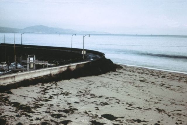
Oil piled up at the seawall near the Santa Barbara Harbor. Note the blackness of the incoming wave; the water has a thick layer of oil on top.
Santa Barbara Channel
Videos
Page
The Santa Barbara Channel is a portion of the Southern California Bight and separates the mainland of California from the northern Channel Islands. It is generally south of the city of Santa Barbara, and west of the Oxnard Plain in Ventura County.
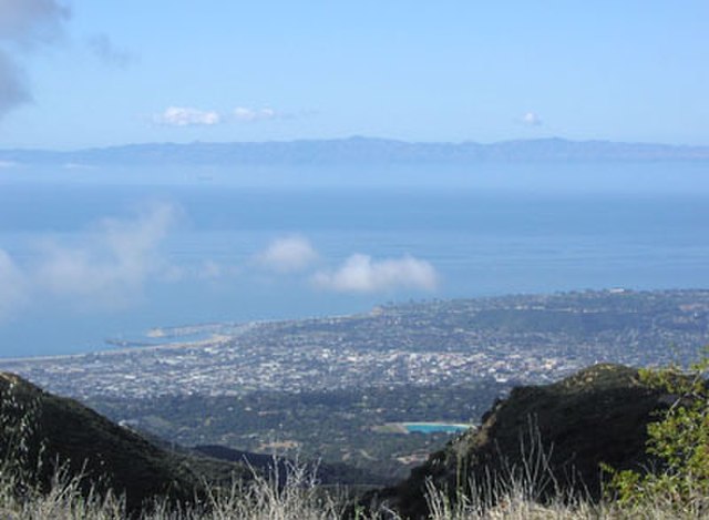
Looking south-southwest, across the Santa Barbara Channel; the city of Santa Barbara, California is below, and Santa Cruz Island is in the distance.