Adriatic Sea
Videos
The Adriatic Sea is a body of water separating the Italian Peninsula from the Balkan Peninsula. The Adriatic is the northernmost arm of the Mediterranean Sea, extending from the Strait of Otranto to the northwest and the Po Valley. The countries with coasts on the Adriatic are Albania, Bosnia and Herzegovina, Croatia, Italy, Montenegro, and Slovenia.

Bari
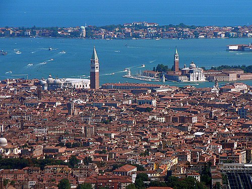
Venice

Trieste

Bay of Kotor, a ria in the Southern Adriatic
Montenegro
Videos
Montenegro is a country in Southeast Europe, located in the Balkans. It is bordered by Bosnia and Herzegovina to the north, Serbia to the northeast, Kosovo to the east, Albania to the southeast, and Croatia and the Adriatic Sea to the northwest with a coastline of 293.5 km. Podgorica is the country's capital and its largest city; it covers 10.4% of Montenegro's territory of 13,812 square kilometres (5,333 sq mi), and is home to roughly 31% of its total population of 621,000. Cetinje is the former royal capital and cultural centre of Montenegro and is the location of several national institutions, including the official residence of the President of Montenegro.

Ruins of the ancient city of Doclea

Constantine Bodin, medieval King and the ruler of Duklja

Battle of Vučji Do, 1876, major battle of the Montenegrin-Ottoman War

Royal family of Montenegro: King Nicholas I with his family. The Petrović-Njegoš dynasty ruled Montenegro continuously for almost 200 years.